Continuing on from Part 1
 |
| Rangi Point Sand Dunes & entrance to the Hokianga Harbour |
Two well known tourist destinations, Opononi & Omapere
villages are on SH12 near the entrance to the Hokianga Harbour, both have
beautiful sand beaches that can be accessed from the road side.
Across the
harbour at North Head, huge golden sand dunes dominate the landscape.
Sandboarding the dunes is a popular activity, charter boats can
supply boards and take you across to the dunes from the Opononi Wharf.
Opononi
became world famous in the mid-1950s when a bottle-nosed dolphin named Opo made
friends with the locals and stayed in the harbour until her untimely death
several months later.
Thousands of New Zealanders flocked to see her, some
driving hundreds of kilometres over gravel winding roads to say hello,
swim & play with her. A bronze copy of the original commemorative statue of Opo straddled by a young boy stands in the main street & it’s still popular to have your photo taken alongside her. The original stone statue is now in a local museum.
On our way south we stop at a Pakia Lookout to say goodbye to the Hokianga Harbour and head on down the coast, coastal views are now replaced with the magnificent kauri trees of the Waipoua
Forest.
 |
| Pakia Hill Lookout |
The drive through the forest is an experience in itself. The towering
forest canopy closes in overhead forming dark green tunnels and huge ancient kauris
have formed natural gateways where vehicles must slow to pass through.
The road edges are fringed with emerald green mosses & luxuriant ferns fronds, it’s cool and damp inside the forest and the outside temperature takes a dive.
Waipoua Forest is the largest remaining tract of native forest in Northland and
it’s also the home of Tane Mahuta, the country's largest kauri tree, which is
approximately 2,000 years old and still growing. A short five minute walk
through the cooling shade of the forest leads you to the awe-inspiring sight of
the majestic Tane Mahuta.
 |
| Love my wide angle lens; makes me appear very tall! |
It’s hard to comprehend how big he is until you stand
beneath him; it’s nearly 18 metres to the first branch, 51 metres
to the top and with a 4.4 metres diameter, it’s clear to see why Tane Mahuta is
called 'The Lord of the Forest'. A boardwalk & surrounding
wooden fence protect the tree from disturbance, kauri have sensitive surface
roots that can easily be damaged.
To get a full view of Tane Mahuta, you can move further along the track, which then leads to another viewing platform. I had my wide angle lens so was able to capture most of Tane Mahuta from directly beneath him.
 |
| Taken from the 2nd platform, further away |
A boot wash at the track
entrance is to protect Tane Mahuta & his fellow brothers & sisters from
kauri dieback which has already killed many of the large kauri in the forest.
The Waipoua Campground (#423) is a great place to base
yourself if you’re wanting to explore the local area & forest.
It’s a basic
campground set in amongst the bush beside a river, the bird life is prolific
and kiwi can be heard calling at night.
 |
| Waipoua River |
Further south and just 35 minutes from Dargaville are the
Kai Iwi Lakes, a sparkling turquoise jewel in the crown of Northland’s
natural attractions.
 |
| Lake Taharoa, Kai Iwi Lakes |
Kai Iwi Lakes, there are three, are white sand
freshwater dune lakes created over 1.8 million years ago when they were formed
by the accumulation of rainwater in depressions of sand.
 |
| Promenade Point Campground, Kai Iwi Lakes |
Underlying ironstone
prevents the water from leaking away. The lakes have no known natural inlets or
outlets, their main source of water is rain, and with a sand base the water is
crystal clear.
Lake Taharoa is the largest of lakes, it’s fringed by pure white
sand and when the sun is shining the lake is a vivid blue & looks to have
been dropped into place from a faraway tropical island. All that is missing are
the waving palm fronds.
There are two camping areas at Lake Taharoa and they
are both looked after by the Kaipara District Council; Pine Beach Campground
(#430) at one end is the busier camp, it has powered & non-powered sites,
toilets, showers and a playground and it’s also more exposed to the hot summer
sun.
The stunning white sand beach is popular
with day trippers, many come with their boats & assorted water toys.
The pine trees that give the camp its name have now gone and natural vegetation is slowly filling in the gaps.
 |
| Sunrise with silhouetted dead old man pines behind Pine Beach camp |
Promenade Point
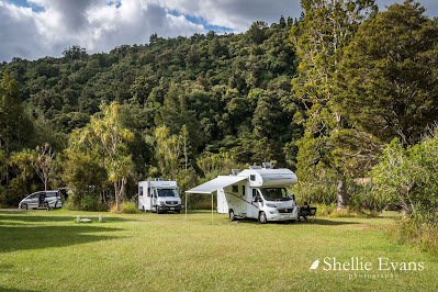
Campground (#427) at the other end of the lake is a more relaxed camping
experience with large grassed areas and sites in amongst the lake side bush.
It's where we spent several gloriously hot late summer days, and had the place to ourselves once the Waitangi Weekend crowds left.
There are shallow areas ideal for swimming at both camps and along the edges of
the lake off the Taharoa Domain Road between the camps; you can also fish for
rainbow trout or paddle a kayak. Hiking & biking tracks also circle the
lakes.
I climbed the hill behind our camp ground to capture the sunset. The photo below is looking back over Lake Taharoa with our camp on the finger of land below the track & the Pines camp at the far end of the lake.
The view from the top of the hill looks out over farmland to the Tasman Sea beyond and a typically stunning west coast sunset.
To be continued...


