Wednesday, May 30

A Quick Trip- Eastern Bay of Plenty

Catch-up

One of our 'rules' while living on the road is to not de-camp during a long holiday weekend. In fact if anything we err on the side of caution, arriving 2-3 days before the weekend so we have a good site and are settled in before the masses arrive. And there we stay put and if we do move on after the weekend we wait a couple of days before pulling out.

We broke our rule Easter weekend. We won't do that again in a hurry.

After four days camped at Moreporks Nest in Te Araroa, Easter Saturday and with a hint of itchy feet, we thought we might as well head over the top and down into the Eastern Bay of Plenty for the rest of the long weekend. We were the only ones left and it didn't look like we'd have any company for the rest of the weekend. I had a few camps in mind that were on the beach or at least had sea views and, well, we hadn't seen too many people on the road. All our camping sites so far had been either empty or near empty so it shouldn't be too hard to find a spot for the next few nights, should it? Famous last words.

Our first stop was for lunch at a very busy Waihau Bay where the tiny settlement was buzzing with holiday makers enjoying the fantastic weather.


I've had a soft spot for Waihau Bay ever since watching the film 'Boy', the general store (below, second down on the right) featured in the movie; it's where Boy tries to impress the girls with his Michael Jackson moves.

We were lucky enough to find one empty boat trailer park that we could back into and have a quick lunch before anyone turned up to claim it. Boats were arriving home from a fishing competition and there were a few worried looks and cross words when MPI (Fisheries Officers) met them at the top of  the ramp. 


Our next stop is just a few kilometers south at one of the most photographed churches in New Zealand. 


The historic Raukokore Anglican Church is over 100 years old and was built in 1894. It sits on a promontory of land surrounded by a rocky shore and exposed to the prevailing salt laden westerlies. 


I also have a soft spot for this church; it's the subject of the very first photo I sold 6-7 years ago. I photographed the church on our road trip around the East Coast back in 2011 and I sold it to a guy who saw it in the photo sharing website Flickr. He wanted a canvas of the church for his wall, he had fond memories of the church from his surfing days in the area. 


Only in NZ; I wonder where else in the world you might find a similar sign inside a church! 


Back on the road we were starting to get a little worried about finding a place to stay for the night. It had already been noted that the Waihau Bay Holiday Park and the small camping reserve next to the Waihau Bay Hotel were both full to overflowing.

I had the Maraehako Camp- which is about half way between Waihau and Te Kaha- marked down as a first option. Photos I'd seen suggested the camp was more relaxed camping site right on the beach with large stand of pohutukawa trees and a stream running through it. Unfortunately the 'No Vacancy, Camp Full' sign was out as we slowed to turn into the gateway. We carried on down the coast.

Campers were spilling out over the confines of the freedom camping reserve at Te Kaha. Although we did see a couple of  narrow areas we could have carefully slotted ourselves into but frankly, we didn't feel like crashing someone else's happy holiday scene.  A little further on the Te Kaha Holiday Park was also a hive of activity. 

There was one more freedom camping area at Omaio to check before a run of holiday parks on the lead into Opotiki, there were also a couple of NZMCA CAPS, but based on what we'd seen so far they were likely to be full too. 

We weren't too happy with the narrow road and gravel track up into the freedom camping area at Hoani Waititi Reserve in Omaio but at least there was plenty of space available. The ground was very undulating and the grass knee high and very thick so it took several attempts to find a level site. Three Traillight motorhomes came in not long after us, they also finding it hard to find a level spot so we all ended up parked haphazardly in the middle of the reserve.


Other campers lined the cliff edge overlooking the sea, I say overlooking but they couldn't see a thing because of the mass of trees also lining the cliff. There are several steep tracks down to the water and rocks below which could be accessed at low tide. The water view in the photo below was taken from the Omaio Cemetery which is in the corner of the reserve. It did us for the night, and we were grateful to find something in the end, but I wouldn't  be racing back to stay there again.


Bringing our East Coast wanderings to an abrupt end, we headed through to the NZMCA Park in Opotiki the next morning.  Brilliant weather, the long Easter holiday weekend and hundreds of holidaymakers had foiled our attempt to explore the Eastern Bay of Plenty coastline. We'll return and explore that section at a more leisurely pace sometime in the future. 


And while the Opotiki Park is another great asset for the Association and a good park for members, after the last few weeks of remote camp sites and seeing very few people, we suddenly felt hemmed in by a 'concrete jungle'.


We took a Sunday (Easter Sunday) drive along the coast and around the Ohiwa Harbour where there were many more people enjoying the sunshine; here at the Te Ahiaua Reserve the freedom camping area was overflowing again and there were many day trippers picnicking, swimming and gathering cockles.


We drove out onto Ohiwa Beach near the estuary outlet where the familiar sight of Moutohora Island, more commonly known as Whale Island, greeted us across the water...


...and still more people were out enjoying their leisure activities and gathering shellfish. It really was a cracker of a weekend and for many, their last chance to relax and catch the summer sun before winter arrives. 


The next morning we headed off again, I just couldn't do another day at the Opotiki Park and being the last day of the holiday weekend, I was sure that we'd be able to find a spot at the Matata DOC Camp as campers pulled out and headed for home.


And sure enough the camp had a number of sites available, the manager saying it had been wall to wall campers all weekend with not one site spare. Many of them were leaving or still in the process of leaving as we arrived. We found a good spot along the edge of the wetland that's behind the camp and parked so we could bird watch out the lounge window. 


One of the many magnificent beaches that stretch for miles along the Bay of Plenty coastline is just over the sand dunes alongside the camp. That's Whale Island again, it's now to the east of us. 


Surf casting is a popular and productive pastime right along this coast.


I hadn't been able to get many sunrises since we left Waipiro Bay over on the East Coast, we'd either been parked behind large hills or in trees so I was up early to check the position of the sun here at Matata. My luck was in, it rose at the far end of the beach so I was able to include the sea and Whale Island in the shot.


I wasn't the only one up and about on the beach so early, a quad bike roared along the beach ahead of me, the red tail light causing me a few photo issues until he turned it off. I thought it was a fisherman until I zoomed in to see he had a kayak on the back...


...which he dragged into the waves before paddling off out into the bay. All was forgiven, it was a good photo-bomb afterall.


Once the fiery colours drained from the sky I headed back to the van, catching the pink hue of a new day...


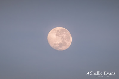
...and a full moon still high in the sky.


We'd booked into Matata for one night but ended up staying three which proved to be a good antidote after our initial disappointment at having to finishing our East Coast exploring early. And it was a good place to gather our wits; next port of call- Mt Maunganui & school holidays! 


Wednesday, May 23

Lottin Point & Another Wharf- East Coast

Catch-up

We'd heard about Lottin Point a few times but hadn't managed to visit it on our last (one and only) road trip around the coast. Then, the road across the top from Waihau Bay to Hicks Bay, seemed to go on forever winding it's way through native bush and pine forest interspersed with sparsely populated farmland. And to be honest, we were in a hurry, we'd stayed in Waihau Bay and had to be in Gisborne the next night and visit East Cape and all the settlements down the coast along the way. Ha! Those were the days- 3 days off, lets race around the East Coast, that'll be a relaxing trip. Not. 

Now that we were based in Te Araroa for a few days we could take a leisurely tiki tour to check out Lottin Point. The road climbs sharply over Haupara Point at the end of the bay, we stopped at a break in the bush (it's actually a landslide under repair) to take a photo looking back along the magnificent coast to Te Araroa tucked under the cliffs at the far end.


...and then it's over the top and another stop at a lookout for a view out over Hicks Bay. We'll call into Hicks Bay on the way home. When we do day trips we find it best to head to the furthermost point first and then explore on the way home otherwise we either run out of time, the weather changes or we get tired and can't be bothered driving any further. 


It's 30kms to the Lottin Point turn-off at Potaka and another 5kms down a very narrow winding road and part gravel track to a bay at the bottom of the hill. We're not surprised when we see a familiar caravan ahead of us, it's Lyn & Sean from Greymouth. 

They'd been parked behind us at Moreporks Nest for the last few days and we'd said our goodbyes earlier in the day. They thought they might head to Lottin Point but were unsure. Looks like they have decided to go for it.


It's a surprise to see a Lottin Point motel sign and then the motel itself half-way down the hill. This is a long way from civilization but wow, what a spot to come to if you're looking for solitude or perhaps to go fishing or diving. There's a helicopter pad at the front of the lawn so I expect a few guests arrive that way. 


Once we get to the bottom of the hill  the road passes through farmland heading towards a little bay tucked into the elbow formed by Lottin Point.


Not far from the last drop down into the bay we have to stop to open a gate. I'm excited to see a small herd of water buffalo in the paddock beside the gate.  I say a friendly hello to the bull who has wandered over to see what I am doing and I reach back into the ute to get my camera. Just as I take this photo he decides he doesn't like me and bellows and jumps at me. 

I have never moved so fast in all my life, the trouble is David had pulled the ute in close (so the caravan could pass) and I couldn't get around the end of it because of a ditch. Thank God for the electric wire along the top of the fence because like many things on the Coast, the fence is pretty flimsy, he stops just short of the wire. And actually, I have moved as fast, when a large monkey baring a mouth full of very sharp teeth tried to climb in my car window in Langkawi- I ended up sitting on David's lap and the gear stick and he couldn't drive away! 


Lyn & Sean carry on through the gate but they wait for us to pass them again before they attempt the last stretch down to the bay. It's a very narrow gravel track through some large trees with overhanging branches and there's also been a wash-out. It would be touch and go for us to get the rig down here.


The finger of land that is Lottin Point reaches out into the Pacific Ocean, the track ends at a tiny rocky bay tucked into the bottom of the point. The water is a deep emerald green, crystal clear and sparkles in the sun. Great swathes of kelp attached to the rocks sweep back and forward in the tide, this would be the perfect place to fish, dive and kayak or just have a swim in the calm waters. A local lady is collecting seaweed for her garden.


Huge gnarly old pohutukawa trees line the shoreline, many with large clumps of the epiphyte Astelia (also know as Perching lily, Kahakaha, or Widow Maker) growing in their branches. Don't you love the 'Widow Maker' name, imagine the damage a clump of that would do hitting you on the scone! It's pleasing to see that one monster tree that has lost it's footing and been blown over, has many new shoots along it's truck and branches. But it's also sad to think of what Myrtle Rust may do to these beauties in the future. 


There's not much space to set up camp as much of it is uneven or deep gravel and there's also a small ford to cross to get to one area. There's a strip of grass along the back of the beach and a grassy area set back off the water behind the pohtukawa. A fisherman has left his vehicle on the only flat spot in one area, a house truck is behind the trees and Sean & Lynn find the last flat area in the middle.


We leave them to set up camp and drive down to the end of the bay to have lunch, they join us for a coffee afterwards and then we say our farewells once again. Easter is fast approaching and they think they'll stay put for the long weekend- wise people.


We head back up the road; here's another photo showing you the track through the trees and a little of the washout just in case you're thinking you might visit in your motorhome. Sorry, it's not quite in focus, I was holding on as we bumped our way up the track.


The water buffalo had moved on and had been replaced by a number of piglets of various sizes who were wandering about or sunning themselves along the side of the road. They weren't in a hurry to move either.


At the top of the road I took one last photo and it was then that I spotted another herd of buffalo...


...lazing about and wallowing in a water hole. Many of the cows had calves with them. 


We headed back towards Hicks Bay, on the way up I had noticed a sign on a gate 'Nipple Hill Farm', and thought that's a rather odd name to call your farm. There must be a story behind it. Well there is and here it is, Nipple Hill, which can be seen very clearly when you're heading east.


We turned off into Hicks Bay where it's interesting to see the signpost as we pass the school. Kura is short for Kura Kaupapa which is a Maori language immersion school. I'm sure there are a few around the country (and especially on the East Coast) but this is the first one I've been alerted to by the signpost.


At the end of the bay are the old freezing works ruins; one of the reason there's another old historic wharf here on the East Coast.


The road- or track because surely it can't be called a road- into the historic Hicks Bay Wharf hasn't improved one iota from our last visit here 7 years ago. It might not have improved but it certainly is no worse, it's still mostly mud and large water filled pot holes.


Access to the top of the rickety wharf is blocked off but you can wander around underneath it at low tide.


The rocky platform provides an ideal place to fish from too, can you see the guy up under the wharf near the edge.


But it's the nearby rocks that are obviously the best place to fish from, these locals told me they've been here for much of the day and they have a sack of fish. One of the guys tells me to select a fish or two from the bag, I don't know why, but I politely decline. They then show me the large kingie and huge sting-ray that are chasing their bait back and forward along the edge of the rocks.


We leave them fishing, one of them pulling in another kahawai, as we bump our way back over the track and head for home. Done for another day.


Saturday, May 19

The Kaka & The Minister

Real-time

When the Minister for Conservation, Eugenie Sage recently made a pre-budget announcement that an extra $81.3 million would be spent on pest eradication, she announced it standing between two large banners. I'm tickled pink to say that one of the photos used was mine; a cheeky kaka feeding on our native flax/harakeke flowers.


As many of you know, I regularly supply photos to DOC (Department of Conservation) for use as they see fit. It's my 'volunteer without gumboots' contribution to conservation in New Zealand- that link is to a past blog with some of my photos from the DOC website.  If you click the DOC link above it you'll see the kaka photo is also on their front page at the moment.

I can just see my 'name in lights' here under the heading! My DOC contact sent me these photos yesterday.


And in case you're wondering, the other banner photo is of a NZ Bush Robin (and I can't read the photographers name).


Thursday, May 17

A Lighthouse & A Big Tree- East Cape; Part 2

Catch-up

Continuing on from Part 1

Once we moved the gathering of horses on from the entrance to the lighthouse walk, it was head down bum up as we set off at a steady pace...


  ...to climb the 800 steps to East Cape Lighthouse. Someone has helpfully carved our progress into the steps; '150' (Really? Feels more like 250), 'There's 301 to go' (I've lost count by now and also read it as, I've done 301 steps and still have 500 to go. Bloody hell!) and finally '800, you did it! (thankyou kind person for your encouragement!). We pass fellow RVers, Angelique, Ken & Louell on their way down- they're staying at Moreporks Nest as well. David plods on, one foot after the other, steady as she goes...


...until we finally arrive at the top. The lighthouse is a popular attraction, many tourists make the pilgrimage to the top to be one of the first in the world to see the new day's sun rise over the eastern horizon.


The East Coast Lighthouse- 14 metres high, 154 metres from sea level and fully automated in 1985.


The views from the top are magnificent; looking south along the coast towards Gisborne...


...east towards East Island (imagine living on that tiny rock as the lighthouse keepers family did in the early days)...


...and west over farmland, with the lighthouse carpark and old buildings in the centre bottom of the shot.

The cloud formation provides some great leading lines for my photos.


We were disappointed to see how rundown the reserve around the lighthouse had become since our visit in 2011. The information panels that once told about the wildlife and East Island had been smashed along with a nearby seat. Rubbish had also been thrown in the bush and over the edge. Idle hands while people wait for the sunrise perhaps?


We headed back down to the carpark, passing a several groups of people coming up the stairs. At the bottom, a large group of Chinese tourists are talking excitedly to some of the horses who are standing by the track. A couple of the children are holding handfuls of grass and they ask me if they are allowed to feed the horses. I show the children how to hold their hands flat to feed them and left them having their photos taken. I also warn them not to go behind or try to touch the foals. I bet they decided that feeding the horses was the best experience that day!


We head back to Te Araroa, stopping to have a late lunch over looking the sea. There are a number of old derelict houses along the coast road, the one on the right doesn't looked to have changed at all in the 7 years since our last visit.


Just to prove that the signs are there for a reason...


...and that cattle, like the horses in the previous blog post, like to cool off on the sand too.


Back in Te Araroa we check out Te Waha-o-Rerekohu, New Zealand's oldest and largest pohutukawa tree which stands in the corner of the local school grounds. Te Ara, The Encyclopedia of NZ says the tree is thought to be around 600 years old but the sign says 350yo so who's right is anyone's guess. Still, it's a pretty impressive tree, its more than 21 meters tall and 40 meters in diameter at its widest point (click on the photo to read the sign)


This should give you some perspective, it's a massive tree!


The day wouldn't be complete without another horse encounter; we come across this little fellow just down the road from Moreporks Nest, he was happily wandering down the middle of the road but when he spotted us coming he made a break for it and trotted off down a driveway.