Catch-up
The DOC camp at Purakaunui Bay is our next stop as we travel north through the Catlins.

Along the way, we stop at the Florence Hill Lookout for morning tea. The lookout overlooks the coastline which includes beautiful Tautuku Bay, where the native bush reaches right down to the edge of the dunes. This is one of the most well known & iconic views you'll see as you travel the Catlins. You can access the beach from a narrow track through the bush at the bottom of the hill, we've done this on one of our previous Catlins trips.

Our destination, Purakaunui Bay, is famous for being one of the locations for the film The Chronicles of Narnia; the Lion, The Witch & The Wardrobe. The towering bluffs along the north side of the bay were used in the film.

Although we've visited the bay before we've not stayed at the DOC camp (it's a basic camp with long-drop facilities). The camping area is large with several areas to park in, although the ground is quite lumpy and can be very boggy even in the middle of summer. There are a few gravel areas beside the road where you can park if you don't want to venture onto the grass.

There's also a couple of grass patches where smaller vans or tents can camp closer to the beach. You do have to drive along the sand to access these areas though.

Once you turn off the Purakaunui Falls Road, there's 6kms of gravel road to travel to reach Purakaunui Bay, the last kilometre is very narrow & one way so proceed cautiously. We find that if you travel these roads late morning or early afternoon you'll usually miss the campers coming out that have stayed overnight or the day trippers heading home in the late afternoon.

I say 6kms of gravel but that doesn't include the 8kms or so on the Purakaunui Falls Road once you leave the main highway at the Catlins River Estuary. This is the better road to take if you're coming from either direction, the others are also gravel, hilly & winding.

We stayed in early February and there weren't too many campers about. Unlike the January day when I visited several years ago when every available space was taken up by tents & motorhomes.
 |
| The Purakaunui River past the camp & out to sea |
We arrived early afternoon and managed to park in one of the better spots, overlooking the beach and beside a small creek that joins the river, so no one could crowd us out.

The road ends at the top of a hill just past the camp & overlooking the beach. I don't think many campers realise that the area at the top is also part of the camp and you can park up there too.

A short vehicle track leads to a couple of reasonably flat areas that overlook the bay in one direction...

...and the lower camp in the other.

I had seen a few vehicles drive through the camp and up the hill, and then return to park up. They probably thought they weren't allowed to stay up the top as there are no signs there but when I saw a DOC worker camped there, I checked the info board out to see that the area was included in the camp boundaries.

I was actually a bit peeved off with the DOC guy to be honest as he had set up his tent in the one clear area I had sussed out the day before, for a sunrise shot. I felt a bit creepy tiptoeing around his tent the next morning trying not to make the grass crackle as I tried to shoot the sunrise.


Other campers had made their way to the beach to watch the sunrise, one person meditating, another doing yoga while others just stood in awe and watched the bay fill with beautiful colour & light.

Many more had no idea what they were missing; by far the best part of the day!

The love bird couple in this tent probably thought all their Christmases had come at once when they secured the perfect spot right on the edge overlooking the beach.

They went out for the day as we did too and when we returned later in the afternoon, a huge squall had blown through and obliterated their gazebo with all the piping buckled & bent and no sign of the top. There was broken china, upended chairs, clothes & shoes scattered far & wide.
We offered them cups & plates to use but they made do with the remnants. I guess they won't do that again in a hurry, luckily their tent stayed in one piece although a few of the guy wires had come loose.

The Purakaunui River flows out alongside the camp and across the beach to the sea. The tannin stained water provided the perfect place for the Red-billed Gulls to partake in their daily ablutions.
It was fun to sit and watch them as they called to & squabbled amongst each other as they lined up to take the next available space when one departed. One gull in particular spent ages having a bath, getting annoyed at another one when it sat too close in front of him and finally leaving with a hop, skip & jump.

Of course a visit to the Purakaunui Bay is not complete without a visit to the Purakaunui Falls, another top tourist attraction in the Catlins. We've been before, actually twice, but I enjoy visiting places more than once, you never know the different conditions you can find from visit to visit. And especially waterfalls as the flow can change dramatically.
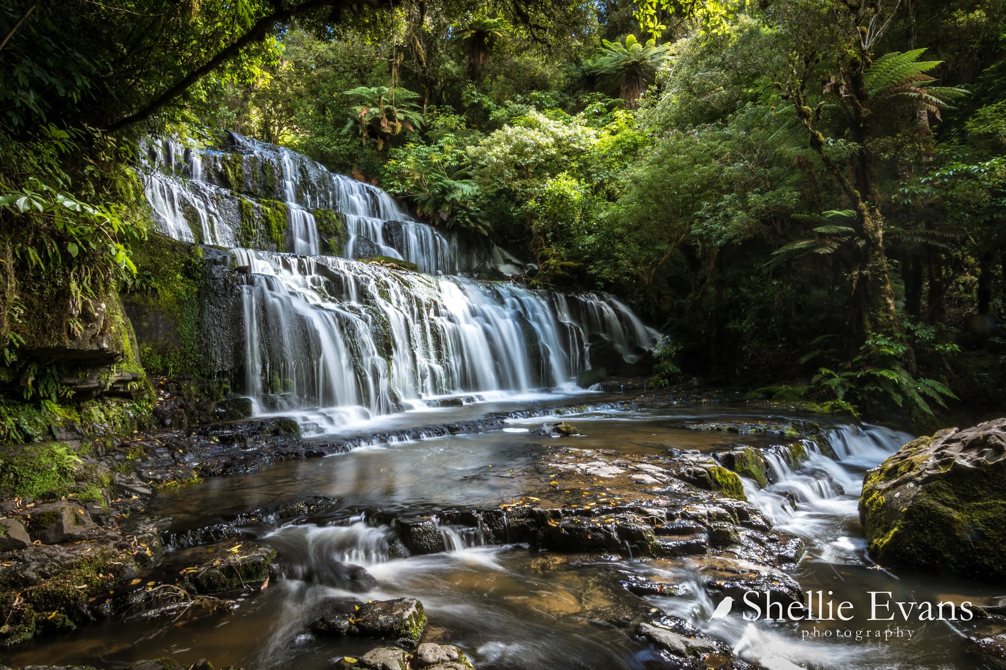
On this day there was a mediocre flow but with a slow shutter speed & my tripod (which I don't usually cart with me on walks, preferring to shoot on the run) I managed some half decent shots. And a bonus was that there were very few tourists crowding out the platform jostling for a clear spot & I didn't have to contend with people down on the rocks in front having in-depth discussions or their picnic lunch! One day I'll catch the falls in full flood. Now that would be a sight.

On the day of the squall we drove around to Jacks Bay to check for sealions. There hadn't been any haul ashore at Purakaunui while we'd been there, or none that I could see.
 |
| Jacks Bay cliffs are similar to Purakauni Bay |
We'd seen a few at Jacks Bay before but not on this day, the beach was bare. So we took a right at the end of the road on the way out and headed to the outlet on the south side of the Catlins River Estuary. Again there was nothing about other than a couple of people gathering shellfish.
We turned around and headed for home looking for a lunch spot along the estuary & out of the wind. We pulled into a small clearing & when I scanned the sand dunes with the binoculars I saw what I thought was a sealion. I rugged up- it had turned cold- and trudged through the dunes in the gale force wind with stinging sand whipping my bare legs.
As I got close this big old fella with his rheumy eyes & gummy mouth lifted his head to look at me.

I'm sure he was thinking "Where the heck did you come from?" as he looked from side to side & rose up onto his hind flippers. He did a couple of shuffles and then thought better of it and collapsed back into a heap on the sand & closed his eyes. I headed off back to the ute, now fighting the wind and sand head on while trying to keep my camera out of harms way, tucked into my jacket. You can see the sand flying past the front of the sealion in the photos.

Back at the camp there was excitement down on the beach. Not only had two sealions hauled out onto the beach while we were out but one of them, a large male had chased a couple & their two children across the beach at a very fast pace and they had been quite terrified by the encounter. Those are his 'running' track marks below. In the background is another camper being very careful how close she got to him- the dark patch at the end of the tracks- to take photos.

He obviously wasn't too worried, he was soon fast asleep oblivious to the terror he'd inflicted, that's him bottom right. I walked to the far end of the beach to check out the other large male dozing in a lump of seaweed (below left & top right).

And then in the rocks at the top of the bay where I located a female sealion, she's barely visible & hiding as best she can from marauding males. Males are relentless in their pursuit at this time of the year, they chase females trying to round them up into harems. Except on the mainland there aren't that many females so they can be the target of many males.
Females are a third of the size of a fully grown male, they are also a creamy beige or grey colour whereas males are brown and have rough hair manes (hence the sealion name). Can you see her? Click the photo to enlarge.


Perhaps this was why the first male wasn't happy to share his beach with humans, he was hunting for his female. I quietly backed off and left her to her hiding spot.


