Showing posts with label lake dunstan. Show all posts

Sunday, April 19

Cromwell- Out & About and Beyond

Catch-up (late October 2019)

Before we leave Cromwell I thought I'd share a few photos I took while out exploring.

A choppy Lake Dunstan on a wild and windy day, taken from just through the trees at the NZMCA Lowburn Park.


Looking down the lake towards Cromwell and the Carrick Range.


A storm front passing over the NZMCA Park at Lowburn, Cromwell. A new section of the cycle-way around the lake passes right behind the park.


Happy hour at Lowburn.


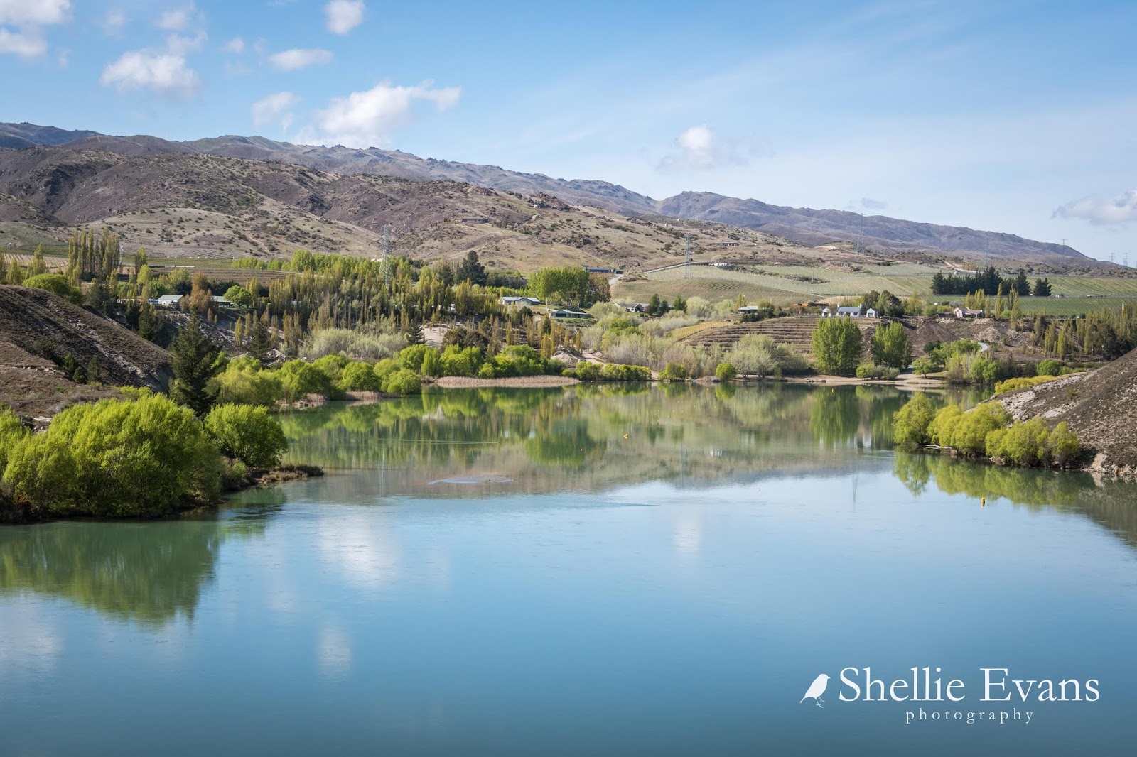
The many moods of Lake Dunstan, this time a calm & reflective day on the lake.


Looking across the lake towards Northburn and the Tarras-Cromwell highway.


We were waiting for news from our Winton family which may have meant we'd have to return to Southland. So once we had stayed our six night limit at the Lowburn NZMCA Park we moved down the road a couple of kilometres to the Lowburn Harbour freedom camping area which has also has a limit (3 nights). 

We have always stayed at Lowburn Harbour in the past but since the NZMCA Lowburn Park opened a few months earlier we'd taken to staying there on our visits. They are both great spots, although the freedom camping site can get very busy during the summer season.


The wind protected Lowburn Harbour inlet nearly always provides perfect reflection opportunities....


...with amazing cloud formations up above.


After using up our three night quota at Lowburn Harbour we moved another few kilometers down the lake to the NZMCA Rotary Glen Park which also has a three night limit. 


The calm early spring weather also provided me with some gorgeous photo opportunities of my favourite Cromwell location; the Inlet at Bannockburn. I try to visit The Inlet everytime we stop in Cromwell; the scene never changes, just the seasons. 

Click on the photo to enlarge and then scroll back & forward for a better comparison view.
October 2019
August, 2019
May, 2016
The Bannockburn Bridge over the Kawarau River.

October 2019
May, 2014
The Inlet at Bannockburn

October, 2019
August, 2019
May, 2016
October, 2019
August, 2019


I drove through to Frankton (Queenstown) for a day's shopping, stopping in the Kawarau Gorge along the way. And in fact I wasn't very impressed with the new shopping centre (or just didn't feel like shopping) so I spent most of my time taking photos there & back. 


The Chinese mining huts at the Kawarau Gorge Goldfields Mining Centre (shot across the river from where the above photo was taken).


Historic Roaring Meg Power Station in the Kawarau Gorge.


Kawarau River and bridge not far from the Nevis Bluff.


And in Queenstown, the Lower Shotover River and The Remarkables, taken from the historic Lower Shotover Bridge which was built in 1871 and was the first bridge to cross the Shotover. 


And finally a few photos from Old Cromwell Town which I visited a few days later. 


Sunday, April 12

Quartz Reef & Bendigo Historic Goldfields- Part 2

Catch-up

Continued on from Part 1

Further north along the range from the Quartz Reef Point tailings are the Bendigo Goldfields. The Bendigo Historic Reserve is a very large area and was made up of several small towns that sprung up on the lower slopes of the range as gold was discovered in the mid 1860s.

An old horse cart & Logantown ruins
We visited the very north end of the reserve when we drove through the Dunstan Mountains on the Thomson Gorge 4WD Track back in 2015, exploring the remains of the Rise & Shine and Come in Time Reefs and the restored ten stamp battery that is there. It was late in the afternoon when we exited the Thomson Gorge Track at Tarras so we decided we'd explore the rest of the Bendigo diggings another time. It's taken awhile but finally we're checking them out.


The road up to the top of the Bendigo Reserve is short and quite steep in places, it passes by the old Bendigo School site and finishes at a carpark in an area that was once known as Welshtown. During the 1860s Welshtown was a residential town which was supported by businesses in nearby Logantown at the bottom of the range.

Looking towards Wanaka, through that gap in the mountains at the back.
The views out over the Upper Clutha valley are wide & far reaching; vineyards and farmland fill the valley from the Pisa Range on the left to Lindis Pass and the Hawkduns at the far right and out of shot. I zoomed in on the interesting shaped effluent/irrigation pond on this dairy farm, not only an interesting shape, but it's huge!


There are quite a number of stone ruins left in Welshtown including a cottage whose walls are relatively intact. Many of the houses here were made of corrugated iron, these are long gone and they weren't necessarily left to deteriorate either. They were easy to dismantle and cart off to the next gold rush.


The size of the cottages is amazing though, some only had enough room for a bed & the fire and that's about it. I guess the men were working the gold fields most of the time and only needed a place to rest their heads overnight.


Families would have lived in some of the larger cottages including this house that belonged to the Pengellys, a prominent mining family in the district.  Can you see the remains of the house in the photo above? (click to enlarge) A close up is in the the photo below, top left. 


There are several walks of varying lengths that leave from the Welshtown carpark in all directions. I take the 1km Welshtown Matilda Battery track through the kanuka scrub heading downhill past grated mine shafts and the remains of several stone buildings including the Blacksmiths store (above, bottom right). 

Matilda battery
The twenty stamp Matilda Battery site opens up at the bottom of the track with a mine shaft and numerous stone foundations including a chimney still standing. In front of the battery are the remains of the mine office and further up the slope are the ruins of several small stone huts where miners working on the battery lived. There's also a collection on the office window sill of broken glass and metal bits & bobs that people have found while fossicking around the site.


It was getting late in the afternoon when I got back to the carpark and I really wanted to walk the 4km Aurora Creek Track but decided I'd come back later in the week to do it, then I wouldn't have to rush and David wouldn't have to wait around for me. But in the end he did come back with me- as my chauffeur- I left him in the Welshtown carpark and headed off across the gully...

The carpark, Welshtown ruins and a snow capped Pisa Range behind.
...around a ridge, through a large open area with masses of vegetable sheep...


...before entering the kanuka scrub and heading downhill. Once again the views out over the valley are magnificent.


It's not long before I reach Aurora Creek and the rocky gorge it flows through.


I find a gap in the rocks that overlooks the gorge and I can now see the old dray track that crosses the creek on a stone causeway which was built in a hurry and by hand in 4 months.


Once across the causeway the track starts to head down the range to the bottom of the gorge but not before it passes through another wide open space known as The Ballroom. 


On the 4th February, 1870 over 300 people made their way here from Welshtown & Logantown to celebrate the opening of the new 10 stamp Aurora Battery. After speeches, champagne & salute firing the crowd moved to the open air ballroom to dance the night away to the sound of violins with a warming fire burning in the purpose built fireplace.


I carried on along the track, which wove back and forward down the side of the hill alongside the gorge, stopping to take in the views whenever there was a rock platform or a gap in the scrub.


More ruins appear on either the side of the track as I near the bottom of the gorge.


And then the track disappears under the kanuka bush and down into the bottom of the narrow gorge...


...where there are a lot more stone ruins on both sides of Aurora Creek.


From the creek-bed the track heads along what once was the main street of Logantown...


 ...past the remains of at least three hotels, a butchery, bakers and more miners huts...


...to finally end at the old horse cart. And where my chauffeur is happily waiting for me. This saves me the walk back up the steep incline to the Welshtown carpark. 


We then head off back down to the loop road and home to Cromwell; Bendigo Goldfields done & dusted.