Real-time
Hi everyone & Happy New Year + one month! I hope you're all well and coping with life in general wherever you may be in the world. It's summer here in New Zealand and we're all feeling very privileged to be able to get out and enjoy it without the restrictions many around the world are experiencing. Although some of us are still waiting for summer to arrive. Especially down here in the south of the South Island (someone must have heard me, it was 30c in Invercargill yesterday)
We had a lovely family time in Christchurch over the holidays and we're now in Southland where we had an appointment for a job to be done on the 5th-wheeler. That has now been completed and we're waiting for the weather to settle before heading off again.
We had a week or so to fill in before having the job done so we spent it in Central Otago at Cromwell & at a rally near Alexandra. While in Cromwell we decided to drive, for the third time, the 'famous in New Zealand' Nevis Road from Bannockburn to Garston.
The Nevis Road is a 4WD road although in summer many 2WD vehicles are able to reach the Lower Nevis settlement from the Bannockburn end of the road. It used to be that 2WDs could make it through from one end to the other in late summer when the fords were running low or had dried out but no longer, the road (track) is very rough & washed out in many places south of the Nevis Settlement and the fords deep & rugged.
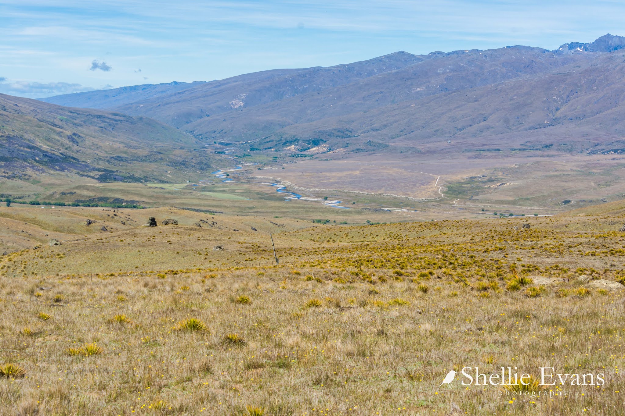
Central Otago had had a lot of rain early in the new year so we weren't too sure whether we'd get through the 65kms to the other end but we were going to give it a darn good go. Once over Duffers Saddle, the view from the top of the Carrick Range down the Lower Nevis is spectacular.
The Nevis River wends its way through the gorge at the far end and down through the valley.
The green home paddocks of Ben Nevis Station on the far side of the river & Craigroy Station on the near side, provide a splash of colour in the otherwise typical Central Otago landscape of dry tussocks, spiky Golden Spaniard /Speargrass & rocky tors.
A lone caravan sits beside the river in amongst gold mine tailings from the Nevis' historic past. Alluvial gold mining is still carried out along the Nevis, as long as you have a permit.
We stop at the old Nevis cemetery even though we've had a look before on one of our previous trips. There are some places you just can't drive past although the view never changes.
One place that had changed was the old cob cottage near the cemetery. It's getting a 21st century makeover, with a new roof, doors, beams & a huge bank of solar panels (jealous much) amongst other things.
Of course my photographer's eye much preferred the look of the old cottage.
David decided we didn't need to stop at the settlement this time as I already had photos. Before I realised we weren't pulling over we were past it. There was a little bit of muttering going on from the passenger seat for a short time before we hit the next ford...
 |
| Gold mining tailing piles at the start of the gorge |
...and then we were into the gorge, with more signs to warn those that think they are bullet proof. And twenty five fords was a little bit of an understatement as we were soon to find out.
There were several easy fords through the gorge before we popped out onto the river flats of the Upper Nevis where a lot more mining was done in the early days. As evidenced by several large dredge ponds, multiple tailing piles, stark cliff faces and the remains of two stone cottages.
There are also several more 'modern' mining huts on both sides of the river which may well be used as fishing huts nowadays.
Just when we start to think the fords aren't anything to write home about, the mother of all fords appears before us.
We get out to check the depths and the best route through them, there are no gravel bases now, it's a muddy base. Some of the tracks are deeply rutted, others you can't see how deep they are through the tannin stained water. Just as we found along the
Hawkdun Range, heavier 4WDs & off roaders have cut some of the fords up quite badly.
The river has made it's own course along several sections of the track. We slip, slide & bump our way through and when we get out on the otherside to check, we notice that some of the fords have a small sign with a red arrow indicating which direction to take when there are multiple choices. The problem is they are all for the other direction, none on our banks.
We suspect that direction arrows might have been used for a rally that has come in from the Garston end.
We pass Roaring Lion Creek where we had lunch seven years ago while we were on a
4WD fundraiser over Nokomai Station. We came off the top of the range down the track you can see. That was such a fun day, we had a ball and still often talk about it. Make sure you read Part 2 if you click the link above, we had a grandstand view of a regular 4WDriver being pulled out of the river.
Further on the river once again took over the track.
And then we came up on a washout that had created a sharp drop-off into the river. It had already claimed a few victims, a number of sump guards and bumper parts littered the river bank.
We couldn't squeeze through on the track above so took the most direct route over a drop of a couple of feet into the river.
Luckily we don't have a long overhang on the ute, although it felt like the tow bar caught the edge as we dropped into the river.
After all the rock 'n rolling and bouncing through so many fords and thinking we were through the worst of the fords, we decided to stop for a late lunch at a nice spot beside the river.

It wasn't long before a guy on a bike pulled up behind us. Expecting a younger person on a trail bike (we usually come across them when out on 4WD roads) it was a surprise when he took his helmet off to see an older person. I offered him a hot drink but he was happy with the handful of cherries I gave him.
We got chatting, talked about the rough ford crossings we'd just done and then it got around to what we do in life. He said he worked for us so we guessed he had a government job. Yes, he said, he worked in Wellington but lived in Upper Moutere. After some more chitchat he introduced himself at Damien, David cottoned on straight away, I was a little slower.
It was Damien O'Connor. (Labour) MP for West Coast-Tasman, Minister of Agriculture, Minister for Trade and Export Growth, Biosecurity, Land Information, and Rural Communities! He was checking out Crown Land (Land Information) by riding his bike through many high country stations & 4WD tracks in the South Island. He had been on most of the tracks we've been on and was working his way through a few more. We had a good chat and then he was off. He took a selfie with us but would you believe it, I forgot to get a photo of him!
While we were talking to Damien (we're on first name basis now) I spotted a Karearea/NZ Falcon fly in to the top of that rock stack behind the bike in the photo above. When I zoomed in on the top I spotted TWO falcon chicks jumping about trying to get food off the parent. Unfortunately I didn't quite get the focus right on this photo, the wind was blowing quite strongly.
The parent flew off across the valley and landed on a rock high above us, calling and staying put, keeping an eye on the chicks while we had our lunch and a hawk soared through on the thermals. It was another good sighting we were able to report to the
NZ Falcon Org who keep a track of falcon distribution around New Zealand.
The falcon is one of our most favourite New Zealand birds and we've probably reported over 60 sightings since we've been on the road. Once tuned in to it, their call is very distinctive and we can instantly recognise it from miles away. This usually means a diversion from what we might be doing to track it down. Other times they just appear in front of us without warning; on a tree branch while walking, sitting on a power pole in the middle of a town, chasing prey past us while we're looking at a view or low flying straight across in front of the ute (which happened just a few days later on our way to a rally). Falcons are much more common than you think.
The fords weren't finished with us yet, once again the river had gouged out the track and we bumped along sharp bedrock for a few hundred metres to the other side.
And then finally we were out of the valley and climbing steadily to the top of the Hector Mountains above Garston. Out my window and far below me, I can see the Nokomai Station track we followed on that rally up the 'Hidden Valley' to the top of the Garvie Mountains.
We head down the winding road into the Mataura River Valley, stopping...
...so I can take a photo of the amazing landscape along the top of the mountains...
...and another photo of the historic Garston Ski Hut, which I'm sure hasn't seen a good dump of snow in years.
The view out over Trotters Plain, Castle Hill and the Eyre Mountains is spectacular. The Mataura River can be see towards the back left below Castle Hill. SH6, the highway from Queenstown to Te Anau is in the centre and the track we're following in the slopes below. Click on the photo to enlarge.
And a pano of the breathtaking view...
Finally we pass through the last gate with it's myriad of signs and head home to Cromwell (110km away), the fast way.