Wednesday, November 23

Pike 29 Memorial

Catch-up

I wanted to post this last Saturday, in time for the 6th anniversary of one of New Zealand's worst mining disasters, but unfortunately we had no internet connection on the day. 

At 3:44pm on the 19th November, 2010 an explosion happened deep within the Pike River Coal Mine located 46km north of Greymouth and where 31 men were working. Only two men came out alive, they were working in an access tunnel closer to the entrance than their workmates.

Emergency services and mines rescue crews worked around the clock for days, waiting for a 'window of opportunity' where gas levels were safe enough to enter and bring the 29 workers to safety. On November 24th, it was all over. A second explosion rocked the mine and any hope for the Pike 29, as they became known, was lost. Six years on, the Pike 29 remain entombed beneath the Paparoa Range.

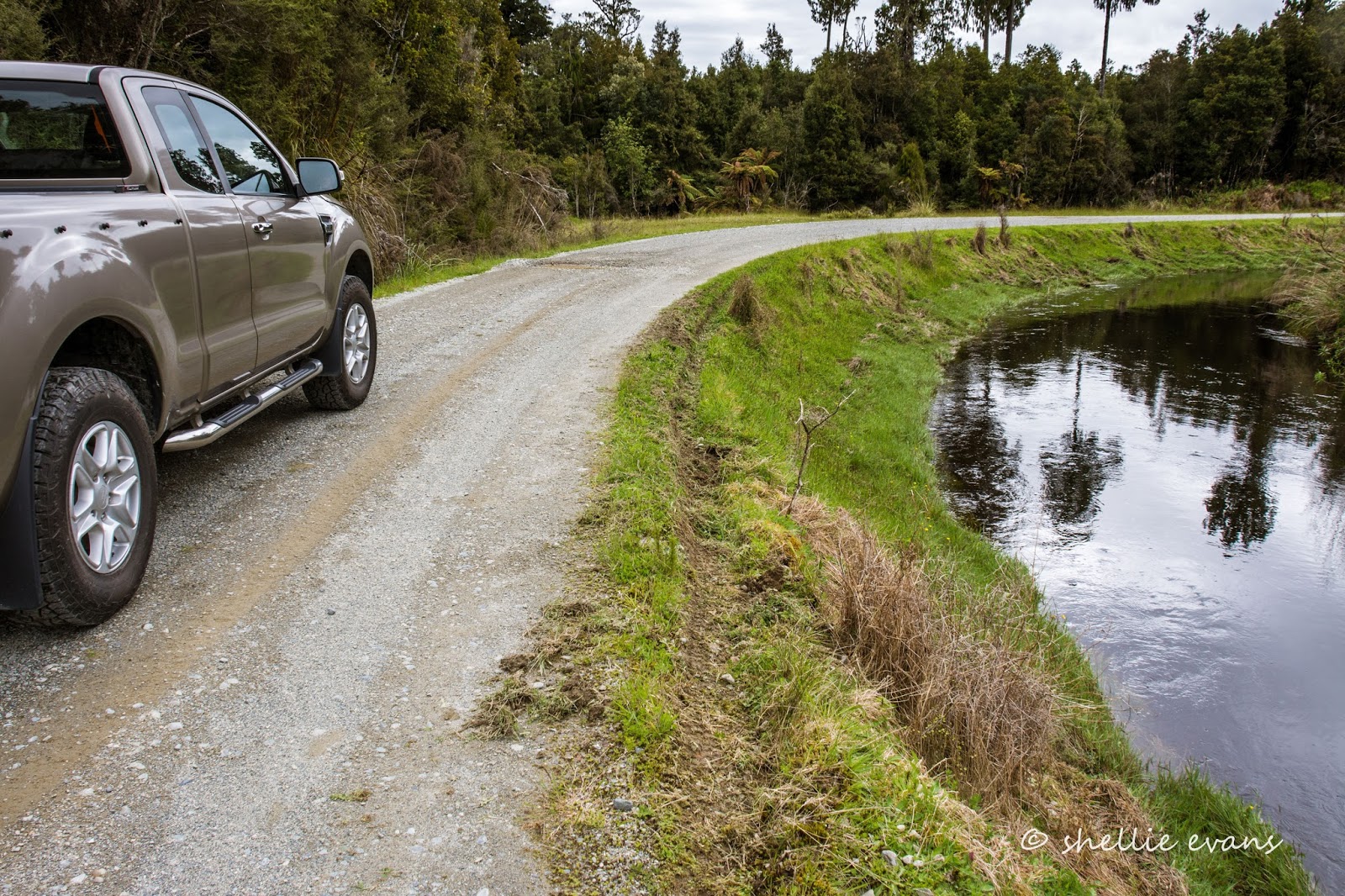
We left Reefton heading for Greymouth turning off the main road just past Ikamatua to follow the Grey River down it's true right. The road is in excellent condition, with long straights, hardly any traffic and bordered by dairy farms for most of it's length. Along the way, I wanted to visit Blackball, a well known West Coast town. 


I hadn't realised the the Pike 29 Memorial was located near the road until I saw the sign. 


We found a place to turn around and returned to the memorial. We had a discussion about whether it was appropriate to visit the memorial, as the tragedy is still quite raw for many New Zealanders, and it did feel like we might be intruding. And especially as we had the 5th-wheeler on the back (I know, I know but if there had been others there, I know we would have carried on). But the sign on the gate made it clear that we were quite welcome, which helped.


And I'm glad we did stop and visit. This small corner of a dairy farm paddock-donated by a generous local family- has become a very special and sacred place for the Pike 29 families and friends, a place for quiet reflection and to remember their loved ones. 


A large rock strategically placed so you're overlooking the Paparoa Range while reading, holds the memorial to the men (click to enlarge the photos).


The Paparoa Range and Pike River Mine are 15kms further up the road beyond the rock. The mine portal is located in the range just to the left of the dying tree. The coal processing plant is to the right of the two large trees.


I have many photos of multi-sign posts from around the country but this one has to be the saddest one of all; the distance to each of the men's home towns.


The shelter held many poignant reminders of the tragic loss.


tag board with the identification cards of the 29 miners- a system used to keep track of who is underground at any given time.


And photos of the men. Also in the shelter were a visitor's book (sad reading), diagrams of the mine workings and the blast, photos of the Memorial landscaping and wired to the floor, a rock from the mine blast.


A gate opened to plantings outside the memorial fence and a gravel path led the way down to a small stream. It's a pity there's a substation blotting the landscape behind the memorial but I'm sure once the plantings establish themselves is will be a minor inconvenience. The memorial area has been very well done, with individual memorials to each of the men around the outside of the white stone gravel koru.


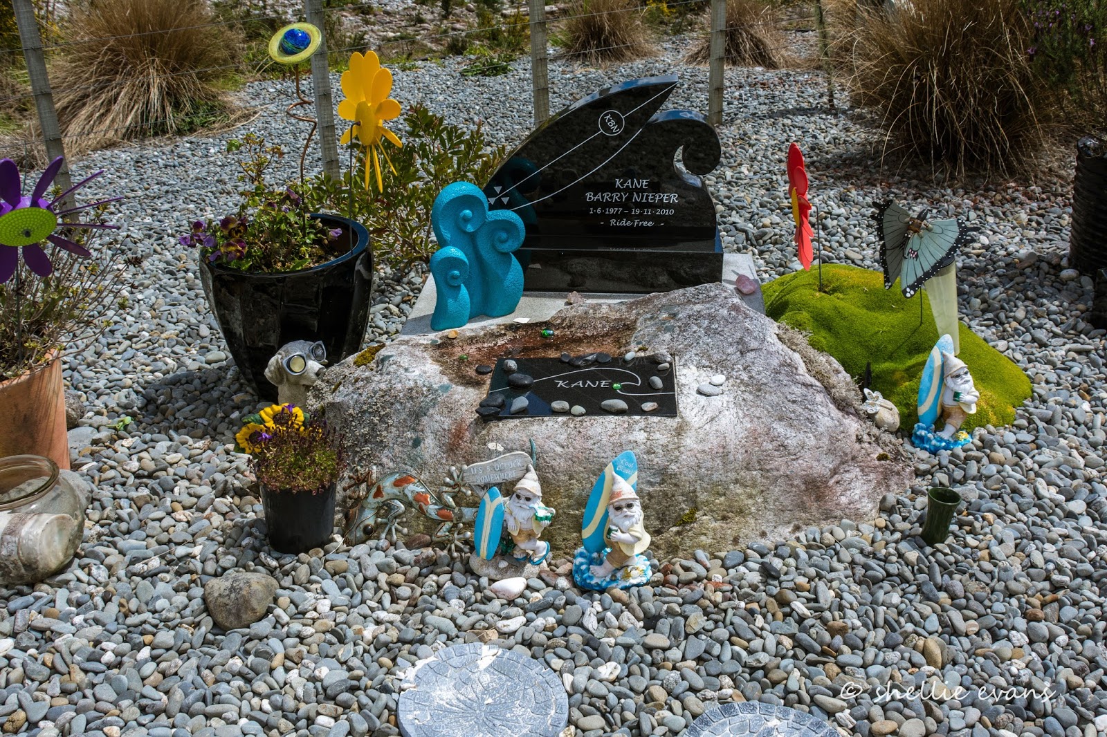
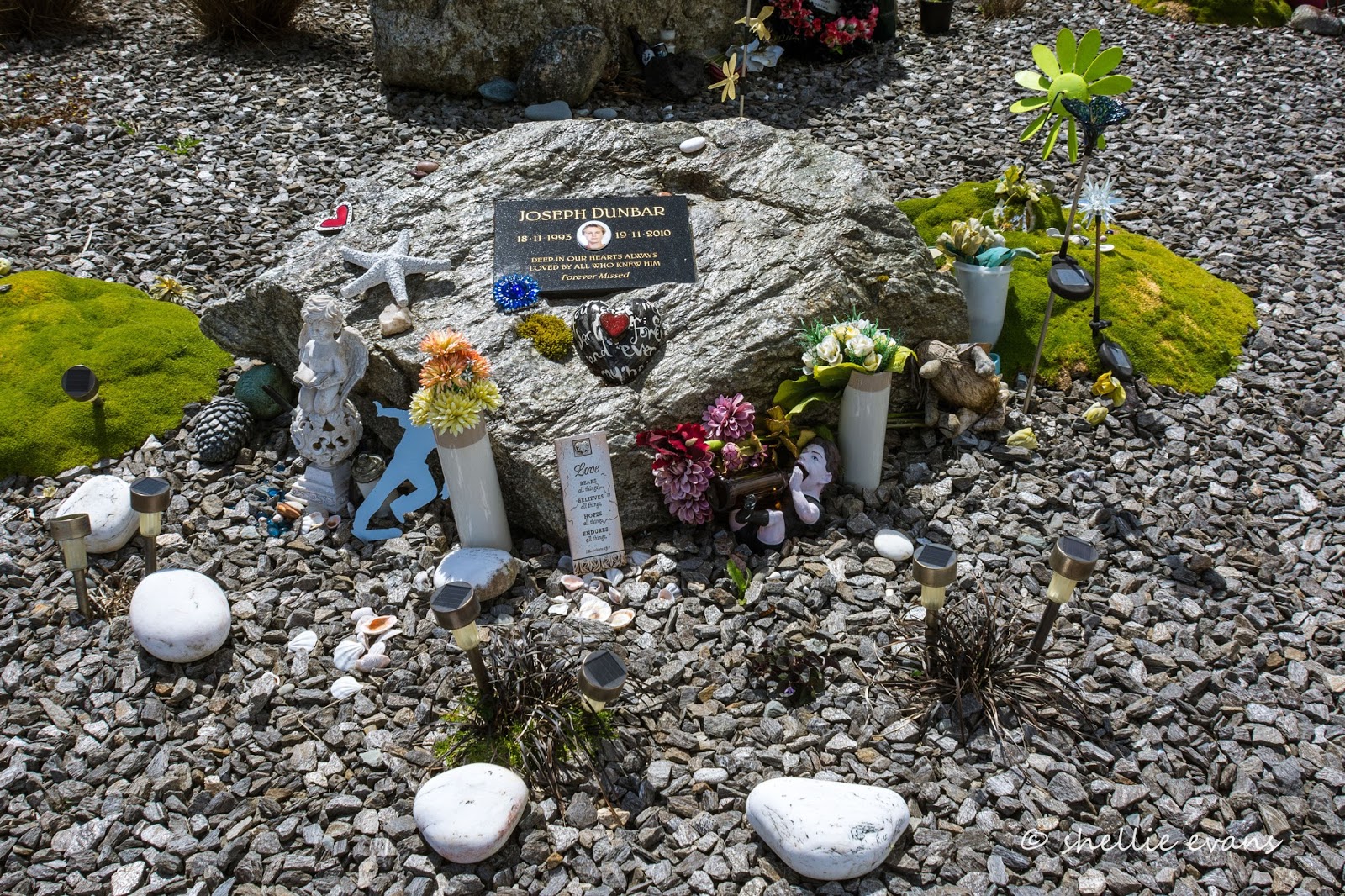
Initially I wasn't going to upload the personal memorials here but I've decided I need to. I know that the families of the Pike 29 don't want people to forget their men and the pain and loss that they have suffered. Perhaps there are families or friends that can't visit the memorial, maybe seeing their man's memorial here will help them sometime in the future as they're searching for solace or a memory.

Each of these memorials is very personal; a heartbreaking glimpse into the lives and character of the men and the people they left behind, a moving reminder of the loss of so many healthy, happy and loved people. There is little doubt that the Pike 29 will forever be remembered by New Zealand.


THE MEN OF PIKE 

They came from near and far away 
The men of Pike to work that day 
The afternoon shift way down deep 
Beneath the mountains oh so steep 
A long way in but further out 
The afternoon shift sets about 
A job not flash but hard and trying 
A job that holds the risk of dying 

From seventeen to sixty two
They start their shift to see it through 
For one his first, for all their last 
How could they know there’d be a blast? 
For all at once no siren whining 
Suddenly the worst in mining 
Dust and rubble fill the air 
A loader driver thrown clear 
Just one other finds the light 
The rest are hidden from our sight 


And so we learn as news is spread
The news that mining families dread 
It’s up at Pike there’s an explosion 
Faces drop and hearts are frozen 
Who, how many, where and why ---- 
Will they make it ---- will they die 


Fathers, husbands, brothers, sons
Coasters, Kiwis, Aussies, Poms 
Mates and friends who we are seeking 
Methane gas from coal seams leaking 
Vents exploded, phones unheeded 
Level heads and strength are needed 
The world above unites as one 
To bring the missing to the sun


Rescue teams are standing by
As holes are drilled and experts try 
To find a way that’s safe and sound 
To rescue those beneath the ground 
Could robots work where men are mortal 
To pierce the dangers of that portal 
But alas all effort fails 
The darkness of the mine prevail


A second blast of rock and thunder
Hope and prayers are rent asunder 
A nation weeps and Coasters mourn 
Pike falls silent, dark, forlorn 
A hole remains within the ground 
Devoid of joy, of life, of sound 


Another hole within the heart
Of those forever set apart 
From those they loved who went to toil 
Digging coal beneath the soil 
Those who gave their lives that day 
To work a shift for honest pay 
They wait at rest within their mine 
The men of Pike, the Twenty Nine

Sean Plunket


Lest we forget

Sunday, November 20

West Coast Progress Report

Real-time

Here's another quick blog to let you know of our progress down the West Coast. I'm starting to get that anxious feeling when I know I'm getting behind in my latest blogs and I still have a few too many past ones to catch up on. The problem at the moment is we're on the move every second or third day and 'Out There' doing things in between. But bear with me, I have some really great blogs waiting in the wings and I will get to them, it might just take a little time.

Whataroa Main Street
After sitting out the rain and stormy weather in Hokitika for several days, a window of opportunity opened in the weather forecast for a couple of fine days, so we quickly packed up and headed south to Whataroa where we parked behind the local pub in their well equipped camping ground. Not. At least there was power ($35 a night, $25 without) but I wondered at any maintenance; we wanted to plug in for a day or two to boost the van and give the solar and everything else a rest, it's been a few weeks since our last charge.

We were the only ones there the first night- the other 5th-wheeler belonged to 'the boss'. With the pub the only available site for camping in the area there were assortment of people staying the next night in sleeper vans, tents and motorhomes. I felt sorry for those that weren't self-contained as the sub-standard 'facilities' were at the back of the pub, a good walk away and locked up after dark.


Talk about the wild west, this was as rough as they come. The owner has a finger in many pies. But, what is that saying? Jack of all trades, master of none...


The only redeeming feature was the awesome sighting of a NZ Falcon/Kārearea...


...who sat atop the hiab on this truck looking a little perplexed as he tried to work out how to extract the starling chicks from the nests inside the arm.


As bad-luck would have it, the next day 'the boss' decided to have the arm repaired and the two starling nests and chicks that were inside the arm went for half a dozen 'octopus' side-show rides of their short life. 

Unbelievably, the nests survived although one chick did fall out (too young to survive) and the parents had to find a new backdoor as the nests slipped down the hollow inside the arm. I couldn't bear to look the next day, when 'the boss' arrived to show someone how the repairs went, swinging the arm up and around a few times. And yet they were still chirping away the next time I walked past. Thank God I'm not there if & when they come to drive the truck away...


The resident Paradise Duck pair had an unusual vantage point to survey their patch...


And the reason we were in Whataroa was, of course, to visit the White Heron/Kotuku sanctuary in Waitangiroto Nature Reserve, the only place in New Zealand where they breed. We'd been waiting for the weather to clear and we picked the right day.


The reserve is a 14km van ride and a 20 minute jet boat sprint away from Whataroa township. We had a fantastic visit, one of the best activities and most enjoyable we've done on our journey- there will be a blog coming soon.


With the Kotuku Sanctuary finally done and dusted (we've had it on our 'must do, can't wait' list since we hit the road) we carried on south to Okarito, a place we thoroughly enjoyed on a day visit back in winter when we passed through. This time we bought our home with us and stayed at the campground for a couple of nights...


 ...so we could do some bird-watching. Can you see the tiny fluffy bumble-bee sized banded-dotterel chick?


And walk the Okarito Three Mile Pack Track & Coastal Walk, along the rocky beach (it can only be walked one hour either side of low tide)...


...to the bridge to nowhere at 3 Mile Lagoon...


...and then return via the Pack Track over the Kohuamarua Bluff, a walk that in the end turned into an epic 12km hike because we couldn't not walk (well one of us couldn't, the other could have passed on it) up the 1.8km side track to the trig lookout, on our way home.

Okarito Lagoon & township
And now we are back at the lovely Franz Josef NZMCA Park where we sat out the rain during our winter visit. And guess what? It's just started raining again.


Thursday, November 17

West Coast Wilderness Trail & the Whio

Real-time

While at Lake Kaniere, and with David giving fishing a miss for the day, we decided to check out our favourite Whio/Blue Ducks at the Kawhaka Intake which is fairly close as the crow flies from the lake but a good 40kms by road. We have to head back to Hokitika before heading north and then back inland on the Old Christchurch Road. We took a shortcut once we reached Kaniere village, along a forest track and over Blue Spur and down the Arahura River valley which is lined with dairy farms.


Then it was 16kms up the Old Christchurch Rd before we turn onto a familiar track (another 10kms further on and the road exits on to SH73, the Otira Highway to Arthurs Pass). This must be our 3rd or 4th visit to this special part of the Coast.


A 5km track runs along the bank beside the deep, dark and seemingly still waters of the canal... 


...passing several small coves...


...and a couple of larger pools along the way. The white foam spreading out over the pond is natural and comes from an inlet waterfall where it's thick and frothy as it enters the canal.


At the end of the track is a carpark...


...and the Kawhaka Intake, the water used to generate power further downstream.


The canal road we've just travelled and the track that carries further on up the river and onto Lake Kaniere is part of the West Coast Wilderness Trail, a 139km multiday bike trail that is very popular and very scenic. When we first visited this area a couple of years ago, we had the area to ourselves, the next time we saw a few people on bikes, this time we saw a few dozen. The Kawhaka section is also a very popular day trail. 


The Kawhaka Creek splits in two on the other side of the dam wall; part of it entering the inlet holding tank (up above) before continuing on down the canal. The other half spills over the dam wall and continues on down the natural water course.


On the other side of the inlet and dam wall the river stretches off up the valley. It's here and along the early part of the canal that we've found the whio/blue ducks in the past. I thought we'd probably not see the ducks in the canal (where we'd seen them up close previously) because if they were breeding they would have a nest up the river. If they had ducklings there would be no way they could get into the canal as the adults fly there to feed.

We climbed to the top of the dam bank and scanned the river for the ducks including the rocky beach where they sometimes rest and the rapids further up the river. We were disappointed but it wasn't a surprise not to find them.


We walked back tho the ute and had some lunch overlooking the reservoir...


...before deciding to walk up the trail a couple of kilometres to where the track met the river once again and where we could see on our map, a walk-wire crossed the water. We thought we might be able to scan the river there for the whio. 


Along the way we were passed by several cyclists. The track was a once an old stage coach and supply route to the Waimea goldfields.


It was a surprise to find the bush covered track suddenly opened up wide to reveal a small ramshackle farm...


...complete with one friendly but lonely bull (I actually have no idea if he was friendly or not but I assume he was given that there was just a single electric(?) wire separating him from us. 


The small paddocks were littered with overgrown wrecks in typical West Coast style.


And high up on the hill across the river was a small 'off the grid' abode.


This is 'The Farm' of Mr Paul Sinclair and until the cycle trail opened he'd have lived a charmed but isolated life deep in the West Coast bush. Now he's set up a 'coffee cart' at his front gate where he can boil the billy while chatting to people who stop on their way past, he even has a chalkboard sign 'Sinclair is in'  


He also takes people on tours around his farm and the old Waimea water race and goldfield settlement. He has an old flying-fox for access over the river when it's in flood, the 'walk-wire' we'd seen on our map.  This is a man making the most of the opportunities that pass by his gate. He is also the local trapper, protecting and monitoring our Blue Ducks.


We had a look up and down the river but still didn't see an ducks. A few more cyclists passed by while we were looking. This section of the track looks to have been washed away and repaired recently. We headed back to the carpark...


...taking one last look up the river when we reached the dam wall. Wait.....is that...no, it can't be...


...two blue ducks chilling out on the rocky beach. I couldn't believe my eyes. There they were resting on the beach exactly where we'd seen them on one of our previous visits. They had arrived while we were walking up the river. They definitely weren't there the first time we looked but I still had to check the earlier photo (up near the top of this blog) just to be sure.


It was a thrill to see them again although it would have been better if they'd had ducklings with them or were in fact sitting on a nest somewhere. I wonder if they've lost their brood already or possibly haven't nested yet. I've sent a query to Hokitika DOC to find out. I waited for 20 minutes or so to see if they felt inclined to move closer but they stayed put. Which was fine, I have plenty of Whio photos.


We drove slowly back along the canal, admiring the reflections, checking for more bird life...


...and wondering at the close call the driver of the vehicle that ran off here had. 


Back on the road we stopped to let this gangly and dare I say it, slightly ugly, pukeko chick run across in front of us. I love his developing blue bib...


...and his extra big feet! (apologies for the slightly out-of-focus shots- he was running fast!) 


While we haven't ridden the West Coast Wilderness Trail, we've visited and walked in a number of the sections and I'd have to say that if I was looking at cycling one of the many trails around New Zealand then this one would be up near the top of my list. 

The scenery is spectacular from pristine wetlands near the coast to luxuriant bush and forested valleys ringed by snow capped mountains just a few kilometers inland. There's historic water races and reservoirs, crystal clear rivers and stunning lakes, along with old gold mining fields and settlements and many beautiful old rail bridges. And then of course there's the prolific birdlife.

Taken on a previous visit to the Whio