Showing posts with label abandoned. Show all posts

Wednesday, June 15

Around and About- Glenorchy

Catch-up

To finish off our visit to Glenorchy, here are a few photos taken out and about-

Looking out towards Glenorchy and Lake Wakatipu. The Glenorchy Walkway loops through the wetland on either a one or two hour walk.


Looking in the opposite direction towards the Routeburn and the Dart River valley with the Humbolt Mountain range along the back, and the small Mt Alfred on the right.


We walked the shorter lagoon loop on one of the miserably overcast and rainy days. This would have been a great walk in autumn, with all the willows in colour. Or in summer when there would be water fowl and babies about. As it was, we only saw a couple of black swans and half a dozen ducks and that was it. It looked as though the boardwalks had been under water during the last few days, water weed had washed over the boards.


On the way back from the lagoon, the path passed a local's personal junk yard...


...which provided me with some good subject material! How's that gypsy caravan, I can just see it being towed behind the Ranger.


The majestic Humbolt Mountains across the valley from Glenorchy. If you look carefully you can see the red of Kinloch Lodge at the bottom centre. Which makes the mountains a pretty impressive size.


Further down the road heading towards the Rees Valley are Mt Albert on the left and Mt Earnslaw.


I took these last few photos just before we left Glenorchy. I spotted lots of interesting subjects while we were out and about but there's only so many times I can get David to stop for me so I went on my own little tiki-tour. Here's another old farmhouse on the side of the road.


And a colourful windmill I spotted in an overgrown paddock.


Back in town, I'd been waiting for a few days to capture the tiny & historic(1891) Glenorchy Library in fine weather.


A Glenorchy house- as they used to be before the road made it to this little backwater at the top of the lake (in 1962, unsealed until 1998). Located on a reserve near the foreshore, the water tower (and some concrete foundations) are all that remains of the Mt Earnslaw Hotel which burnt down in 1959.


Head of the Lake Community Church- another one to add to my country church album.


And a final collection of the most famous building in Glenorchy; the historic Wharf Shed.


Tuesday, May 10

Winton to Queenstown- Lake Hayes

Real-time,  two blog posts for the price of one today! We are out of range tucked up beside a tiny little lake just out of Queenstown (tucked up out of the weather too, we hope) and have come into town to get a few supplies and upload a couple of blogs.

After a ‘slight’ detour down to Winton two weeks ago, we said goodbye to the family on Friday and headed north again, back towards Queenstown. We had a lovely time but needed to leave them to it after their extremely busy first week back at school and work after the holidays.The weather was great, very mild and sunny for this time of the year and with spectacular sunrises and sunsets nearly everyday.


We took a picnic lunch to Dunsdale Reserve on one of the perfectly sunny days. The reserve is located in the Hokonui Forest Conservation Park a few kilometres inland from Hedgehope on the Winton to Gore highway. After passing through a pine forest on a typical forestry road of gravel, mud and corrugations, it was lovely surprise to find a beautiful green open park at the end of a the road, surrounded by native bush with a small river on the boundary. Self contained freedom camping is allowed here and I’ve heard that it’s a very busy place over the summer holidays. Today there was just one house truck and us.


There’s an easy 1hr return walk up one side of the river, passing a small waterfall on the way and through an open burn at the far end before returning down the other side of the river. Ollie managed to spot a large trout sheltering under the bridge at the top of the walk which spurred him on just in time, as he was getting tired.


The kids also had fun locating as many different birds as they could (when they stopped long enough to watch and listen) and there were plenty; fantails, tomtits, brown creepers, bellbirds and wood pigeons swooping and diving high above the trees. The bush is in mast this year and covered in a mass of colourful berries, both high and low, providing plenty of food for both birds and pests alike.  The red berries are on a pittosporum, the  translucent orange berries are hanging from the Myrtaceae shrub and the red berries with black caps in the two bottom photos are on Kahikatea trees.


For a bit of variety when we left Winton we took a different route, crossing the Oreti Plains through Wreys Bush, up to Mossburn, onto Five Rivers and then back onto SH6 through our favourites country towns of Athol & Garston and then on along the edge of Lake Wakatipu. It was about 20kms longer but the roads were nice and straight and with hardly any traffic.

We stopped just south of Athol at the old Fishermans Retreat Tea Rooms. I saw the autumn colours were just starting turn when we passed on our way south two weeks ago, so I was hoping they were still showing. The Tea Rooms look abandoned but just after I’d finished taking a few photos, smoke twirled up from the chimney and a fat ginger cat came out of the undergrowth towards me. Somebody must be living out the back.


With no strong winds and mild weather, many of the trees were still in their beautiful autumn colours. Behind the tea rooms are a row of ramshackle cabins, obviously where fishermen used to stay while fishing the local rivers (trophy trout rivers)- that’s the cabins in the top left photo. We continued on, stopping briefly at Athol so David could check a couple of things in the van. Never one to miss an opportunity, I quickly took some autumn shots of Athol’s St Bartholomew Church.


It’s a quick and…I was going to say smooth trip through the Devils Staircase alongside Lake Wakatipu, but that would be fibbing- the road along the lake is extremely lumpy with plenty of dips and rises where subsidence has been repaired. It felt like we were riding a roller-coaster!


Our destination is beautiful Lake Hayes, located in the rolling countryside of the Arrow Basin between Arrowtown and Queenstown. The lake is surrounded by golf courses, luxury houses, vineyards and lifestyle blocks. The Remarkables once again form a backdrop to some stunning scenery.


Lake Hayes has a small area where freedom camping is allowed for two nights only, and only between the signs. You can see the one beside us and the other one is at the far end. It’s also well known (or should be) that the Queenstown Lakes District Council rigidly police their freedom camping bylaw and rangers check the sites regularly.


There’s a walking (and cycling) track right around the lake which takes about 2-3 hrs to complete. It must be like the Mount walking track; it’s very popular and used regularly by locals for their daily exercise. A continuous parade of cyclists, walkers, pushchairs and dogs pass by our camp site. It’s very pleasant under the willows at the waters edge where there’s also a number of kayaks, canoes and paddleboards passing by.


By late afternoon a steady stream of sleeper-vans, campervans and motorhomes arrive to stay the night. The allowed space isn’t that big and would comfortably hold around 10 vehicles. By night fall there were 19 vans squeezed into the space, with a few of the smaller vehicles out the back under the willows. The two motorhomes to the right of us were outside the sign and I was worried for them. They have tried to park correctly but there is no space left (that’s when you need to find another park….or go to a campground). I know of someone that was fined for parking just outside the sign here.


There were also at least 10 other vehicles parked up for the night elsewhere in the reserve. They were either choosing to ignore the rules or were oblivious to them. More fool them. I’m not sure whether I slept through the visit on the first night or the ranger didn’t come but I know he came the next night at some un-Godly hour shining his torch on every vehicle and writing down registration numbers and checking self-containment stickers. I bet those that where elsewhere in the park woke up blissfully unaware that their numbers had been taken and a $200 fine was awaiting them when they returned home or returned their rental vans.


I was up early to catch the sunrise and found an old favourite down on the lake edge; two Australasian Crested Grebes calling to each other as they dived and fished in the shallows.


Sunrise over The Remarkables, you can see the ski field access road zig-zagging up the side- a bit of a necessary blight on the landscape.


Clouds gather over Queenstown at the end of the lake and a rainbow forms a perfect bow over the lake.


The pink sunrise glow quickly disappeared to be replaced by darkening storm clouds and big spots of rain. Thankfully it didn’t last long, which was just as well, as we only had one day to do one of our ‘must do’ road trips before we had to move on.


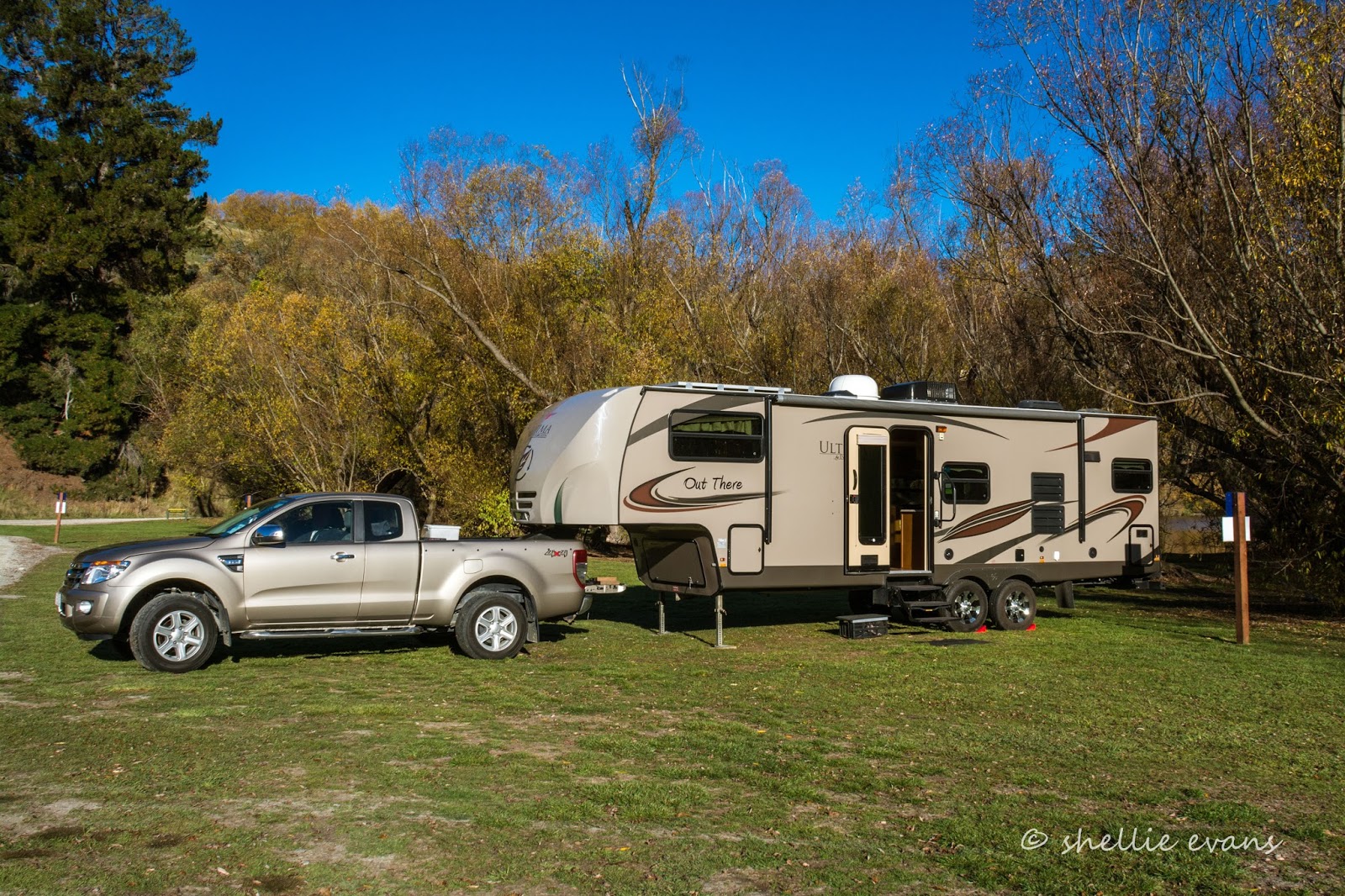
While we were getting ready for the day- I was cleaning my camera on the sofa and David was cooking his breakfast- I felt the van move. When I looked up, a woman had stepped up to our top step, and was holding onto the handrail, posing for a photo! The bloody cheek of it.

We often have people (mainly tourists) taking photos of the van or themselves in front of or to the side of the van but have never had someone be this rude, especially as our door was open (the screen door was closed) and we were inside. She got a short shift from me, I opened the door and said “EXCUSE ME….”  as she nearly fell off the step. Another lady came rushing over apologising profusely and then asked if she could have a photo taken! I was lost for words.

A group of about 15 people had arrived in three Jucy people mover rentals (thank God they weren’t sleeper vans), sped into the gap between our vans, tumbled out of all the doors, took dozens of photos down on the water front and under the willows, posing this way and that and then spread out around the remaining motorhomes taking photos. Then they all piled back into the cars and roared off. So keep your eye out for a marauding pack of shutter happy tourists who have no idea of personal space! I tell you, life on the road is never dull.


The rest of the day was taken up with a exhilarating drive through Skippers Canyon and visit to the remains of the Skippers gold field.


But you’ll have to wait for that blog, it deserves it’s own post.


It was another stunning sunrise the next morning but it soon clouded over.


We’d also had our two nights and it was time to move on. It’s a pity the council don’t allow three nights at Lake Hayes, this would give people two full days to do their activities. We still have a few things to do but we’ll wait until we come back through after we’ve been down to Glenorchy and Kinloch at the bottom of the lake.

We stopped at the top of the hill so I could take one last photo of what was left of the autumn colours. The willows have just about shed all their leaves and being such a dull day the colours weren’t so great.


Wednesday, March 18

Much in Murchison

We stayed at the NZMCA Park in Murchison for six nights in the end, relaxing, catching up on computer work & enjoying the small country township which was always busy with passing travellers; alot who stop to refuel both vehicles and themselves.

I mentioned in a previous post how hot it was, in fact it was extremely hot every afternoon that we were there. Low cloud and fog settled in the valley overnight so the mornings were always cloudy and overcast but by lunchtime it had lifted or burnt off and with not a breath of air, the sun was a scorcher! Our outside temperature gauge ranged from 32-36 degrees some afternoons. Inside wasn’t much better at 30+.

I got so distressed with the heat the first afternoon, that I went to the shop next door to ask the guy where the local swimming hole was. He directed me back up the road, past the cemetery, through the domain campground to ‘eel pool’, a deep hole on the edge of the Buller River. Not even the pool’s name was going to stop me from jumping in. And it was heaven! Another couple (workers from the pub) were also there, they were jumping off from the rocks, I was happy enough with my pool.


That evening, and for the next two, a massive thunder & lightening storm formed & then raged over the mountains to the north of us, luckily the rain didn’t reach down into the valley. Light from the sunset cast an eerily glow over the park.


We don’t eat out that much while on the road, we’re usually out in the wops or passing through towns but with Murchison having so many eateries (5 or so cafes, 2 pubs & one small restaurant- and this is a very small township) and with us parked just a few metres from them all what could we do? Let’s just say it was our contribution to the local economy. We had dinner at the pub (nothing to write home about), went to dinner (with some lovely people) at the Cowshed Restaurant, a tiny quaint 16 seat room on the side of a garage (great food).   And had breakfast at The Rivers Cafe (a very popular cafe) set up in an old service station, the outside seating was across the old forecourt. We also had morning tea at another couple of cafes and all served good & tasty food and all were very busy.


And who were those lovely people we went to dinner with? Jackie & Bob, David’s sister and husband! It was a lovely surprise to see them, our paths crossing just for the night. They were on their way back home to the Bay of Plenty (via Golden Bay) after catching up with their family in Southland over Christmas.


Whenever we’re on a remote walk beside a tumbling mountain river we’re always on the lookout for NZ’s rare & endangered endemic duck, the Blue Duck or Whio. So far we’ve not spotted any. So when we found out the the Fyfe River near Murchison has around twenty pairs of ducks along it’s reaches, it was an ideal opportunity to see if we could tick another native bird off our list.

The Fyfe River is located in a remote valley beside Mt Owen in the Kahurangi National Park. We drove up the winding gravel Owen Valley East Road for about 15kms before coming to a private farm which we had to cross to get to a track that skirted around the edge of a gorge that Fyfe River flows through. We knew we were in the right area, the familiar 1080 drop warning board had a Blue Duck photo this time, at the Lake it was a Kaka photo.

After driving over a rough farm track, opening and closing a few farm gates and startling the cattle & sheep in the paddocks as we drove through, we parked beside Frying Pan Creek. The track started just across the creek near a broken concrete ramp that saved us getting our feet wet- little did we know that we had dozens of water crossings ahead of us.


It’s the first time we’ve seen a dydimo ‘clean your gear’ station at the beginning of a track, although it would have helped if the detergent bottles had something in them. I think it’s a lost cause though, because this was a stream we crossed just a few hundred metres up the track- coated in filthy ‘rock snot’.


We followed the track through farmland for about 2kms, chasing a flock of sheep ahead of us all the way. Why they didn’t just run off the side I don’t know. We stopped occasionally to help ourselves to a few ripe blackberries although we were just a couple weeks too early to pick ourselves enough for a blackberry & apple pie, but the ones we did find were tasty & sweet. David started out in his track pants- it was overcast & cool when we left camp but by the time we started the walk the sun had broken free and was beating down on us yet again, he had to roll his pants up to try & keep cool. By the time we got home his trackies were covered with spikey biddy-bid seeds- both on the in & the outside! He then had to spend the next couple of hours picking them all off!


Eventually we entered the bush and started to climb & climb some more. The track narrowed and became more overgrown as we went on. We crossed the creek dozens of times, clambered over fallen trees and along slippery rocky walls. These photos are from the beginning when it was an easy climb. It was a beautiful walk, brilliant green mosses and ferns smothered the ground and trees and the bird life was amazing.

In the end I had to put my camera away in my backpack(a first!)- hence no photos of the tough terrain, that and the fact that it was very dark in the bush and we really had to watch our every step. After an hour or so of tramping and hauling ourselves through the undergrowth, and after checking David’s topo map app, we realised that we’d not make it to the river with enough time to return to the car. Looking at the map we’d only probably got about two thirds of the way to the river and still had to climb upwards before dropping down into the river valley. Once there we’d have to follow the river upstream for a bit to locate the ducks. We reluctantly decided to turn around and leave the ducks for another day.


Before heading back down we found a large rotten log to sit on to have a snack. Unfortunately the rotten log was really, really rotten and when we both sat down, it collapsed and started to roll down the bank. We jumped clear as it broke in three and came to rest against a tree. Immediately three bush robins came flying in to see what we’d exposed. They are so nosy & friendly hopping around us and grabbing anything that moved. We also spotted a bellbird having a poke around in the rotten fibre.

It was late afternoon by the time we got back to the car, we knew we’d made the right decision. Next time we’re just going to have to get out of bed a bit earlier! Because it was overcast we initially didn’t think we’d do the walk, we were just going to drive in there & check the location.


Right next door to the NZMCA Park is the Dust & Rust Vintage Store, a very cool building filled with memories from the past. The building is a Historic Places Category building, it used to be Commercial Stables where wagons and coaches pulled in for the night. They drove in through the front archway, the horses were put in stalls on the left inside and the coach drivers had a room on the right hand side.


Some historic buildings and abandoned farm houses from around Murchison. The theatre building sits right in the middle of the NZMCA Park (which has recently been extended to the other side of the building), you can see our van through the shrubs, backed up to the side.


Of course I couldn’t not take a photo of Murchison’s Anglican Church of St Pauls could I?


Hodgsons General Store brought back memories, it reminded me of the general store that used to be in Nuhaka in Northern Hawkes Bay. We’d visit it as kids when we were holidaying at Mahia- usually to get a huge icecream on a hot summers day while Mum bought groceries or on our way back to the bach from the Morere hot pools.


The shelving was typical of a general store when it was packed to the gunwales and was supported by locals from far & wide. Unfortunately nowadays with supermarkets and convenience stores in the same town the general store has lost a lot of it’s impact. Photos, old tins, containers, bottles and goods from the past lined the top few shelves. Everyday items were sparsely placed on the other shelves. I love the Aulsebrooks banner along the counter front.


We visited the longest swingbridge in New Zealand, which spans the Buller River 16kms south of Murchison in the Upper Buller Gorge.  The bridge is 110 metres long and is suspended 17 metres above the river. There’s also a ‘Comet Line’, a 160 metre zipline (flyingfox) that crosses the river beside the bridge.


David was a little nervous about crossing the bridge but when we got there he strode out without a worry just as the Buller Jet roared past underneath us.


It certainly was a long bridge but in fact I didn’t think it was as bad as some of the smaller ones I’ve been on. I think it makes a huge difference when you have rocks and roaring rapids below, here the Buller was deep and green as it flowed past.


We took a 30 minute walk through the bush on the otherside (which is known as the ‘Buller Peninsula’) to view the Ariki Falls. On the way we crossed the  White Creek fault line; the epicentre of the 1929 Murchison earthquake where the ground was thrust up 4.5 metres. There were also stone wall reminders of the gold rush and other relics from the past.

The walk was a little muddy and overgrown but eventually we made it to the ‘falls’, a very short fall after which the river was forced through a pink & grey granite gorge. Kayakers often paddle down the falls and through the chasm. We were underwhelmed with what we saw. But I think that had something to do with the constant harassment from the sandflies.


As we crossed back over the bridge a couple were riding back via the comet line. It looked pretty sedate compared with the zipline in the Mokai Canyon. I even thought about having a ride but by then I was back to the other side and it would have cost me an extra $10 to cross the bridge again!


Been there, done that- crossing back over the bridge.