Real-time
Contined on from Part 1
While at Fairlie we did a day trip to Timaru to visit, of all places, Super Cheap Auto & Briscoes. David needed a new heavier duty jack, he'd bent the head of the last one awhile ago and it had been a problem when we'd had the blow-out and we also needed a new electric heater, our old one had been dropped and made an annoying whirring noise and then it blew blue smoke (there's a theme going on here....)

After visiting the shops, we drove down to Caroline Bay, apparently the most popular beach in the South Island (it's lovely but I think there must have been some parochial voting going on). It looks nice & sunny in these photos but boy was it bitterly cold.

And as if to rub salt into the wound, I heard a whole lot of noise coming from a group of people near the container wharf in the far corner of the bay.

The mid winter Polar Plunge was about to happen....brrrrr....

...and just as I zoomed in on the people the countdown started and then a roar went up to go as a small group of people clad in a varying array of costumes and swimsuits raced for the water. After a quick dunk under the water most exited it just as fast. Some very brave people indeed!

We did a loop on our way home, taking some of the back roads behind Pleasant Point looking for a couple of places of interest (as highlighted in one of my map books); Hanging Rock Bridge was a non event. But it wasn't until I got home that I realised it wasn't the bridge that was of interest it was the nearby 'Hanging Rock', a huge lump of limestone overhanging the riverbed (which of course I didn't see). Duh!
But in my defence, the map book did say 'Bridge', if it had left that out I'd have looked further for the Hanging Rock.

I did love the sign that was nearby. Some wag has hung a rock (in it's own little string bag) off the road sign.

The other place of interest was the Kakahu Kiln...

... a huge lime kiln that's sitting in the middle of farmland and bush out in the middle of nowhere. This kiln was built in 1876 and was used until about 1900. Lime from the surrounding area was burnt- using coal from the area too- in the kiln. The burnt lime was used for agriculture & in the building industry.

Click on the photo to read more about this fascinating industry and why it didn't last.

There is a 3 hour, 8km part-loop track up behind the kiln, it follows part of the old tramway which brought the limestone chip down to the kiln, passes Balancing Rock (they like naming their rocks around here) and finishes at the Pinnacle Lookout. I walked up the track to check the top of the kiln where I could see a small tree growing out of the centre, along with some long grass. I hope they clear the tree before it does any damage.

We decided the 20 minute Escarpment Walk just down the road would be far enough for us today.

We followed the sheep track across the paddock, dodging piles of poo as we went, to the escarpment where huge boulders are scattered like giant's marbles around the base.

Up close the large boulders are mushroom shaped and eroded around their base, apparently this happened thousands of years ago (and I thought it was the sheep). The area is of great spiritual significance to local Maori. I had a quick look for Maori paintings, similar to the ones we were shown at a secret site when we stayed at nearby Albury Station, but didn't find any. There could possibly be some up in the rocks and caves further up the slope but the ground was very boggy so I didn't explore further.

From Kakahu we continued on along the gravel road until we popped back out onto the main road not far north of Geraldine. And then it was a smooth ride home back along the highway with a quick stop at the viewpoint high above the Fairlie valley. The township is behind those trees, centre right.

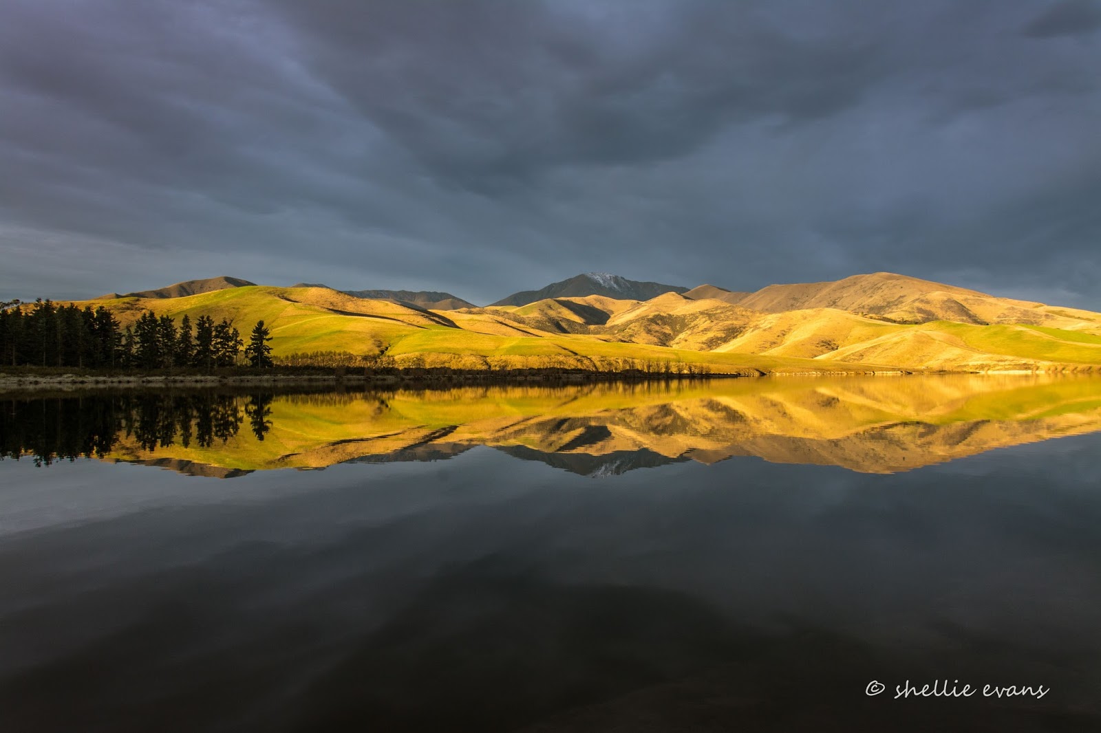
Lake Opuha, a man-made irrigation reservoir is just 12km from Fairlie, it's very popular during the summer for water sports and fishing and there are also three freedom camping areas, one we stayed at the last time we visited this area (again in the middle of winter). We drove up to the dam face, we hadn't actually visited here the last time. The water was silky smooth.

Below the dam a narrow gorge channeled the water down to a small pond. We watched a car head down the narrow track over the top of the spillway and then diagonally down the face of the dam and along a dirt road to the pond, it returned soon afterwards. I wondered if there was a picnic, swimming area there. We didn't check it out.

We drove back around to the Bennetts Road boat ramp/camping & picnic area and had afternoon tea just as the sun was about to disappear behind Two Thumb Range.

While we were there two locals arrived and unloaded their jet skies. Our peace & tranquility were shattered as they blasted their way around the lake.

Several days later I drove the loop back out to Lake Opuha hoping to shoot some reflection photos in the late afternoon sun, and also find some rolling farmland before the sun went down. Some of you may recall my reflection photos from our last visit, here's one from the latest visit; pretty similar if you check that link. It's a great spot to visit.

On the way home I stopped on the road beside a newly sown paddock that I'd spotted while driving past with David a few days earlier. I loved the rolling landscape and the shadows cast by the setting sun.

This one is of the farm buildings, how I would have loved to have actually got into the paddock and found a spot where the composition in both photos could have been better.

I did head around to a side road to see if I could get some better shots but unfortunately the sun had disappeared off the front paddock. Time to head home...

...although I couldn't help stopping for one last photo at the lookout again, just as the sun disappeared behind the mountains.

Which wouldn't have been a problem had word not got to me that due to the severe cold temperatures and a few days of pea soup fog, a hoar frost was building up in Twizel. Darn! Darn! Double Darn!
Just 100km stood between me and my bucket list photo. For four winters over the last seven years I have hoped for a hoar frost, I've captured a few mini frosts but never the big one, the money shot; bright blue sky and white frosted trees dripping in icicles. They have happened but always where we've not been at the time. And because the roads are usually treacherous to drive during the frost you need to be Johnny-on-the spot to be in with a chance.
As we headed out late Friday morning past Mt Dobson (tyres arrived and fitted), I wondered if I was going to be in time.