Showing posts with label tekapo. Show all posts

Sunday, November 14

Autumn in the High Country

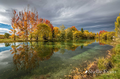
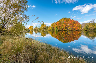
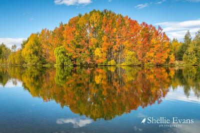
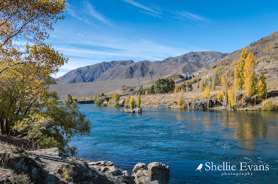
I've been procrastinating too much & look where that got me. I'm still in autumn! The photos are too lovely to miss so here you go an autumn photo fest. 

Out & About Around Twizel
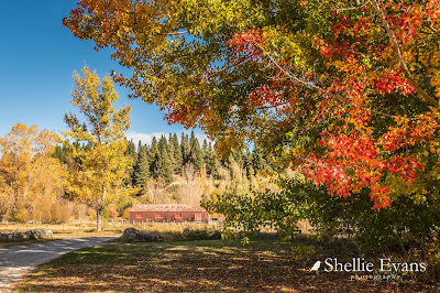
Ben Ohau Station Stables
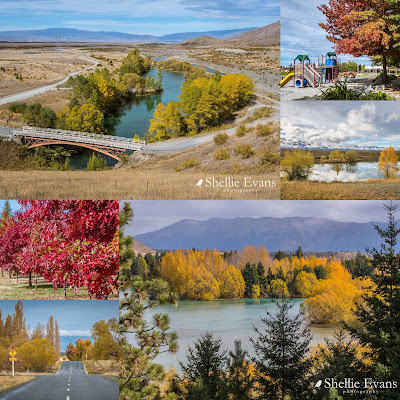
Clockwise- The Old Iron Bridge, Twizel Village, Loch Cameron,
 The Lagoon at Lake Ruataniwha, Glen Lyon Road ford, Glen Lyon Rd trees
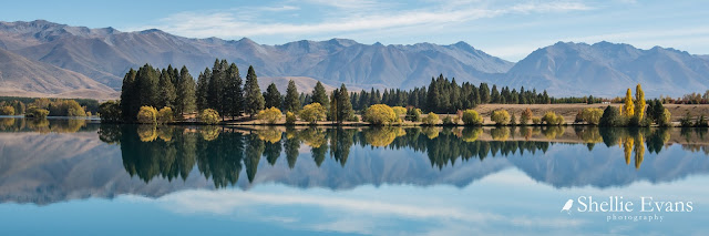
Lake Ruataniwha & Ben Ohau Range
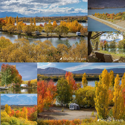
Ohau C Camp, Lake Benmore

The Lagoon, Ohau C Camp
Ohau C Camp looking very resplendent in autumn colours

Ohau C lagoon on a different day
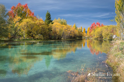
Reflections- Wairepo Arm, Twizel


Kellands Pond, Twizel 
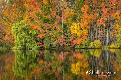
Hard to believe this was taken in NZ and in the high country


This is a favourite place to stop for a drink or just to relax for a few minutes when I'm photographing around the ponds.


Poplars always make a great show during autumn & are even more impressive when they line the entrance to a farm- SH8, Omarama


On my way to the Otematata Wetlands at Lake Aviemore I stopped at the top of the road overlooking a farm station & Lake Benmore in the distance- as you can see, other than the briar bushes, there's not much autumn colour away from the waterways. That's the A2O Cycle trail in front of me, heading off down the Waitaki Valley to Oamaru.


A farmer's work is never done.


Sailors Cutting harbour on Lake Benmore (this is the southern end of the lake, when I mention Lake Benmore it's usually the north end). Since this photos many of the willows that line the road side (where the boats are) of the harbour have been removed due to age & weakness. 


Otematata Wetlands, Lake Aveimore, Waitaki


With it's network of tracks and ponds, the wetlands are a great place to visit and especially in the autumn. The birdlife is also abundant & I was lucky enough to see a lone Kotuku/White Heron on one of the ponds.


Take a photo of the information board with the map or download the map from my link above because it's easy to get lost as the many tracks crisscross each other. There are several entrances, I went in off Loch Laird Road. One of the tracks ends up (or starts if you are staying there) at Boat harbour camping ground.
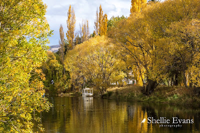
Boat Harbour- Otematata
Benmore Dam & the Waitaki River/Lake Aviemore


A quiet side diversion from the main lake & great place for children to play; Loch Laird camp ground.


Another high country station near Otematata.


Glencairn Station, Twizel


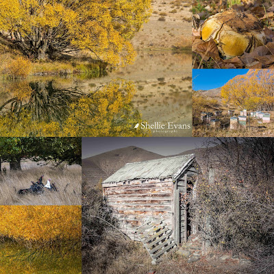
Clockwise- Pond reflections, Monster puffball, Beehives,
Chook house, Willow reflections, Wild turkeys
Simons Pass- SH8, Tekapo-Twizel Highway


Freedom Camping at Patterson Ponds which is sadly no longer available (Genesis closed it because of the perceived flooding threat) 


Patterson Ponds & Tekapo River. My beautiful Patterson Ponds are slowly dying, bird & fish life gone. The river course has changed, the inlet into the ponds is high & dry and much of the water has drained out. And is still draining out at the south end of the 8 or so ponds (see bottom left photo). This was once a vibrant and active little ecosystem, an oasis in the middle of a parched & dry landscape and it's so sad to see.


Aurora at Tekapo River- It was a new location for me when an aurora alert went off. It wasn't a strong one but I still managed to pick up a few beams.


Exploring Godley Peaks Road (again) down the western side of Lake Tekapo
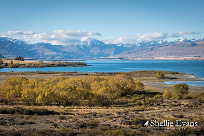
Lake Tekapo
Another favourite; Lake Alexandrina


Lake Alexandrina; top, middle & bottom camps. Including a caretaker having a quiet moment with his pet sheep who follows him around while he checks the pest traps each morning (bottom left photo)


And to finish with, a chance sighting of a rare Black Stilt/Kaki 


Tuesday, July 23

Hunting for a Hoar Frost- Mackenzie Country; Part 1

Real-time

Was I going to be too late to catch my hoar frost? That was the million dollar question. We left Fairlie late morning on a beautiful sunny day. There would be no dilly-dallying on this trip; straight through Burkes Pass and down into the beautiful Mackenzie Basin, the snow capped Southern Alps forming a stunning backdrop. I love catching that first sight of the mountains, they are jaw-dropping spectacular no matter what time of the year it is.


Through a busy Lake Tekapo village with Mt John directly ahead and not a scrap of snow in sight. It's hard to believe that Tekapo has already had a good dumping of snow this winter, I missed that too.


Then it's along the straights, dry tussocks grasslands stretching off into the distance and not a flowering lupin in sight...


...up over a hill and then around the corner and the first sighting of beautiful Lake Pukaki and it's turquoise blue waters.


As we head over the spillway and past the lookout carpark I ask David to put his window down and snap a shot of a beautiful Aoraki/Mt Cook standing proudly at the head of lake; it's not often you see her without her head in the clouds. It's just as well I have a few dozen similar photos, we'll not be stopping to take in the view today.


By the time we reach our destination, the NZMCA camp at Ohau B Canal, I'm pretty much certain if there was a hoar frost it has now melted back into the land. There's a patch of frosty grass in the shaded lee of the small hill behind the camp and I also spied a shaded row of heavily frosted pines along the main road but that's it, it's now a brilliantly fine sunny day, although the temperature is a very brisk 4 degrees. 


I check a Facebook page I follow and see stunning photos of a blue sky hoar frost taken near Twizel this morning! I'm gutted, it looks like I'm six hours too late. If only the tyres had arrived on time. Later in the afternoon I check back on Facebook and see that someone has mentioned that the willows at Lake Benmore's boat ramp were covered in frost this morning and it may still be there.

As I loaded up the ute with my gear, I stopped to take a photo of an Australasian Crested Grebe as he paddles past the rig. This is my favourite South Island lake bird and I'm happy to see another three birds floating around the salmon farm across from the camp.


I headed off down the canal road towards the lake, keen to also see how many anglers were trying their luck along Ohau C canal. Two weeks prior, 3000 salmon- due to be harvested later in the year- had escaped from their pen at the salmon farm. They had been providing a fishing bonanza for anglers that had come from far & wide to try their luck. 


I had seen photos, during the early days of the escape, of shoulder to shoulder anglers on the banks of the canal near the farm. There were still dozens fishing this afternoon but they were a little more spread out. At this time of the year you would usually only see maybe two or three anglers along this stretch of canal.


I carried on down to the Ohau C power station, the last power station on the canal before Lake Benmore.


It wasn't a surprise to find a couple of dozen anglers fishing on both sides of the canal and along the dam wall here either. I'm no fishing expert but I've learnt from a lot of time spent observing, that salmon (and trout) either hang out around the farm, feeding on the excess food that escapes the nets that contain the farmed fish, or swim to either end of the canal (looking for an escape or to spawn?) 

There is no escape for Ohau C fish, it's one long canal. Ohau B fish at least have a change of scenery available to them via Lake Ruataniwha and Wairepo Arm.


There's maybe 5 or 6 kilometres of canal between the farm and Ohau C power station so you would expect there to be some fish in between but it's very rare to see an angler in that middle ground, on any of the canals. 


I left the happy fisher people behind and headed down to the lake (I saw several large fish discreetly placed in bins near vehicles- I say discreet but how do you hide a large fish tail when it's obviously taller than the bucket. Fold it in half?) 

Sadly the willows along the boat ramp harbour weren't dripping in icicles either although the reflections made up for that a teeny weeny bit... 


... and the large pond in the centre of the campground was also devoid of frost. It was still bitterly cold so maybe if I found some shaded trees I might have a chance...


I drove quickly back up the canal. Actually not that quick really, because I find it quite off putting driving along the edge of the canals. It feels like I'm suddenly going to veer off the road and disappear under the deep blue water never to be seen again. I focus on the centre line.

I pass the anglers, the power stations, and David sitting in the van at the camp site and then I'm back out on the main road. And heading to one of my favourite- and most photogenic- places in the Mackenzie Basin, no matter what season it is. Wairepo Arm is a large body of water that joins the Ohau B Canal and is fed from Lake Ruataniwha. Wairepo Arm is just opposite our camp and another salmon farm sits on the corner of the canal and the pond. 


Wairepo Arm reflections are spectacular, especially during autumn when the colours on the willows and poplars are vivid yellow, although winter isn't half bad either! No hoar frost here though.


I have one last port of call in mind before the light fades; several narrow coves near a small island close to shore on Lake Ruataniwha, and beside the Lake Ruataniwha Holiday Park. 


It's very cold here as the reserve is tucked into a pine forest and sits below a natural river terrace so the sun only reaches into it's depths for a few short hours during winter.


But the calm milky blue water provides some beautiful reflections, even better than Wairepo Arm on this day.


But sadly there's still no hoar frost or even remnants of one so it's time to head home and see what tomorrow brings...

Lake Ruataniwha- looking towards SH8, the salmon farm (and our camp) are the white patches on the right.

Later on that evening I check the Facebook page again and my disappointment was intensified when I saw hoar frost photos from some of the places I had visited in the afternoon.

Many thanks to Nikki Adams who lives in Twizel for allowing me to use her gorgeous photos. Look familiar? And just a few hours separate the shots. I've included mine again so you can compare, click on the photo to enlarge.

Lake Ruataniwha-


Wairepo Arm-


To be continued...Part 2