The road to Skippers through the Skippers Canyon, alongside of the Shotover River is world famous in New Zealand, and is in fact, famous out there in the world too. In 2014 it was labelled by a British driving firm as one of the 22 most dangerous roads in the world to travel. I wouldn't say it was that dangerous but it's a very difficult road to drive, and a road that rental car companies do not insure for, or allow their vehicles to travel on. All I can say is thank God for that, it's enough to meet half a dozen vehicles coming the other way let alone a few dozen foreign drivers thrown in the mix.
Skippers Road is accessed from the Coronet Peak road, high above the Arrow Basin, where we stop at a lookout to take in the wide sweeping view- the cloud foiled my attempt to get a clear photo though.

Looking right towards Lake Wakatipu and Queenstown with the Coronet Road below.

And then it's onto the Skippers Road with it's many warnings....

...and over Skippers Saddle a short distance later with more dire warnings. If this doesn't frighten the bejesus out of you then I guess you're ready to tackle what's ahead...

Skippers Road was built during the gold rush, when a precarious pack track was the only access to Skipper township and the Upper Shotover diggings, 14kms further up the Shotover River. Constructed between 1883 and 1890, the road was considered a major engineering feat for its day.
Straight down...
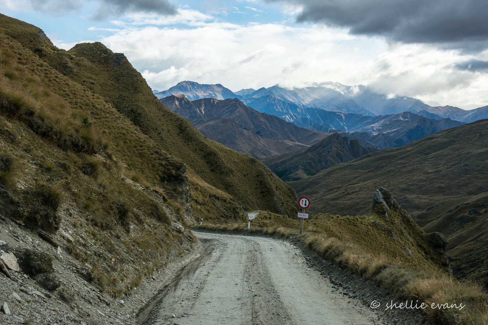
Round a tight bend with a huge drop off (don't look out the window)...

Through Hells Gate...

...and we stop briefly to look at Castle Rock across the gully...

...and check to see how much further down Long Gully...

...the road winds. The scenery is magnificent; dramatic schist bluffs, sheer cliffs, rocky tors and bronzed tussock in all directions. The Richardson Mountains are to the west on the otherside of the Shotover River (which we haven't seen yet) and the Harris Mountains to the east.

It's Saturday and we're a bit worried about the number of vehicles we might meet on the road. There aren't too many areas to pass and because we're travelling downhill we have to give way which means if we can't safety pass we have to back up. Thankfully the first person we see is a mountain-biker coming up the hill (you've got to be keen), later we see perhaps half a dozen other vehicles at various places, all in suitable spots to pass. Good timing by everyone.

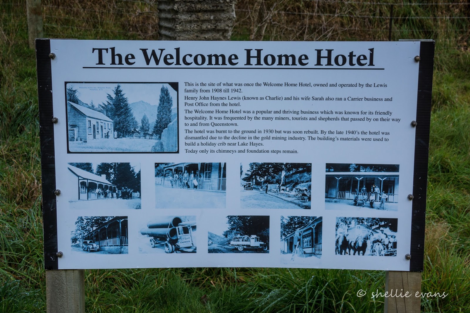
We arrive at the bottom of Long Gully to find the remains of the Welcome Home Inn beside the road, a place that sure would have been a welcoming beacon of hospitality after travelling in to or out of Skippers. A place to rest awhile or overnight before tackling the next treacherous section. I'd not like to be in any vehicle driven by someone who might have had one too many to settle the nerves though.

The hotel was the first in the area and was built in 1863 (it would have been pack horses back then). Destroyed by fire and rebuilt twice it was finally demolished in 1951. Click on the photo to enlarge for more details.
We carry on through to the end of the gully before starting to climb again...

...stopping once more, when the road meets the rugged drop off into the gorge and Shotover River far below. During the gold rush, the Shotover River was known as "the richest river in the world". It didn't live up to it's name but it sure drew in the miners. Looking downstream...

...and upstream. Once again the views are breathtakingly spectacular.

And then it's onto the real scary bit (for me sitting on the edge where it seems David is trying to keep as far away from the rock wall on his side as possible). Skippers Road clings to the side of Skippers Canyon, which drops vertically down to the Shotover River below.

This three-kilometre stretch of road involved workers hanging off ropes hand drilling and blasting the solid rock to create a platform, now called Pinchers Bluff, 183 metres above the river.

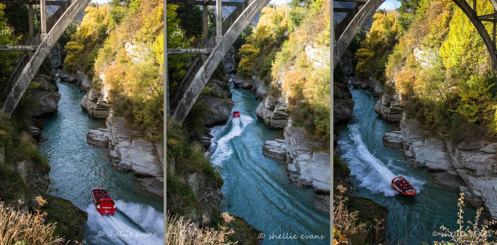
The road winds on; we pass Deep Creek where there's a launch area for the jet boats that tour Skippers Canyon and then we stop to view the Pipeline Bungy footbridge, this bungy was once the highest in the world at 102 metres. I'm not so sure it's running anymore, I couldn't find any information on it other than a mention that AJ Hackett (the father of bungy) had purchased it at some stage.

Our next stop is Maori Point, a very important spot in this historic gold mining area. After the first gold was found near Arthurs Point (where we are staying at the holiday park), miners moved upstream until they encountered the first gorge. They had to find their own way over the hills as the river was swift and deep and confined to many narrow steep gorges. They descended to beaches where possible, checking for gold as they went.
In 1862, two Maori miners (Raniera Erihana & Hakaria Maeroa) made it to a secluded gorge in Skippers Canyon where they made an amazing discovery. They saw a promising area across the river and tried to cross when one of their dogs followed and was washed away. Raniera went to rescue the dog and landed on a small beach. He could see particles of gold in the crevices of the rocks and started to dig in the sandy beach. With the aid of Hakaria they gathered 25 pounds (300 ounces or 11.5kgs) of gold before nightfall. Maori Point was born. Unfortunately, in those days, Maori were not allowed to bank and the men entrusted a friendly clerk with their booty. The clerk promptly disappeared with his loot, never to be seen again.
The flat land below Maori Point soon became the booming settlement of Charlestown. Hotels, butchers, bakers, a post office, a police station and bank were established at Charlestown. The population peaked at about 1,000 but by 1864 the easily gained gold had been won and the population dropped to about 400. Today all that remains are the stones of a fallen chimney below our lookout point, and an information board and this plaque beside us.

We're now getting close to Skippers, across the way we can see the remains of water races and sluicing scars on the plateaus either side of Stony Creek.

Chinese miners arrived at Skippers in 1866 and re-worked small claims along the Shotover tributaries. Not all Chinese were miners though, some supplied goods and services-

I love this photo, it's very dramatic, and to give it some scale, have a look for the cottage at the back on the far right of the plateau known as Pleasant Terrace.

In many of the photos you may have noticed dead trees up the sides of the canyon and down into the river bed; here we are passing through them on both sides of the road.

Wilding Pines are a major problem throughout the South Island's high country, destroying and blotting out iconic landscapes. It's great to see they've been tackled on such a grand scale here in Skippers Canyon. Although it will take over 20 years for the tress that aren't felled, to topple over and start to break down.

Finally we reach the historic Skippers Canyon Suspension Bridge, which opened in 1901.

The bridge is 96 metres long and crosses over, 91 metres above the Shotover River.

Suspended on 14 wire cables, the single-lane bridge improved access to the Skippers gold mining settlement. The bridge was opened after 3 years of construction and with costs that had doubled to about 4000 pounds (around $700,000 in today's money).

In reality, the bridge was built a couple of decades too late. By 1901 miners were leaving Skippers and the population had fallen to less than 100. The school closed in 1927 and by the 1940s the settlement was abandoned. Local farmers continued to use the bridge and since 1985 it has provided access to the Mt Aurum Recreation Reserve, which includes the ruins of the town.

To be continued... Part 2