Showing posts with label franz josef. Show all posts

Friday, November 25

The Wet Coast

 Real-time

Well, once again we have succumbed to the West Coast rain. Two weeks ago today torrential rain started at Lake Kaniere and it hasn't really stopped since. While I was laying in bed last night listening once again to the loud drumming on the roof- and it had been steady for the last 48hrs- I counted out the fine days we'd had since the lake- 4 days, FOUR bloody days, that's four days of sun in two weeks. OK, I lie, there has probably been an extra four or five hours of sun here and there but basically it has persisted down non-stop for the last two weeks.

Franz Josef  NZMCA Park
And I know you can't have a rainforest without the rain but this has just been ridiculous! It's just as well we managed to visit most of the attractions during our winter visit otherwise I'd be seriously peeved off. And it's also just as well we managed a fine day to visit the white herons, the number one reason for our revisit to the Coast.

In the end we gave it our best shot, we even sat through 4 days of rain out of the 5 we had at Franz Josef before deciding this morning that it was time to head to the sun before we lost our.... (check the van name).


We did have a welcome distraction for a couple of nights though, our friend Jan and our favourite dog Blue came to visit. Jan had been to Cromwell in her motorhome and was heading back to her home near Picton, via the West Coast so she could say hello to us. We had a lovely couple of nights despite the wet weather and Bluey was a very spoilt dog. He was allowed inside the van where he made himself right at home. If you know David, you'd know that he doesn't allow just any dog in the van (cellphone photo).


It was a mass exodus out of the Franz Josef this morning in the pouring rain. Most of the vans were heading north including Jan & Bluey. We were heading south.


 I decided on a new name for the 5th-wheeler- I changed it from 'Out There' to 'Outta Here'.

The rain had settled into a heavy drizzle as we passed through Franz Josef village. 


I feel very sorry for the tourists that are on a time schedule, most are driving 'the tourist loop' around the South Island and are including the very long drive along the Coast to see the glaciers which remain hidden all the time the weather is like this.

On the only fine day we had, I drove to Franz Josef Glacier do one of the walks I'd missed when we'd visited during winter. I couldn't get into that walk's carpark (admittedly it was small) but then I couldn't get a park at the main car park where there are three large areas either, they were all full of campervans and hire cars. It was like Piccadilly Station, so I took a couple of photos, got back in the car and drove home.


Today, Fox Glacier was also shrouded in mist and raining as we drove through... 


And it continued to rain all the way south. We passed at least 8 cyclists along the way; you have to take your hat off to their dogged determination. Cycling along miles from nowhere; uphill and down dale, soaked through and no doubt cold on a day like today. They also take their lives into their own hands on such narrow roads with so much traffic and drivers that are often unfamiliar with the road and in some cases driving!


We had a short delay at one of the one way bridges waiting for the Stop/Go man to change his sign. I thought they might have been putting up the Christmas lights...but I think they're just giving the bridge a makeover.


We stopped at Bruce Bay for lunch and it lived up to it's reputation today- wild and windswept with waves crashing on the rocks. 
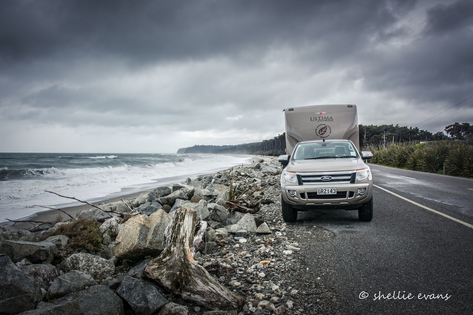

The West Coast of tourist brochure fame...now also known by us as the Wet Coast. As someone said to us, "Don't you know it has a silent 's' ". 


Approaching Haast, and along with the rain, the wind is now howling a gale outside.


Across the long one way Haast River bridge and the weather doesn't look like it's getting any better up in the the mountains.


Nope, that looks like rain.


We pull into a small layby on the edge of the Haast River to let the cars behind past and I take the opportunity of clicking a few photos looking down the river back towards the Coast. 


We pass through the Gates of Haast and crawl up to the top of Haast Pass and the rain is still persistant. 


And it rained all the way down the other side and onto Makarora and out the other side, as we drove alongside Lake Wanaka.


The road was dry but the spots still heavy on the screen as we passed through The Neck and onto Lake Hawea.


We stopped at the lookout and I had just enough time to take a few shots before the rain caught us up.


We carried on, finally leaving the wet weather behind as we passed Lake Hawea township. Shortly after we pulled into the Albert Town campground on the banks of the Clutha River, near Wanaka, where it looks like they haven't seen a drop of rain in weeks!


Pity that, because I have the feeling we brought it with us. As I type I can hear big fat plops on the roof.


Wednesday, August 3

Sunsets, Churches & Memorials- Glacier Country

Catch-up

One last post from the West Coast to tie up some loose ends, before the rain chased us to Canterbury and then back to the North Island for the remainder of winter.


I managed to catch a couple of reasonable sunsets at Franz Josef, jumping in the ute and racing down to the river for this one when I saw the mountains behind turning a beautiful pink.


Often people are looking at the sunset itself rather than over their shoulder at the more subtle colours that appear on the landscape behind, especially when it's mountains and snow. Here's the sunset looking down the Waiho River towards the coast. I was actually a bit late to catch the brilliant gold that filled the cloudless sky before the sun disappeared over the edge, it's lost some of the colour here. 


You'll remember we were parked at the NZMCA Park in Franz Josef for about 10 days, most of them in the rain and with the park to ourselves. There was no point in moving on until the worst of it had passed and we still managed to do a bit of exploring between the heavy downpours. There's nothing worse than breaking camp in torrential rain.

We did have two little buddies who kept us amused; a Tomtit/Riroriro couple, who obviously called the bush that surrounded the park, home. Everyday we'd hear a little scratching at the window and one of them would be peering inside. They see their reflections in the windows and are trying to chase the 'intruder' off. That's the female on the left and the male on the right. They also attacked the mirrors and windows on the ute.


Everytime I stepped outside the van the male would fly in to check me out, especially if I wandered around the park's perimetre.  He's got his hackles up, perched on the gate; perhaps there was another male nearby.


The park was certainly a lovely place to be when it wasn't raining. Although when it wasn't raining the glacier tour helicopters were flying past very close, there were a few days when they started at first light and ran until dusk. A slight negative to the peaceful scene but it is a tourist village afterall.


Next destination, Hokitika. We stopped for a quick photo at Lake Wahapo, a brooding lake with very murky water and a drowned Kahikatea and flax swamp at the north end where the very wide gravel braided Waitangitanoa River flows in. I bet the fishing and birdwatching would be great in amongst there. 


We stopped at Whataroa, a sleepy town having a rest over winter from the many tourists that come to see the White Heron sanctuary. And it was here that I found the fourth and last in the church series; Our Lady of the Woods.


We headed north out of Whataroa catching a glimpse of the Southern Alps before crossing the Whataroa River- another wide gravel fan cascading down from the rocky mountains behind, and turned back towards the coast.


Another stop in Harihari to add more churches to my ever growing collection.


That's St Annes Catholic church at the top and sadly the church at the bottom is going the same way as it's sign...


Further on and we pull into rest area that has a number of memorials on top of a small hill overlooking the coast. 


This is the Surveyor's Monument Reserve and also the gateway to South Westland (if we were coming from the other direction).


Our next stop is the gold mining town of Ross, where once again there's hardly a soul about in the sleepy little town. Ross was settled during the 1880's gold rush and at the north end of town is the Ross Goldfields Heritage Centre which includes an information centre and a number of historic buildings and gold mining relics. You can also pan for gold. Once again it's closed up for winter.


Ross promotes itself as the start(or end) of the 136km West Coast Wilderness Cycling Trail which starts(ends) in Greymouth and passes through many areas we've already visited on the Coast including Hokitika, Lake Kaniere and along the canal where we found the Blue Ducks


We stopped into say hi to Matt Dove at the Totara Bridge Station (we know his parents & sister from Tauranga). Matt is in the process of developing a fabulous camping ground and accommodation modules for his "Coastal Container Retreat". It's right on the beach and is also strategically placed at the end of the cycle trial. It will be opening for the summer season and we'll certainly be back to check it out.


The sun set on our West Coast travels a few days later; we stayed a couple of nights at the Hokitika NZMCA Park but with more incoming rough weather forecast, we decided we'd really had enough rain to last a month of Sundays, so we made the decision to head back over Arthurs Pass to Christchurch to dry things out, do a few errands and decide on our next move.

Hokitika River Sunset


Monday, August 1

Peters Pool- Glacier Country, West Coast

Catch-up- West Coast

There are a number of walks that leave from the Franz Josef Glacier car park, including of course the main attraction, to the Glacier itself. On what turned out to be our last sunny afternoon (the weather packed up and so did we), I returned to walk a couple of the shorter tracks.

The first walk was to Peters Pool, a short 1.2km return walk. It's a lovely walk through beautiful luxuriant green rainforest with the occasional view of the glacier valley and the mountains behind.


With most visitors walking the glacier track, I had this one to myself and was able to take my time, enjoying the bird life along the way...


...and stopping often to take photos of the many different mosses, lichen, fungi and berries growing in the damp understory and along the moss covered banks.


Peters Pool is another Kettle Lake just like Lake Matheson. There are numerous kettle lakes around the valley, left behind by the retreating glacier hundreds of years ago. Large blocks of slower melting ice left huge depressions in the valley floor. Kettle lakes have no inlets or outlets and are basically just great big puddles filled by the rain (of which there is plenty) and evaporated by the sun. Eventually the kettle lakes (especially these smaller ones) will disappear as vegetation grows in from the sides, and peat and mud naturally fill the depressions. 


And here is the reason Peters Pool is a popular walk. Just like it's big sister, Lake Matheson, the reflections of the mountains behind are magnificent. The pool is named after a 9 year old boy, Peter Westland, who camped here all by himself in 1894. Of course back then the glacier was in full view, reaching around the corner with the terminal face right at the back of the lake. Of course the forest has since re-generated too.


A group of foreign tourists (English speaking) arrived as I was taking photos, they got all excited about the birds they could see across the pool sitting on the grass mounds at the edge (right hand side).


I tried to keep a straight face as they turned to me and asked if they were Kiwi! 


I carried on further down the path thinking that it might have looped back around to the Sentinel Rock Walk, the other short walk I intended to do, but it joined the Roberts Point Track and a walking track back to the Franz Josef Village. 


Roberts Point Track started on the other side of the swingbridge across the Waiho River, which contains ice melt from Franz Josef Glacier and the contents of the many waterfalls that cascade down the mountain sides along the valley. 


I crossed to the otherside and could see straight away why the Roberts Point Track is classed for experienced trampers only. The track was narrow, muddy and very rocky and that was just the first few metres along the edge of the river. 


It then climbed steadily up and along the valley wall towards the glacier where the views are meant to be stunning, looking out over the surrounding mountains and down over the glacial ice. There's another large warning sign (there's one back at the carpark) clearly pointing out that this is a difficult track and that trampers have in the past lost their lives by not following the guidelines.  


It's a 5-6 hour return tramp and you need to allow enough day-light hours for the walk. Something I'm not so sure my 'kiwi spotting' group took any notice of. They disappeared up the track as I returned across the bridge; half of them wearing trainers and carrying no backpacks. I took these photos at 1:30pm.


I retraced my steps back past Peters Pool to the carpark and then took another track to the Sentinel Rock lookout. It's a short 20 minute steady climb to the rock platform...


...where the views are pretty impressive looking up the river valley to the glacier.


Sentinel Rock emerged from the glacier in 1865 (not that long ago in the scheme of things), it's an example of how the glacial ice ground the schist bedrock into a Rouche moutonee or 'sheep rock'.


Since 1909 the glacier has retreated over 3kms...


Here on the information panel the glacier retreat over the years can be clearly seen, there was even a lake at the terminal face for 10 years from 1939-49 (remember to click on the photo to enlarge)...


From the lookout platform I can see across the river to one of the swingbridges on the Roberts Point Track (I've zoomed in here), and guess what? My 'kiwi spotting' group have just crossed it and are disappearing into the bush. You might be able to see the bridge in the photo, 4 above, down low, in the dark valley, just above the bottom step rail. They still have a long way to go. 


I return to the carpark and take a few more photos on the way back home, the Waiho River bailey bridge is always a good subject.


And just behind where I'm standing to take the bridge photo is another photogenic subject; the historic St James Anglican Church, tucked into rainforest and located on the banks of the river.


Opened in 1931, the church's altar window took in the panoramic view of the glacier- see bottom left photo (as a previous stamp collector this is another familiar sight for me, there's a 1946 postage stamp depicting the view). By 1954 the glacier had disappeared from the view.

I found the foundation stone very interesting- I wonder if anyone else has spotted the significance? (see below for an answer)


Divine intervention?  


Here's another sister church to Our Lady of the River at Jacobs River and Our Lady of the Snows at Fox Glacier, this is the third in the series- Our Lady of the Alps (one more to come).


And the significance of the foundation stone? The date the stone was laid; the 3rd of February, 1931. 

While the Governor General, Baron Bledisloe, was conducting formalities and laying the stone, my home city Napier, was being destroyed by a massive earthquake.