Showing posts with label rocks. Show all posts

Wednesday, October 19

Beach Hop South- Mataikona & Riversdale

Catch-up, this might be the last blog for a few days. Labour Weekend (a long weekend for Kiwis) is fast approaching and I think I'll take a few days off from my screen to relax and enjoy the early summer sunshine. 

As you've probably gathered from the previous Castlepoint blogs our sunny days in camp didn't last long. Two days of spring sunshine without the hint of a breeze and then dark storm clouds rolled in from the east.


For a few hours they stayed at sea and then headed north...


...before returning down the coast; with heavy rain and the wind whipping up the waves...


...and blowing bucket loads of sea foam and seaweed on shore.


The locals weren't impressed...


And nor were we...


It was cold, blustery and wet, there was nothing for it but to sit it out.


A gift for the locals came riding in on the waves...


A breakfast bar for birds- thousands of tiny goose barnacles smothered the log which would have been bobbing about in the ocean for a long while. Not quite above the tide line, the birds squabbled for the best position, landing and alighting as each wave swept over the top of it.  


After three days of stormy weather and cabin fever about to set in, we decided on a drive to blow the cobwebs away. And no, we did not stop at the local pub, the well known Whakataki Hotel which is back down the road about 5kms, just before the road hits the coast. The hotel is also CAP (costs apply parking) for NZMCA members, it used to be free parking until the usual happened, the minority spoilt it for the majority and abused the facilities. So now everyone pays.  


We turn off just before the pub, we're heading up the coast a short distance, to the settlement of Mataikona. The road is narrow and winding as it passes over a bluff but opens up once it reaches sea level again. We pass through a few small settlements, this one is called Sandy Bay. No prizes for guessing why.


And look, I found my ideal woolshed! With a cottage attached to the end of it. 


Further along the road we stop to check out some very fascinating rock formations. The Mataikona Rocks are a hidden geological gem; the spiky rows are the result of sandstone being compressed by the weight of the Pacific Ocean, then bent and buckled by colliding tectonic plates.


They are usually hidden by the sea so if you're wanting to see them, time your visit for low tide. The tide is on the way in when we stopped and by the time we returned back down the road, they were gone. I wanted to come back at low tide to walk out to the end and explore the rock pools but unfortunately the weather didn't settle until our last day. 


We very rarely come across traffic on these back country dead-end roads but today's vehicles are an unusual assortment; a fellow RVer freedom camping- he'd have been buffeted about overnight, a loaded logging truck, we moved off the road to let him past and I'm glad we didn't meet him on the bluff. And a police ute, which passed us twice, once while we were parked in the middle of the road! 


Just past Mataikona the road turns inland and follows the Mataikona River for a short distance before it becomes a 4WD track that comes out somewhere around Tinui. The river is also the province boundary line between Manawatu-Wanganui to the north and Wellington to the south.


We turn around just past the Paua Pad...


There are quite a number of  baches and make-do shacks sheltering in a pine plantation that runs alongside the road. I've been told that fishing and diving are very bountiful along this stretch of the coast.


On our way back to the main road we stop one last time, at the bluff, so I could take a photo looking down towards Castlepoint with Castle Rock towering above at the rear.


We then headed back inland to Tinui and down to Riversdale, 50 kms to the south of Castlepoint. At one stage we were going to take the 5th-wheeler down there and stay for a few days but with the weather not playing ball we decided to just do a day trip there. It rained on and off all the way...


...and it was cold and so blustery when we arrived, it was a quick run to the top of the sand dune to grab a shot and say 'been there, done that'. I don't even think David took a look. We found a sheltered spot at the end of the road to have lunch and then cursed the weather because we couldn't do an interesting walk along the beach, through the dunes and back along a stream. Well, we could have but it would have been no fun. 


Of course I couldn't leave without taking the obligatory church photo- Riversdale's St Josephs Church.


On the way home we stopped at the Tinui Cemetery where the Tinui Anzac Walkway begins. It's a steep climb to the top of Tinui Taipo (Mt. Maunsell) where the elusive ANZAC Memorial Cross is located (you'll recall I couldn't see it from the village). 

The walkway is through native bush plantings and  private farmland and is only open from Nov 1st to April 25th each year (which I think is just as well as I didn't really feel like a steep hike to the top). I'd seen a small pine enclosed in a cage near the information shelter when we were passing earlier and before realizing the significance of the walkway, I thought it might have been a wilding pine with an explanation as to why they are such a pest. Imagine my surprise to see that it was a very special Lone Pine! 


Back home and the barnacle bar is still providing food for the locals, this time a pair of Variable Oystercatchers, one with unusual striped underpants. Their antics reminded me of those slippery logs you  have to run across without falling off into the swimming pool. The tide spun it around and over as the birds ran up and down balancing carefully so as not to have to jump off.


They were late to the party though, most of the barnacles were gone. After seeing off the gulls they set about cleaning up the left-overs, sticking their bills down every nook and cranny prying out tasty morsels until the log was bare.


Mr & Mrs Red-billed Gull were not impressed.


Finally, after five days of cold, rain, wind and salt spray the sun came out....and David had to clean the van again! There's a lighthouse across there, somewhere.


Thursday, June 4

Sculptures In Stone - Castle Hill

We left Lake Pearson on the last leg of our journey across the middle of the South Island, from the West Coast to the east heading for our next destination, Christchurch.

The road snakes through the dry Canterbury High Country with it’s rugged mountains, jagged bluffs and scree slides, as we head into the Castle Hill Basin and it’s distinctive limestone rock formations.


Castle Hill Basin lies between the Torlesse & Craigieburn Ranges and we stop at Castle Hill Village for a quick look. The village began as a development back in the early 1980s when the owner of Castle Hill Station wanted to create an alpine village beneath the Craigieburn Range as a centre for recreational activities in the area.

The houses are mainly holiday homes and there are no shops in the village. But there are four ski-fields within easy reach, a range of walking and tramping tracks throughout the nearby Craigieburn Forest Park & the Torlesse Tussocklands Park. And along with caving at the Cave Stream Reserve and rock climbing at the Castle Hill & Flock Hill limestone boulder fields, there’s plenty of outdoor activities to keep you occupied.


This ‘sculpture’ sits on the roadside near the entrance to the village- I took a photo for Dad; his golf club in Napier has some huge old tree trunks carved into golfing figures sitting alongside the road. The club paid a few thousand dollars to have them carved- and look they could have saved a few dollars had they seen this guy first (looks like he’s scored a hole-in-one). A $2 hat from Dollar Shop, a bit of bark scraped off and Bob’s your uncle!


Our next stop is just down the road at the well known Castle Hill (Kura Tawhiti) limestone formations. The beautiful and barren Torlesse Range forms a stunning backdrop to the carpark.


We head off towards the boulder pile at the end of the path- they don’t look that big from back here. The rock formations are the water eroded remains of limestone, formed 30-40 million years ago when much of present day New Zealand was covered by the sea.


A track leads off from the main path to a jumble of boulders but we decided to continue on to the main attraction.


While taking a photo I was overtaken by what appeared to be half a dozen ‘Sponge Bob Square Pants’. Disappointingly they turned out to be just plain old rock climbers. That’s their folded crash pads on their backs- although they look rather thin, I don’t think I’d trust falling onto them.


There are hundreds of rocks and dozens of big boulders in this pile.


We decide to follow the climbers along the front of the huge rocks, we might get to see them do some climbing. Now we’re up close we can see how large the rocks are; there are people dancing about on top up there.


We turn a corner and see the Sponge Bobs are disappearing up another steep path and heading to a boulder pile way off in the distance. We decide this will be as far as we go.

David heads up to a fenced off rock to check it out. People have been carving their names in it although I’m not sure whether that’s the reason it's fenced (I mean initials could be carved anywhere in any of the rocks if you so wanted), perhaps it’s unstable. Or perhaps there's some old Maori rock art on it that we failed to see.


I leave David to wander back the way we came while I walk around to the back of the rocks, it's here that I can finally see why the rocks were named Castle Hill, they look like the rocky remains of an old ruined castle.


It’s quite a distance to walk along the back and up on to the rocks at the end and I hope I can get back to the beginning through the back way. Here at the back, you can see that the exposed rocks have a more honey-combed effect from the erosion. You can also see how large the area is; I’ve walked along the fenceline from the back left and up onto the rocks at this end.


Up on top here, it’s quite wide with many tracks in and out of the boulders. There are two school groups visiting and they have ‘disappeared’ in amongst the rocks. One group is playing hide & seek, and the seekers are finding it just about impossible to locate their mates. I’d say it would be very hard to find anybody especially when it came time to call them to leave. Can you spot them?


I’m not sure how much the kids were learning but they were sure having fun in this natural playground.


Although it’s autumn and the day was rather hot, it was still a surprise to find a couple sunbathing on their towels in the lee of a large rock.


I found my way back to the front where David was waiting for me and we made headed back to the carpark. Castle Hill reminded me of the Elephant Rocks we saw last year near Duntroon, although these were on a far grander scale; well worth a visit but give yourself plenty of time to explore.


Our next stop was for lunch at one of the last of the high country lakes along the highway, Lake Lyndon. There’s a freedom camping area here but I’m not so sure it's very welcoming at this time of the year. Talk about a barren, windswept and very dried up lake. I have seen photos of it in the spring though, with snow capped mountains behind, wild flowers in full bloom across the lake front and water fowl feeding along the edge. Never judge a book by it’s cover.


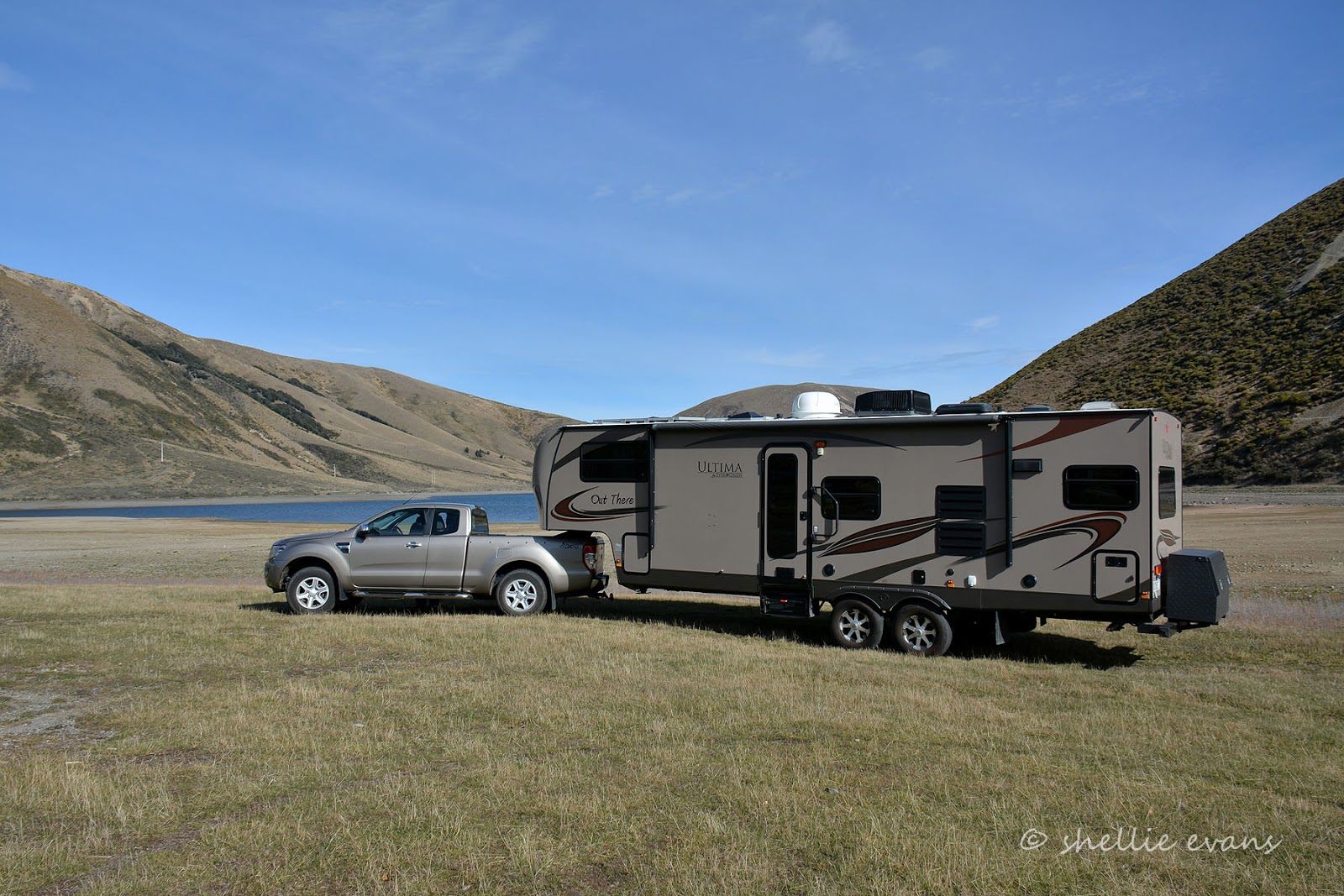
At least it made a fine canvas to show off the rig!


Replete, and keen to hit the road, we headed off to Christchurch, dropping down out of the high country and out across the Canterbury Plains.


Thursday, April 16

Punakaiki- Pancakes & Blowholes

Continuing on with our journey down the Coast-

We left Westport just as the rain started to fall and it really hasn’t stopped much since. As the locals say- ‘you can’t have a rainforest without the rain’. But then I’ve also heard them complaining too!

I spotted this poem on a cafe wall which just about sums it up-
Rain
It rained and rained and rained
The average fall was well maintained
And when the tracks were simple bogs
It started raining cats and dogs
After a drought of half an hour
We had a most refreshing shower
And the most curious thing of all
A gentle rain began to fall
Next day but one was fairly dry
Save for one deluge from the sky
Which wetted the party to the skin
And then at last the rain set in
                                                       Anonymous
We’ve cursed it the odd day, but mostly we’ve just got on with it. Because we have no time frame it’s just a matter of sitting out the rainy days (great for catching up on blogs) and venturing out in between showers. One bonus is that we’ve had plenty of rain water to top up our drinking water containers and our house water tanks have been full to overflowing many times.

We made our way down the coast passing through some amazing coastal scenery- the bits we could see between downpours.


I kept reminding myself that we’ll be back this way someday before we bring this journey to an end. But there will be one beach that I’ll return to very soon- a very special beach that not too many people know about. I’m hoping I’ll visit it when we return to Greymouth after we’re finished with Hokitika (which, for those that are directionally challenged is south of Greymouth so we’ll be doubling back to Greymouth for a few days and then crossing over the Divide via Arthurs Pass).

Hokitika will be as far south as we’ll travel the West Coast this time- we'll come up from the bottom of the island to complete it later in the year. We need to get to Christchurch to have some servicing done before the onset of winter…..although I think we missed the memo that says it’s already started! There’s snow on them thar hills.

I’ve passed through Punakaiki twice in my lifetime stopping for a short visit both times, one I can’t remember and the second time was when David and I caught the TransAlpine train across to Greymouth from Christchurch about 17 years ago and then we headed north and over Lewis Pass to Hanmer Springs for a short break. I can hardly remember that visit to Punakaiki either- just a few snippets here and there but one of them was the amount of Nikau Palms that lined the road- Punakaiki didn’t disappoint this time either.


There wasn't too much traffic on the road and when we did pass a vehicle it was mainly hire campervans, so it was a surprise to suddenly round a corner and find a lot of activity in the carparks and on the roadside as we passed the entrance to Punakaiki Rocks.  We’re definitely in tourist country now. We also had our first foreign tourist driver episode (which for my overseas readers has been a major issue in NZ over the summer) where a driver had stopped in the his tracks on a narrow winding section of the road and was backing up. Not pulling over to the left and waiting to do a U turn, just backing up, up a winding hill. Luckily we saw his reverse lights and were able to pull up well in advance. I gave him a polite smile as we passed.....yeah right!

We planned to stop at a CAP (costs apply parking), a NZMCA park over property in Punakaiki for a few nights and we found it just south of the Rocks and right beside the Punakaiki Resort. We were familiar with the resort, we stayed there not long after it opened and when it was known as the Punakaiki Eco Resort, now we were sharing the same beach. The CAP was a great place to stay, a large raised gravel area that had obviously been prepared for subdivision, very close to the blowhole & local walks, and with a wild west coast beach just through the flax bushes. It was just a pity it rained solid for 2 out of the 3 days we stayed, and rained on and off on the 3rd day. But we did get to witness a very impressive thunder storm and light show out over the ocean one night.


Of course our first visit had to be to the famous Pancake Rocks and Blowhole at Dolomite Point, which are located just off the main highway at Punakaiki. The 20 minute loop walk starts out in native rainforest with many Nikau Palms before passing through dense flax and coastal vegetation as it nears the rugged coastline.


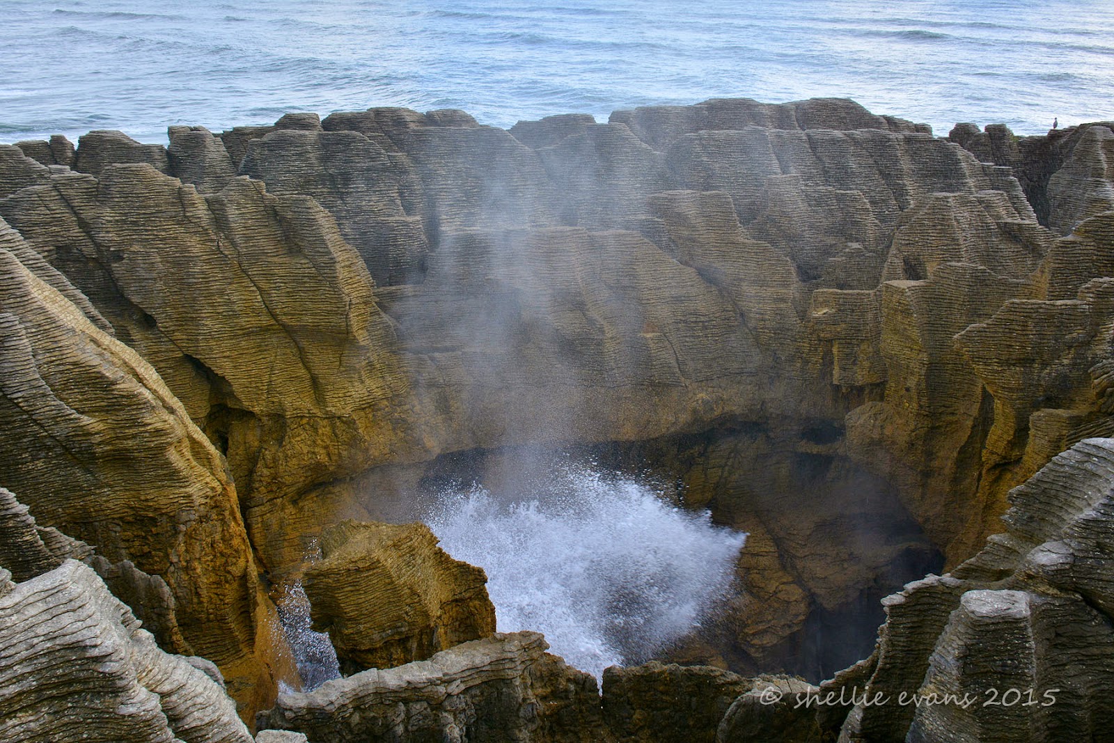
There are numerous formations and smaller blowholes in amongst the rocks before you get to the main iconic blowhole, Putai. This surge pool is called the Devil’s Cauldron and at high tide it lives up to its name as the waves gush in from the sea channel and break against the rock sides getting bigger and higher as the tide rises.


 From the information panel-
Looking like giant pancakes the unusual limestone formations were formed 30 million years ago from minute fragments of dead marine creatures and plants that landed on the seabed about 2 km below the surface. Immense water pressure caused the fragments to solidify in hard and soft layers. Gradually seismic action lifted the limestone above the seabed. Mildly acidic rain, wind and seawater sculpted the bizarre shapes.

The main attraction, is of course, Putai – the largest blowhole – where on stormy days the seawater swells upwards from the rocks in a giant wall of spray. Coinciding high tide with a westerly wind is the best time to visit the blowholes as then the water is forced through underneath the rocks and up into the blowholes producing huge plumes of sea water.

Today, it wasn’t quite high tide and there was no wind but the sea was still a little rough (from the storm overnight), so we managed to see a few reasonable blows.


The Chimney Pot Blowhole-


The walkways, railings, platforms and information panels have been very well done and I’m sure the many hundreds of visitors that walk the track every day, leave feeling they’ve seen an impressive and unique landscape and also learnt a little about how it was formed. Of course a good show by Putai would be the icing on the cake but I don’t think it’s totally necessary to be impressed by this spectacular coastline.

If you look closely, you can see our van parked up near the beach in the background of the photo on the top right. That’s how close we were to the Pancake Rocks.


After the blowholes the track carries on around the edge of the rocks and at one point disappears down through a narrow rocky gap before climbing up the other side….


…to a lookout point, looking north up the coast. It’s late afternoon and the sun makes a brief appearance….along with a rainbow over the top of the rainforest.


There is another well known walking track just up the road from the Pancake Rocks that is also well worth a visit. The Truman Track begins again in a beautiful sub-tropical rainforest of ferns, nikau palms & rimu trees with this coastal tarn (is there such a thing?) right beside the carpark.


As the track nears the coast it passes through dense coastal flax again before emerging onto a headland with stunning views up and down the coast. At this point my memory is jogged; I knew David & I had visited an area before, where we’d climbed down onto a beach underneath a cliff overhang- I thought it was back at the Rocks but that was clearly impossible when I saw how rugged that area was. This was the spot!


A stairway leads down the north side of the headland to a gravel beach with cliffs, caves, a waterfall, more amazing rock formations and what looks like an extinct blowhole. The beach is accessible only at low tide and even then it’s quite scary with the rough seas and crashing waves. I leave David in the cold wind, scanning the ocean for seabirds while I climb down over the boulders and under the tiny waterfalls that are dripping off the rocks above.


I want to take a photo of the waterfall that looks like it’s flowing out of the rock wall at the far end of the beach.


I take a few slow shutter shots to get a silky ribbon of water, but the wind is blowing hard and most of the shots have the water flow at a weird angle.