Catch-up; It's been a busy couple of weeks, we've been chasing the snow and exploring the Canterbury high country. I have hundreds of stunning photos and lots to tell you about in due course. In the meantime this blog may seem a little out of place now, much of the MacKenzie Country is smothered in thick winter snow and especially the access road to Aoraki/Mt Cook and the National Park.
On a clear, crisp and sunny morning I left David fishing for that elusive salmon at the canal and headed to Aoraki/Mt Cook National Park to re-walk the Hooker Valley track. We've walked it before, back in early December, 2015 but it was overcast then (great for photos though). I wanted to walk the 10km return track again and see it in a different light. I stopped at Pete's Lookout to grab one of the iconic shots of Aoraki; looking up Lake Pukaki to New Zealand's tallest mountain at the top of the lake.

I parked beside the DOC White Horse Hill campground and near the trailhead, it was bitterly cold out of the sun but I could see it heading down Hooker Valley ahead of me as I set off at a brisk walk, being careful not to step on any icy puddles that would send me for a skate.

The first of the three swingbridges that cross the Hooker River which flows down from the Hooker Glacier Lake, then into and out of, the Mueller Glacier Lake.

This is no gentle flowing stream, those boulders in the river below the bridge are the size of small cars. You can see a couple of people crossing the bridge in the photo above.

Mt Sefton towers high over the lake and in the stillness I can hear regular whooshing and booming sounds echoing around the valley. When I zoom in on the mountain I can see great clouds of snow and ice breaking off an ice shelf and tumbling down the face, from high up on a ridge near the peak.

Each time I get to a swingbridge, I wait for others to finish their selfies before I can get a clean shot.

Just before I reach the sun, Aoraki/Mt Cook comes into view at the head of the valley.

Which is just as well because as soon as I step into the sun (which instantly has a lovely warming effect), it's directly ahead of me and right in my face and the camera's! There's no getting away from the lens flare here, so I shoot as best I can by closing down the aperture (f/22) and cutting off most of the sun so I get a sunburst and although it's not a good one at least I can see Mt Cook underneath!

I now have to take my photos looking back down the track so the pesky sun doesn't gatecrash every shot.

This is the last of the three bridges over the Hooker River(above), it's just below the moraine walls of the Hooker Glacier Lake and not far from the lake outlet.

A short track leads off the main path to a small tarn tucked in amongst the alpine vegetation. It's a surprise to see down the valley and off in the distance the Hermitage Hotel, back in the Mt Cook village. Of course it makes sense as Aoraki can be seen from all rooms at the Hermitage.

From the tarn it's just a gentle climb up over the top of the moraine wall to the lookout point complete with lovely large picnic table.....and a dozen or so people. I sit and have my lunch watching as people arrive over the top of the ridge, oohing and aahing as they take in the glacier lake and Mt Cook ahead of them. Unfortunately the sun is now sitting right above Mt Cook spoiling the view as they jostle amongst themselves to get the best selfies.

I was hoping the lake might have been frozen or semi-freddo with lots of icebergs bobbing about. The icebergs break away from the Hooker Glacier at the head of the lake. Sadly it wasn't frozen and there was only one big dirty 'berg that look more like a rock sitting in the middle of the lake.
The real surprise was down at the lake's edge below us, numerous small icebergs had been sucked towards the river outlet on the far side of the lake. They'd become stuck in an icy embrace by the beautiful coloured frozen glacial water.

And to give you some perspective, here you can see people at the edge. In fact if you look closely at the photo above you can see two people sitting on the rocks in the centre of the photo and another couple standing over by the outlet (click to enlarge the photo).

Many of the people arriving took their lookout photos, glanced around the mountains and then turned tail and headed out again. They were unaware of the magical spectacle down at lake level. I was unaware as well! Luckily I twisted my arm and forced myself to get down there to touch an iceberg.
Never mind the icebergs, this strange but stunning phenomenon was right along the lake's edge; an ice wave caught in suspension looking like it was just about to break onto the shore.

The wave was made up of hundreds of large irregular shaped plate ice piled on top of each other. A large patchwork of beautiful broken ice.

Up close there was quite a bit of noise as the ice cracked and slipped as it melted in the warm sunshine. People were also picking pieces up and smashing them on the rocks or throwing them out onto the ice adding to the noise. I know, I know, but don't tut-tut, it was a so much of fun, I was drawn to do the same. I felt like I was attending a Greek wedding smashing plates! (the lookout is behind that green mound, top centre)

Some people also chose to climb over the ice wave and try their skills at walking(skating) on the frozen lake. Most of them failed and made a spectacle of themselves in the process! The guy below managed to scoot out to that small 'berg to have his photo taken sitting on it. He fell coming back. It really was so slippery.
Another guy walked quite a way out before his feet left him too it. I did feel sorry for him because I know that awful feeling when suddenly you're on your back in a heap on the ground. No one was willing to walk out and help him either and I don't blame them. He half crawled, half slipped his way back to terra-firma and hobbled off, pride deeply dented. Muffled sniggering could be heard nearby.

My theory is that the ice has formed on the lake and then the wind's got up and blown onshore quite ferociously and for quite some time, pushing lake water underneath the layer of ice breaking it up in the process and then pushing that onto shore as more ice formed behind. Whatever, I was thrilled to see another amazing spectacle of nature.

And I spent so much time down at the lake edge I finally managed to get a shot of Mt Cook without the sun spoiling it, it had moved off ever so slowly to the left. The Hooker Glacier terminal face can be seen at the top of the lake.

It was time to head back down the track to the carpark, there were lots more people out enjoying the warm sunshine which has now filled the whole of the wide flat valley floor.

I took another photo of Aoraki/Mt Cook (sans sun) just before the mountain disappeared out of sight as I neared the beginning of the track.

And another photo of the Hermitage tucked in under the mountains on the far side of the valley. 'Rock flour' has turned the Mueller Glacier lake the beautiful teal colour the high country lakes are known for. The lake is trying to freeze too, there's a line across the centre just above the island where the ice is forming.

There was one more short walk I wanted to do before I left the mountains and I was in a hurry to drive the few kilometres around to the trailhead. It's a short gut-busting walk straight up the moraine wall to the Tasman Glacier Lake. As per usual I've spent way too much time on the other walk and the sun is now fast disappearing behind the mountains, a shadow is quickly creeping across the vast expanse of the Tasman Valley. Darn! Oh well, I managed a few good shots the last time we climbed to the lake.

The Blue Lakes (which are blue no longer, check the link above for the reasons why), are frozen, so I'm hoping there might be a few icebergs on Tasman Glacier lake. I climb on as fast as possible hoping the shadow hasn't covered the lake as well.

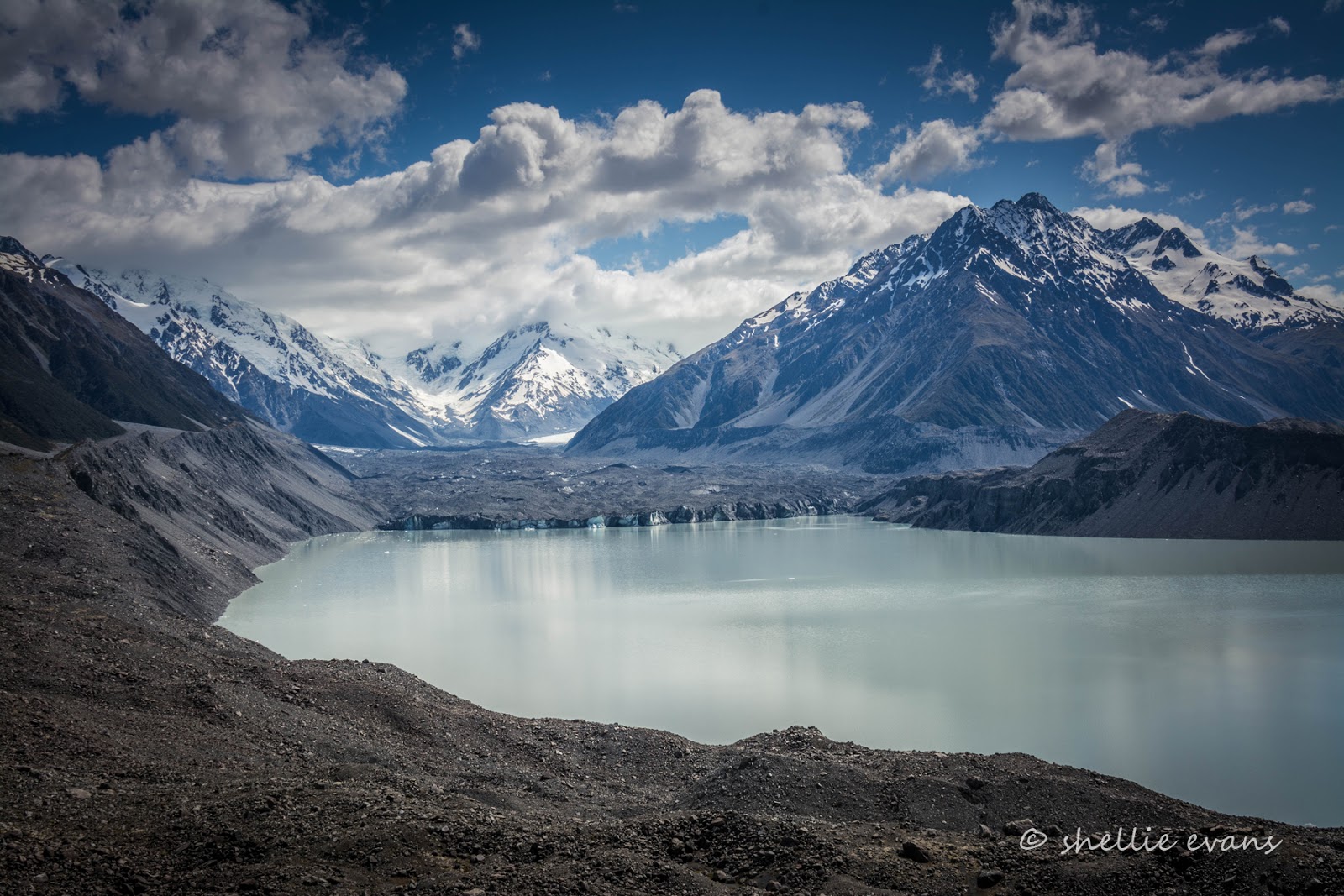
Arriving at the top gasping for breath and with my heart pumping twenty to the dozen, I'm disappointed to see no 'bergs (well no huge ones, just a few specks here and there) and the lake disappearing into shadow as well (click on the photo to enlarge).

Oh well, I sit down on a rock and casually take in the scenery as I wait for my breath to catch up and my pulse to return to normal. I take quiet satisfaction in seeing much younger (and supposedly fitter) people arrive, panting and gasping for breath as they virtually crawl over the last step. A few of them are Lions supporters and they're obviously suffering from the celebrations- the Lions played the Crusaders the night before and won 12-3.