Showing posts with label lake hayes. Show all posts

Monday, June 12

Four Camps, Two Walks

Real-time

Originally we planned to stay on in Winton (Southland) for 2-3 weeks but we were having such a lovely time with the family that it ended up being nearly 6 weeks before we pulled out from our cosy corner at the end of the driveway (we heard that the grandkids couldn't get over the size of their yard when they came home from school later in the day). You know you've spent a little too much time in one place when autumn comes and goes. By the time we said our goodbyes, the copper beech had lost all it's leaves.


We decided to ease back into our travels driving a short distance each day as we make our way up the South Island. David's having a few back issues and we need to be in Christchurch towards the end of the month so he can fly to Tauranga to see a specialist. We're hoping it's nothing too serious but want to keep on top of it because, as you can imagine, without a driver we ain't going nowhere fast!

Camp #1 Lumsden NZMCA Park- where nobody loved us, we had the whole park to ourselves on a cold and dreary day that matched our mood. We were missing the family and it always takes a few days to settle back into routine.


Camp #2 On the banks of the Mataura River near Garston. We've visited this hidden gem a number of times to have lunch or to fish but have never stayed overnight. It's a pity it's not the fishing season, and the trout know it too. They kept swimming up and down taunting us.


We had the pleasure of meeting the fifth generation farmer who has his farm on both sides of the river and the main road in the Garston valley. He was shifting a mob of sheep across his vintage 'bailey bridge' with five of his dogs, including Paddy 'the king of the castle'.


As you can see the weather hadn't improved by the next morning as we headed off towards Queenstown. Winter is well and truly underway down south.


Camp #3 Lake Hayes, Queenstown- another familiar reserve, this time we decided to test out the ambiguous freedom camping rules at the lake. On previous stop-overs we've had to park in a small area between the camping signs, but with one sign missing and anecdotal evidence that as long as you are CSC (certified self-contained) you can park anywhere in the reserve at the moment, we gave it a go. 

We found a spot under the willows near the lake's edge. If a ranger came by early in the morning (as had been the case in the past), I didn't see him. And we've yet to receive our recent mail, so if a ticket has been issued the fine may be growing in size as we speak.


Walk #1 Lake Hayes Walkway. For various reasons we had never walked the 7.5km loop walk around the lake even though we've visited the lake several times. I was looking forward to doing it when the autumn colours were at their best back in April, but it was raining when we stopped for lunch before heading to our next destination. 

The track climbs a short distance before winding its way around the side of a large hill that borders the west side of the lake. Ahead of us The Remarkables hide their heads in the low cloud.


And even though the weather still wasn't the best, it was a good time to complete the walk; the lake was a millpond and the reflections magnificent. That's an Australian Coot at the top right, they are usually quite shy but the ones at Lake Hayes are used to people.


We both couldn't get over how many abandoned, disintegrating and rotting dinghies, yachts, canoes, kayaks and sail boards there were, stashed right around the lake's edge. They were hidden under fallen trees, buried in the undergrowth, covered in mould and leaf litter and filled with water. It's such a shame, I'm sure there would be many schools or clubs that would love to have them. I don't understand why the council hasn't done anything about having them removed, many of them are an eyesore.


This dinghy was one of the better ones it also made a good subject, especially with the reflections behind.


Camp #4 Lowburn, Lake Dunstan, Cromwell- I want to say an old favourite but it's not actually a favourite just a very familiar camp site. We seem to stay here on the way to somewhere else or on the way back. This time we had the place to ourselves which is very unusual as it's a huge site and usually very popular. Another 3-4 motorhomes joined us later in the evening but they all stayed up the back. It also happened to be the long Queens Birthday weekend so we stayed a couple of days and expected to see a few more people but they didn't eventuate. They'd probably headed off to warmer climes. 


Finally we had some blue sky and I shot some lovely reflections of boat harbour at the south end of the park.


Walk #2 Bannockburn Sluicings Walk- a 3.5km loop walk we avoid no more! The last time we thought we'd do the walk it was the middle of a hot Central Otago summer. A barren dry landscape on a scorcher of a day does not hold much appeal I can tell you. We read the information board and slotted the walk in the 'must do sometime' folder and headed home for a cool drink in the shade!


The track loops through the former Bannockburn gold field which was sluiced and mined from 1862 into the 1930's. We walked the track anti-clockwise which saved us a bit of a climb in the other direction. Here the sluiced landscape mirrors the natural one of the range in the background.


The track winds its way through the sluicings past the remains of dams, water races, tunnels, stone walls and channels. There are also the remains of a few stone houses including the Blacksmith's shop, and caves and rock shelters where some of the poorest miners lived. 

Menzies Dam (bottom left)  was the largest miner's dam in Otago, the stone walls were at least 2 metres high on three sides of the dam holding water in an area the size of a rugby field. The dam was fed by elaborate stone water races from Long Gully and the Carrick Range up behind us. You'll recall the water race we saw multiple times as we drove the Carricktown 4WD Track and saw the Young Australian Waterwheel.  The dam provided 'liquid gold' for its owners, the water was sold at £4 per week for a 'head' of water, equivalent to 28.3litres (or one foot) per second. Gold sold for £3.15s per ounce in 1872 so it was a considerable out-going expense especially if you had a bad week mining.


The track winds it way through the middle of the sluicings and up onto a small plateau to the remnants of Stewart Town which is behind the dam, and named after one of the dam owners. Here there are the remains of several old stone and rammed earth buildings dating from the 1860s and a very old orchard of apricots & pears that still produce fruit. 


The track then follows the cliff edge back towards the starting point. We've walked right around the outside of this huge chasm. Piles of tailings sit in great mounds along the base of the cliffs. Another walking/mountainbike track  passes straight up the centre of the valley. 

You'll most likely not see it, but if you click on the photo to enlarge, there's a tiny black dot on the path, a person walking uphill. That'll give you an idea of how vast the expanse is. It's also a long way down to the bottom of the cliffs and quite scary to be on the edge- watch children if they're with you on this walk.


Towering cliff faces are all that is left of the hills that have been sluiced away to find the precious gold. Some of the pinnacles we pass were left by miners to mark the corners of their claims and give an indication of how much of the area the miners had sluiced.


Once off the plateau the track passes through this smaller canyon past caves and piles of tailings. Can you see David reading the sign in the top photo below? That also gives you some idea of how much earth has been moved and how the landscape has been changed.


Back in the carpark we can see the bare vineyards of Bannockburn below us, here looking towards the Kawarau Gorge. A new liquid gold. Such is Central Otago.


Thursday, May 18

A Remarkable View

Catch-up; we're still parked up in Winton with the family. We've been here a little longer than expected (4 weeks today) and winter has finally caught up with us with a very cold Antarctic blast blowing through the deep south this afternoon. I'm looking forward to seeing some snow soon, either here on the ground or when we eventually hit the road again. In the meantime thank God for diesel heaters and the family's power point; the electric blankets are heaven on a cold night. 

We've visited Queenstown at least a dozen times during the last few years and have managed to explore much of the surrounding countryside. But there's one road that we hadn't driven up; it's either been closed, the cloud has been too low, chains were required or we've just been too busy exploring elsewhere.

The Kawarau River outlet leaves Lake Wakatipu at Frankton with Peninsula Hill behind
While we were waiting for the family to arrive the next day we decided to finally check out The Remarkables Road, a 14km ski field access road that zig-zags its way up the side of the dramatic mountain range that forms a stunning backdrop to Queenstown.


Before we get to the access road though, we have to fight our way through the permanent traffic jam that passes by the airport and a shopping centre in Frankton. Next we join the queue to cross the single lane bridge over the Kawarau River, an inconvenience that will be a thing of the past by late next year.


State Highway 6 is the main route south from the centre of the South Island and it's always a bottleneck here at the bridge and especially during the ski season with skiers moving between town and the ski field. We'll see if it makes any difference to the traffic jams around Frankton in due course. I fear not as more and more planes bring in more and more tourists.


Anyway, back to the road. The views, as you climb, are absolutely stunning and it's hard not to stop at every corner to take them in. This is only a couple of kilometres up the road- you can see it weaving through the centre of the photo below- we're looking south down the Kingston arm of the S shaped Lake Wakatipu, with the Remarkables on the left and Cecil Peak across the water on the right, Bayonet Peaks are to the left of Cecil Peak and the exclusive development of Jacks Point is front and centre (click on the photos to enlarge).


The next stop is overlooking the Shotover River delta where it joins the Kawarau River directly below us and out of sight. The Lower Shotover Bridge on the main highway can be see centre right, with Morven Hill centre and some of Coronet Peak at the back right. The Wastewater Plant's settling ponds are also at the centre.


If you don't know Queenstown and were wondering what the perfectly formed terraces were in the above photo, they are reclaimed land at the end of the airport runway. That's the Frankton Arm of Lake Wakatipu, with Queenstown proper hidden in the shadows down the right hand side of the arm.


We climb higher and stop again, this time looking to the right with Lake Hayes taking centre stage. The Kawarau River flows out of sight to the right and off towards the Kawarau Gorge. And at the far back centre of the basin and again partly in the shade, is Arrowtown. Part of the Crown Range is on the right.


Here's a pano of the Wakatipu Basin with the road we're following below us. Can you see the cyclist coming into view- phew, now that would be hard work! Excuse the sun flare, I'm looking straight into the sun.


I wonder if you spotted the plane in the photo, two above? Just above the top bend in the river? It's a Jetstar plane and this will be the same company & time slot that brings David's daughter in from Auckland tomorrow. He had the not so bright idea of sending me to take a photo of it arriving tomorrow afternoon, now I tell him we'll use this one and pretend it was her plane! 

And look at those houses in the Lake Hayes Estate. They remind me of the song 'Little Boxes'-

Little boxes on the hillside
Little boxes made of ticky-tacky
Little boxes on the hillside
Little boxes all the same


Checking out Queenstown airport from above is very popular with sightseers and plane spotters alike because you're able to drive up the surrounding mountain roads and watch planes come in below you. The other viewpoint is near the top of the Crown Range, there the planes fly over the top of the range and then drop down in front of you and fly along the river corridor to the runway.


Here's the Lake Hayes Estate again, it's no wonder the main highway is so busy, there are roundabouts on the highway and the entrance roads lead off out of sight. The houses can't be seen as they sit lower down on the river terraces.


It's hard to imagine that it takes 14kms to reach the ski field which sits at 1280 metres above sea level. There are far too many switchbacks to count, and care must be taken, as much of the road has sheer drop-offs without railing. It's just as well 11kms of the road are sealed because once we hit the gravel, the road is diabolical, it's one continuous strip of deep corrugations and many potholes. David is not a happy chap.


But we've come so far so we must carry on (although David doesn't think so), and by the time we reach the carpark, we've had enough of bouncing about and don't feel like exploring any further....which means I can't bring you a stunning photo of the new Base Building!


We head back down, weaving all over the road and at varying speeds, as David tries to miss the potholes and ride over the top of the corrugations. If anyone saw us I'm sure they'd think the driver was drunk! We pull onto a newly flattened mound near the road and on the edge of a huge drop-off, it's seems too small to be a carpark, perhaps it'll be an area to fit chains although it seems a little high for that and they'll definitely need to put a barrier around the outside.

Across the valley in amongst the trees is Arrow Junction and nearby is the zig-zags of the Crown Range Road which crosses the range and passes through the Cardrona Valley to Wanaka, an hour away. 


The switchbacks take you up and across farmland on the Crown Range Plateau. here you can see the road cutting across the plateau and then start to climb through the range. The other lookout to watch planes from, is on that flat area just before the road heads inland. 


From the edge of our lookout I can see the road weaving down below us. To give it some perspective I waited until a car came into view, can you see it? Across at the back of the Basin, the sun is now shining on the autumnal coloured trees on the slopes behind Arrowtown.


Further on and Lake Wakatipu and Queenstown are ahead of us now, with Walter Peak across the lake, centre left. We have one more stop, there's a knoll ahead of us (and people standing on it) which has another great lookout over the airport. 


I leave David scanning for planes...


And join a couple of family groups on the knoll who are also checking out the planes and views below... 


It's not long before another plane heads in, this time one from Air New Zealand.


In between planes I take more photos of the views, this one is looking south again, towards the Kingston end of the lake. It's a lot higher this time, you can see the beginning of the road switching back and forward as it climbs the lower slopes. 


We watch a plane departing...


...and I take one last photo, a zoomed in shot of Lake Hayes before we head back to Arthurs Point and home...


 ...back through a traffic jammed Queenstown. Where else in the world could you see the surreal sight of paragliders floating down from above while you're fighting rush hour traffic through a busy city centre?


Saturday, May 13

Queenstown Lakes in Autumn

Catch-up

We headed off to Queenstown on Easter Monday both looking forward to seeing David's daughter (who we haven't seen in a year or so) and her partner when they arrived off a plane from Australia, the next day. Our Winton family also drove through for a couple of days of family time too.

We stopped at a very busy Cromwell dump station on our way out of town and then made our way back to the main road, past the autumnal looking Bannockburn vineyards.

The road through the Kawarau Gorge is also known as 'The Golden Highway' due to its gold mining history but at this time of the year, it also reflects the beautiful colours of the poplars and willows that contrast against the stark grey rock faces and brilliant blue of the river that flows through the gorge.


We stopped at Lake Hayes for lunch, we've stayed here a couple of times but for this visit we're heading to a campground so we can chill and relax without the worry of having to park in the allocated space and move after two nights.


It was a brilliant blue sky sunny day with just a slight chill, the cloud hund low around the Remarkables but dissipated soon after this photo was taken. Whenever we stop, I'm always out and shooting photos straight away. It's been proved too often that if I wait until after that cup of tea or lunch, the scene will change and the moment gone forever.


The next day I came back to Lake Hayes to get a few more photos of the autumn colours.


I also stopped at another little rest area half way along the lake where I'd seen a bright blob of brilliant yellow...


...and found not only the willows on the lakeside above but this beautiful setting below. With the lake's walking trail passing along the front of the property and the reserve on another side it's no wonder there were numerous signs telling people to 'Keep Out'. Unfortunately there are a few overseas tourists who have no idea of personal space (or couldn't read) and were clambering over the garden at the front of the house.


After lunch at Lake Hayes we moved on to our regular campground when we're not freedom camping, the Top10 at Arthurs Point, just above Skippers Canyon on the Shotover River. Queenstown campgrounds are always busy and I'd booked our usual site a few weeks ago, the one we can neatly slot into without too much hassle as all the sites are reasonably small and tight. 

'Yes, Mrs Evans you can have your preferred site #41, no, that's fine, no problems, we look forward to seeing you again' 


...except they forgot to tell me they've added a nice little toilet portacom over the clearway. 


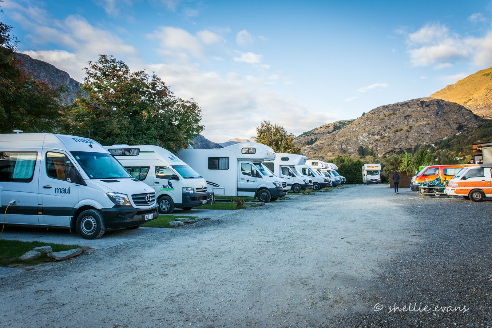
With a little maneuvering David managed to park the van in perfectly but luckily we arrived early afternoon as it was chaos later when the rentals vans started arriving. As it was we had a guy drumming his fingers on the steering wheel of his rental as he waited to pass us to another site. Impatient bugger!


The camp have also put in a new dump station but unfortunately while the previous one was bad enough for access, there's no way we'd fit into this one. Luckily we'd done our business at Cromwell.


As the afternoon wore on, the rentals filed in...


...until there wasn't a site to spare...


Being able to back in off  the clearway is not the only reason we like our preferred site, this is the only site with a hedge on either side too, so it's great for privacy. Being tightly packed in like sardines is not our idea of camping but we've found out, that if we want to do a few things in Queenstown and/or are there for a few days and want to have no worries, this Top10 suits us fine. And actually when you're totally self-contained you can keep your own space or get involved as it suits. 


We weren't due at the airport until mid afternoon on Tuesday so I left David relaxing and went for a drive through to Arrowtown to check out the autumn colours.

Arrow River
The Arrowtown Autumn Festival was due to start the next day with the big finale on the weekend. 


We've attended the festival twice before and had we not been tied up with family this year, we'd have probably gone to this one too. Well, gone to the NZMCA rally associated with the Festival anyway, just to enjoy the camaraderie and to see Prue & Harry again (who organise the rally).


Although it doesn't look like it from here, the little town was full to overflowing with every spare space taken by cars, rental motorhomes and buses, many parked along the river bank below the main street, with dozens of people crowding the footpaths and shops and this wasn't even the Festival proper! 


Having seen it all several times before, I made a hasty retreat to the cenotaph above the town to take some scenic shots.


Once finished there, I headed for Lake Hayes (photos at the beginning of the blog) and then home stopping to take a photo of this stone cottage I'd spied as we passed a clearing yesterday.


Not for the first time this season, I've felt autumn wasn't quite firing on all cylinders. Yes, there was still lots of colour but many trees had already shed their leaves and other weren't colouring up before dropping theirs. I guess I've been spoilt having now experienced three Central Otago autumns.