Saturday, May 13

Queenstown Lakes in Autumn

Catch-up

We headed off to Queenstown on Easter Monday both looking forward to seeing David's daughter (who we haven't seen in a year or so) and her partner when they arrived off a plane from Australia, the next day. Our Winton family also drove through for a couple of days of family time too.

We stopped at a very busy Cromwell dump station on our way out of town and then made our way back to the main road, past the autumnal looking Bannockburn vineyards.


The road through the Kawarau Gorge is also known as 'The Golden Highway' due to its gold mining history but at this time of the year, it also reflects the beautiful colours of the poplars and willows that contrast against the stark grey rock faces and brilliant blue of the river that flows through the gorge.


We stopped at Lake Hayes for lunch, we've stayed here a couple of times but for this visit we're heading to a campground so we can chill and relax without the worry of having to park in the allocated space and move after two nights.


It was a brilliant blue sky sunny day with just a slight chill, the cloud hund low around the Remarkables but dissipated soon after this photo was taken. Whenever we stop, I'm always out and shooting photos straight away. It's been proved too often that if I wait until after that cup of tea or lunch, the scene will change and the moment gone forever.


The next day I came back to Lake Hayes to get a few more photos of the autumn colours.


I also stopped at another little rest area half way along the lake where I'd seen a bright blob of brilliant yellow...


...and found not only the willows on the lakeside above but this beautiful setting below. With the lake's walking trail passing along the front of the property and the reserve on another side it's no wonder there were numerous signs telling people to 'Keep Out'. Unfortunately there are a few overseas tourists who have no idea of personal space (or couldn't read) and were clambering over the garden at the front of the house.


After lunch at Lake Hayes we moved on to our regular campground when we're not freedom camping, the Top10 at Arthurs Point, just above Skippers Canyon on the Shotover River. Queenstown campgrounds are always busy and I'd booked our usual site a few weeks ago, the one we can neatly slot into without too much hassle as all the sites are reasonably small and tight. 

'Yes, Mrs Evans you can have your preferred site #41, no, that's fine, no problems, we look forward to seeing you again' 


...except they forgot to tell me they've added a nice little toilet portacom over the clearway. 


With a little maneuvering David managed to park the van in perfectly but luckily we arrived early afternoon as it was chaos later when the rentals vans started arriving. As it was we had a guy drumming his fingers on the steering wheel of his rental as he waited to pass us to another site. Impatient bugger!


The camp have also put in a new dump station but unfortunately while the previous one was bad enough for access, there's no way we'd fit into this one. Luckily we'd done our business at Cromwell.


As the afternoon wore on, the rentals filed in...
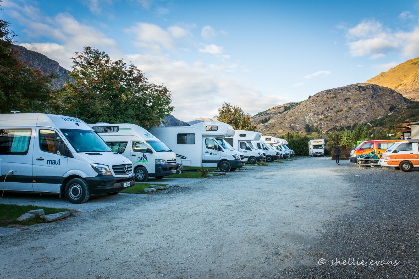

...until there wasn't a site to spare...


Being able to back in off  the clearway is not the only reason we like our preferred site, this is the only site with a hedge on either side too, so it's great for privacy. Being tightly packed in like sardines is not our idea of camping but we've found out, that if we want to do a few things in Queenstown and/or are there for a few days and want to have no worries, this Top10 suits us fine. And actually when you're totally self-contained you can keep your own space or get involved as it suits. 


We weren't due at the airport until mid afternoon on Tuesday so I left David relaxing and went for a drive through to Arrowtown to check out the autumn colours.

Arrow River
The Arrowtown Autumn Festival was due to start the next day with the big finale on the weekend. 


We've attended the festival twice before and had we not been tied up with family this year, we'd have probably gone to this one too. Well, gone to the NZMCA rally associated with the Festival anyway, just to enjoy the camaraderie and to see Prue & Harry again (who organise the rally).


Although it doesn't look like it from here, the little town was full to overflowing with every spare space taken by cars, rental motorhomes and buses, many parked along the river bank below the main street, with dozens of people crowding the footpaths and shops and this wasn't even the Festival proper! 


Having seen it all several times before, I made a hasty retreat to the cenotaph above the town to take some scenic shots.


Once finished there, I headed for Lake Hayes (photos at the beginning of the blog) and then home stopping to take a photo of this stone cottage I'd spied as we passed a clearing yesterday.


Not for the first time this season, I've felt autumn wasn't quite firing on all cylinders. Yes, there was still lots of colour but many trees had already shed their leaves and other weren't colouring up before dropping theirs. I guess I've been spoilt having now experienced three Central Otago autumns.


Wednesday, May 10

Carricktown- The Shiny Finally Gets Through; Part 2

Catch-up

Carried on from Part 1

We leave the Young Australian waterwheel behind, fording the water race and once again steadily climbing up to the next ridge. Clutha Valley comes back into view.


I forgot to put the panos up in the first part of the blog so I'll drop them in here for you (click on the photo to enlarge)


And here's one as we leave the waterwheel, you can see it just about centre in the photo; a light grey dot.


We finally reach the top of the ridge where the Spaniards are thick on the ground and rocky tors dot the landscape.


The track levels out and heads east across the top of the ridge, there are now numerous small bogs to cross as the water pools in the hollows. We're now around 1200 metres above sea level and in the winter this area would often be deep in snow. We suddenly see life across the divide and spot two vehicles making their way cautiously towards us (remember to click to enlarge).


We find an area to pull off the road and wait for them to come through. A good time to take some more photos! This is looking west and under those clouds are The Remarkables; the backside of the Remarkables, we're not that far from Queenstown. Did you spot the merinos? 


I climb back in the cab and we wait patiently for them to appear over the rise in front of us, they disappeared out of sight and took such a long time to re-appear, we think they must have been waiting for us as well. Eventually they come into sight, give us a wave as they pass and carry on across the track. 

Discussing the track later, we think that perhaps we should have done it in this direction too, descended the range, instead of climbing it. The view over Clutha Valley would have opened up in front of us as we headed down the range, I wouldn't have had to get out as much to take photos and David would have seen more of it too. But then again, David likes going up a track rather than descending it.


We move off again, spotting a blue figure against the skyline ahead of us; the German runner who passed us back at Carricktown. We'd actually caught sight of a blue dot moving through the landscape several times but we're now catching him up. Maybe he stopped to talk to the guys in their vehicles and that's what held them up.


We pass carefully through one last bog...


...and head up to Watts Rock, the highest point on the Carrick Range at 1322m.


I get the fright of my life when I climb up to the trig beacon and find the German guy resting against one of the rocks taking in the view back along the track we've both just crossed. I wondered where he'd gone.


He tells me he's going to return by the same route, all 14kms of it. I tell him he can do a loop, carry on along the ridge to Duffers Saddle and then down the Nevis Valley road back to Bannockburn. He's worried he'll get lost but I assure him there's only one way out of the valley as long as he turns left at the end of this track and we won't be far behind him anyway.

He heads back to the track just as a guy on a trail bike comes roaring up behind the ute. Talk about Piccadilly Station! The bike rider stops for a chinwag with David. David offers the runner some water; he's not carrying a thing and is dressed in T-shirt and light running shorts, and like the girls earlier, it's not the ideal attire for a run in the mountains where the weather can change at a moments notice- lucky it is reasonably mild today.


The bike guy tells David he's worried about the two girls though, he passed them at the wheel (9kms from the bottom of the range) and told them they'd have to head back soon as the weather was due to close in late afternoon, you can see the cloud approaching in this pano.


From my vantage point atop the rock I watch as a vehicle passes along the Nevis Valley Road heading towards Cromwell and then I spot the runner taking a short cut across to the Nevis Road too. Off to the south I can see the Nevis Road running south through the valley. 


We carry on and our track drops down to join the Nevis Road just north of Duffers Saddle- travel dots finally joined! We've driven the Nevis Road a couple of times in the past and both times I was unaware of where the Carricktown track left the road. That's because there are no signs although that looks to be about to change, there's a DOC info shelter going up beside the cattlestop at the entrance to the track, which is good because there are several tracks in various states heading off in all directions. 

We stop at the Saddle for a cup of tea and another Ranger pulls in beside us, the driver pouring himself a coffee and joining David to compare notes.


We watch as dozens of vehicles pass us heading in both directions- people out for a Sunday drive over the highest public road in New Zealand! The road into and along the valley floor is fine for regular vehicles in fine weather, it's the Nevis through the gorge at the end of the valley and beyond that drivers need to be cautious of.


Afterwards we search around the nearby rocks looking for lizards (no, not Giant's this time, we're out of their range) but only find a couple of fast moving small ones and two NZ Shorthorn grasshoppers, camouflaged beautifully against their surroundings, although the green one leapt out of the grass ahead of me and into some not so well coloured plants.


It's time to head for home and this time we can see the valley ahead of us, although it's getting very hazy and the shadow of the Pisa Range covers part of the lake.


We pass by and over the Carrick Water Race a couple of times on the way down the range. It's still an important asset for the local community with an intricate network of side canals that leave the race on its downward journey, irrigating the farmland and orchards far below.  I guess the water race will also come under scrutiny when Central Otago's controversial new water allocation permits are needed to be negotiated before 2021.


We now heading down Long Gully...


...and through 'Dead Horse Pinch', where today vehicles make the slow climb to the top of the range.
In the early days many horses didn't make it up the steep incline while pulling wagon loads of mining dredges and material into the Nevis Valley. On their way back out of the valley the wagons dragged 'brake-stones', massive stone slabs behind them to check their descent. These slabs were later used to build the woolshed at the bottom of the road. 


Unfortunately the map won't let me draw the line over our route taken, it obviously doesn't like to be taken off road so I've named all the places and if you zoom in you'll be able to pick up the track(see purple & blue markers).


Monday, May 8

Carricktown- The Shiny Finally Gets Through; Part 1

Catch-up

We did another 4WD expedition on Easter Sunday and this time managed to join two more travel dots- Bannockburn to Duffers Saddle. We left the road at Quartzville which is just behind Bannockburn in Central Otago. Quartzville was once a service town for several gold mines higher up the Carrick Range. 


The track is a bit narrow and lumpy to start with, we hope we don't meet anyone coming down as there's nowhere to pass for a kilometre or so.


As we climb higher the lake and Cromwell come into view behind us. The Carrick Range forms the southern boundary of the Clutha Valley, Lake Dunstan & Cromwell. The Pisa Range runs along the left hand side of the valley and the Dunstan Mountains are along the right.


Off to our left and far below are the colours of autumn and the green of irrigated farmland behind Bannockburn. The road to the Nevis Valley runs through the valley; another 4WD track, the Hawksburn Road, heads over the Cairnmuir Mountains in the background to Clyde. We drove that 'road' last year.


Thankfully the track is dry and we make steady progress, climbing higher and higher. There were over 40 mines up here and in the nearby ranges during the height of the gold rush through the 1860s. Mines with weird and wonderful names such as these-

1. The Elizabeth. 2. Royal Standard. 3. Star. 4. Heart of Oak - later Last Shot. 5. Young Australian. 6. Caledonian.  7. Border Chief. 8. Crown and Cross. 9. Day Dawn. 10. John Bull. 11 Norwegian. 12. Perseverance Reef.  13. Perseverance Claim. 14. Veil of Avoca. 15. New Royal Standard. 16. Golden Star. 17. Dawn of Hope. 18. Duke of Cumberland. 19. Rob Roy. 20. Matchless. 21. Excelsior - afterwards Welcome. 22. Black Horse. 23. Coleen Bawn. 24. Nil Desperandum. 25. Patience. 26. Leader. 27. Robert Burns. 28. Golden Gate. 29. All Nations. 30. Kohinoor, or Amateur. 31. Golden Phoenix. 32. Heart of Lothian. 33. Enterprise. 34. White Horse - later Try again and Last Chance. 35. Golden Crown. 36. United Bannockburn. 37. Bonanza -later Frying pan. 38. Go by.


Here we pass by the site of the Caledonian. The signposts look very familiar, they are the same as the ones that mark the gold mines through the Nevis Valley on the far side of this range.


I say we made steady progress, and we did but it included many stops to take photos of the view opening up behind us. It would seem the resident merino sheep like the views as well, everything I step out, it's onto a road covered in sheep poo and smelling strongly of urine- they must sleep on the road at night and head off into the scrub during the day.


Other than a couple of mountain bikers in the carpark at the beginning of the track, we hadn't seen a single person on the 7 kilometre climb to the remains of Carricktown. So it's a great surprise as we come over a brow in the track to see ahead of us, not only the remains of Carricktown, but two girls sitting beside one of the old stone cottages having lunch. Where the heck had they come from? 

These two German girls, who were not ideally dressed for such a rugged walk in the mountains, had nothing better to do on a quiet Sunday in a sleepy Bannockburn so decided to walk to the Young Australian Waterwheel which was still another two kilometres or so further on. 


Carricktown was built to also service the surrounding mines and as a result of being closer, Quartzville, at the bottom of the track, was abandoned soon afterwards. 


How's this for a view from your front door? Straight down the Clutha Valley. Of course back then there was no lake, just the mighty Clutha flowing through the valley. Lake Dunstan is a manmade hydro lake formed during the 1980s when the Clutha River was dammed at Clyde.


The remains of several buildings are scattered along either side of the track and while I'm clicking away I suddenly spot a blob of blue bouncing along. What the heck! It's a guy running. Crikey. Another crazy German, this time out for a Sunday run.


We carry on passing through a couple of shallow bogs as the track zig-zags its way up the side of a steep slope. We stop in a rough gully...


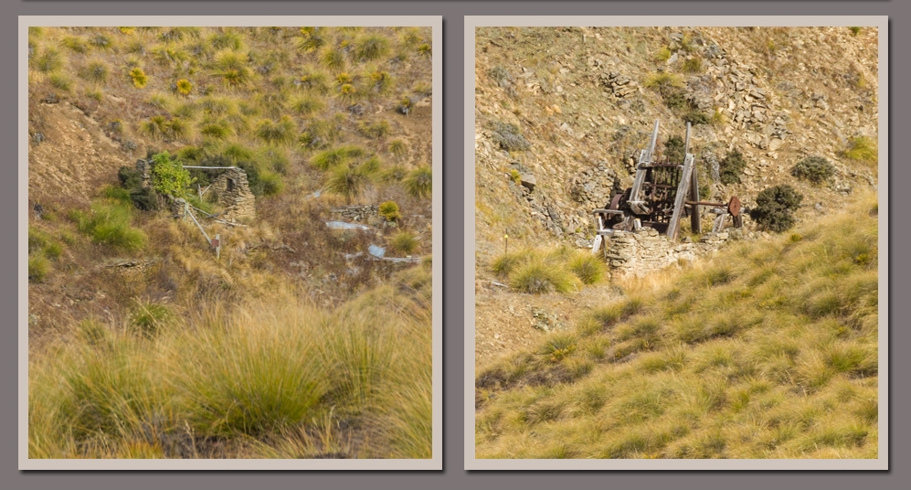
...where the remains of the Elizabeth Reef stamper battery are, along with tailing piles which are also known as mullock heaps.


We're now climbing above the winter snow line, there's a lack of briar bushes and prolificacy of Spiny Spaniard or Speargrass, an alpine plant that loves the cold and snow. 


We're nearing the top of the first ridge now and I can see the track disappears over the top further on so we stop for a last photo looking back down the valley. You can just about see it here, the confluence of the Kawarau River, the lower blue ribbon of water, and the Clutha River, which is actually part of Lake Dunstan and leaves the lake at the right flowing through the Clutha Gorge to the Clyde Dam.


We pass the remains of two large, shallow dams that were obviously used in mining operations and with...


...one last gate to open and shut...


...we arrive at the site of the Young Australian gold mine and the Carrick Water Race...

The top track is the road ahead of us (if you look carefully you can see a running blue blob), the lower track is the water race.
...and the 7.9m diameter wood and iron waterwheel (restored in 2011) which, in 1874, was dragged 1100 metres up the mountain to drive the 10-stamper battery at the Young Australian workings.


Looking totally incongruous in the barren and dry mountain landscape, the waterwheel drove the stamper battery which pounded the hard gold bearing quartz rock to gravel.


Across the valley from the wheel are the remains of the battery and a couple of stone huts.


The 34km Carrick Water Race was speedily built between 1872 to 1874 to bring water from the isolated Nevis Valley, over the mountains and down to Bannockburn, the water sold to miners along the way. 


There were many bitter legal disputes as miners thought they'd purchased the water completely and objected to the race owners re-selling to other users further down the mountain.


To be continued....Part 2