Catch-up
We packed up and left Houhora before the forecast heavy storm arrived. We'd decided it would be best to return to the
NZMCA Park at Tokerau Beach, park up there and sit the wild weather out along with the Christmas/New Year busy holiday period.
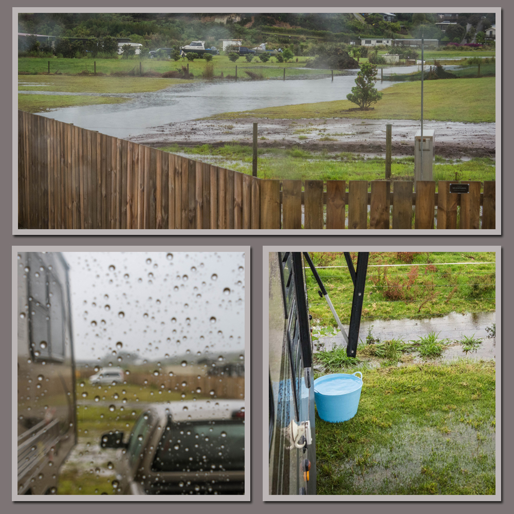
With the top half of the North Island on a wild weather alert we didn't expect too may campers to arrive at Tokerau over the next few days. And we were right, there was just one other caravan on site when we arrived two days before Christmas and a only a handful of others trickled in over the next few days. This time we parked in the top corner overlooking the horse paddock and with just a peep of the beach behind. Just as we finished setting up, big fat rain drops started to fall and rogue gusts of wind rocked the van. The rain became torrential and the wind more constant...

...and that was how it was for the next two & half days, a solid wall of rain bucketing down on us from the heavens above. We watched as the creek filled the floodway up and quickly grew wider and wider as it flowed through the back of neighbouring sections and into the NZMCA Park drain. We saved a few trips to the local fire station to get fresh water by collecting bucket loads of it off the awning overflow. We'd only just empty one bucket and it'd be full again within seconds; in the end our water tank was overflowing and the ground around us started to flood too.
Christmas Day was wet although we did get to see a gap in the thick grey blanket of a sky late in the afternoon. And we actually had a lovely day even though we were by ourselves. Of course we missed the family scattered around the country & overseas but we enjoyed the relaxed pace of being forced to stay indoors and preparing and eating a smaller Christmas dinner than we'd normally have.
Before we knew it Boxing Day arrived, the rain moved on, summer resumed and a few more campers arrived. And in fact Christmas Day was the last day of any significant rain we had for nearly five months as we travelled around the Far North, Northland, the Coromandel, the Bay of Plenty and Hawkes Bay.
Over the next few days an assortment of RVs arrived and, with plenty of space available on both sides of the drain, found themselves a spot in the sun.
Most were keen to check out Tokerau Beach as soon as they were set up and it didn't take them long to find the lovely wide grassed track that took them straight to the beach (a road separates the track entrance from the beach). The Park may not be quite beachfront but it's a pretty close second and I'd say it will quickly become one of many people's favourite parks.
From the camp I managed to photograph a number of sunsets which were just as spectacular as the
sunrises I captured from the beach on the last visit.
Released from our 'cabin fever' Christmas we decided to head into Mangonui and...
... have another lovely fish 'n chip lunch at the 'famous in NZ' Mangonui Fish Shop again.
 |
| Lunch from our previous visit |
Of course we didn't allow for a throng of holidaymakers who had the same idea! The queue came out the door and ran off down the footpath.
We gave that idea away, purchased some of their delicious Raw Fish Salad for later and wandered back through the village, checking out the fishermen on the wharf and dodging people, dogs and vehicles along the narrow road through the village shops. All the cafes and the hotel were overflowing with people enjoying the holiday atmosphere. Before we left for home, I climbed the steep road and then several flights of steps up behind the village to photograph a church that had a fabulous view over the Mangonui Harbour.
On the last day of 2018 we went on a tiki-tour around the Karikari Peninsula, calling in on some of the beaches we'd visited just a few weeks before. And what a transformation! The DOC camp at
Maitai Bay had the full sign out although there were still a few spaces here and there. I guess some campers would have cancelled due to the weather and others were still to arrive after New Years Eve.
The boat ramp and carparks were full and a small tent town had taken over all the camping bays at both the top & lower camps. When
we stayed here at the beginning of the month there was just us and a couple of small tourist vans.
Waikato & Maitai Bays are side by side at the top of the Karikari Peninsula, both with beautiful golden sand crescent shaped beaches. There weren't too many people on the beach at Waikato Bay on this day but many more than the deserted beach we'd seen on our last visit.
And a sure sign that holiday makers & summer had arrived was the icecream van tucked up in the corner of the bay.
I did get the shock of my life when I climbed up to the top of the small ridge between the two bays...
...to see that Maitai Bay was full of people; swimming, sunbathing, picnicking and playing on the beach.
A bit of a contrast to the last time I looked over the side.
And even though the beach was busy (relatively so), there was still plenty of room at the north end of the bay.
We left Maitai to the masses and headed off back down the peninsula; I wanted to show David the stunning beach I had found when I went exploring during our last stay at Tokerau. This time we took a shortcut that I knew about but hadn't managed to drive last time because there was a large deep muddy bog blocking my way. I wasn't game enough to drive through it without David (to help get me out if I got stuck).
You'll see it on the map below, Waimango Road is a public 'road' although there are a couple of unlocked gates to open & close. The surprise is at the end of the gravel straight where it has been left to the elements and farm vehicles. From there on it's mostly a bumpy, dusty dirt track but a section of it skirts around the edge of a large swamp and that was where I'd come to a halt at the bog. This time the bog had mostly dried up (even with the recent rain) and I'm not so sure it was a 'shortcut' even though it cut off about 10kms. It probably would have been quicker to take the longer route but hey, where's the fun in that?
The dirt track exited onto Puheke Road, the road that leads to one of my favourite beaches in the Far North. Last time I visited it there hadn't been a soul in sight; I had the whole beach to myself. Today I felt like, "Hey you guys get off my beach, you're spoiling the perfectness!"
In reality, there were just a few families enjoying a sunny day (and roughing up my perfectly smooth sand with their games).
We drove up a gravel track to the top of the hill beside the beach (Mt Puheke- up here in the Far North where the sandy land is mostly flat, they call any sizeable hill a mountain). The carpark overlooked beautiful Puheke Beach in one direction...
...with a breath-taking view overlooking Karikari Moana (Bay) and the white sand and large dunes of Karikari Beach in the other.
These are the large white sand dunes with the wetland and dune lake behind, that can be seen from the Maitai Bay road, and from the villas and hotel rooms of Carrington Estate (below).
We were amazed to see that a group of people had set up their tents (which looked to include the proverbial kitchen sink) on the slope below the carpark; a perfect spot overlooking the bay but I'm not so sure it would be comfortable sleeping on a slope. We were also surprised at how steep the track past the tents and down to the rocks below was, and then to see a ute and fishermen at the bottom. Hopefully they have good tyre grip to get back up the slope on the slippery grass.
And while I'm talking about being amazed, the next surreal sight was an ambulance arriving with it's lights flashing. What the heck? They were quick to ask if anyone had called 111, no one in the carpark had so they drove down to the tents, no one there had either. They'd come all the way from Mangonui, 40 minutes away and were just about to leave after checking back with base when over the rise from the direction of Karikari Beach came a young woman huffing and puffing.
The patient was stuck down in the rocks; he'd speared himself in the leg with his speargun while clambering over the rocks and he couldn't walk. The young woman found him and his mate on her way back up from the beach.
One of the ambulance officers set off down the track to find and attend to the guy while the other called back to base, a Mangonui firetruck would have to come out (another 40 minute trip), so the firefighters could stretcher the guy out. He'd be spending his New Years Eve in hospital, or at least in the out-patients no doubt.
And what were they looking at? (for those that follow my
Facebook page), they were watching the paramedic heading off down the track.
On the way back down the road we stopped for one last photo overlooking Puheke Beach and then headed home (the long way round) for a quite New Years Eve.
On New Years Day I was preparing dinner when I spotted out the back window, a tiny wisp of smoke on the otherside of Doubtless Bay around the Taipa area. It quickly grew and within a couple of hours smoke was billowing across the bay. I could see a couple of helicopters flying around and the orange glow of a large fire that had quickly spread through the tinder dry scrub. I later read that there were 5 fire trucks in attendance & 2 helicopters and it took over four hours to bring under control.
You may have noticed in the photos that between the NZMCA Park and the beach is a large horse paddock which held a dozen horses, most of them looked like retired race horses. Now, does this look the face of innocence?
The horses provided quite a bit of entertainment each day as they made their way around the paddock grazing together, chasing each other, annoying each other, scratching each others back, checking any campers dogs out and generally being nosy.
So we couldn't stop laughing when we came home one day to see that one of the horses had ripped and chewed a great hole in the neighbours shirt which he'd hung on the fence. It does say in the shed not to hang washing on the fences (a standard rule in all NZMCA Parks), and it also said not to feed the horses! I chuckled even louder when the neighbour arrived later to see what had happened and commented that it was the only shirt he had with him!
 |
| Wasn't me he said as he peered through the hole. |