Catch-up; November 6, 2017
I have wanted to do the 14km (return) walk along the beach, from Marfells to Cape Campbell, for a very long time. Cape Campbell forms the south-eastern tip of Cook Strait and the top of the South Island's east coast.
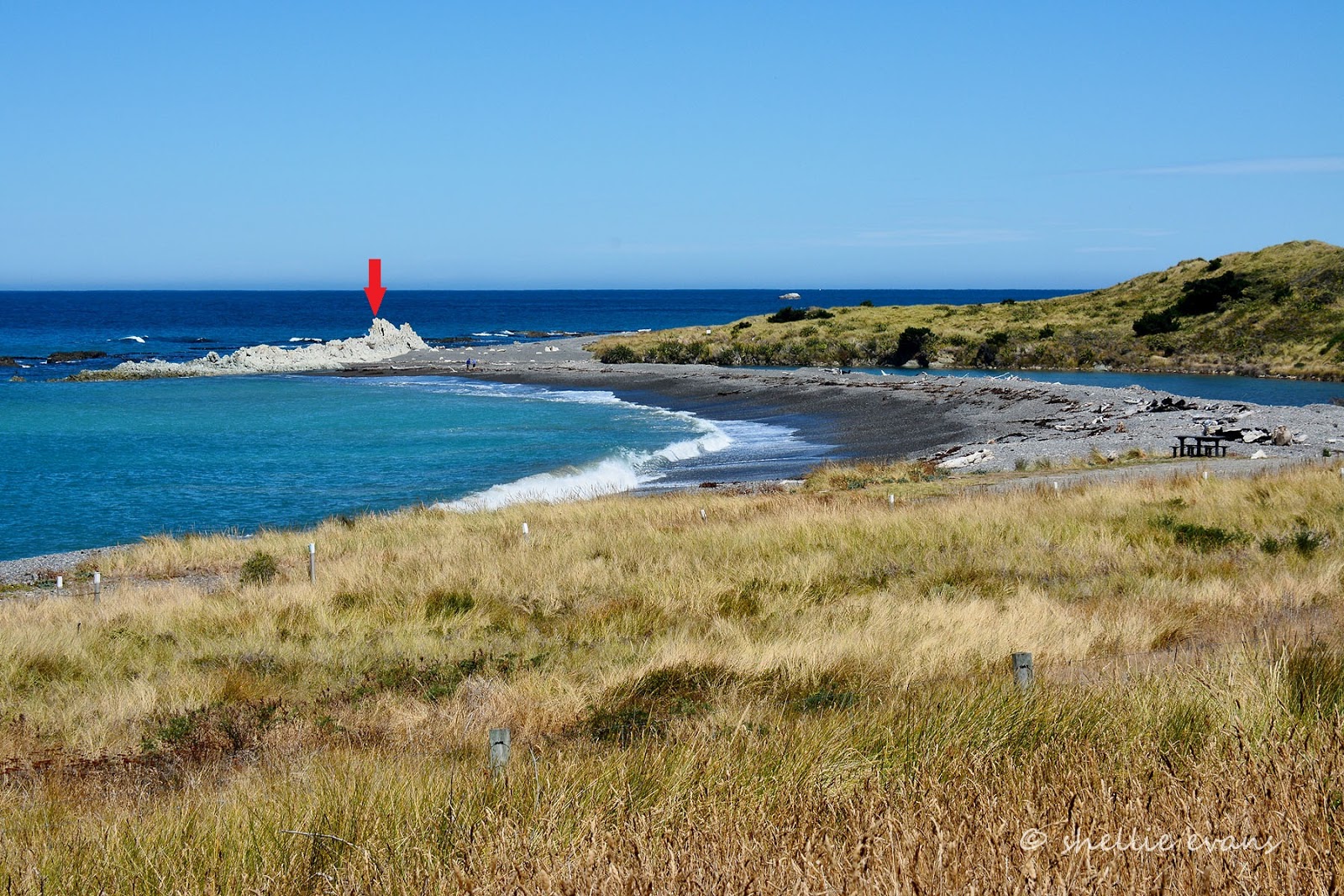
This photo was taken just past Mussel Point, from here there's still 6kms to walk to reach the lighthouse; that tiny dot on the end.

Before the earthquake, the walk was subject to the tide and I'd never quite made a concerted effort to time it right. Either the tide was wrong or the weather wasn't great, though I'd always watch wistfully as quad bikes loaded with families and/or divers, fishers and all their gear, disappeared around Mussel Point.
 |
| Looking back towards Mussel Point |
Now that the 'quake has lifted the seabed, the tide doesn't have quite the hold over the coastline it once did. There are couple of bluffs where it does reach and one landslide that looks like it came down in the 'quake. You'd have to reach them right at the top of the tide for them to be a problem and if you did I would say you'd only have to wait 15 minutes or so before the tide turned and it cleared enough to pass.

It was a stunningly beautiful day for a seaside walk and I had the whole beach to myself all the way to the Cape. With not another soul in sight I took my time exploring the newly formed rock pools and checking out various shore birds in the driftwood and dunes above the high tide line.

I also found a seal resting in the warm sunshine, obviously the quad bike that was returning home just as I left camp had found it too, cutting in a bit too close for my liking. Amongst the Variable Oystercatcher and Black-backed Gull pairs there were quite a number of Banded Dotterel pairs who were acting a lot like they had either a nest or chicks nearby- can you see one resting behind the driftwood?

I left them to it and moved back down onto the smooth sand, where it was much easier walking. You can see where the tide reaches in this shot looking back to Mussel Point. There is a narrow dirt track just above the tide line that I suspect sheep have formed. I guess if there's a lot of wave action it might be a little harder to pass through here near high tide.

And speaking of sheep; how's this for living on the edge; ewes and their lambs right at the top of the cliffs peering down at me passing by.

And as I scanned the papa cliffs I found a few more resting on the slopes which are way steeper than they look here. I thought they were goats at first. Sheep have now gone up in my estimations, they are way more agile than I'd given them credit for. They're still crazy though (click the photo to enlarge)

As the kilometres shrink, the lighthouse grows in size. I zoom in and think I spot a couple of vehicles parked beside the buildings. Selfishly I think 'darn!', I'd have liked the place to myself.

In this eastern corner of Clifford Bay and just before the Cape, the ocean current and wave action has dumped great piles of seaweed on the papa rock platform and up onto the gravel behind. The top layers have dried in the hot sun but underneath it's a smelly, slippery, slimy mess. And I think to myself that I'll carefully walk over it to the papa platform near the water, then cut the corner off to the lighthouse.

I know before I even hit the deck that I've stepped onto something even slipperier, wet papa rock that hasn't had time to dry in the late morning sun. I stumble forward, then sideways, one arm flailing trying to gain balance the other trying to keep my camera safe. I think I have it under control just as my foot slips into a narrow channel and I pitch forward landing on my knees, belly and hands. Bugga!
My camera hand is buried in mud, the camera resting in my palm and just out of the muck, there's blood trickling from one knee and a massive scrape on the other. A few small sharp shells stick out from my other palm and I'm dripping wet (I've landed in a shallow water filled scrape) with odd bits of seaweed and driftwood stuck to my clothes. And I ache.
Thankfully my pack is safe on my back, I remove it and find one lonely dried out wet-wipe to wipe the camera down (which I find has taken a small hit on the lens- double bugga!), clean my hands and then wipe away the blood and mud- all in that order. Even though I know there's no one around I still look to see if anyone has seen my little performance. I then feel eyes on me, I'm sure they're wondering what on earth I'm doing and I guarantee they're laughing under those blank stares.

I gather everything together and step forward....Yee-o-ouch!!!....my left foot can hardly take my weight, I've done something serious catching it in the channel. Until I moved I'd been unaware of how bad it was. Now what to do, there's no phone reception and I can hardly walk. I think I'll have to hobble to the buildings and if it hasn't come right, see if the people there can help me. I move cautiously forward, one small step at a time until I reach the lighthouse buildings.

I'm sure I saw two vehicles parked in front of the cottages, now there's not a soul in sight. They didn't pass me so where did they go?


I cautiously hobble across the grass to the bottom of the stairs and then slowly haul myself up them one at a time.

It's hard work and I make sure I hold on to the rail at all times, it is rather steep.

I stop often to rest my foot and to take in the views below and back over Clifford Bay.

Finally I reach the top and I shuffle around the side of the lighthouse to find a step or something to sit on to have my lunch and rest awhile.

When I look over the otherside, I spot the two vehicles from the cottages heading south towards Cape Campbell Station. The farm actually owns the lighthouse cottages now and hire them out for self-catered stays. They also run the Cape Campbell Walk, a 4 day trek through the farm and around the coastline, staying at various farm cottages along the way.

The cottages can be accessed via the farm and when I zoom in on the people, I see they have a TV camera and big fluffy microphone; perhaps they're doing a doco on the earthquake; they have just walked back from off the rocks. The other vehicle's occupants have closed the gate and headed off around the far point. I'm now definitely on my lonesome.
Although it's a nice surprise to find out that I now have phone reception so I call David to let him know that I've had a small fall and while I'm OK, it might take a while for me to walk home. So don't panic. He wants to come and get me and while the beach would be fine to drive down, we both doubt he'll get through the very deep and soft pea metal back on the camp side of Mussel Point. I assure him I'll be OK, I'll just take my time.
I also get the usual "Oh no, not again, weren't you being careful?" "Yes, of course I was being careful, do you think I do this for the fun of it? Grrrrr.....

I have my lunch and then take a few photos of the lighthouse; I'm getting quite a collection of lighthouses now; like swingbridges, cribs and churches they make interesting subjects.

I change to my wide angle lens so the lighthouse doesn't fill the whole shot and I can see the surroundings...

...and I can take a wide angled shot of the Cape. Cape Campbell is in the middle of Ward Beach and Marfells Beach and much of this rocky platform would have been under water before the 'quake too; the green algae is the new low tide zone.

That's the North Island across the water, centre right and the Marlborough Sounds to the left. I really wanted to clamber down and out to the point in front of me so I could get a shot looking back towards the lighthouse but I managed to restrain myself.

I gave David one last call to say I'd be on my way in 15 minutes, just so he could monitor the time, then I carefully made my way back down the stairs, stopping to take some photos of the cottages before carrying on.

The lighthouse and cottages were used in the the film 'The Light Between Oceans', based on the bestselling novel by M. L. Stedman. Here's my photo and a screen shot from the film's trailer-


I hadn't dare take my boot off back at the lighthouse, in case I couldn't get it back on but I could certainly feel that my foot was swelling up inside. It looked like the weather was about to change too, hopefully I'd get back before any wind or rain arrived. Wait.....is that......yes it is! It's a vehicle and it's heading my way. My hero!! (click to enlarge)

David made it through the pea gravel- after a chat with, and a few tips from the camp host- the art is to somehow just keep the vehicle moving. He also threw our large rubber mats in the back in case he had to use those to drive over to get out. He could have let the tyres down a little too but thought he'd risk them as they were.
What a relief it was to see him. I'd managed to cover about 2kms but I was beginning to think the task ahead of me was going to kill me....ok, well not kill me, but certainly damage my foot.
 |
| A mirage? |
It was heaven to lower myself into the front seat and have David navigate our way back home. Although I had a tinge of disappointment knowing I couldn't complete the 14km round trip.

We both had a bit of a 'hold your breath and egg the vehicle on moment' driving back through the metal, I think I even closed my eyes as the momentum died and we very nearly ground to a halt but David managed to just keep it ticking on and inching forward until we were free.

And that was how I found myself at the Blenheim Hospital A&E the next day having an x-ray (heavily sprained), wearing a moon boot (no half or small sizes left) and being told to rest my foot for three weeks. Yeah right, didn't they know we were heading to Tauranga to catch up with family and prepare for Christmas. The boot lasted all of two days, I did rest my foot as much as I could over the next few weeks. I tried my best to not rush around and eventually, after 4 weeks it returned to normal.