Showing posts with label marfells. Show all posts

Sunday, March 29

Cruising into a Crisis; Part 1

Real-time

It's very hard to comprehend how much the world, our world, has changed since this photo was taken just one month ago. As we usually do on our way to and from Napier, we called into one of favourite campsites for a couple of nights before continuing on to say cheerio to Mum & Dad in Napier.

Night Sky- Glenfalls
Glenfalls DOC camp is beside the Mohaka River and not too far off the Napier-Taupo Road. We'd wanted to stop for one last camp at Glenfalls before we returned to the South Island. It could be 18 months or so before we'll be back in the North Island. We'd also been having some exceptionally hot days (35c+) and the thought of cooling off in the river was very enticing.


We'd spent the previous few weeks in Tauranga after making a dash up the country in mid January from Lake Benmore in the Mackenzie District where we'd be having a lovely time waiting for the summer heat to kick in. We needed to sort our gear out which we'd had in storage for the last 8 years, we'd gone unconditional on a property we bought in Twizel, with settlement in mid-April.


We were going to whittle down our gear and only take essential items & furniture to Twizel. As it turned out we decided to ship it all to Twizel and sort it there; finding somewhere to sort it in Tauranga, the triple handling, disposing of furniture we didn't want and even the extremely hot days, all worked against us. Crown Furniture Removals came and filled two containers; yes, we did have a lot of gear! The containers were then shipped off to Christchurch where they will be held until we take over the property.

Sunrise- Matata Lagoon
Happy to have that all sorted we spent the rest of the time catching up with family & friends, staying at the Mount Holiday Park and the Matata DOC Camp to escape the sweltering heat and visiting friends in Kawerau before heading off to Napier.

Grandchildren, Maddie & Joel enjoying a Sunday paddle at Sulphur Point, Tauranga
Towards the end of our first week in Napier, I started to feel a little anxious about getting back to the South Island. New Zealand's first case of Covid-19 virus was about two weeks old and new cases were still in single figures. All of them had been traced back to overseas travel and there were no cases of community transmission. Yet.

I just had a niggling feeling of wanting to be across the Strait and in the South Island should anything happen. What? I had no idea. Like most people, never in my wildest dreams (David's favourite saying) did I think a lockdown would happen. Heck, I don't even think we knew what a lockdown was or what it would entail a week ago.

Ferry Landing Reserve, Ballance Bridge & the Manawatu River- Woodville
When WHO (World Health Organisation) declared an official pandemic on Wednesday, March 11th, I felt it was time for us to make a plan. I booked our crossing with Bluebridge for Thursday, March 19th and this time, for the very first time, I also booked a cabin. I have no idea why, it wasn't because of the virus, that didn't seem such a threat then. I just felt it would give us a place to rest after an early start. And as it turned out, it was very fortuitous. 

From March 14th, many large gatherings and events were cancelled and all people entering New Zealand had to self-isolate for 14 days. But there are still only 8 confirmed Covid-19 cases in the country. 

Titahi Bay Boatsheds, Wellington- South Side
We still weren't in any rush though, we said our goodbyes to Mum & Dad and headed out of Napier on Monday 16th. We stopped overnight in the freedom camping area at Ferry Landing Reserve near Woodville and then travelled onto the Plimmerton NZMCA Park for the next two nights. We'd leave for the ferry from there. I even had time to photograph the Titahi Bay Boat Sheds, something I'd been wanting to do everytime we passed through Wellington but had never had the chance.

Titahi Bay Boatsheds, Wellington- North Side
Thursday, March 19th. There were now twenty eight Covid-19 cases confirmed and over 7000 people self-isolating (or meant to be, with reports coming in of people arriving in the country and still sightseeing). That cabin earnt it's weight in gold as we self-isolated away from other passengers.

Canada Geese & Onepoto Road Boat Sheds, Porirua Harbour
I was still a little anxious about the crossing and whether I'd chosen a good day to sail. I don't usually book until 2-3 days out just in case there's a major weather event or a southerly blowing. Luckily we had a very smooth crossing and I felt a great sense of relief when we pulled into Picton, not only because of the good weather but we'd also made it back to the otherside. 


Rumours were swirling around on various motorhoming social media pages that the Cook Strait might close, many people had started to worry that the ferries would stop running and they'd not get home. Others also said that the Government would never close Cook Strait. Hmmm....I wasn't so sure.

Lake Grassmere Salt Ponds
Obviously others thought the same as me, there were many motorhomers lined up at the Picton ferry terminals and parked up in town waiting to cross back to the North Island.

February & March are the height of the holiday season for many retired motorhomers; the Christmas and New Year rush is over, children are back at school and families have returned to their home bases, the weather is usually much more settled and the South Island is a premium destination to visit at this time of the year.

Harvesting salt at Lake Grassmere Salt Works
Adding to the usual influx of motorhomers to the South Island, the NZMCA National Rally & AGM was held in Oamaru in early March, with the occupants of a several hundred extra motorhomes attending the rally and then continuing on to Warbirds Over Wanaka, the Bluff Oyster Festival and Arrowtown Autumn Festival just to mention a few.  All of these events had been cancelled in the previous few days due to restrictions around the gatherings of large crowds.

Marfells Beach DOC Camp, Marlborough
We called into the Blenheim Racecourse as we had a couple of errands to do in town and thought we'd stay the night there but when we saw how full the park was we decided to carry on south and stay at the DOC camp at Marfells Beach. We'd do the errands when we reached Christchurch.

We had a late lunch parked on the side of the racecourse drive, all the while motorhomes just kept on arriving. And we sensed a quiet urgency in the orderly stream of 40-50 RVs heading north on State Highway 1 during our 32km trip south to the Marfells Beach turnoff. We waved as they streamed past, waving extra hard as we spotted friends & on-the-road acquaintances heading in the opposite direction.


I started to relax a little once we were parked up on our usual site at the end of the Marfell's camp. We then heard that the government had closed our borders to all but New Zealand citizens and permanent residents, things were starting to ramp up. But still we had no idea what was to come.

Wild spinach would have provided campers with plenty of greens
 if the camp had been open during lock-down.
We thought we'll be fine now that we're in the South Island, we even decided to spend a couple of days at Marfells; it was lovely, warm and sunny and there was no hurry to get to Twizel. Settlement was still three weeks away.


But nature decided otherwise and we woke to a howling gale and the rig being sandblasted so we made the decision to pull out and head to Kaikoura.


To be continued....Part 2


Friday, December 22

A Walking Adventure to Cape Campbell

Catch-up; November 6, 2017

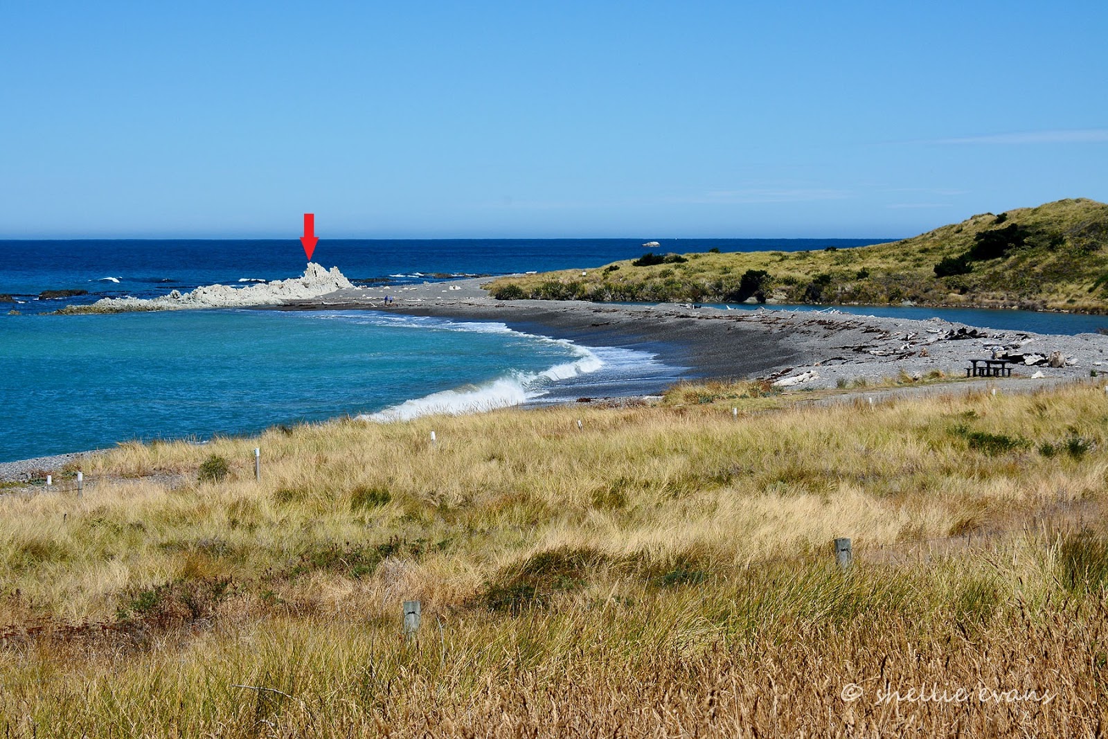
I have wanted to do the 14km (return) walk along the beach, from Marfells to Cape Campbell, for a very long time. Cape Campbell forms the south-eastern tip of Cook Strait and the top of the South Island's east coast. 

This photo was taken just past Mussel Point, from here there's still 6kms to walk to reach the lighthouse; that tiny dot on the end.


Before the earthquake, the walk was subject to the tide and I'd never quite made a concerted effort to time it right. Either the tide was wrong or the weather wasn't great, though I'd always watch wistfully as quad bikes loaded with families and/or divers, fishers and all their gear, disappeared around Mussel Point.

Looking back towards Mussel Point
Now that the 'quake has lifted the seabed, the tide doesn't have quite the hold over the coastline it once did. There are couple of bluffs where it does reach and one landslide that looks like it came down in the 'quake. You'd have to reach them right at the top of the tide for them to be a problem and if you did I would say you'd only have to wait 15 minutes or so before the tide turned and it cleared enough to pass.


It was a stunningly beautiful day for a seaside walk and I had the whole beach to myself all the way to the Cape. With not another soul in sight I took my time exploring the newly formed rock pools and checking out various shore birds in the driftwood and dunes above the high tide line.


I also found a seal resting in the warm sunshine, obviously the quad bike that was returning home just as I left camp had found it too, cutting in a bit too close for my liking. Amongst the Variable Oystercatcher and Black-backed Gull pairs there were quite a number of  Banded Dotterel pairs who were acting a lot like they had either a nest or chicks nearby- can you see one resting behind the driftwood? 


I left them to it and moved back down onto the smooth sand, where it was much easier walking. You can see where the tide reaches in this shot looking back to Mussel Point. There is a narrow dirt track just above the tide line that I suspect sheep have formed. I guess if there's a lot of wave action it might be a little harder to pass through here near high tide.


And speaking of sheep; how's this for living on the edge; ewes and their lambs right at the top of the cliffs peering down at me passing by.


And as I scanned the papa cliffs I found a few more resting on the slopes which are way steeper than they look here. I thought they were goats at first. Sheep have now gone up in my estimations, they are way more agile than I'd given them credit for. They're still crazy though (click the photo to enlarge)


As the kilometres shrink, the lighthouse grows in size. I zoom in and think I spot a couple of vehicles parked beside the buildings. Selfishly I think 'darn!', I'd have liked the place to myself. 


In this eastern corner of Clifford Bay and just before the Cape, the ocean current and wave action has dumped great piles of seaweed on the papa rock platform and up onto the gravel behind. The top layers have dried in the hot sun but underneath it's a smelly, slippery, slimy mess. And I think to myself that I'll carefully walk over it to the papa platform near the water, then cut the corner off to the lighthouse.


I know before I even hit the deck that I've stepped onto something even slipperier, wet papa rock that hasn't had time to dry in the late morning sun. I stumble forward, then sideways, one arm flailing trying to gain balance the other trying to keep my camera safe. I think I have it under control just as my foot slips into a narrow channel and I pitch forward landing on my knees, belly and hands. Bugga! 

My camera hand is buried in mud, the camera resting in my palm and just out of the muck, there's blood trickling from one knee and a massive scrape on the other. A few small sharp shells stick out from my other palm and I'm dripping wet (I've landed in a shallow water filled scrape) with odd bits of seaweed and driftwood stuck to my clothes. And I ache. 

Thankfully my pack is safe on my back, I remove it and find one lonely dried out wet-wipe to wipe the camera down (which I find has taken a small hit on the lens- double bugga!), clean my hands and then wipe away the blood and mud- all in that order. Even though I know there's no one around I still look to see if anyone has seen my little performance. I then feel eyes on me, I'm sure they're wondering what on earth I'm doing and I guarantee they're laughing under those blank stares.


I gather everything together and step forward....Yee-o-ouch!!!....my left foot can hardly take my weight, I've done something serious catching it in the channel. Until I moved I'd been unaware of how bad it was. Now what to do, there's no phone reception and I can hardly walk. I think I'll have to hobble to the buildings and if it hasn't come right, see if the people there can help me. I move cautiously forward, one small step at a time until I reach the lighthouse buildings.


I'm sure I saw two vehicles parked in front of the cottages, now there's not a soul in sight. They didn't pass me so where did they go?


I decide that there's not much else I can do except walk very slowly home. And yes I have a PLB (personal locator beacon), we always carry one, but this situation wouldn't warrant setting it off- I can still move and I'm not in any danger. And anyway I still have photos to take. Because I've come this far and the lighthouse is my target, I'll not let a bung foot stop me from climbing the stairway to it.


I cautiously hobble across the grass to the bottom of the stairs and then slowly haul myself up them one at a time. 


It's hard work and I make sure I hold on to the rail at all times, it is rather steep.


I stop often to rest my foot and to take in the views below and back over Clifford Bay.


Finally I reach the top and I shuffle around the side of the lighthouse to find a step or something to sit on to have my lunch and rest awhile.


When I look over the otherside, I spot the two vehicles from the cottages heading south towards Cape Campbell Station. The farm actually owns the lighthouse cottages now and hire them out for self-catered stays. They also run the Cape Campbell Walk, a 4 day trek through the farm and around the coastline, staying at various farm cottages along the way.


The cottages can be accessed via the farm and when I zoom in on the people, I see they have a TV camera and big fluffy microphone; perhaps they're doing a doco on the earthquake; they have just walked back from off the rocks.  The other vehicle's occupants have closed the gate and headed off around the far point. I'm now definitely on my lonesome.

Although it's a nice surprise to find out that I now have phone reception so I call David to let him know that I've had a small fall and while I'm OK, it might take a while for me to walk home. So don't panic. He wants to come and get me and while the beach would be fine to drive down, we both doubt he'll get through the very deep and soft pea metal back on the camp side of Mussel Point. I assure him I'll be OK, I'll just take my time.

I also get the usual "Oh no, not again, weren't you being careful?" "Yes, of course I was being careful, do you think I do this for the fun of it? Grrrrr.....


I have my lunch and then take a few photos of the lighthouse; I'm getting quite a collection of lighthouses now; like swingbridges, cribs and churches they make interesting subjects.


I change to my wide angle lens so the lighthouse doesn't fill the whole shot and I can see the surroundings...


...and I can take a wide angled shot of the Cape. Cape Campbell is in the middle of Ward Beach and Marfells Beach and much of this rocky platform would have been under water before the 'quake too; the green algae is the new low tide zone.


That's the North Island across the water, centre right and the Marlborough Sounds to the left. I really wanted to clamber down and out to the point in front of me so I could get a shot looking back towards the lighthouse but I managed to restrain myself.


I gave David one last call to say I'd be on my way in 15 minutes, just so he could monitor the time, then I carefully made my way back down the stairs, stopping to take some photos of the cottages before carrying on.


The lighthouse and cottages were used in the the film 'The Light Between Oceans', based on the bestselling novel by M. L. Stedman. Here's my photo and a screen shot from the film's trailer-


I carefully hobbled along the driftwood strewn gravel track and made my way around the outside of the pesky seaweed pile (the cause of all my problems) back to the smooth sand. I knew once I reached there it would be a lot easier going and I could get into a less painful walking rhythm that might not be fast, but would get me home at a steady pace.

I hadn't dare take my boot off back at the lighthouse, in case I couldn't get it back on but I could certainly feel that my foot was swelling up inside. It looked like the weather was about to change too, hopefully I'd get back before any wind or rain arrived. Wait.....is that......yes it is! It's a vehicle and it's heading my way. My hero!! (click to enlarge)


David made it through the pea gravel- after a chat with, and a few tips from the camp host- the art is to somehow just keep the vehicle moving. He also threw our large rubber mats in the back in case he had to use those to drive over to get out. He could have let the tyres down a little too but thought he'd risk them as they were. 

What a relief it was to see him. I'd managed to cover about 2kms but I was beginning to think the task ahead of me was going to kill me....ok, well not kill me, but certainly damage my foot.

A mirage? 
It was heaven to lower myself into the front seat and have David navigate our way back home. Although I had a tinge of disappointment knowing I couldn't complete the 14km round trip.


We both had a bit of a 'hold your breath and egg the vehicle on moment' driving back through the metal, I think I even closed my eyes as the momentum died and we very nearly ground to a halt but David managed to just keep it ticking on and inching forward until we were free. 


And that was how I found myself at the Blenheim Hospital A&E the next day having an x-ray (heavily sprained), wearing a moon boot (no half or small sizes left) and being told to rest my foot for three weeks. Yeah right, didn't they know we were heading to Tauranga to catch up with family and prepare for Christmas. The boot lasted all of two days, I did rest my foot as much as I could over the next few weeks. I tried my best to not rush around and eventually, after 4 weeks it returned to normal. 


Saturday, December 16

Earthquake- Ward Beach, Marlborough

Catch-up


There were even greater changes around Cape Campbell and down the coast at Ward Beach; closer to Kaikoura and the epicentre of the earthquake. That's the old high tide line at least 30-60cm (1-2 feet) above David's head and the new high-tide line where the green algae ends.

November 2017


Ward Beach, like Marfells DOC Camp, was a regular stop-off point for us before the November 2016 Kaikoura Earthquake. We often spent a few nights at one or the other on our way up State Highway 1 to catch the ferry or when heading south again after a North Island visit. After the 'quake and due to the major damage done to the road and rail network, SH1 was closed at Clarence, 45kms south of Ward. 

July 2014

High tide
The camping area is beside rugged & wild Ward Beach and is located on land that belongs to a local farmer. The site is actually right next door to the Ward Beach Reserve where no camping is allowed, but open the gate and drive on through & anyone with a CSC (certified self-contained) vehicle can camp on the other side of the fence for a small donation to the farmer, to be left in his letterbox back up the road.  

February 2015

Low tide
Once again I've been able to compare pre-'quake photos I had of Ward Beach with the ones I took when we visited the beach while staying at Marfells. I didn't have too many that are direct comparisons but you can still see a huge difference in the rocks that protect each side of the tiny beach (I have no idea why I didn't think to check the old ones out before the visit so I could take the new ones in the same spot!).

Remember to click the first photo to take you to a slide show and then use your back and forward arrows to view them enlarged and side by side.

November 2017- After the 'quake showing the rocks to the left of beach. In the two photos above you can see the same rocks before the event.


February 2015- down on the beach 


November 2017- This photo is a bit deceptive because the rocks you can see in the photo above are the rocks on the hard left and out of shot in the photo below. The rocks on the right were under water above.  


February 2015- before the earthquake a local crayfishing company launched their boats from a 'dozer at the beach most mornings. Since the 'quake, they have been unable to due to the shallow bay and exposed rocks. They have also been unable to get resource consent to launch them further up the coast. Sadly, they have become another one of the many businesses up and down the Kaikoura Coast that have suffered in the aftermath of the 'quake. 


November 2017- the vertical slabs of rocks on the right appear to be the same ones behind the boat in the photo above.


July 2014- On the right-hand side of the small beach the Flaxbourne River flows into the sea.


November 2017- you can certainly see the difference here after the 'quake, the gravel banks on both sides of the river and the rocky outcrop at the outlet have been pushed up...


...blocking off the river mouth- November 2017.


February 2015- before the 'quake and on the other side of the rivermouth looking back towards Ward Beach


February 2015- an arrow marks submerged rocks...


November 2017- that are now exposed.


And three more comparison shots.

Two photos from slightly different angles- February 2015


And the comparison shot- November 2017


It's not until we get up close to the rocks on the left side of the beach that it becomes apparent how far the earthquake has actually lifted the seabed. Before the 'quake most of these would have been under the water with just the tops of the bigger rocks sticking out in the wave zone.


The rocks now tower over us as we walk around them- before the 'quake we'd have had to wear wetsuits, fins and a snorkle to explore. Green algae grows below the new high tide line.


The rock David is examining is now 'beached' with no low tide mark on this side, yet the high tide line before the quake is 30-60mm above his head.


Up close, the remains of seaweed and shellfish cover the crumbling rock.


Dried stumps of seaweed...


...long dead shellfish hiding in their rocky holes and large carpets of barnacles are all that remain on the bleached rocks.


The rocky reef and papa rock platform at Ward Beach was once covered in great trails and thick forests of bull kelp that swirled back and forward in the waves, rising and falling with the tide. 

February 2015-


This was once home to a diverse coastal ecosystem; crayfish, paua (abalone), green-lipped mussels, other shellfish and fish lived and sought shelter in the channels and caves around the reef. 

And this was the heartbreaking sight that greeted locals in the days after the 'quake (photo supplied). 

November 2016


One year on and the coastal landscape has gone through another dramatic change from those early days after the Kaikoura Earthquake.

November 2017- taken from the same position as the photo above (coincidentally) 


I know that there were several RVers parked at Ward Beach (and Marfells) on the night of the 'quake; we met a couple who had been at the beach a few days later at our Franz Josef camp site- they were still visibly shaken. They had dashed as far away as they could from the continuous aftershocks, along broken roads and past crumbling buildings, to the West Coast.

They were still cleaning up their van after the violent jolt threw open their drawers, cupboards and fridge and dumped clothes, crockery and food in one big broken jumble on the floor. They had to climb over the pile, in the darkness, to get to the door to escape. After the initial big shake and with the worry of a tsunami, they gathered together with the other campers in the darkness and then all made their way back up the road to the farm homestead, cautiously checking for rock slides along the way. 

In time people will forget how the beach looked before the 'quake or not even be aware of the dramatic changes that happened back in the middle of a dark night in November 2016. It will still be a wild and beautiful beach with amazing sunrises. 

July 2014
And people will still come to steal a quiet moment, sitting in their cars mesmerized by the crashing waves or sheltered from howling wind. They'll still come to relax, fish or explore the rocky shoreline (now with even more rocks and pools) and should they know of it's history, marvel in wonder at Mother Nature's incredible force. 

July 2014