Saturday, June 21

A Weekend in Waikouaiti

It was a fine day for exploring and our first stop was the beach just  a couple hundred metres down the road from the camp ground. They don’t only take their dogs for a walk along the beach around here.


Low tide, firm sand & a long sweeping crescent of a bay makes it ideal to exercise the race & harness horses from the local stables. The vehicle “towing” seven horses drove steadily up to the far left of the bay then turned and made it’s way back along in front of me as two trotters arrived and they all headed way out of sight down the other end of the bay.


About 20 minutes later they came back past me for another stretch up to the other end, the horses looking like they were having a good work-out. We can’t say we’re not seeing some unusual sights on our travels.


Our next stop was Karitane, the seaside settlement that we drove through yesterday morning when we took the scenic route along the coast. Karitane is located between the wide Waikouaiti River estuary and a smaller ocean beach, separated by the Huriawa Peninsula. This is the site of the historic Maori Pa a Te Wera (fortified village) and there are a number of tracks over the headland and points of interest with information boards telling the story of the Pa.


It was a surprise to come over the rise on one of the tracks along the ridge & see this natural arch along with a blowhole nearby. And in the centre of the peninsula just below the site of the whare (home), a fresh water spring. Obviously why this was the perfect site for a fortified village; able to see approaching enemies from four sides, fresh water & an endless supply of seafood.


The track continued on along the shore line back to Karitane, here a manmade breakwater guides boats into the estuary. At the far end opposite a small commercial wharf & located on an overgrown bank was this plaque commemorating a century of community service by Plunket. Of course! Karitane. It suddenly clicks and I realise that this is where Sir Truby King started the Karitane nurses & hospitals. It’s a bit of a strange place to put the plaque though.


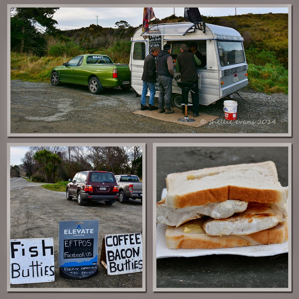
On our way to Karitane we passed this caravan in a layby beside the main highway, selling coffee & fish & bacon butties, it obviously sowed a big seed in David’s head because on our return he pulled in without warning & ordered a fish buttie for lunch (even though it was mid-afternoon & I had lunch with us!)


David was soon joined by two guys who were as impressed with the size of David’s fish buttie as he was. They turned out to be the two surfers we’d seen paddling across the river mouth when we were on the track. David enjoyed his buttie and another “on the road” kiwi experience!

We drove back into Waikouaiti village in search of the large estuary that we’d heard about which was just off the main road and in fact ran along the back of the campground. We found one of the entry walkways near the racetrack and as we pulled over a white heron (kotuku) lifted out of the channel beside the path. Too late for a photo but a great welcome. We could see plenty of ducks; mallards, grey, shovellers & paradise, a large flock of Canada geese, a few domestic geese, white faced herons, shags & pied stilts.


And feeding on the edge of the next pond three Royal Spoonbills (kotuku nutupapa).


Breeding spoonbills have yellow eyebrows and grow distinctive long white crest feathers (plumes) on the back of the head. This male already has his eyebrows.


I watched them for quite some time while they fed in the shallows near where I was standing. Like mine sweepers they all moved in unison sweeping their bill back and forward through the water. When they touched something, I’m assuming a fish or a crab, they rapidly chased it through the water before throwing their bill up in the air releasing the fish before catching it at the bcak of the bill and swallowing it fast.You can see a tiny fish in these two shots.


I was reluctant to move on but we had one more place to visit and the afternoon was drawing to a close. Further on from the estuary and towards the beach was another historic site. We drove to the end of the bay and continued on up a farm drive that ended near the historic Matanaka homestead.

The homestead itself is a private family home but we follow the well marked track for a few hundred metres through a stand of gum trees beside the public car park and a surprise awaits us. At the end of the track across a paddock with the ocean as a backdrop are a collection of stunning farm buildings.


These buildings belong to Otago's first farm which was established here at Matanaka in 1840 by Australian whaler Johnny Jones who had bought the land and an adjoining whaling station in 1838. There is a stable, a granary, a school house, a privy and a farm shed still standing today, all in their original positions. These are probably the oldest surviving farm buildings in NZ and are cared for by the historic places trust, they are rated Category I heritage structures.

The Shed
The buildings make great photography subjects but the nearby gum trees cast long shadows in the setting sun.

The Stables & Shed
Inside the granary is an old whaling boat and in the stables are old tack & saddles including a side saddle. The privy (top left, in the photo below, beside the granary) still had the boxed toilet with lift up lids (nailed down for obvious reasons), in fact it was one large box with three lids. Hmm.....imagine that " 'morning" " 'morning".....


Waikouaiti is turning out to be a great place to stop for the weekend. We realise that had we not had the issue with the van we would have passed through here not giving it a second thought.

Friday, June 20

Friday 13th- Waikoua….where

Well it started out ok; a lovely sunny winter’s day and we were about to hit the road again, time to leave Dunedin & continue our snail’s pace journey north to warmer weather.  After being by ourselves for most of the week, the NZMCA Park was beginning to fill up. RVs arriving from far & wide, their occupants very excited to be going to the All Black vs England test match on Saturday night at the stadium.

Never mind All Ways,  I think this guy came the wrong way......or the long way or perhaps both!


We pulled out of Dunedin late morning and after the long haul up the northern motorway hills & down the other side, we eased into our usual steady pace of 85-90kpm (90 being our maximum allowed) At the aptly named Evansdale we turned right to follow an 18km scenic loop along the cliff tops overlooking the Pacific Ocean through Seacliff & Karitane.


The road was very narrow and winding with some tight corners in places, but the worst part was all the rail crossings we had to stop or give way to. The railway ran straight (of course), the road didn’t, up & down and over and back, the road weaved itself along the line.

Not before time we finally came to the end of the hills & a lookout, looking north over Karitane Beach & Huriawa Peninsula in the foreground onto Waikouaiti’s Butterfly Bay & Matanaka (Cornish Point) further on. It was a very hazy day but looked like it would be a great place to explore. We were headed further north so this was going to be as close as we got to the beach......famous last words.


Further north we turned into the Shag Point peninsula, thinking we’d see the seals while we had some lunch. We hadn’t stopped here on the way south late last year as we’d been to Moeraki & Katiki Point where we’d seen lots of seals & penguins. Shag Point is a well known tourist stop; today, we were the only ones in the carpark. And there were only a handful of seals on the rocks beside Boat Harbour & a few sunbathing on a grassy knoll further along.

Boat Harbour
The narrow Boat Harbour inlet must provide excellent shelter for the locals launching or hauling out their boats, except in a heavy easterly swell I would think. Can you spot the seal on the far right rock ledge down by the water? Another one is out on the point- see the following photo.


We walked down to the grassy mound where the others were snoozing but the surrounding grass was long and there are old mine shafts about and probably sleeping seals so we didn’t get too close. The smell wasn’t that pleasant either.


Back at the 5th-wheeler, I put the slide-out out about two foot so I could get lunch ready, it really is great to have your home right there; it’s so easy to make lunch, sit at the dining table if it’s cold outside and watch the world pass by.


On hearing an unusual noise when we pulled the slide-out back in, David decided due to our last episode, he'd be extra cautious and have it checked out back in Dunedin where we had a contact. But of course being a Friday afternoon with the weekend due and an All Black test match happening, Dunedin would be in shut-down mode. It’s not Friday the 13th is it?

And that was how we found ourselves checking into the delightful but deserted Waikouaiti Beach Motor Camp right beside the golden sands of Butterfly Bay. And enjoying fish & chips at the tiny local pub while the locals had their raffle evening.

Hi-de-hi????  :)

Wednesday, June 18

Orokonui Ecosanctuary

I have followed the success of the Orokonui Ecosanctuary for quite some time on Facebook so with a sunny day finally dawning in Dunedin we decided to pay the reserve a visit, although by the time we got sorted it was well into the afternoon before we left. Orokonui is located 20kms north of the city overlooking Blueskin Bay, it’s a 307 hectare mainland “island” surrounded by 9kms of pest exclusion fence. The 1.9 metre tall stainless steel mesh fence is designed to keep out all introduced mammals, at ground level a steel skirt stops burrowing animals and a curved hood on the top stops climbing animals like cats & possums from entering the reserve.

And what a magic place it turned out to be, a definite highlight of the journey so far and one we will definitely be returning to when we come back to Dunedin (I know, I know…..another thing to add to the ever growing list of re-runs; this trip may just last 3 years!)


We parked beside this friendly fellow who was obediently waiting on the tray of a ute. while his Dad was doing some landscape work near the carpark.


The visitors centre was stunning; facing north east to catch the all day sun, it fitted into the environment so well. There was a large café overlooking two small ponds & the bush further on along with many nature displays & exhibits on show inside. We entered the reserve through a two gate locking system (so a rodent couldn’t make a dash in with us) and with a well marked map were able to explore in our own time. The sanctuary also does guided tours both day & night.


We made our way to the top clearing first as that was where we’d seen two takahe striding through while we were putting our boots on at the car. Takahe are flightless birds that belong to the rail family. They are similar to our pukeko (NZ swamphen) but much larger and were once thought to be extinct. The last 4 birds were taken from their home in the Murchison Mountains near Te Anau in 1898. It wasn’t until 50 years later in 1948 that they were “re-discovered”. There are now 270 birds at various sanctuaries around NZ but they are still on the critically endangered list. The two Orokonui takahe came from the successful breeding population on Mana Island in Wellington Harbour.


Not far from the takahe was a small open enclosure with stacks of rocks, native grasses & mingimingi growing. This brightly painted Maori figure took centre stage.


And sunning themselves on the rocks in the mid afternoon sun were the largest lizards I have ever seen in New Zealand.


These are Otago Skinks, they can grow up to 300mm in length and are in fact the largest lizard in NZ. They are only found in the Otago region and are one of NZ’s rarest reptiles. I’ve never seen them before or even heard about them so this was a fascinating sight. They have beautiful & quite striking markings which is obviously why Southern Maori call them mokomoko (moko is a permanent body and face marking)


We walked a number of tracks through the thick regenerating bush in the reserve catching sight of the usual bush dwellers; tui, bellbirds, kereru, tomtits, warblers, robins and a noisy flock of kaka. Far down in the valley are the saddlebacks & the tallest tree in NZ; we didn’t have time to walk that route. Along with the kaka noise the bird song in the bush was amazing, how wonderful it would be to have all that noise throughout New Zealand’s bush & forests. On some of the bush walks we’ve done we’d be lucky to hear half a dozen bird calls. It’s quite sobering to realise how far introduced predators have decimated our native bird population.

This male bellbird (koromiko) was singing his beautiful tune from the top of a tall bush, no doubt trying to impress the ladies.


The track came out into a clearing towards the end and it was here that we heard a slightly familar but not often heard bird call. It sounded like a large cricket, clicking away in the tall grass. But no matter how long we stood there we could not locate the source and when we moved it stopped altogether. We decided to see if we could locate this tiny secretive bird up near the takahe, where we began our walk, on the aptly named Fernbird Track. For in fact the clicking noise we heard belongs to the fernbird (matata).

We followed the predator proof fence around past the visitor centre and up the rise to the top of the reserve again…..


….back past the takahe who were now out grazing on the grass in the warmth of a fast setting sun.


And then as we approached the skink enclosure we heard that familiar clicking again. It took David a few moments to locate which bush it was coming from and as he did out popped our very first sighting of a fernbird (matata). I managed to grab a couple of quick shots before it jumped down behind the rocks and quickly made it’s way towards & over the fence and disappeared just as quickly into the bush on the other side, fernbirds are poor flyers but very fast movers.

And they aren’t called fernbirds because they live in ferns, although they probably do, their main habitat is dense lowland or wetland scrub. They’re called fernbirds because their tails look like fern fronds, they’re quite soft & feathery and spike like the feathers we used to add to a headband to make us look like Indians when we played Cowboys & Indians as kids. My next mission is to photograph a bird & it’s tail feathers!


We hunted about & stayed watching for another 15 minutes or so but sadly we failed to sight a bird & we heard no more clicking either. Never mind we finished our visit on a high and I ticked another bird on my list.

The sanctuary closed at 4:30pm and we were the last ones out the gate. The tussock & toitoi had turned a golden bronze in the setting sun.


And as the cloud rolled in from the sea over the top of Mopanui & the birds continued their evening song we both agreed we will be back in the summer and explore all day. I might just manage to get that shot of that tail too.

Monday, June 16

Baldwin & the Mole, Dunedin

After 4 days of dreary weather the rain finally stopped and we decided to do a little tiki-touring before it returned. It was overcast and bitterly cold but at least it was dry. We’d already decided not to “do” Otago Peninsula on this trip, we’d be back & we really wanted to explore the peninsula, renowned for its wildlife, during spring, summer or maybe even autumn when there was going to be more nature activity and when it was also drier. So we followed the road up the other side of Otago Harbour, the north side, heading for the Mole at Aramoana.

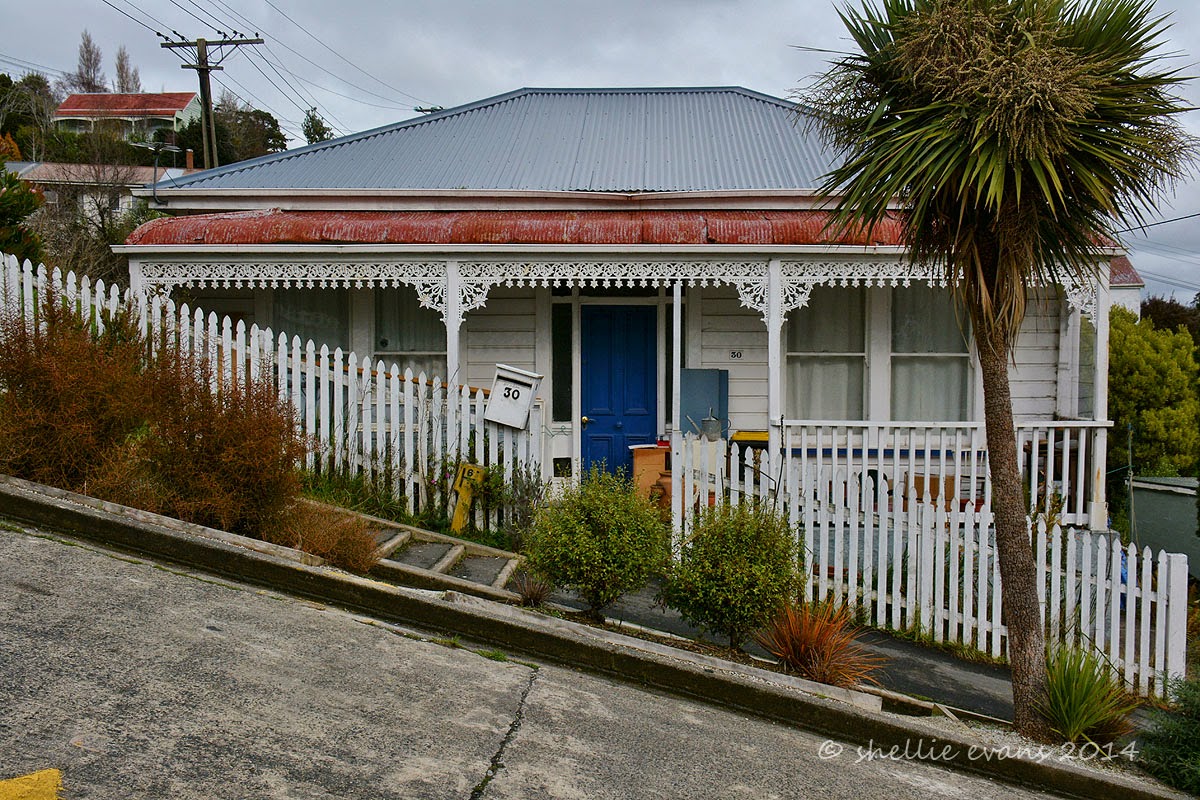
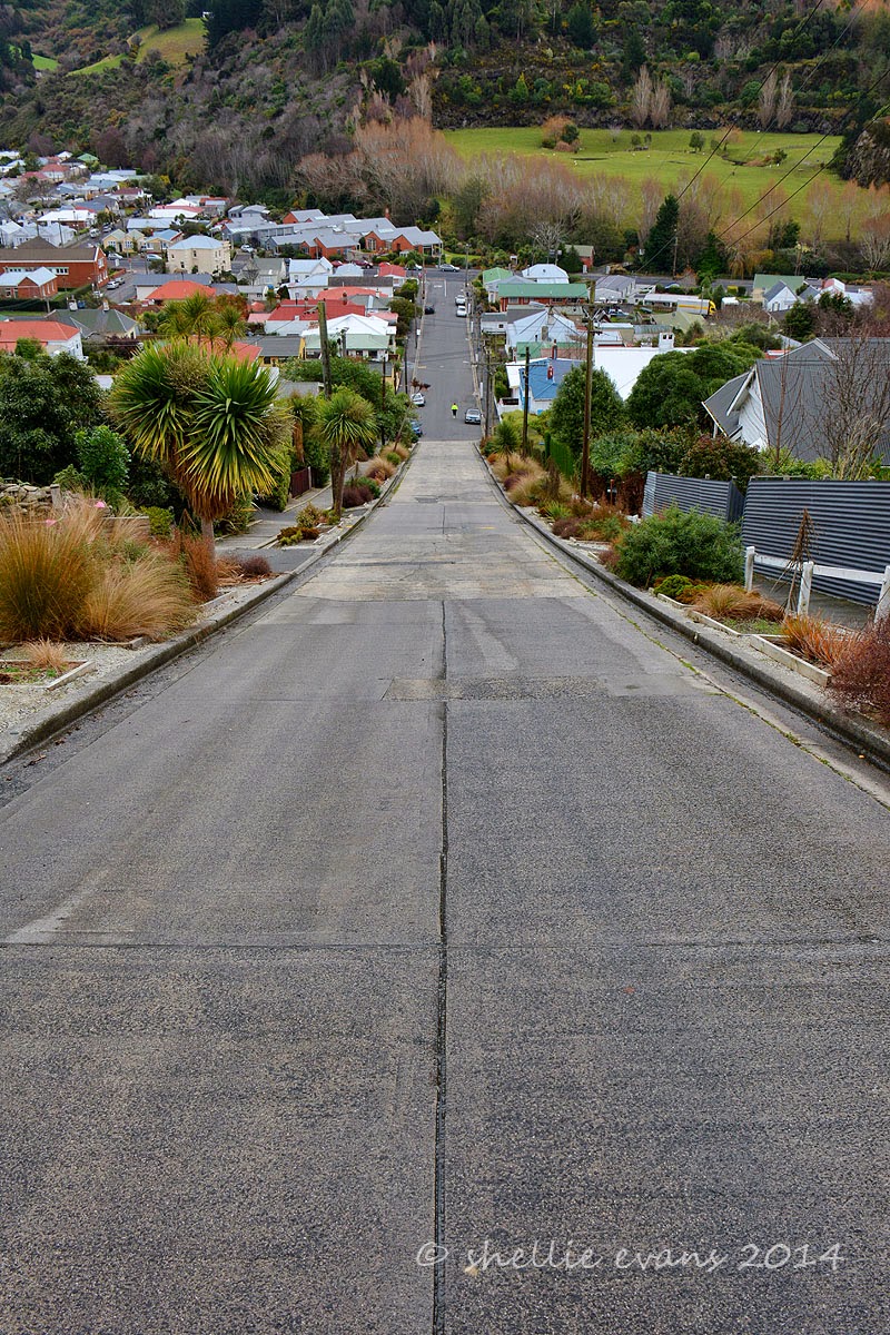
But not before a slight diversion to the steepest street in the world (according to the Guinness Book of Records), Baldwin Street is 161 metres long and climbs a vertical height of 47.22 metres which is an average gradient of 1 in 3.41. At it’s steepest section the gradient is 1 in 2.86. It looks very deceptive from the bottom but once you start the climb you’re made very aware of how steep it actually is.

I loved the old single story houses on the road, they really gave an indication of how steep the street is with their sides disappearing into the hillside. I also smiled at the “No Junk Mail” stickers, especially at the top. Poor posties, you’d think that if they had to walk this road everyday then at least the residents could accept a few pieces of junk mail.


Half way up I managed to waylay a local for a bit of a chit-chat for a good 5 minutes while I secretly recovered my breath. And if you look closely at the cars down in the valley you’ll see a familiar face sitting in a Ford ute reading his iPad paper, piker!


The prize at the top; a much appreciated water fountain & a seat to rest the shaking legs. And darn. I forgot the Jaffas!


We followed the road on up the valley from Baldwin Street then turned sharply at the Upper Junction dropping quickly down to Roseneath on the harbours edge. This was the view from the top looking out towards the entrance and across the water to Taiaroa Head on the tip of Otago Peninsula.


We had a quick drive through the wharf area at Port Chalmers but it was just too cold & windy to linger and our tummies were starting to grumble. We stopped just around the corner from the Port at Carey’s Bay Hotel (built in 1847), in Carey’s Bay (surprise, surprise) for lunch, enjoying the warmth of roaring fire while we had Blue Cod (for him) and Seafood Chowder (for me), both of which we thoroughly enjoyed.

We also enjoyed the company of a delightful older couple who arrived just after us but had the window table reserved so had the best seat in the house. They told us they come to the restaurant regularly and always have the window seat, they obviously make a occasion of it as they ordered up large, both wine & food. Although you’d think that as they come so often the lady would know what she might like to eat & what was on the menu. She just couldn’t decide on what to have and sent the waitress away a couple of times while she dithered further. In the end she ordered salmon but I have the feeling it was still a spur of the moment choice, because as the waitress walked away. she whispered to her husband “I had that last time, didn’t I? Oh well…..”


Suitably replete, we continued on around the harbour’s edge. The road is very narrow in places and falls off a sharp edge into the water, being high tide it felt like we were about to drive into the harbour in some places, the corners are very tight. Along the way I spotted a shag on one of the beacons that looked unfamiliar, it had a pure white front and white wing strip.

We turned around and crawled back slowly along the road, stopping just short of the beacon. A Little Black Shag was poised to fly but it was the one underneath that we were keen to see up close. I grabbed a couple of shots (still too far away to get a good close-up) but good enough to identify when we got home. It turned out to be a Stewart Island Shag (Kawau), found only in southern New Zealand & with a population of fewer than 5000 birds. Another bird I can add to my Twitchers list!


Finally after a long & winding 27kms, we arrived at the very end of the harbour & the Aramoana Mole. The Mole is a 1200 metre long man made breakwater that keeps the main channel clear of silt & sand. There’s also 5 ships that have been scuttled along the length of the Mole adding to the breakwater & making suitable diving wrecks too. I walked a short way along the breakwater but the icy wind was whipping through making it quite unbearable so I quickly returned to the warm ute where David was waiting for me (he’s not silly).


Across the harbour was the lighthouse on Taiaroa Head, I looked to see if I could see any albatross soaring on the thermals but no such luck. They will just have to wait until we return.

Tucked into the sand dunes near the Mole, and with no obvious sign that it is there, is a memorial to the victims of New Zealand’s worst mass shooting & most horrific crime. Twenty four years ago this tiny sleepy seaside village was ripped apart when David Gray went on a murderous 24 hour rampage shooting dead 13 people, including children and the local police sergeant. I am sure many New Zealanders can remember exactly where they were or what they were doing as the event unfolded. A bit like knowing where you were when JFK was assassinated. I was visiting Napier & was shopping in Taradale when I heard the news on the car radio. I was so upset that I went to a phone box (no mobile phones then) and called David in Tauranga to get some comfort & hear a familiar voice.


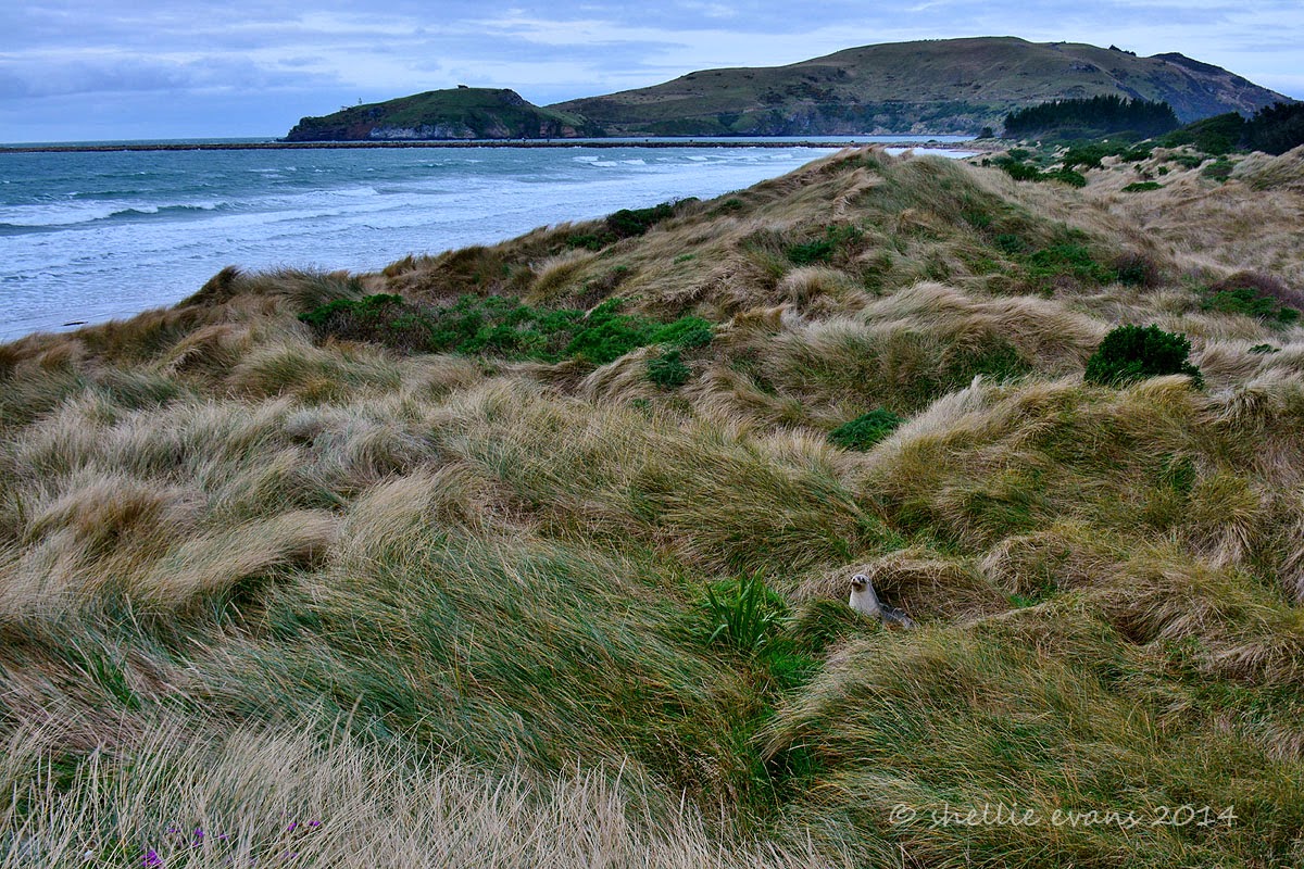
We drive to the north end of beach and climb to the top of sand dunes, the wind is still blowing fiercely on shore and look who we disturb from his slumber, sheltering in the dunes.


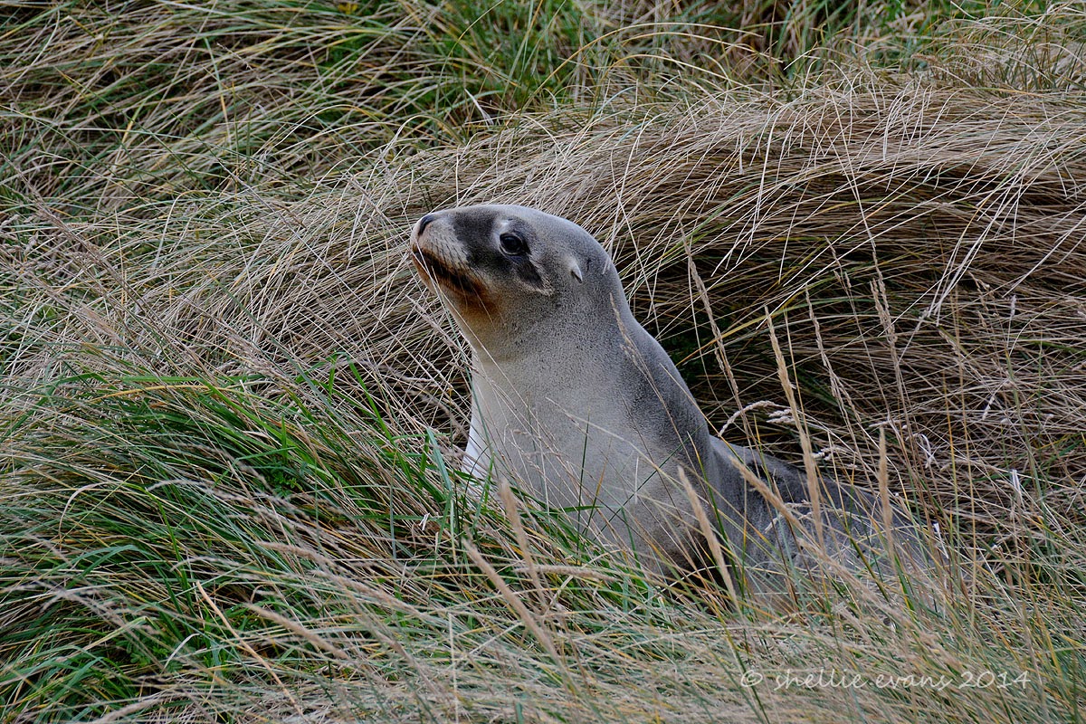
A very well camouflaged NZ Sealion (Whakahao), he’s been sleeping for awhile as he’s bone dry & blends into the sand tussock very well.


He also looks very comical with his “chocolate” lips- must be the fish oil that has stained his mouth.


He decides to investigate us further and making hard work of it, slithers & slides through the grass towards us, climbing up a bank before deciding that’s too much like hard work and rolling back down into the dip where he promptly goes back to sleep.


Another car arrives in the carpark and the lone occupant makes his way down the track to the beach before heading north on a walk. The Keyhole Rock towers above him. I imagine his surprise if he came across our sealion on the track. The long sand tussock would cover a sleeping sealion quite easily. I wonder who would get the biggest fright.


We decide to head for home before it gets any colder and along the road we catch up to the dredging ship that was near the Mole when we arrived. The channel must run very close to the edge of the harbour here as the ship looked huge. I’d love to see the cruise ships arriving, they would tower over the roadway and I bet the passengers would get an impressive view of the countryside.


This little cottage amazed me, located on a tiny ribbon of land tucked between the harbour & the road. And being renovated by the look of it too. I’m not sure I’d like the traffic whizzing by so close & at quite a speed and I wonder about the waves when the wind gets up.