Showing posts with label fantail. Show all posts

Friday, April 21

Ettrick Farm Stay- Central Otago

Catch-up- and I'm getting further behind because suddenly we're with family again and busy, busy! 

It's not every day a mob of sheep runs past your rig while you're sitting on the step having a cup of coffee...


And it's not everyday a pack of farm dogs sit obediently nearby while their master has a cuppa with you either. Well, six of the seven dogs sit obediently, the seventh, that little cutie with the big feet, front left, is still learning the ropes. 


Jack, the huntaway pup wanders off wondering where his human Dad has disappeared to (his real Dad is the dog he's watching on the right). Jack checks out the yards, chews on a few sticks and comes over to me for lots of pats. Although when he sticks his head under one of his mates as they lift their leg, he's no longer welcome and he can't understand why. He looks at me a little perplexed as I shoo him away as yellow liquid drops off his lovely long eyelashes and his big roman nose.


We've stopped at another NZMCA POP #8872 (park over property) but not just any POP, this POP is hosted by our friends Prue & Harry. It's on their home farm at Ettrick, a small settlement just east of Roxburgh, and known as a great apple growing area. 

There's Jack at the back, not following instructions again!
In fact there's a huge apple orchard belonging to a neighbour behind the shelterbelt.  Later in our stay Prue drives me over to the orchard and we whizz through a maze of apple trees, bumping along the rows in her little 4WD, dodging bins and pickers and stopping to pick a few different varieties of apples along the way. I come home with a huge bag of apples, so many I have to give a few away later in the week.


Prue and Harry are very active NZMCA and local area Clutha Valley members, it's how we met them. They were hosting the first Warbirds Over Wanaka show we went to (and probably the second but we stayed down below on another farm for that one), then they hosted both the Arrowtown Autumn Festivals we've attended and also the Omakau Cavalcade just the other week. It was Pru who saw me with my camera at the first autumn festival and asked if I'd like a helicopter ride to take photos of the rally. 


What a wonderful place to spend a few days on our way to Queenstown. It was lovely to just stop and relax for a time, catch up with Prue & Harry, share a happy hour or three and more than a few laughs.Prue & Harrys' son now runs their large family farm out the back of Ettrick, up on the range behind, near Moa Flat but Harry is still very active in helping out there and running his home farm here.

If I had been ride fit I could have gone with Harry to help with the mustering that they were doing at the Run, which is even further back on the range (and actually not that far from Piano Flat as the crow flies over the mountains). Oh how I would have loved to have gone for a ride, I might not have been able to walk for a week, but it would have been so worth the discomfort.


This is Bo as in Mr Bojangles, he looks a little sad because his Mum went to golf and left him on his own. He wandered down to say hello and made himself at home on our mat. I took him back to the garden after an hour or so thinking he might not know the way (yeah right). But the next time I looked out he was back on the mat. As soon as he heard Prue's car coming down the drive later in the day he perked up and did a little dance on our mat until she spotted him. 


I was thrilled to find a black NZ Fantail/Piwakawaka flitting about catching sandflies that were gathering around the outside of the van. This is a black morph fantail and they are quite rare making up only about 5% of the total fantail population, most fantails are pied.  Black fantails are usually only found in the South Island. 


I left David pottering about the van while I went on my own little tiki-tour over the hill to Moa Flat one day. I love the things you find along the road when you're in no hurry. I stopped to take a landscape shot over some rolling hill country when I had that strange feeling of being watched.

It didn't take me long to spot this fellow in the grass by a gate. As soon I made eye contact with him he high-tailed it out of there. With no houses in sight for miles, I'm sure he was a wild cat, although he was fluffier than most we've seen on the road.


A little further on I stopped to talk to some horses...


...including this cute little foal who wasn't too sure about me leaning over the fence...


...she just wanted to get on with dinner.


Moa Flat is more a place name for an area than a settlement, there are mainly farming families nearby but they are obviously very proud of their place in the world.  I spied this Moa sculpture and Moa sized egg beside the road. For my overseas readers, Moa are an endemic extinct NZ Bird and were once the tallest bird in the world, standing 4 metres high. Prue told me later that the locals often dress the sculpture in relevant themes; Christmas, Guy Fawkes, Easter, even their rugby team colours when there's a match on.


I carried on south towards Heriot, leaving the high country farms behind and dropping down into a beautiful lush green valley, stopping to take this pano as it opened up before me (click photo to enlarge). That's the Blue Mountains along the back of the valley and towards the right hand end is the small West Otago township of Tapanui. 

State Highway 90 runs right through the valley joining Southland to Otago, it's the usual route we take to Central Otago from Winton when we go via Gore, exiting at Raes Junction. Now that I know this road is sealed all the way to Ettrick, it'll be a handy short cut with the 5th-wheeler on the back.


Heriot is as I imagined it, a one horse town a little worse for wear. When I mentioned to Prue that I was heading to Heriot (who even knew there was a Heriot in NZ) she did look at me like 'Really?'


But I was happy, I'd done some exploring, added another couple of churches to my collection...

Heriot Community Church
and captured a few more old buildings for Heritage New Zealand.


Afterwards I headed home, back over the same route, stopping to take this photo just before dropping back into Ettrick. The range across the Clutha River valley at the back is the same one we crossed on our way to Lake Onslow a few weeks ago.


Saturday, February 11

Piano Flat, Southland

Real-time

I thought I'd do a quick post before we move on to our next destination this morning. We've had a wonderful relaxing time at the lovely Piano Flat DOC camp which is north of Waikaia in Southland. And look at that weather! Finally we're having a little bit of summer, although it's quite cool overnight and first thing in the mornings. 


Piano Flat is at the end of 40km plus road- well actually, it's not quite the end of the road but more on that in a later post. Some of you will remember the convoy of 4WD vehicles that were caught in the snow for a few days last winter? Piano Flat is near the beginning of a 4WD track that goes up and over Old Man Range where they were snowed in. 

The campground is tucked into a valley on the banks of the Waikaia River and surrounded by 10,500ha of beech forest. 


The area gets its unusual name from its gold mining past. Harry Selig was the first person to recover gold on the flat, he was was also a piano-playing member of a local orchestra formed to entertain the early settlers and miners. For a short time the flat was known as "Piano Harry's Flat", the title stuck long after Harry moved on.


There are old mine shafts and the remains of several water races in the surrounding bush. One of the races still supplies water to some of the cribs and to the camping and picnic area. 


This is how you make a statement with your crib! 


There's also an old style playground which was built in 1958, it has been restored with the help of the crib owners and the two farm stations that surround the forest.


Due to its remote location, Piano Flat is more of a destination than a place to call in to on the way past. Many generations of Southland families will have had their annual holidays at Piano Flat, it's also popular with anglers, kayakers, trailbikers and 4WD enthusiasts. 


We arrived on the Sunday of the long weekend but it was still a surprise when we came around the corner to see so many campers ahead of us. We were expecting a few people, not a few hundred! 


We happened to arrive on the first day of the Southland area's two day orienteering event. 


We hardly saw anything of them though, they disappeared into the forest early in the morning, returning late afternoon.


They were also camped in the first part of the campground, we carried on up the road to the second area where there were just two other groups camping. A few day trippers visited on the last day of holiday weekend...


...and then it was just us and the birds for the next four days.....oh, and the sandflies. Ten times as many as Cattle Flat!


Our view across the river took in the home range of NZ Falcon family; 2 adults and a very demanding juvenile.


Several times a day the parents come flying in, high above the clearing with a meal which they aerial drop to the youngster. I caught it on camera here, it's way, way out of my lens range and cropped heavily, but you can see the drop. And that is a falcon underneath, not a flounder!


And while its parents were away hunting we were privileged to see the juvenile at close quarters; resting on a  tree overhanging the river near the van, flying along the river (screeching for food) or practicing it's hunting skills, chasing swallows, ducking and diving across the grass behind us.


There are a number of walking and tramping tracks through the bush and along both sides of the river. Some are more demanding than others, we've managed to complete the shorter ones and do sections of the others. There's a very long 10km loop tramp up one side of the river and back down the other, starting at the swingbridge in the campground.


A side tramp off the river loop heads to the Titan Rocks, a 6.5hr climb to a point high above the valley. Needless to say we gave that one a miss. We walked to the junction instead taking our time, bird watching along the way. For such a small area of bush, in comparison with other South Island areas and National Parks, the bird life is prolific.

Clockwise- Juvenile NZ Fantail, South Island Bush Robin, South Island Tomtit-male, Bush Robin, NZ Falcon(J), Tomtit-male, NZ Fantail, Bush Robin, Tomtit-female(J)
'Now, I'm sure I saw lunch around here somewhere'
The river track has been made more difficult to walk because of the washouts and debris left behind by a recent flash flood. Just 3 weeks ago after 57mm of rain fell during a 24hr period, a wall of water rushed down the valley. At the campground the river was 4 metres above its usual height and further up the river through a gorge area the river has been at least 8 metres high. There are great swathes of debris caught in trees branches and hollows along the river banks. 


A tide line of forest litter and thick silt coat areas of the camping ground close to the river. We have a line of debris in the long grass outside our front door and you can see how high and far away we are from the usual river flow. 


The crib owners have a new water feature; a huge beech tree has fallen into the river from an eroded bank just across from us...


...and floated downstream, ending up on a shingle island in the middle of the river.


What is more amazing is the fact that this tree found it's way under the swingbridge without doing any damage and at the height of the flood. 


Taken from the middle of the swingbridge-


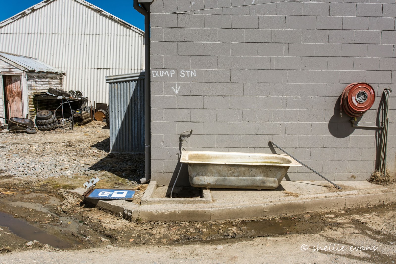
And one last photo to make you smile. You'll notice on the map below we took a detour to Riversdale after we left Cattle Flat. We wanted to dump our waste before heading to Piano Flat, it took a little while to locate the advertised dump station. Only on the Mainland!


Saturday, June 11

Haast Pass

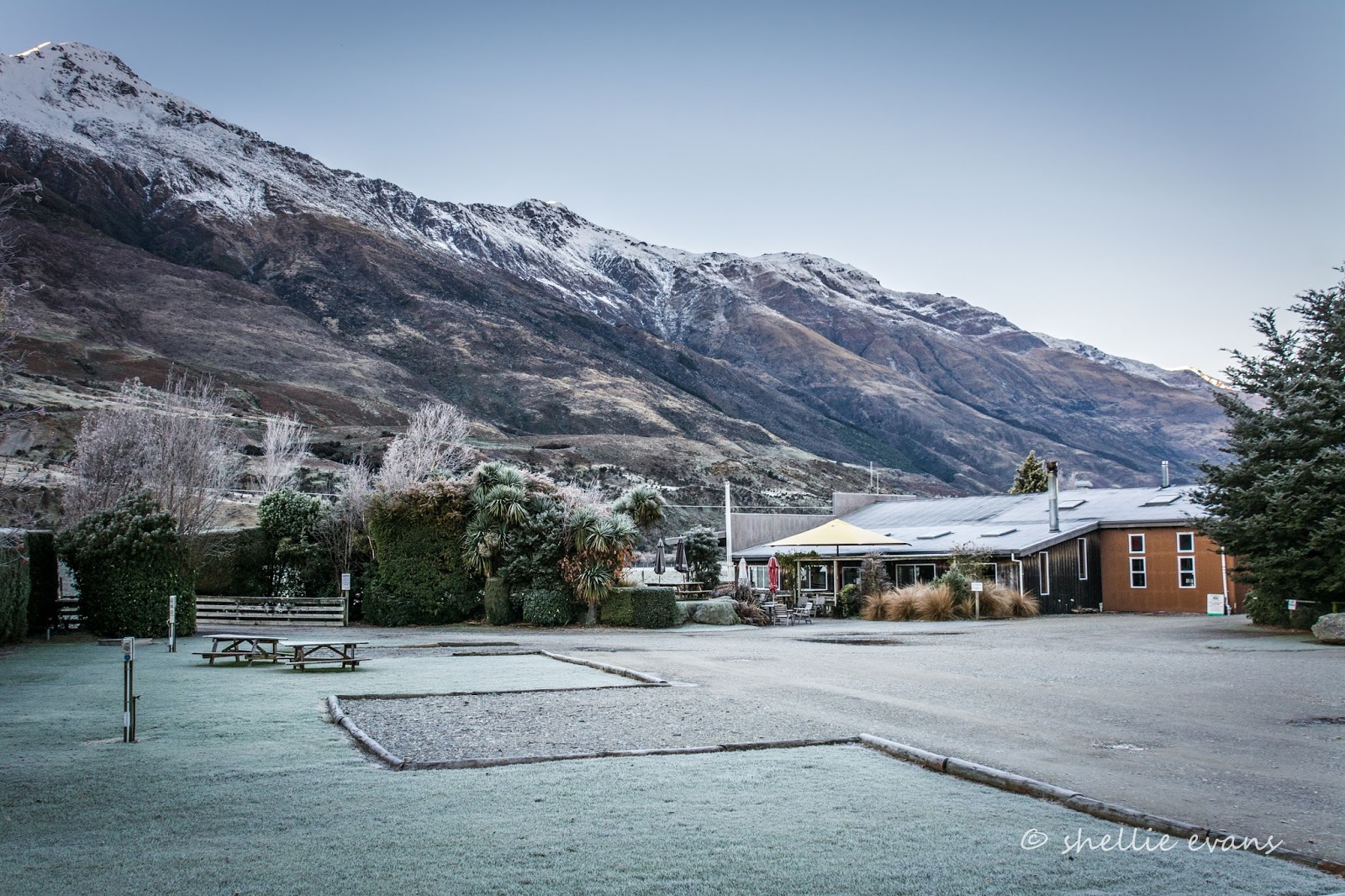
With another sunny day waiting in the wings (behind the mountains), we left a very cold and frosty Makaroa behind and carefully made our way over the icy road to our first stop in Haast Pass. 


The Blue Pools are located at the mouth of the Blue River which joins the Makaroa River deep within the thick bush of the Pass. It's a short and easy 1.5km return walk (1 hour) to the pools but the first thing we notice when we step out on the path through the bush is, (surprise, surprise), how bloody cold it is. It's freezing, and I usually don't feel the cold too much, but this was bone chilling cold. A good reason to step lively, I tell David. Needless to say, he's not impressed. We stop for a moment or two at the occasional sunny spot on the track, it's amazing how quickly you can feel the warmth from a weak sun. It's not too long before we can see the Blue Pool bridge across the river.


We cross over the Makaroa River swingbridge, being careful not to touch the wire rope too often- it's covered in thick ice and our gloves stick to it. Luckily the boards are covered in wire netting providing a good grip for our boots on the frosty bridge. 


We even have to scrape the ice off the information board beside the pools, to read it.


We're back into tourist territory; DOC have gone all out in providing well formed pathways, information panels and this excellent stable bridge so the pools can be seen clearly from above. 


The blue colour of the pools is a result of the light refraction on the clear, snow fed, icy cold water- I can relate to that; that's why my hands and nose are ice blue! A few hardy trout swim through the pool, it's obviously very deep as they look tiny down by the floor, growing to reasonably sized fish as they approach the surface.


Looking back towards the Makaroa River swingbridge- the rocky beach and surrounding trees are coated in icicles.


David has had enough of the cold, he heads back to the carpark while I take a track down to the edge of the pools...


...being very careful not to slip over as I cross the frost covered rocks, unlike this fellow who quickly regained his composure as he slipped and stumbled over them. 


And then the next lot of people did the same. I wonder how many have no idea how ice works. 


Our next stop was just down the road at the Cameron Flat DOC Campground which looks to have had a recent upgrade, there's several parking tiers, all surrounded with bollards and rails. It's well set out for the summer influx of campers although it's not our cup of tea. We're not keen on this type of regimented DOC camp, where the camping areas are marked out and they usually don't allow for larger rigs either. 


There were a couple of things going for the camp though; it catches the early morning sun and it has a fabulous view out over the Makaroa River Valley.


By the time we're back on the road and climbing towards the Pass summit, the icy roads are turning to slush and we can hear the recently spread grit splattering up underneath. We stop at the top...


...and decide that the Haast Pass Lookout Track looks a little too steep and a little too long at 3.5km.... maybe that can wait until the summer if we're passing through. The problem then will be the lack of carparking for our bigger rig- that's one plus travelling out of season.


We're ticking the stops off quickly now, especially when the attractions are right beside the road. Fantail Falls are next and it's just a quick 5 minute walk to see them. With such a dry summer and autumn there's not too much water flowing over them. We're a little underwhelmed (thankfully the walk wasn't too long).


And once again the rocky beach is covered in thick frost, which actually appealed more than the falls to some Irish travellers I spoke to in the carpark. 


David wanders back to the vehicles via the river, checking for trout along the way. I take some more frost crystal photos.


With no pull-offs or slow vehicle bays on a long haul up the next steep incline, we pull across the road to let traffic from behind pass...


...where there's a very steep drop off into the Haast River far below...


And it's not until later that I realise that this is the area where, 2 years ago, a landslide wiped a tourist's motorhome off the road and into the Haast Gorge during a severe weather event that hit the area. The badly mangled van was later found wrapped around a huge rock downstream. Sadly one person's body was never found and the 2nd's was found 50kms away washed up on the beach north of the river mouth. It's hard to believe that such a tragedy could happen surrounded by such a majestic landscape. Never under-estimate the power of nature.


We head downhill, passing a number of signs counting down the metres left before your time runs out to take the emergency off-ramp (or should that be up-ramp)! I can't even imagine how terrifying that would be. This is the first time we've seen anything like this on  our travels, and although it was steep it didn't appear to be that out of the ordinary. Maybe it's because the gorge and river are at the bottom of the drop...


...along with the 'Gates of Haast'. We crossed over the bridge and pulled into a parking area so I could get some shots of the river and bridge.


The roar of the water passing through the narrow gorge tumbling over and around the huge boulders was deafening. I 'found' this information plaque on a rock wall, hidden under the overhanging ferns on the other side of the road.  


Our next stop is at the spectacular and aptly named Thunder Creek Falls which appear like magic through a tiny gap in the bush, dropping 28 metres over a smooth rock face into a small pool below. David likes walks like these, its another short 5 minute walk from the carpark. 


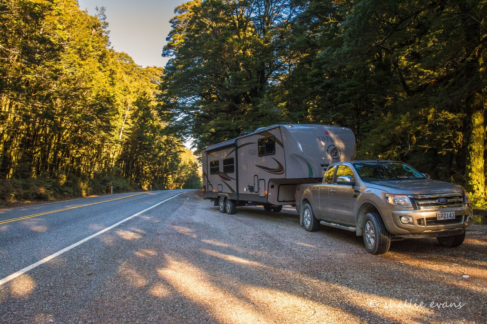
We stop at the only other  DOC Campground on the Haast Road for lunch. Pleasant Flat isn't so pleasant today, the sun disappears behind the mountains just as we pull in and it's soon cold and very damp; thank God for the diesel heater, which we set going as soon as we stop. It doesn't take long to roar into life and the interior is soon toasty warm while we have hot soup and warm bread rolls. I love travelling with the van on the back!

Pleasant Flat is also another regimented campsite with rails and bollards around numerous areas that are tucked into the bush and out here around the shelters and toilets. We wouldn't fit the vehicles in here during the busy season either, except maybe outside the loos! No thank you.


Our last stop of the day is at the Roaring Billy Falls. I catch a glimpse of the falls over the top of the trees at the back of the carpark and try to decide if it's going to be worth walking to them. They are already in the shade and in fact it looks like they might not see the sun at all during the winter, tucked into a narrow gully between mountains. 


It's a 15 minute walk through a fern and moss laden silver beech forest to the Haast River bank where the view isn't any better. I cross the wide rocky river bed to the edge of the river and the foot of the falls but they are even more obscured by the overhanging trees, the noise is...well...a roar. Been there, done that, crossed it off the list. 


Back on the road and it seems to take forever to wind our way down through the wide Haast River valley until we finally reach the tiny settlement of Haast...


...which we pass right on by and turn left just before the exceptionally long single lane bridge over the river. We're heading south along the coast to the Haast Beach campground, a classic original kiwi campground. Except that it isn't actually at Haast Beach which is just 4kms south but at Okuru, 16kms south. There's plenty of signs letting us know that we're nearly there.


Haast Beach campground is a large property with lots of open space around the central ablution and kitchen blocks and two rows of cabins. It's the long Queens Birthday weekend and after our host tells us that there's a 4WD club due to stay in the cabins for the weekend, we find ourselves a quiet spot out the back with the whitebaiters 'retired for winter' caravans. Perfect! 


Well nearly, there's no cellphone reception so no internet, which is fine for a few days but it still feels like we've had an arm chopped off. We're given 2x 250mb vouchers when we check in (worth $25 each, a mistake we learn later, it should have been a five dollar, 50mb voucher). When we check the provider we find we can buy more data.....at 10 cents a mb. That's $100 a gb! That's some expensive satellite internet. Take note all you landlubber landliners with your endless supply of gigabytes.

And, I have to report here that I still had about 40mb left after 3 days careful use while he who shall remain nameless, used his voucher and then purchased another $10 worth, using all that as well!