Showing posts with label bush. Show all posts

Tuesday, February 7

Bushy Park Forest Sanctuary, Kai Iwi, Whanganui

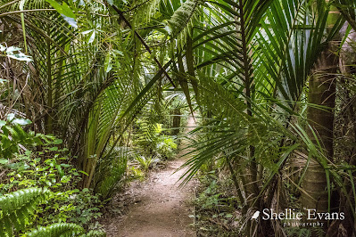
Surrounding the historic Bushy Park homestead is the 89 hectare Bushy Park Tarapuruhi Forest which is a Forest & Bird Project.  


The forest is a rare example of North Island temperate lowland forest. Lowland forests such as Bushy Park historically harboured the largest and most diverse communities of native and endemic plants and animals. 


Bushy Park Tarapuruhi is unusual in that it survived (most lowland forest was clear felled) and it is relatively unmodified; there has been no logging or burning of the main forest. It was also fenced to exclude domestic livestock in the mid/early 1900s and is now surrounded by a 4.8km pest & predator fence protecting the forest and birdlife from introduced mammals.

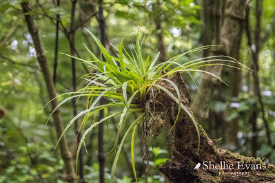
Astelia epiphyte 
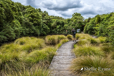
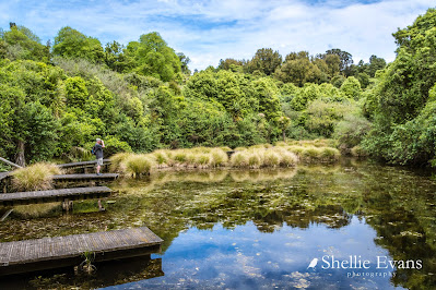
David searching for frogs. They were having their very own concert in the Bushy Parks wetland. But so typical of frogs, they stopped as soon as they spotted us.


I think the little jetties are so school & other education groups can check out the pond for bugs & insects.


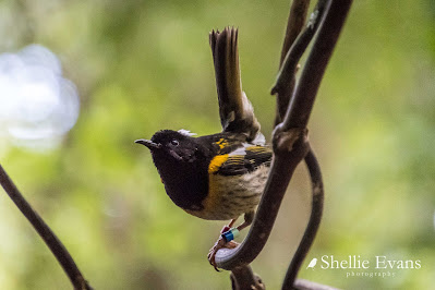
A male Hihi/Stitchbird on high alert. There's a feed station nearby & several males are trying to use it hence this one zipping about chasing them.

The stitchbird was both rare and poorly known about until the 1990s as few people had an opportunity to visit the single remnant population on Little Barrier Island. With careful management & conservation Hihi can now be seen at several protected sanctuaries.

The female Hihi/Stitchbird is hardly ever seen because the boys take over the feed stations. This one approached but was soon seen off (hence the blurry photo, you have got to be quick to capture them!).

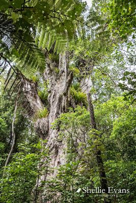
Ratanui the big rata tree of Tarapuruhi/Bushy Park is 36.2mtrs tall. Hard to believe that this rata started out as a small vine that grew up it's host tree and then sent out roots down to the ground, became established & slowly swallowed up its host (often a rimu). And look at all those 'widow makers', large clumps of the epiphyte astelia. Epiphytes growing on a tree that started life as an epiphyte.


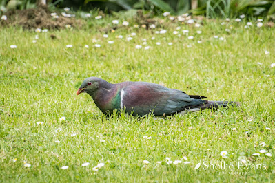
A big plump Kereru/Wood pigeon grazes on the homestead's front lawn. Our native pigeons often graze on the ground in large flocks, I once saw a group of around 50 or so birds in a paddock in Golden Bay. And if they're not grazing they are often being goof-balls, chasing each other, rolling over, doing mock attacks & aerobatics just off the ground.


There were so many Tieke/Saddleback in the forest, they were calling to each other, flying about & pulling apart rotting trees on the ground & scratching about in the forest litter but they are very hard to take a photo as it's so dark in the bush & they are so fast in amongst the tangle of undergrowth. So as I was checking out the homestead garden...


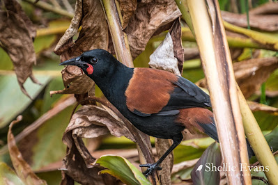
... I don't know who got the biggest fright, me or the Tieke when I heard some rustling in the undergrowth & crept up to see what it might be. And look who popped out!

Tieke are endemic (found only in NZ) and classed as 'relic'- a small population stabilised after declining. North Island Saddlebacks (and South Island Saddlebacks) are found only on predator free islands or in protected mainland sanctuaries. Because they are weak fliers & spend a lot of time on and near the ground they are easy prey for predators especially rats & stoats.

Did you know that the South Island Saddleback/Tieke has a different coloured juvenile to the North Island Tieke? South Island juveniles (commonly referred to as ‘jackbirds’) are covered entirely in chocolate brown plumage for their first year whereas North Island juveniles have the adult black plumage with the beginnings of the coloured saddle. 

Tieke/Saddleback Jackbird- Ulva Island, Rakiura/Stewart Island

The homestead's lower carpark is also a POP #4565 (park over property), with a maximum of 3 vehicles a night at $20 for two people ($7 extra person). We visited Bushy Park in the ute but thought it would be great to stay & wake up to a dawn chorus although I think our size rig would be borderline getting up the narrow drive & manoeuvring around in the carpark.  


Saturday, February 11

Piano Flat, Southland

Real-time

I thought I'd do a quick post before we move on to our next destination this morning. We've had a wonderful relaxing time at the lovely Piano Flat DOC camp which is north of Waikaia in Southland. And look at that weather! Finally we're having a little bit of summer, although it's quite cool overnight and first thing in the mornings. 


Piano Flat is at the end of 40km plus road- well actually, it's not quite the end of the road but more on that in a later post. Some of you will remember the convoy of 4WD vehicles that were caught in the snow for a few days last winter? Piano Flat is near the beginning of a 4WD track that goes up and over Old Man Range where they were snowed in. 

The campground is tucked into a valley on the banks of the Waikaia River and surrounded by 10,500ha of beech forest. 


The area gets its unusual name from its gold mining past. Harry Selig was the first person to recover gold on the flat, he was was also a piano-playing member of a local orchestra formed to entertain the early settlers and miners. For a short time the flat was known as "Piano Harry's Flat", the title stuck long after Harry moved on.


There are old mine shafts and the remains of several water races in the surrounding bush. One of the races still supplies water to some of the cribs and to the camping and picnic area. 


This is how you make a statement with your crib! 


There's also an old style playground which was built in 1958, it has been restored with the help of the crib owners and the two farm stations that surround the forest.


Due to its remote location, Piano Flat is more of a destination than a place to call in to on the way past. Many generations of Southland families will have had their annual holidays at Piano Flat, it's also popular with anglers, kayakers, trailbikers and 4WD enthusiasts. 


We arrived on the Sunday of the long weekend but it was still a surprise when we came around the corner to see so many campers ahead of us. We were expecting a few people, not a few hundred! 


We happened to arrive on the first day of the Southland area's two day orienteering event. 


We hardly saw anything of them though, they disappeared into the forest early in the morning, returning late afternoon.


They were also camped in the first part of the campground, we carried on up the road to the second area where there were just two other groups camping. A few day trippers visited on the last day of holiday weekend...


...and then it was just us and the birds for the next four days.....oh, and the sandflies. Ten times as many as Cattle Flat!


Our view across the river took in the home range of NZ Falcon family; 2 adults and a very demanding juvenile.


Several times a day the parents come flying in, high above the clearing with a meal which they aerial drop to the youngster. I caught it on camera here, it's way, way out of my lens range and cropped heavily, but you can see the drop. And that is a falcon underneath, not a flounder!


And while its parents were away hunting we were privileged to see the juvenile at close quarters; resting on a  tree overhanging the river near the van, flying along the river (screeching for food) or practicing it's hunting skills, chasing swallows, ducking and diving across the grass behind us.


There are a number of walking and tramping tracks through the bush and along both sides of the river. Some are more demanding than others, we've managed to complete the shorter ones and do sections of the others. There's a very long 10km loop tramp up one side of the river and back down the other, starting at the swingbridge in the campground.


A side tramp off the river loop heads to the Titan Rocks, a 6.5hr climb to a point high above the valley. Needless to say we gave that one a miss. We walked to the junction instead taking our time, bird watching along the way. For such a small area of bush, in comparison with other South Island areas and National Parks, the bird life is prolific.

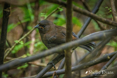
Clockwise- Juvenile NZ Fantail, South Island Bush Robin, South Island Tomtit-male, Bush Robin, NZ Falcon(J), Tomtit-male, NZ Fantail, Bush Robin, Tomtit-female(J)
'Now, I'm sure I saw lunch around here somewhere'
The river track has been made more difficult to walk because of the washouts and debris left behind by a recent flash flood. Just 3 weeks ago after 57mm of rain fell during a 24hr period, a wall of water rushed down the valley. At the campground the river was 4 metres above its usual height and further up the river through a gorge area the river has been at least 8 metres high. There are great swathes of debris caught in trees branches and hollows along the river banks. 


A tide line of forest litter and thick silt coat areas of the camping ground close to the river. We have a line of debris in the long grass outside our front door and you can see how high and far away we are from the usual river flow. 


The crib owners have a new water feature; a huge beech tree has fallen into the river from an eroded bank just across from us...


...and floated downstream, ending up on a shingle island in the middle of the river.


What is more amazing is the fact that this tree found it's way under the swingbridge without doing any damage and at the height of the flood. 


Taken from the middle of the swingbridge-


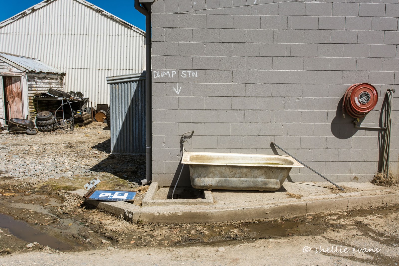
And one last photo to make you smile. You'll notice on the map below we took a detour to Riversdale after we left Cattle Flat. We wanted to dump our waste before heading to Piano Flat, it took a little while to locate the advertised dump station. Only on the Mainland!


Wednesday, October 5

Sheltering from the Wind

Real-time

This is just an update post to let you know we have finally finished our mega beach hop south along the east coast. We left Ngawi on the Cape Palliser road this morning, heading for some shelter because of the gale force winds that have been forecast for the next couple of days and we found an amazing POP #5142 (for those that are desperate to find out where we are!).


This is Waiorongomai Station, and it's on the western side of Lake Wairarapa, tucked in below the Rimutaka Forest Park. A beautiful large grassed area surrounded by very mature native trees and the Oreore Stream which is not too far away. There's a 4.5km DOC walk up the stream bed to the Waiorongomai Hut which is located in the forest park- we may do this walk tomorrow but the stream is actually running quite high and it looks like we have to cross it a few times on the way which is a bit of a deterrent. 


Camping here in CSC vehicles is through the goodwill of the station owners and unfortunately dogs are not allowed. We had to maneuver a little under some of the overhanging trees- this was more to save the tyres from getting muddy on a couple of the tracks but we made it through and now we're parked up with the place to ourselves surrounded by blue sky, bird song and a few strong wind gusts.


It feels strange to be back in the bush after all the coastal scenery we've had the last three weeks. And don't worry, I'll be back to finish off the beach blogs soon. 

I can't add a map- the internet connection here is borderline so I'll do it when we have a stronger signal.

Tuesday, May 5

Treetop Walk & Lake Mahinapua

We’ve now arrived in Christchurch where we’ll be for the next week or so catching up on maintenance and preparing the van and it’s occupants for winter.

I must get on and post these catch up blogs, it’s beginning to feel like a lifetime ago when we were parked up at the Hokitika NZMCA park. I’ll try to keep the typing to a minimum and let the photos do the talking. We’ve done so much since Hokitika and seen more stunning scenery- we really do live in a beautiful country, such a diverse landscape in such a small package. And I’m only talking about a tiny section of the West Coast and high country Canterbury. Needless to say, I’ve taken hundreds of photos since these ones too.

How many New Zealanders recognise this hotel? Mahinapua Pub was made famous by a long running advertising campaign for Mainland Cheese. The exterior was the backdrop, and along with the two grumpy old men discussing the merits of Mainland Cheese, became world famous in New Zealand.


The hotel is located about half way along a very long (for the West Coast) straight just south of Hokitika and on this day we had a clear view of the Southern Alps and Mt Cook (Aoraki). We travelled this straight a few times while in Hokitika and on each occasion passed 2-3 police cars &/or a speed camera car parked on the road side. I guess this is where recent reports of speeding vehicles, some doing over 160kph, come from. It seems like the drivers have broken free from the narrow winding roads, with their one way bridges, further south and their foot has hit the floor.


Just south of Ruatapu (at the end of the straight) we turned inland and headed to one of the Coast’s newest attractions; the West Coast Treetop Walk which is located at the eastern end of Lake Mahinapua. The walkway opened in late 2012 and as soon as we drive through the entrance to the carpark we can see that building this attraction has been a major undertaking. It’s a lovely sunny afternoon and we decide we’ll have lunch at the cafe after we’ve done the walk; there are a number of groups enjoying lunch at the outside tables in the sunshine, I think this is also a meeting place for friends and families on weekend outings.


Getting to the beginning of the treetop walk involves a short steady climb to the top of hill behind the cafe, if required though, you can catch a ride up in a golf cart. Native trees and shrubs along the way have name plaques in front of them and there are also information boards on some of the native birds found in the forest.


The walkway is 20 metres above the forest floor and forms a 1.2km loop through the tree canopy.


A 107 step spiral takes you up to the platform of the 47 metre tall ‘Hokitika Tower’…..


As you climb the views down onto the walkway are impressive but if you don't want to get vertigo don't look past the walkway to the forest floor below….


Once at the top, the 360 degree views are spectacular. From up here you can see from the mountains to the sea. Looking east towards the mountains….


And north-west over Lake Mahinapua to the Tasman Sea; a tiny sliver of blue in the background.


The small platform at the end of this walkway arm provides a closer view of the lake shore; the end of the arm is cantilevered and has quite a bit of bounce about it, similar to crossing a swingbridge. There are over 13,500 bolts holding the structure together and it was designed to move with the wind which is just as well as the weather on the West Coast is not always as perfect as it was this day.


There are 11 numbered ‘stop’ points along the walkway which correspond to the numbers on a map & guide brochure received when you purchase your tickets. Each stop has informative information on birds to look out for, plants growing in the rainforest or on the tree at that point. Unfortunately we didn’t see any birds other than a couple of silhouettes flying past at great speed off in the distance.

While we enjoyed the walkway, I was a bit disappointed that it didn’t pass through a thicker forest canopy- perhaps we were a little underwhelmed because we have seen such beautiful lush rainforest in our travels. I’m not so sure it’s such a good representation to our overseas visitors of a West Coast forest though. We both thought it was a very brave person who undertook this impressive project and I'm sure once the under-story and the plants along the tracks and paths grow a little more it will have a more established feel about it.


We called in to the DOC reserve & camping ground at Lake Mahinapua on the way home. The entrance is off the main highway near the hotel, the drive in is through a narrow bush tunnel, it’s one way with the exit further down the road which is just as well as you wouldn’t want to meet somebody coming out, there’s no passing or turning around. The lake is a favourite spot of yachties and picnickers and much prized for its clear, colourful reflections from the surrounding bush.There are quite a number of walks in and around the lake but we decided we’d just have a look around today.

We were going to bring the van down here after Hokitika (there’s a large DOC campground), get the boat out again and stay for a week or so but because of all the grotty weather we’ve been having (yes, really) we decided we’ll not risk it this time and perhaps stay here when we come up from the bottom of the Coast later in our travels.


Lake Mahinapua is a shallow lake and only one metre above sea level. Steamers and barges used to ply the seven kilometre length transporting a constant flow of gold-seekers rushing from one strike to the another as rumours of riches flew up and down the coast. One of the old paddle boats is on display beside the lake.


We found this unusual RV parked in the campground. Look closely, it’s not a fifth-wheeler and it’s not a cab-over; it has wheels. Whatever it is, it’s rather cute & it’s somebody’s pride and joy.


Down on the lake front we find the vehicle that tows it; a ute with three tow balls; one on either side just below the back cab doors and one on the towbar. The well-side fits into the slots in the van, everything hooks up and away they go, the van being towed on it’s own wheels. Just like a trailer.


And preparing to go fishing in their inflatable dinghies, we found the owners (in the yellow life jackets) and their friends. We were a little worried about how much air was in the smaller dinghy especially when the husband climbed in and sat on the side. Luckily the lake was flat calm but I bet he had a wet bum before the outing was over. The dog appeared to be the most excited about going fishing leaning over the front and sides willing the others to hurry up and get a move on.


Just north of the lake entrance is the Mananui Bush Walk, a short 30 minute walk through bush to the beach and back. And what a beautiful day to visit the beach. It would seem that if visitors can’t build a stone cairn (or add a stone to somebody else’s cairn) they build a driftwood tepee! There were half a dozen or so tepees lined up near the exit from the track. At least it would be easy to find the track entrance again if you went for a walk down the beach; one sand dune looks like the next on a long beach like this.
How many places in New Zealand (and in the world for that matter) can you see snow capped mountains from a beach where it still feels like summer.