Showing posts with label sugarloaf. Show all posts

Wednesday, August 28

45th Southern Parallel Track- Cromwell

Catch-up

Just a few hundred metres down the road from the Lowburn NZMCA Park in Cromwell is the 45th Southern Parallel, the line that marks the halfway point between the Equator and the South Pole.

Click the photo to enlarge
I've passed the sign and carpark many times, it's on SH6, the main Cromwell-Wanaka highway. And everytime I think to myself  'I must do that walk....one day'.


Most of the time when I'm passing it's a hot summer's day and when I glance up the track I think to myself, 'no thankyou, not today'. 


But finally the time has come, today is the day. It's a blue sky day and about  minus 4c in the shade! The 2km loop track starts by going straight up the face of Sugarloaf Terrace, a glacial outwash terrace (outwash is the meltwater that flows from a glacier). A few hundred steps make the climb a little easier...


...although tucked into the shade of a narrow gully, they are covered in frost today so I have to tread carefully. 


A well placed seat welcomes the weary at step #364 (I'm trusting in the sign because I lost count at about 160).


The road noise disappears and passing vehicles are shrinking as I climb higher and higher.


Finally the top is in sight...


...and I take another photo looking out over Lake Dunstan to Northburn on the other side. Taking photos is a good excuse to take a breather....I'm sure I have a photo from every dozen steps.


501 steps later and I reach the top where there's another seat and a pile of rocks. I think regular walkers must carry one of two down the steps to fill in gaps or pack against a loose step as they go.
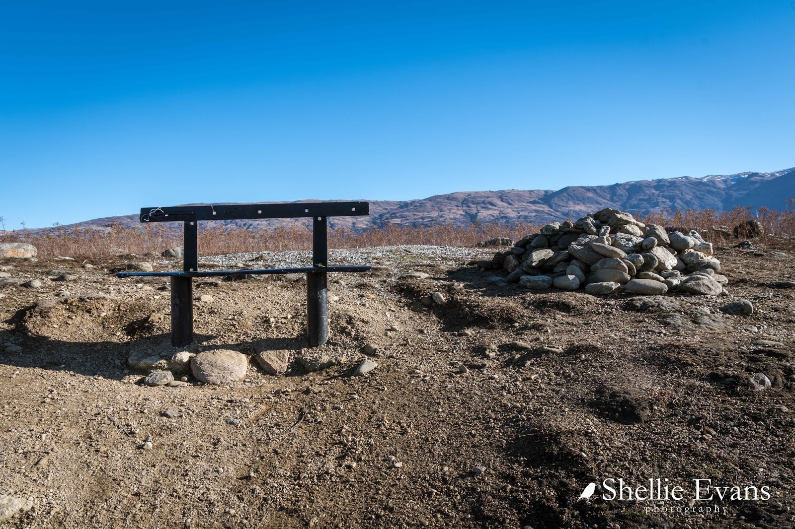

There's a chilly wind blowing and even with the sun it's very cold on the top of the terrace. I head to the edge to check out the view.


The vegetation is very alien up here. What looks like a paddock of cow pats is actually the alpine plant Raoulia, commonly known as 'vegetable sheep'. Often the plants are 60-70cm (1-2 feet) high and they form densely compacted hard cushions, hence their name as they look like sheep from a distance. 

But this particular species of Raoulia are low growing and instead form large very flat mats. They are hardy plants that enjoy dry conditions and will take over at the expense of other vegetation especially where rabbits are a problem and have cleared the land of other plants.


From the edge of the terrace the view up Lake Dunstan is spectacular. I've used my wide angle lens to get as much of the view in as possible. The NZMCA Park is located just behind the first lot of brown trees on the lake edge, in front of the green pines. (click on the photo to enlarge)


When I zoom in on the Park, I can see 'Out There' all on her own.


Across the lake are the vineyards on Northburn and the Northburn tailings tucked in there somewhere, that's another walk I will do the next time we're in Cromwell.


To my right and at the far end of the lake is Cromwell.  The 45th Parallel marker pole is just ahead of me too. 


The row of pines in the photo above, grow up the edge of Sugarloaf, which if viewed from below at Lowburn Inlet, looks like a small hill. The pines are over the right hand edge (photo taken in 2014).


 I follow the track along the edge of the terrace...


 ...until I reach the marker pole. The track then drops down a narrow gully, which is in fact part of the old gold mining escavations and is full of tailings...
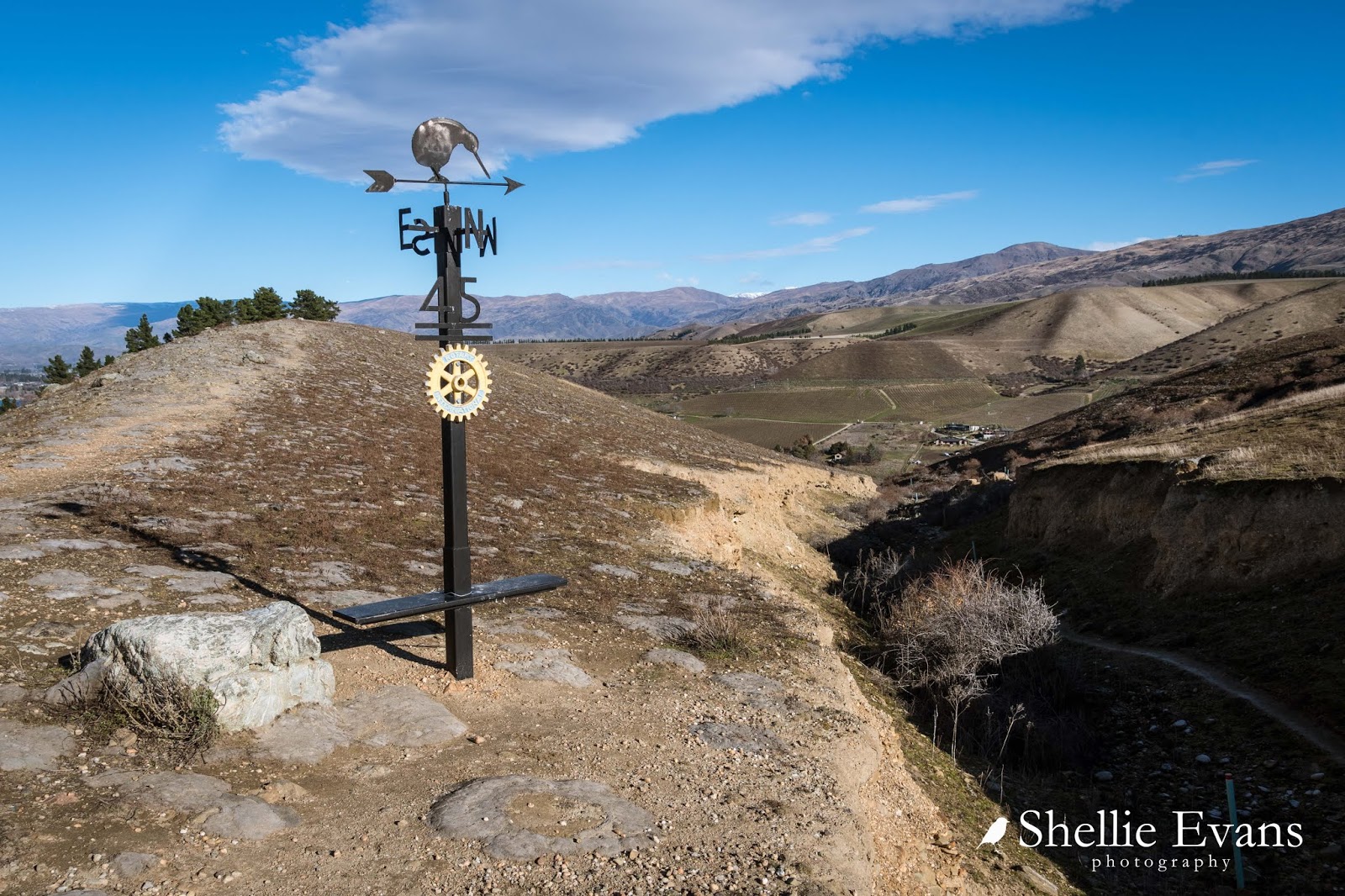

...but I continue on along the top until I reach the trig station at the top of Sugarloaf.


This is what I wanted to see. Lowburn Inlet below...


...Lowburn Harbour at the back and in the middle, the Lowburn freedom camping area.


And at the top of the inlet is the new Lowburn housing development on the slopes below Lowburn Terrace. I think I need to come back up here in autumn.


And here is a panorama of Lowburn, this is 6 photos stitched together. I saw a similar photo of this view on a building in town and that made my mind up that I needed to do the walk on this visit.


From the trig there's an unofficial track down the side of the terrace...


...and back into the gully and mining tailings...


From there it was down to the Inlet...


...and then back along the lake front and home.


Done & dusted and not that bad afterall!


Friday, September 8

Port Hills- Dyers Pass and Gebbies Pass

Catch-up 

Before we left Christchurch I managed to do a quick tour over the Port Hills through Dyers Pass to Governors Bay and then back to Weddons via Gebbies Pass, roads we hadn't explored on any of our previous visits to the city. I was waiting for a fine day, but in the end I had to do it on another not-so-great day similar to the one I had when I explored Godley Head at the other end of the hills.

First stop was at the very busy Sign of the Kiwi cafe, an iconic Christchurch landmark; built in 1916-17 as a staging post and opening as a tearoom and rest house. The cafe was closed after the 2011 earthquake and didn't open again until January this year. Just a month later it came very close to being destroyed in the massive Port Hills fire.


I drove along the Summit Road and up to the top of Sugarloaf where another iconic Christchurch symbol is located; the radio & television communications tower.


From there the views are expansive out over the city, across the Canterbury Plains to the Southern Alps behind. In the foreground the regenerating hillside is slowly recovering after the devastating February fires raged out of control and burnt over 1650 hectares of the Port Hills. The Sign of the Kiwi is located just out of sight to the left, where the two sections of the Summit Road meet (click to enlarge).


Parts of the badly damaged Adventure Park including the chairlift can been seen across the valley.


The dead pine trees are slowly being removed.


The fires were ferocious and burned on both sides of Dyers Pass Road and also jumped the Summit road below and burnt up to where I'm standing.


Here's a photo taken during the fire from below, Sugarloaf and the communication tower can be seen at the back, on the left.


I carried on a short way past Sugarloaf until Governors Bay came into view down the inside of the Port Hills rim. I'm heading to the other side of that first finger of land and crossing over Gebbies Pass at the lowest point of the hills behind.


I then returned to Dyers Pass and drove down to Governors Bay, stopping to take a photo of the Governors Bay Jetty (see it in the photo above?) which looks a similar length to the well known Tolaga Bay wharf, north of Gisborne. It was closed and in need of repair; a noticeable section in the middle sagging into the tide.


Next stop was the historic St Cuthbert's Church which was built in 1860. 


It was extensively damaged in the September 2010 earthquake and had only just reopened after a major rebuild.


With the temperature dropping and the day not getting any brighter it was just a few quick stops at places of interest as I wound my way along the very tight and winding roads that follow along the edge of Governors Bay...


...until I reached the old Blacksmith building on the corner of Gebbies Pass Road where I turned inland... 


...and found two more churches to add to my collection- St Peters Anglican Church at Teddington...


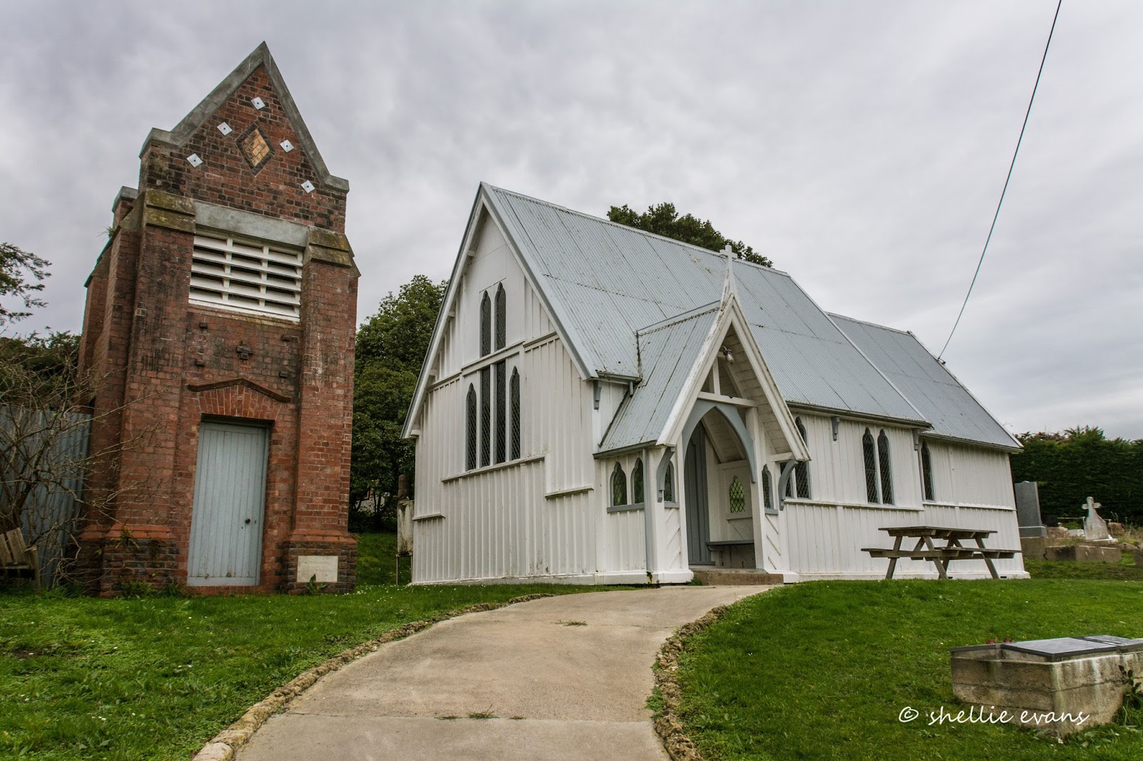
...and the Anglican Church of the Epiphany in Gebbies Valley, which must have one of the most elaborate belfries in all of New Zealand's country churches.


And then it was home to Weedons, to pack and prepare to move on out.


Friday, July 25

Kaikoura Peninsula Walkway

With an entry point to the Kaikoura Walkway just a few steps away from where we were parked it was too good an opportunity to miss. The complete walkway is a 12km long loop that takes in the town, the coast road to Point Kean, the peninsula’s cliff tops, South Bay and Toms Track across farmland back to town. I decided to just walk the 4.5km sea cliff section from South Bay to Point Kean, where I’d call up David to come and collect me.

I set off up the the very steep stairway behind us and after crossing a couple of paddocks came to a junction in the track with no signposts, one headed over the hill in the direction of town so I took the other track and carried merrily on my way heading towards the cliffs. After a short while the path headed down hill through a pine plantation and next minute (nek minit) I popped out into an alleyway beside the backyards of some houses. Houses in South Bay! South Bay just a short FLAT 20 minute walk along the beach from where we were parked.

Low tide at South Bay with the snow capped Seaward Kaikoura Range behind.


By the time I wound my way through the back roads of South Bay and crossed the reserve to the grand entrance to the walkway I had wasted an hour! (I suppose not wasted as such, it was good exercise). I then realised I had forgotten by binoculars so I was able to call David up and he delivered them to me just down the road. Everything happens for a reason. That’s what I told myself anyway.

The South Bay Powhenua, at the entrance to the walk, tells the story of Maui going fishing in his canoe and pulling up the house of Tangaroa (God of the sea)


It was a very impressive walkway entrance, in fact the best I’ve seen on our travels. The building is shaped like a waka (Maori war canoe) & has a number of large interpretation panels inside explaining the wide range of geology in the area. The second Powhenua is of Maui fishing up the North Island.


The shelter also had a large panoramic section cut-out in the wall providing the perfect frame for the limestone tidal platform out front.


A wide fenced boardwalk led around the edge of the bay to a steady steep climb on a cobbled pathway to the top of the first cliff & to a lookout platform, again shaped like a waka, overlooking Limestone, South & Goose Bays, and the mountains beyond.


At various points along the way there were interpretation panels telling the stories of the land, the sea, the animals & of the people who lived on the peninsula. There was a very cold and bitter southerly blowing and I was very thankful for my scarf, hat, gloves & warm jacket and although there were very few people on the track the few I did pass were not dressed for the weather, no jackets, short sleeves and unsuitable shoes.


Limestone Bay


Behind a predator proof fence located on the sea cliff near Whalers Bay are the nesting burrows of a new colony of endangered Hutton’s Shearwaters. Kaikoura is the only place on earth that the Hutton’s Shearwaters breed. The usual breeding colonies are up in the mountains behind Kaikoura but these sites are under pressure from various environmental issues so this new site was set up as a safe guard.

Chicks are brought down from the mountain colonies a few weeks before they fledge and are fed & housed in artificial burrows behind the fence for up to four weeks. This ensures that this new site will imprint (on their bird brain) and that they will then return here to breed. In 2009 the first of the chicks returned to breed, five years after leaving. It will take some time to fill the area fenced off but eventually the fence will protect a breeding population of 10,000 birds.

I liked the little fenced booth to sit in and catch your breath......and to protect you from marauding sheep perhaps......? :)


The peninsula has many small bays and tidal platforms that would make for some interesting exploring in the summer.


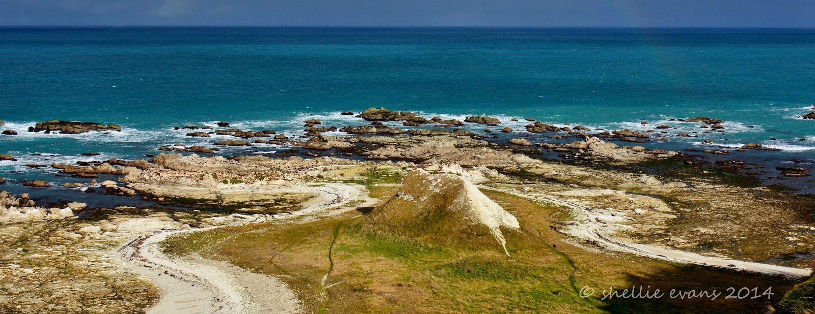
Whalers Bay & “The Sugarloaf”- a wooden stairway follows the same route down the cliff to the shoreline that former whalers used many years ago when Kaikoura was a very busy whaling station.


Whalers Bay nowadays supports a very large NZ Fur Seal (Kekeno) colony. Well I thought it was large until I walked a little further on. These seals appeared to be a lot more skittish than the ones at Point Kean & further up the Kaikoura coastline because as they saw me coming most started to move away looking over their shoulders as they went. I didn’t want to disturb them so I took a few zoomed shots and headed back over the path and up the steep stairway.


Seals rest on a "Hanging Garden"


“I’m the King of the Castle”


Outcast- this little fellow was all by himself out to the side. He wasn’t happy to see me either.


Back at the top I continued on along the walkway and at the next view point it was a huge surprise to see the size of the seal colony below. Like chocolate sprinkles on a cake there were hundreds of seals, dotted across the grass & resting head to tail over the limestone rocks. White rocks with lots dark patches, stained from the resting seals. I was too far above them to get a whiff but I can only imagine the stench that would emanate from that lot.


The track continued on around another small bay to another platform…..


…that revealed even more seals, hundreds of them taking up every available space on every limestone peak that cleared the tide.


It was fascinating watching them through the binoculars, a withering mass of blubber moving about, some finding new spots to rest, others getting a growling for encroaching into another space, some arriving, some leaving, some cooling off in tiny pools of seawater and many just sleeping. A city of seals going about their business. Imagine the food bill!


This next photo should give you an indication of how high up I was. Can you spot the two people exploring on the rocks? While I was standing taking photos near this edge here I got the fright of my life when a person suddenly appeared in my viewfinder. How could that be I thought, I’m pointing it out over the cliff. I moved closer and he had climbed up a very steep ridge that came up the point from below, a steep clay wall with no plants on it and a few gouges he could use for foot & handholds. How he made it I have no idea. He looked pretty startled himself when he found he was at the top. Some people…..


Finally I reached Point Kean & the carpark (with the town of Kaikoura in the distance), and the end of the section I was walking. I thoroughly enjoyed the walk and although it was cold I had walked it in the right direction, I had the wind to my back the whole way.


The carpark seals slumber on. These guys have no fear, unlike their cousins in the colonies further round the point.


My personal taxi arrived and we headed off to get groceries with just a quick stop at the historic Fyffe House, Kaikoura’s oldest surviving building & a link to Kaikoura’s whaling past. It was built in 1860 and stands on piles made from whalebone vertebrae. Across the road is an old brick chimney, this is all that remains of the former customhouse. I thought it looked like it would be a great place to cook up a pot of mussels or BBQ the crayfish you just pulled out of the sea.


Back in town the clouds had lifted off the mountains to provide this beautiful snow covered backdrop. Imagine waking up each day with this on your doorstep, you couldn’t help but go off to work smiling.