Showing posts with label tiki touring. Show all posts

Wednesday, June 19

Lake Tutira Reflections

Before we left Napier David & I had wanted to visit Boundary Stream, a 702ha mainland island bird sanctuary & scenic reserve located on the eastern flanks of the Maungaharuru Range 60kms north east of Napier. The reserve is home to a number of threatened species including kiwi, kaka and kokako & the New Zealand falcon. You may recall back in February when we stayed at Glenfalls we travelled inland hoping to reach Boundary Stream but gave up after travelling over 10kms on a bone rattling & dusty corrugated gravel road.

We didn't leave until late morning & in hindsight we should have left much earlier to fit in one of the longer walks & a visit to Shines Falls which in the end we missed out on.  As it was we decided to stop & have a look at Lake Tutira on the way past, it was a brilliantly sunny & still winter's day & the lake looked stunning.


I also spotted a church up on a plateau that I wanted to take photos of & David also wanted to check out the fly fishermen we could see on the other side of the lake.

Is that the Loch Tutira Monster?
William Guthrie-Smith (an author, ornithologist & conservationist) settled in Tutira from Scotland in 1880. Tutira Station was once over 60,000 acres with 32,000 sheep, Guthrie-Smith subdivided some of his land after WW1 & gave it to returned servicemen. A man well beyond the times he wrote about the serious effect introduced species, both plant & animal, were having on native flora & fauna. Herbert Guthrie-Smith died on 4 July 1940 at Tutira where he is buried. The 2,000 acres that remained of the station were left in trust to the New Zealand public as an educational and recreation reserve. Thousands of Hawkes Bay children have many happy memories of Tutira school camps courtesy of Guthrie-Smith's generosity.

The Tutira Memorial Church had a prime position on a hill overlooking the lake, you can see the calm lake in this photo.
 

We arrived at Boundary Stream mid afternoon and chose one of the shorter walks to do, we hoped we'd have enough time to complete the walk & then drive around to the Shine Fall's car park 12kms away & do the short walk to the falls from there. It would have been a ten hour return walk to the falls if we'd done it from here & there was no way we had the time or the stamina to do that.

Boundary Stream Scenic Reserve
We met a DOC worker who was heading into the bush to do some kiwi tracking with his portable radio tracking device, if we had more time we wouldn't have minded tagging along to check that out. We completed the shorter walk & were pleased to see a falcon flying overhead & a number of rifleman, both quite rare. I didn't manage to get any photos though, it was just too dark in the bush & getting darker by the minute as storm clouds jostled for space in the the blue sky. Once we'd finished we decided there wasn't enough time to visit Shine Falls so we headed back to the main road & home.


Driving back past Lake Tutira, the lighting over the lake was fantastic as the setting sun was caught between the dark storm clouds & the high range it would shortly disappear behind. We drove around the lake edge to check out the DOC camp on the other side where we could see three or four vans parked up for the night.


It was the "right place, right time" for me to shoot a few dozen beautiful shots of the lake & the beautiful autumnal colours & the wonderful reflections. Within 10 minutes the sun had gone.

Here are a few for you to enjoy-


Sunday, April 14

Cathedral Cove

Cathedral Cove is another very popular tourist attraction we decided to visit. The signpost said a 45minute walk to the cove but it’s very deceptive when you look at it from the viewing platform by the car park. It looks like it’s just a few hundred metres away and I’m sure some of the people we saw making their way there thought the same too. A couple of women were in high heels, a few wore stockings on an extremely humid & hot late summer's day, some carried their handbags like they were going shopping & then there were some very elderly people with walking sticks.


In fact it’s two & half kilometres of pretty strenuous  walking, up & down and over some very uneven ground in places even though it’s a well marked & worn track. The climb up the very steep stairway out of the cove on the return leg is a real killer.


Was it worth it? Well we decided we liked seeing it better with a wine in hand while lunching on the deck of the boat safely anchored in the lee of the famous archway for the afternoon, much less of an ordeal! J Actually it wasn’t that bad & it was great to see it from the beach & walk through the huge cavern but it would have been nicer if the sky had been blue for me but then again, that would have meant a very hot walk back to the car.


The above shot may look familiar, some of the scenes for The Chronicles Of Narnia - Prince Caspian Movie were shot inside the archway.


Cathedral Cove's famous sea stack, Te Hoho, crowned with Pohutukawa trees, stands strong despite the endless erosion of the Pacific Ocean. The eight million year old ignimbrite rock is made of white pumice and volcanic ash.


We also visited Cooks Beach, another large crescent of white sand with a good number of baches & holiday homes five & six deep lining the beach, another very popular holiday spot. 
 
Cooks Beach & Lonely Bay
Next stop was the lookout at Shakespeare Cliff which gave a panoramic view right around Mercury Bay, from Whitianga’s Buffalo Beach in the west to Hahei in the east and all the islands in between & further afield. Straight across the water was Simpsons Beach where we were staying a couple of nights ago.

Centre back- Buffalo Beach, Whitianga
Centre Left- Flaxmill Bay

Simpsons Beach, the pines we stayed under to the right


Shakespeare Cliff & Flaxmill Bay
Then it was down past Flaxmill Bay, another little beauty, & one we’ve anchored in for a swim & relax awhile during the day. On & up over the little rise to Ferry Landing & the wharf where the passenger ferry from Whitianga comes & goes all day long. A five minute crossing saves a half hour & 40kms trip by car. 

 
Some obviously think the ferry is too expensive :)


Ferry Landing Store & Library; I guess you only need a small library because the books will be short stories as the ride is only five minutes long.
 
Mercury Bay Islands & part of the marine reserve
Along side the ferry landing were a family of oystercatchers, the parents teaching the two chicks how to gather shell fish. Each time they managed to stab a limpet or nab a cockle when it opened it's shell they make a big fuss & headed for the beach with the youngsters hot on their heels. The young birds quickly took over finding their own dinner.


A quick stop at Hahei on the way home, which is a very popular beach due to it being very close to Cathedral Cove, it also fronts the marine reserve that covers a wide area on this side of Mercury Bay. A lot of kayak tours leave from Hahei Beach, along with glass bottom boats so visitors can see the spectacular sealife around the reefs & islands of the reserve. A very long time ago in the early days of our  boating adventures we totally forgot about the reserve & stopped for a fish. We wondered why we had a very fruitful couple of hours! Luckily nobody spotted us, it’s a possible $300,000 fine & forfeiture of your boat if you’re caught.

Hahei Beach from Cathedral Cove lookout
Hahei Beach


Friday, April 12

309


That’s the 309 Road, a road that strikes fear in the most ardent Coromandel traveller. The 309 is the “shortcut” route between Whitianga & Coromandel township, all gravel & all winding, straight up & over the range.


The signs say it all. But in fact again, after the roads we’ve been on lately this one was a doodle. We’d even take the fifth-wheeler over it if we had to. Not that we have any intention of doing that but still if we ever had to, we’d be up for it.

I wanted to visit the Waiau Kauri Grove & Falls which looked like it wasn’t that far down the road but in fact as it turned out was only 8kms from the other end, just down the road from the Mussel Kitchen, where we had lunch a couple of weeks ago!

It was lovely to see so much Rata flowering right through all the native bush and especially on the trees near the roadside.  Rata, along with the pohutukawa,  belong to the myrtle tree family. It is under considerable threat caused by browsing possums; an imported pest destroying a native parasite. Rata are epiphytes, they start life in the canopy of the trees and send their roots down to the ground where the roots slowly thicken & enclose the host tree, killing it and taking over the dead structure. A rata tree can be huge, growing up to 25 metres high, with a 2.5 metre wide trunk.

It was only a short walk through lovely native bush to the kauri, a magnificent grove of about 12 huge trees that have been there for well over 600 years, young by kauri standards. A kauri somewhere else in NZ was aged at over 4000 years old when it died. It is unclear how these kauri survived the intensive logging (plundering) that happened over the Coromandel from 1880 to 1930 but these were located on mining land & it’s thought the company may have restricted the loggers. 

The trees remained undisturbed until WWII when the government  wanted the timber to aid the war effort. The locals were unimpressed and formed what is thought to be the first Coromandel conservation action group. Much to their amazement their plea was heard by Wellington & a reserve  was  established  around the kauri trees. The biggest kauri in the grove measures  1.9 metres through & 6 metres around it’s trunk & it’s 16 metres to the first branch. The biggest Kauri ever measured, Kairaru, had a 20 metre girth and was twice as high as the tallest kauri in this grove. That is humungous!


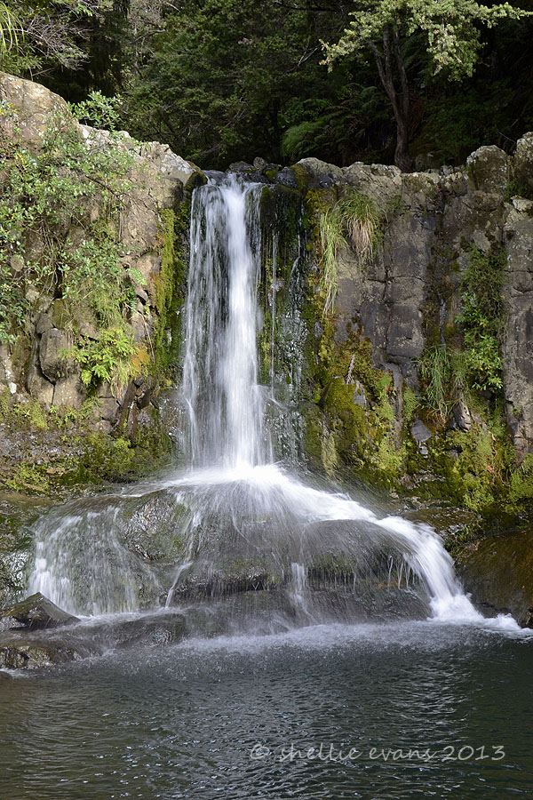
Next stop were the Waiau Falls which were just down the road, a lovely place for these tourists to have their lunch. Unusual falls too in the way the water fell & hit a centre rock then spilled either side. I bet when the river is in full flow the effect wouldn’t have been quite the same.


After the falls it was time to head back over to the other side and it was then that we met these trucks on the road, four of them in total. Not so bad as we had warning that they were coming, they were dumping more gravel on the road. Back & forward all day long, a huge quarry was at the beginning of the road. Very handy for the 309.

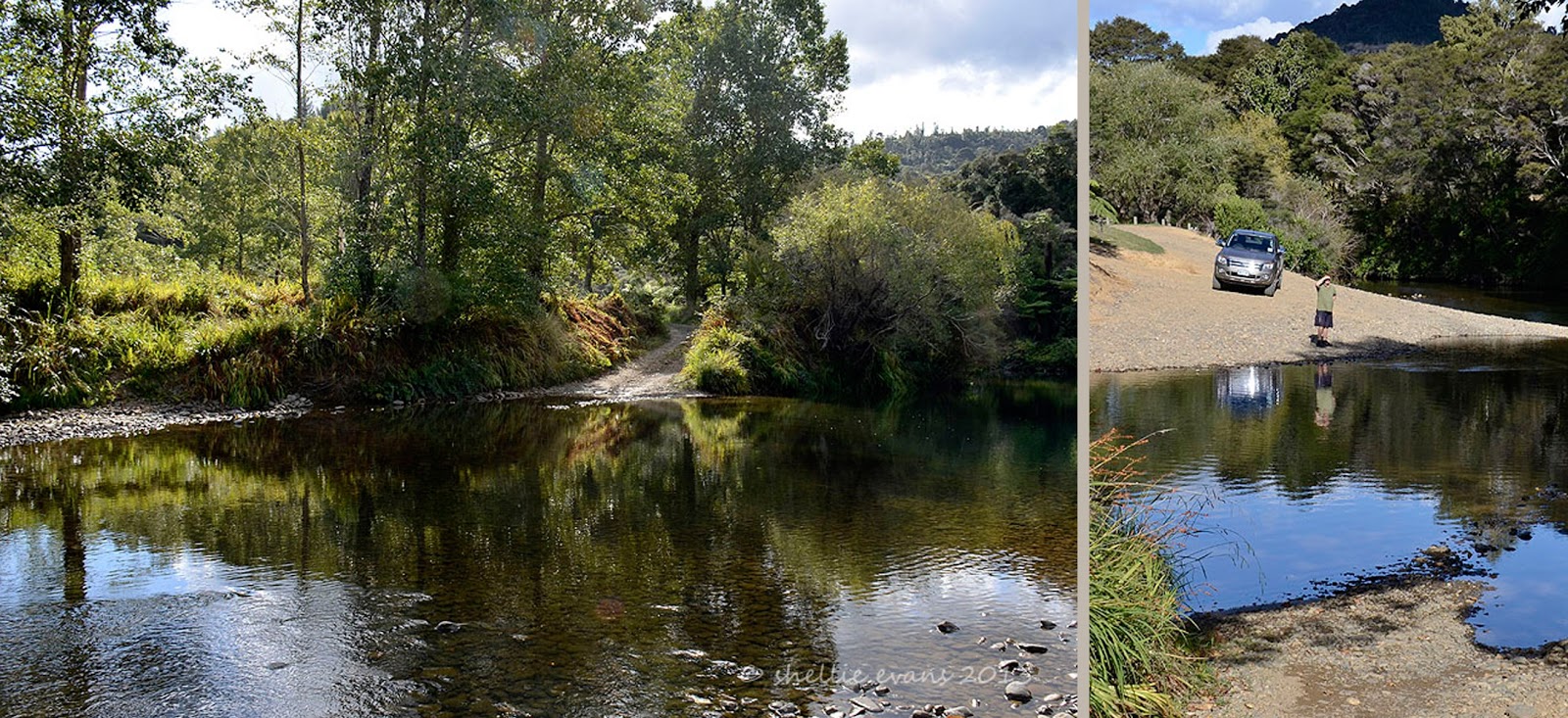
We stopped at a couple of lovely reserves beside the river on the way home, this one was called the 309 Waterhole. How would you like to cross this every time you needed to drive to town. There were a couple of houses up the drive, David was trying to decide if he would cross it or not, in the end he decided he wasn’t going to be a hero even though he got me to cross it to check out the depth! J


Thursday, April 11

Endless Summer

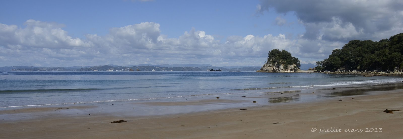
New Zealand has 16,000kms of coastline, how lucky are we all to have beaches like these on our doorstep. These are all within a 20km drive of where we are staying at the moment.
 
I'll let the photos do the talking......  
Otama Bay
Otama Bay

Otama Bay
From Black Jacks Road; Opito Bay
 
Opito Bay
 
Opito Bay
  
Matapaua Bay
 
Matapaua Bay

Kuaotunu, Gray, Rings, & Matarangi Beaches
 
Rings Beach

Matarangi Beach
 
Matarangi Beach

Great Mercury Island from Otama Beach