Showing posts with label sign. Show all posts

Monday, January 20

On The Road Again

Finally after a few false starts we will be back on the road again this morning a little over five weeks since arriving in sunny Invercargill. Those first brilliant sunny, calm, blue sky days lulled us into a false sense of promise; it's been downhill all the way, and fast, since then. Even early this morning as I type at the table watching the camp come alive, the wind is still strong & gusty & the rain has begun to fall.  But we will pull out of camp this morning, we've made that decision and we are more than  ready to go. In preparation we pulled off site yesterday to empty our tanks as usually the camp dump station is busy in the early mornings as other vans empty before heading off so we decided to do our ablutions in the relative quiet of late yesterday morning. Our camp ground host, Doug had rigged up some extra pipes for us to use because as some of you might remember, we couldn't quite get to the sump before and had to use a Public Dump station when we left for the farm on Christmas morning.


We are once again stocked to the gunwales and have completed all our last minute errands, all except one that is; we do need to get a WOF (warrant of fitness) on the 5th-wheeler which will be our first port of call but after that it's be around to say a last farewell to the family, point the rig north east back towards the Catlins and with a brisk tail wind it shouldn't be too long before we can set up camp again. We have a tentative plan for the next few weeks; the first step is to complete the Catlins before moving inland. But as we're finding out, and the beauty of not working to an itinerary, plans can change from one day to the next so who knows where my next post might come from.
 
Despite the weather we have loved being in Invercargill, I now know why it is such a lovely city; that's to distract you from the weather- although Southerners are quick to point out that they had a glorious summer last year - yeah, OK,  we believe you. We have loved catching up with the family and while we'll miss them we know we'll be back in May to see them again.
 
I made a few notes & took some shots of a few quirky & odd things that I came across in the city;
 
This barber shop is just down the road from the camp-


Potatoes are sold by the bucket on the side of the road- "Bucket of Potatoes $20" and you get to keep the bucket albeit without a handle!
 
Virtually every shop has a sign "Please remove muddy boots"- this just goes to prove that the weather is crap! ;)
 
A good Southern Man (or woman) doesn't drink & drive


Cherries are sold by the box load (on the side of the road also) at around $8kg- big fat plump juicy cherries! Yummmmm....

The standing joke was that Tim (Invercargill's colourful mayor) would turn up to welcome us at the café where we had lunch a few times. Instead of Tim we got Marcus (TV celeb) & his brand new baby!


A good Southern family mostly eats white bread, or white bread covered in cheese- yes, there are different styles & flavours of bread but nowhere near the variety & amount I've seen elsewhere. My favourite ciabatta might have half a dozen loaves or buns available if I'm lucky and that's in the large Pak 'n Save & Countdown supermarkets.

There are plenty of low flying wood pigeons around the city-


This van was in our campground-


Wine is very expensive & not available from the supermarkets, the Trust have a monopoly in Invercargill city and you can only buy from a liquor store. My usual bottles of wine are $3-$4 more expensive, and that's on special.

Cheese Rolls (that Southern specialty) are sold in the supermarket by the half dozen!


Keep smiling, see you "Out There"

Friday, April 12

309


That’s the 309 Road, a road that strikes fear in the most ardent Coromandel traveller. The 309 is the “shortcut” route between Whitianga & Coromandel township, all gravel & all winding, straight up & over the range.


The signs say it all. But in fact again, after the roads we’ve been on lately this one was a doodle. We’d even take the fifth-wheeler over it if we had to. Not that we have any intention of doing that but still if we ever had to, we’d be up for it.

I wanted to visit the Waiau Kauri Grove & Falls which looked like it wasn’t that far down the road but in fact as it turned out was only 8kms from the other end, just down the road from the Mussel Kitchen, where we had lunch a couple of weeks ago!

It was lovely to see so much Rata flowering right through all the native bush and especially on the trees near the roadside.  Rata, along with the pohutukawa,  belong to the myrtle tree family. It is under considerable threat caused by browsing possums; an imported pest destroying a native parasite. Rata are epiphytes, they start life in the canopy of the trees and send their roots down to the ground where the roots slowly thicken & enclose the host tree, killing it and taking over the dead structure. A rata tree can be huge, growing up to 25 metres high, with a 2.5 metre wide trunk.

It was only a short walk through lovely native bush to the kauri, a magnificent grove of about 12 huge trees that have been there for well over 600 years, young by kauri standards. A kauri somewhere else in NZ was aged at over 4000 years old when it died. It is unclear how these kauri survived the intensive logging (plundering) that happened over the Coromandel from 1880 to 1930 but these were located on mining land & it’s thought the company may have restricted the loggers. 

The trees remained undisturbed until WWII when the government  wanted the timber to aid the war effort. The locals were unimpressed and formed what is thought to be the first Coromandel conservation action group. Much to their amazement their plea was heard by Wellington & a reserve  was  established  around the kauri trees. The biggest kauri in the grove measures  1.9 metres through & 6 metres around it’s trunk & it’s 16 metres to the first branch. The biggest Kauri ever measured, Kairaru, had a 20 metre girth and was twice as high as the tallest kauri in this grove. That is humungous!


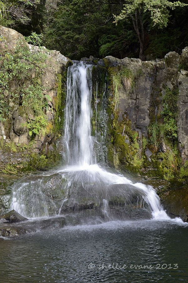
Next stop were the Waiau Falls which were just down the road, a lovely place for these tourists to have their lunch. Unusual falls too in the way the water fell & hit a centre rock then spilled either side. I bet when the river is in full flow the effect wouldn’t have been quite the same.


After the falls it was time to head back over to the other side and it was then that we met these trucks on the road, four of them in total. Not so bad as we had warning that they were coming, they were dumping more gravel on the road. Back & forward all day long, a huge quarry was at the beginning of the road. Very handy for the 309.

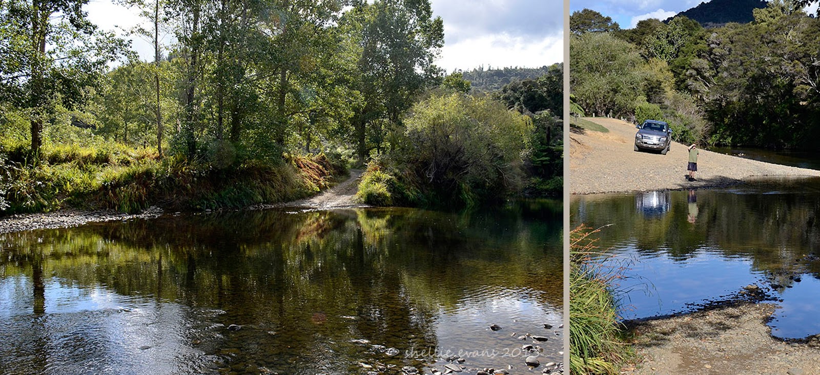
We stopped at a couple of lovely reserves beside the river on the way home, this one was called the 309 Waterhole. How would you like to cross this every time you needed to drive to town. There were a couple of houses up the drive, David was trying to decide if he would cross it or not, in the end he decided he wasn’t going to be a hero even though he got me to cross it to check out the depth! J


Sunday, April 7

A Busy Life

Life on the farm at White Star Station is a busy one & we’ve enjoyed watching the comings & goings around  the main farm house & through the farm gate near where we’re parked in the very large “house paddock”.


Along with the farm activities there have been quite a variety of guests that pull into the paddock late in the afternoon looking for accommodation, there are only a couple of accommodation options in this remote area. Here the guests have ranged from a number of young foreign couples on their OE, a single biker travelling the peninsula, and older English couple at the end of their three week dream NZ holiday. And last night a large group of young men who had travelled from Auckland for the night, they’re going horse trekking today.

It was a shock to our system to get back from Stony Bay to find there was a party going on in the back yard of the cottage they had rented which is just behind our van. They had a huge fire burning in the outdoor fire pit (luckily I had brought my washing in, in case of rain, before we left for Stony Bay otherwise it would have been totally covered in smoke) & the windows all open & a stereo inside the house cranked up as loud as it could go. Actually, it wasn’t quite as loud as it would go because after an hour or so the volume suddenly increased to the point where we couldn’t hear the TV inside our closed up van. I’ve never heard Indian music played so loud before, not only was the music loud but they were singing to it too! I was waiting for some action to come from the farm house but realised they were out for the evening so in the end I went across to have a word. They were very nice about it & turned it down to a reasonable volume. Going by the beautiful curry smell coming from the kitchen I was hoping they might have offered us dinner. No such luck.

I'm not too sure who will have the more fun today, the horses or the guys. There are going to be a few sore heads going by the bottle pile & the muted noise coming from the cottage this morning.

This morning the peace & quiet was shattered again by the sudden bellowing, barking & shouting happening outside our van. A herd of cattle were being moved into the house paddock but once they thundered in through the gate the guys forgot to call off the dogs. The farm bikes shot off over the bridge to the woolshed while the dogs kept on rounding up the cattle. The cattle went thundering past, around in a big loop and then headed straight back towards us. The dogs were having a ball & ignoring the farmers who were shouting & whistling from way over the other side of the bridge. Life on this farm would never be boring.
It was time for us to hit the road again, we are headed back to Coromandel township then across the range to Whangapoua on the eastern side of the peninsula. We came across this guy & his mate just down the road, no helmets either!

A Man's Best Friend
We stopped in Coromandel to fill up the fridge & empty our tanks. After two weeks of isolation without many vehicles or people, Coromandel town felt like the “big smoke”. Being a Sunday there were many people out enjoying the sun, there were also two or three groups of bikers from Auckland out on their Sunday ride. They provided a bit of entertainment with their various antics firstly, in trying to walk after getting off their bikes, & then attempting to remove some of their gear so they could sit at a table & eat. At least the sun wasn't too warm, it must be bloody hot sitting in full leathers. They obviously love riding the winding roads, we met another lot coming over the range.

We had lunch (& a flat white that I’d been dreaming about for days) at Umu, a nice little café right on the junction of the high street & the main road heading south, great for people watching & watching the passing traffic in all its forms.  
 
I had steamed mussels in cream & curry & David had the Mussel Chowder. Great value with good sized servings. The mussels still weren’t as nice as mine though.

This made me smile, it was just across the road outside the liquor store where we topped up on the necessary too.
 
Then it was onto the Coromandel Smoke House to check out what they had on offer. We purchased a few small portions of fish & mussels to sample & then headed back to the van to stow everything & then back onto the road again & off over the hill to Whangapoua.

Brown Teal- Pāteke

With less than 2000 wild Brown Teal (Maori name Pāteke) in New Zealand, I was extremely lucky to spot quite a number of them on a tidal river bank which we passed over a number of times while driving near Colville.


Brown teal are nocturnal & omnivorous, feeding on the muddy tidal flats in amongst the mangroves. During the day they rest up on the edges of the tidal streams. They were very wary & as soon as they were aware of me they took off swimming up stream, they came out from under the mangroves and boxthorn by the dozens. I managed to creep up closer on a small flock on another nearby stream.


The Brown Teal is a small dabbling duck species endemic to New Zealand, they were once widespread throughout NZ but they are now classed as New Zealand’s rarest waterfowl species. Brown Teal are only found on Great Barrier Island, eastern Northland & the upper Coromandel where they have been re-introduced. New populations have now also been established on several predator free islands.
Brown teal are mainly brown in colour (surprise, surprise) with a distinctive white eye ring. Males in breeding plumage have a green head that can range from subtle to very strong iridescent green & sometimes they have a white collar on the neck.  When not in breeding plumage, both sexes look alike although they have different calls. In  this photo you can see the dark bronze chest, a hint of green on one of the heads & the white collar on the front duck. Brown teal breed during winter & spring.
Another rare bird to tick off my list!

This sign was near Port Charles, a very long way
 from where I saw my Pateke

Saturday, April 6

Stony Bay & Finishing the Coastal Walk

We had one more bit of exploring before we leave the tip of the peninsula; Port Charles & Stony Bay. Both of these along with Sandy Bay are located on the eastern side of the tip and to get to them we crossed over the range just north of Colville and then turned left at the only intersection for miles, turning right would have taken us back past Waikawau Bay and on to Kennedy Bay which then loops back to Coromandel township. We were going to do this road if we had of stayed at Waikawau  before heading south but we’ve heard it’s very corrugated & extremely winding towards the end & as we're not stopping at Waikawau, it now makes sense to head back to Coromandel township the way we came up, on the western side. 


Part of a "Shoe Fence" at the beginning of the climb over to Port Charles
It was only about 14kms from the intersection to Stony Bay but it might as well have been 44kms, Port Jackson’s road had nothing on this one for winding. After 5 kms & 150 corners I lost count & at least every 3rd or 4th one of those was a sharp blind one. The road winds itself through beautiful native bush that covers most of this side of the peninsula. This is the Moehau Range, it forms the backbone of the upper Coromandel Peninsula but runs steeply down to the coastline on this side. Mt Moehau at 892metres, is the highest peak on the peninsula & is of special significance to Maori.

 
Port Charles is the first of only two settlement we come across, population 150,  it’s located on the edge of a large enclosed deep harbour & it would seem fishing is the main activity here. There is also a large mussel farm at the entrance.

The road, which is not council maintained- got narrower & no less winding from Port Charles. A along the way there were tantalising glimpses of the rugged coastline. Finally we dropped down into Stony Bay & the end of the road.


A gate opened into the DOC campground and the other end of the Coromandel Walkway which we had half completed the other day from the other end- (read about it here)

Stony Bay, as the name implies is a beach of pebbles & boulders, very beautiful & surrounded with magnificent pohutukawas festooned with huge astelia epiphytes.
 
We had brought our tramping gear but hadn’t quite decided whether we’d do the walk or not but once we got there and saw that the track disappeared up the side of the hill & into the bush, a totally different scene than the other end, we decided we’d do it now that we were here. We’d walk to the lookout which was one steep climb away from Poley Bay, where we’d ended up coming in from the other side. We could now say we had walked the 7km track apart from that small section. In fact we’ve walked nearly double the distance considering we had to retrace our steps twice.
One of the large pohutukawa that line Stony Bay
It was overcast & rather grey but there were signs that the sun was going to break through, either way; rain or hot,  it didn’t matter as we were under the bush canopy most of the way. It certainly was beautiful, the path was lined with brilliant green ferns, pongas, mamakus and dozens of nikau palm. Some areas were certainly very tropical looking especially when the track crossed one of the numerous waterfalls. The path ran around the steep slopes that fell from the range above down to the rocky coast below, it weaved in and out of the valleys between each vertical ridge and & each turn back out to the ridge edge there was a waterfall. Although with no significant rain for months the falls were more of a trickle. It would be very magical after heavy rain & a little more difficult to cross I would think.
 
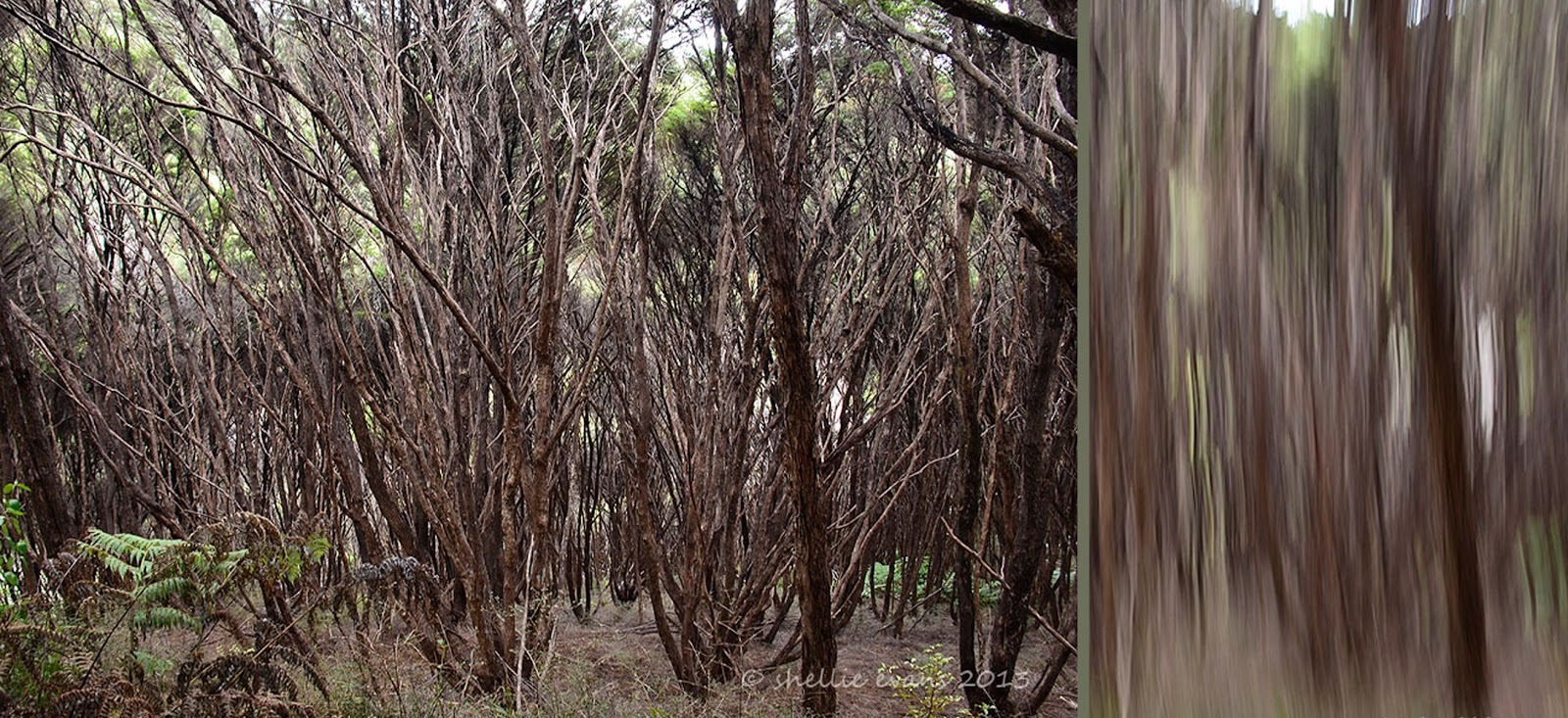
For quite a distance the track also passed through a manuka (tea tree) forest which was the highlight for me. It’s the first time I’ve seen such tall manuka, it’s usually shorter scrub but these were very tall and under the canopy were masses of relatively straight narrow trunks & branches.  On the ground grew bright green ferns which contrasted against the brown of the trunks. Looking down the steep slopes at the mass of branches gave me a touch of vertigo. I did some of my camera tricks too J
 
 
Throughout the bush and in fact all along the roadside are bright marker pointers written in various codes. These mark areas where there are pest traps or bait stations set. As most of this area is conservation land & many kiwi reside & have been released here, DOC obviously have an intensive pest eradication programme running.
That's NZ Mistletoe on the trunk
Two hours, 4.8kms and many tantalising views of the coastline & secluded bays later we finally reached the fork that led to the look out.
Centre photo- Mt Moehau
After a steep scramble up a slippery clay track we were greeted with fabulous views up & down the coast and out to Great Barrier Island. And there not very far away were the Pinnacles which were the prominent point of interest when we came in from the other end.
 
Port Charles harbour entrance is back centre

The track winds it's way back & forward over these ridges. Stony Bay is around the last point over by the green patches
We ate our lunch perched precariously on the side of the cliff. David also rescued a small stick insect that was being harassed by a wasp and then we were off again back to Stony Bay.  

It was a quicker trip back, our legs were starting to tire & by the time we reached the ute we were totally exhausted, we’d done nearly 10kms & shaved an hour of the return leg. I know this because David has an app on his phone called “My Track”, which keeps all the data. I have a few photos of him standing on various tracks looking at his cellphone. I kept thinking what’s he doing checking his phone so often. I’m thinking he’s looking for that elusive cell phone reception but he’s not, he’s checking the data. That is so typically my husband, I said he was a train-spotter ;)

We stopped in Sandy Bay just before the hill over to Port Charles for a well deserved coffee before heading home back over that winding road again. And with that we have done the northern tip of the Coromandel. We’ve got quite attached to this area & will be sad to leave.
Sandy Bay Baches


Sunday, March 31

Coromandel Coastal Walkway


It was overcast today, ideal to walk part of the seven kilometre Coromandel Coastal Walkway which runs from Fletcher Bay, at the end of the road coming up the western side of the peninsula & Stony Bay, the end of the road on the eastern side. There is no road access right around the tip of the peninsula so this a great way to see this rugged & remote area. It’s a 56 kilometre drive over narrow & winding roads from one bay to the other so it is wise to either walk part of the way then return or if in a group, have a vehicle left at either end & swap keys when you meet on the track. Some even carry their tents & packs & stay overnight at either end, returning the next day.


The views are fabulous, the coastline steep & rugged with jagged rocks, offshore reefs, island & small wild rocky bays as far as you can see. This area is known as the Pinnacle Coast.


Click on the photo to see the rock fisherman in the first photo

The first section crosses the hilly farmland of the Colville Farm Park which was purchased by the Crown in the 1970s, with the intention of preserving the coastline & forested inland slopes for the benefit of all New Zealanders. It was a steady & steep climb through the first paddock where there was a large flock of sheep which had obviously decided they quite like to rest on the level track at night, most of our time was spent dodging large amounts of sheep poo.


The next open section we crossed is known as ‘The Six Foot Track’, an old bridle path constructed & used by pioneers with pick, shovel & wheelbarrow to join the two bays. Not far from here is a valley of flax that early settlers harvested for a mill that they had in Port Jackson where the fibres were dried, baled & shipped to Auckland. The tin shack set high up the slope is used by itinerant scrubcutters.


About an hour and a half after setting off the track passed through a large area of manuka scrub, then we started a steep descent down into Poley Bay which is a small compact cove with a shingle beach. This was going to be our turnaround point. Large pohutukawa, ferns & nikau palms dominated this section & it was a shame to see so many mamaku ferns (Black Tree Ferns) in various stages of dying. Apparently the endless summer as taken its toll on our native forests & especially with the ferns which need a lot of moisture & frequent rain.

 
We had a break & ate our lunch in Poley Bay and while we were sitting there a family came climbing over the rocks, they’d been exploring as the tide went out. It was a surprise to see them as it was a long way in and quite a strenuous hike to where we were. The two little boys were two & five & had walked the whole way. They were now headed back & Dad said as long as they didn’t push them they'd make it all by themselves. Although the wee one must have finally decided enough was enough as we caught a glimpse of them on the last section before home with the boy riding on his dad’s shoulders.

The climb out of Poley Bay was very steep and slow, we were both relieved to get back to the carpark at Fletchers Bay, especially as it had just started raining although that didn't seem to stop the campers from enjoying themselves.