Friday 29 June 2018

Clifftops & Coastlines- Coromandel

Catch-up; I'm trying hard to catch up on my blogs as we're off to Melbourne for two weeks on Monday to visit family and are especially excited as we're going to meet our near-new grandson; 6 month old Otis. I have one more blog to post before Sunday and then I'll be taking a break for a short while. Enjoy these last few Coromandel blogs...

I did a little bit of exploring in between waiting for fish for dinner; driving to Fletcher Bay one day and walking the Muriwai Track another.

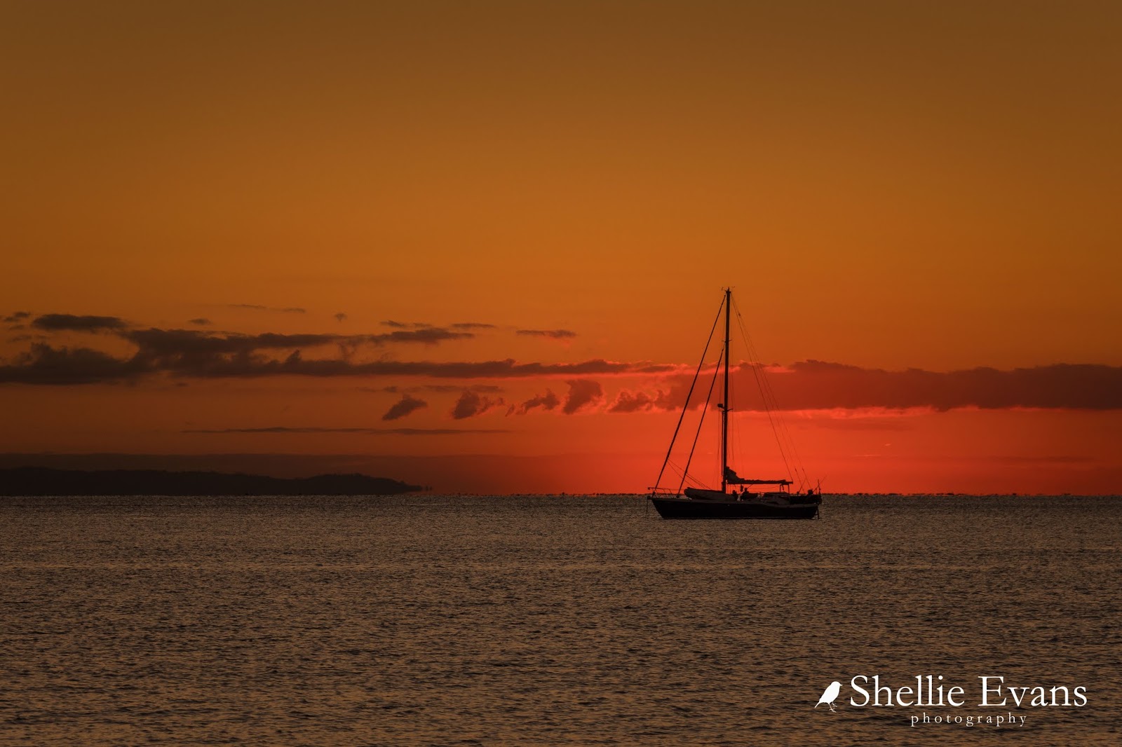
Fletcher Bay is at the end of the road, 6kms further on from Port Jackson and also on the tip of the Coromandel Peninsula. It's where the Coromandel Coastal Walkway starts (or finishes, depending on which way you walk it) and there's also a large DOC camp tucked into the valley behind the bay.


This road is also a narrow winding road which follows the contours of the land above the cliffs that drop off to the sea below. But this road is not suitable for large vehicles, not because of the road itself but because of a deeper than usual ford crossing not too far beyond Port Jackson. If you are low to the ground and/or have a long overhang you will scrape your backside trying to cross it. But if you do get through, make sure you vacate Fletcher if there's a major weather event forecast- you'll see why in my next blog. 

Fletcher Bay is tucked in front of The Pinnacles, the sharp tooth shaped rock ahead (a couple more are obscured around the point), that's Square Top Island centre left and a tiny portion of Great Barrier Island on the left.


From a look-out point half-way along the cliff edge the 180 degrees views out over the Colville Channel are magnificent- this is looking west towards Cape Colville, which forms the west end of Port Jackson...


... and east towards The Pinnacles, with Cuvier Island on the horizon. Cuvier, an uninhabited island is north of the Mercury Islands. You can see the road at the top of the bush line here, curving it's way towards Fletcher Bay. It's a long way down!


Overlooking Fletcher Bay, just before the road drops down to sea level. The camp reaches quite a way back up the valley behind the bay. Across the way you can see the start of the 10km Coromandel Coastal Walkway (and mountain bike) track which finishes in Stony Bay way over on the otherside of the peninsula and 50km by winding narrow gravel road from here.


We walked the track- to the middle and back from either end on our last visit to the Coromandel- 20kms in total. It was the best way to do it without having to catch a shuttle from the far end back to camp or in fact walk the full 20kms there and back in one day. The link above is the first half of the walk and this is the link for the walk from the Stony Bay end. I'd highly recommend walking all or part of the track though, the views are spectacular.


I did miss walking the Muriwai Track on our previous visit to Port Jackson, I left it too late and then the weather packed up. This time I had the grand idea of doing a daily 6km circuit, up the road from camp, along the Muriwai Walk and back home along the beach but in the end that's all it turned out to be- a grand idea!

Instead I got David to drop me up at the start of the track and then I walked back to camp.....once only! That's him driving home below.


The Muriwai Walk starts out looking pretty average, although there are lovely views down the valley overlooking the road.


But around a couple of corners and the views are absolutely breathtaking! The narrow track stretches out along the clifftop and disappears over the top of the knoll in the distance.


Flaxes, thick kikuyu grass and several large pohutukawa trees hang off the steep cliffs as they drop away to the rocky coastline below. Channel Island and Little Barrier Island are centre stage.


Looking back I can see Flat Top Island, the lookout area and the road to Fletcher Bay; this photo is the reverse of the Cape Colville photo, #3 up above, I hadn't realised that you could actually see the Muriwai track in that photo.


Over the knoll and Cape Colville comes into view with the track running along the top of the ridge line. There's a short track down the edge of this hill, down to the rocks below but it's very steep and I only climb down a short way, to a flat dusty scoop in the ground which looks like it's been a sheep's lookout at some stage. I take a few photos looking along to the Cape...


...and peer over the edge when I get the surprise of my life to see a fisherman on the rocks far below. Well I think it's a fisherman, I can't quite make him out so I zoom in and see that he's all set up for a day's fishing. Where the heck did he come from? And now I feel like I'm spying so I quickly pull back and head up to the track...


...to carry on along the top. The grass is thick and has overgrown the path in places, I have to thread carefully otherwise I stand on the long grass with one foot and trip myself up when the other foot slides underneath it as I step. I have visions of me slipping over the edge...


...and tumbling down the slope, snatching at the grass and flaxes as I whiz past. At least the fisherman would hear me screaming. Click the photo to enlarge, check the red arrow to see him from this angle. The sheep lookout I climbed down to is right up the top, on the edge of the photo.


Finally Port Jackson comes into view over the ridge to the left...


...and down below a tiny hidden cove. The track crosses a narrow ridge above the cove, then climbs up and off along the top again.


Once on the ridge I have a fantastic view of Port Jackson, even spotting 'Out There' tucked in front of the trees at this end of the beach.


And on the other side I now have a clear view of the little cove- apparently known as 'Bum Bay' by the locals for reasons that are now clearly obvious!


I take a few photos of the lovely pohutukawa tree hanging off the side of the cliff above the cove.


You can't see it in the photo above but each pohutukawa along the walk has it's own self-setting gas operated Goodnature possum trap attached to protect it from the furry pests. 


I climb the short flight of steps to the top of the cove, this looking back over the track and up the steps on the other side. It's no wonder there's a caution on the track signs to watch for windy weather.


My photos just don't do the scenery and views justice, many times I stood in awe taking in all the splendour. It is an absolutely spectacular walk and well worth doing, other than a couple of staircases there's not much effort involved either, downhill most of the way if you start at the top.


The track cuts through a farm paddock and finally winds down the last grassy hill to Port Jackson Beach...


...and there's 'Out There' looking very lonely all on her own at this end of the camp. 


I stopped to say hello to Mr & Mrs NZ Dotterel who are feeding near the stream outlet. That's a wind blown Mrs in the top photo, she's a little more nervous than Mr and skirts a wide circle around me as I crouch down to photograph them.


My arrival home is timed just right. The dark broody clouds, which sat high above the range inland from the coast have now moved out over the beach. There's a storm a brewing.


And here's one last photo, I just had to do something with that heart shaped planting of pines on the slopes above Port Jackson Station homestead... 


Tuesday 26 June 2018

A Return to Port Jackson- Coromandel

Catch-up

After 2 weeks at Simpsons Beach in Whitianga it was time to head north to our next destination and another one of our favourite camps in the Coromandel. Port Jackson is right at the top of the peninsula; a beautiful crescent shaped bay with a sandy beach overlooking the Colville Channel. Channel Island sits off Cape Colville at the eatern end of the bay and Little Barrier and Great Barrier Islands are on the horizon. The Port Jackson DOC camp stretches along the length of the bay with camping sites just a few steps up from the beach. 


Rather than travel all the way to Port Jackson in one day and have to drive the difficult last section of the road late in the afternoon we stopped at White Star Station for the night. The farm station is just a few kilometres south of Colville and it's where we stayed for a few days on our last visit. Back then we thoroughly enjoyed exploring the farm tracks and gold mines that are located up on the range above the farm. 


We were a little concerned that White Star weren't taking campers any more as their listing was missing from the NZMCA Directory (there are very few camping options at the top of the peninsula) but no, they are still happily in business. A son & his family now live in the farmhouse and are usually out on the farm for most of the day but people are welcome to drive in and park up in the paddock (if its not too wet) or along the back hedge and catch up with them later in the day. We backed into the feijoa hedge where there are a couple of power points available for a small charge. It was a good chance for us to recharge the batteries after being off the grid for a couple of weeks. 

The view from the feijoa hedge
We headed off the next morning, a little apprehensive and keenly aware that we were about to travel THAT road.  

It wasn't long before we came up behind a sleeper van dawdling along the road enjoying the scenery. As they pulled over to let us pass I spotted a flat tyre. I leaned out the window and asked if they knew they had a flattie. 'A flattie' they said 'what's that?' 'A flat tyre!' I said. 'Flat tyre? Oh no! I didn't know' she said from the drivers seat. 'I don't even know if we have a spare, we only bought the car 2 days ago' he said. 

Half an hour later we had them sorted (and they did have a spare though that was half flat too). That's David being David in photo #3, using the air hose as a mike... 'Now for the camera could you tell us how you're enjoying NZ so far and what do you think of the Coromandel?'


The road from Colville to Port Jackson is only 26kms long and while the first 15 or so kms are your standard narrow, gravel, slightly winding road, it's the last 10kms that are to be treated with caution. When Mr TomTom tells you it'll take 2.5 hours to travel 26kms you know you need to heed his words of advice. In fact this time it only took us around 90 minutes with the 5th-wheeler on the back (last time about 2hrs) and just 40 minutes when we travelled the road by ute one day.


I think I've already mentioned that we spent 6 weeks in the Coromandel on a previous trip, not long after we started with this lifestyle. In fact it was more of a shake-down trip when we threw ourselves into the deep end, travelling to and staying at sites that were often not recommended because of our size.

Huge Pohutukawa trees tower over road from both sides
It has actually stood us in good stead because we quickly learnt what our limitations were and have consequently travelled far and wide to many places others fear to travel. Even now, when we mention Port Jackson we often get horrified looks or mutterings of  'no way', 'not on that road'. And just in case you have missed them, all links I have included in the paragraphs above are of blogs on the road & Port Jackson from our previous visit.

Hmm...is that puddle a precursor of things to come?
The road is narrow, it has numerous blind corners, a number of shallow fords and once you start to climb, steep drop offs down to the rocky shoreline below; the key is to take your time and approach every corner cautiously, watching in the distance (if you can see) for approaching vehicles- little swirls of dust in the summer or light beams at night are good indicators.

Other than that it's a stunning road to drive with fabulous views out over the Hauraki Gulf. Unfortunately the sun was right in my face so I only have shiny shots to show you; here you can just see the road cutting through the cliff sides about a third of the way up.


This is the magnificent view out my window as we leave the rocky coastline behind and take the long slow haul up and over the tip of the range...


...stopping at the top for a quick 'must have' photo looking down over Port Jackson below. It's been a long time between visits but we feel like we're coming home.


We stop to check in at the DOC office and say a surprise hello to Ursula one of the camp managers who along with her partner Frederick have managed the camp for a few years now. They actually weren't in residence on our last visit to Port Jackson but we met them at Lake Rotoiti (Nelson Lakes) last year when they came to say hello. They've followed my blog and belong to a number of the same motor-homing Facebook pages that I do. Frederick arrived at our door later on to say hello and welcome us with some fresh snapper fillets! 


There are only a handful of campers in camp and we have the pick of the sites; we had a look at our last site which was in the middle of the camp but decided to head right to the end where we would be closer to the boat ramp and where we were sited right on the beach with fabulous views right around the bay. Sadly the sun disappeared and a big dark wave of cloud settled above us for the remainder of the day. 


By sunset the 'wave' was heading over the Hauraki Gulf towards Auckland.


The following day David got the Takacat ready for fishing....


...and there it sat for the next 2 weeks. The weather closed in for a number of days and then when the sun came out the wind blew and blew, on an ocean that was not very nice for a tiny boat to be bobbing about on.


We weren't too worried about the down time, we caught up on lots of computer work and enjoyed the rest and relaxation. And David became slightly obsessed with the mice he was catching in a couple of traps he had set up near our site- we lost count after 3 days, 15 mice in total! Others were caught and disappeared; we think stoats may have been carting them away in the night.

The last time we were at Port Jackson we also caught a few mice, a couple even drowned after they slid down the van tyre and into a bucket of water- I had felt sorry for them as they must have been swimming around and around all night. I hadn't known that they'd actually been inside the van, it was only after I found a half eaten marshmallow Easter egg a few weeks later, which I'd hidden at the back of the pantry, that I realised they'd been inside having a feast! They'd even eaten half the coloured foil!


From the dinning table, as I worked away at the computer, I watched the many boats and ships passing through the Colville Channel, including the the tall ship; the Spirit of Adventure on a particularly blustery day with it's sails reefed.


A couple of days later I spotted it again, heading in the opposite direction, this time with most of it's sails up.


Every night the sunsets were magnificent and perfectly positioned right in the middle of the bay...


...and these rocks, exposed at low tide, made for some great foreground interest.


One evening a fishing boat photobombed (in a good way) my shot as it motored through the channel.


 And on another evening a yacht came into the bay to anchor, making a great silhouette for my sunset shots.


As the sun moved towards the horizon, I captured it sitting atop the mast like a big golden ball of energy...


...before it slid down the pole...


...and out of sight.


It never fails to amaze me how slow the sun moves when you're all set up and waiting on the beach (in the cold air) for it to set and yet other times you just happen to glance out the window and see it racing for the horizon, only just managing to catch it before it disappears! 


A couple of times while I was dancing around on one foot trying to keep warm- having shot out of the van without my jacket and not going back for it in case I missed the million dollar photo (I wish)- I heard a little peep-peep near me as the resident pair of NZ Dotterels raced past. 


Finally the day arrived when the water was calm enough for David to go fishing (which was just as well as a severe case of cabin fever was brewing).


And we enjoyed the fruits of his labour for the next few days. 


Peace had returned to our little world.

New Moon