Showing posts with label Northland. Show all posts

Wednesday, August 31

Tinopai To Port Albert, Northland

Continuing on with my Northland blogs from February, 2019. 

From Dargaville we headed south to our next destination, Tinopai, a small settlement at the bottom of the Hukatere Peninsula, a reasonably large finger of land that juts out into the mighty Kaipara Harbour.

The Tinopai Camp Ground is right one the edge of the harbour with fabulous views out over the water.


It was the perfect spot to spend a few days relaxing in the middle of a hot summer.


Powered sites are available at the top end of the camp beside the water too & near the facilities, which, like many classic kiwi campgrounds are pretty basic but adequate. 


Of course the harbour is tidal and the view doesn't look quiet so inviting when the tide is out. Except when I captured it late in the evening, the sky with a rosy hue, as the sun dipped below the horizon behind us.


My sister & husband- who we'd seen several times while travelling around Northland- drove across from Whangarei to spend the night in their tent beside us before we headed further south & back to the South Island. 


There's a small marina beside the campground with the usual collection of small boats & old launches; some well loved, others that had seen better days. I didn't have to go far to capture the stunning sunrises either, just to the back of the rig.


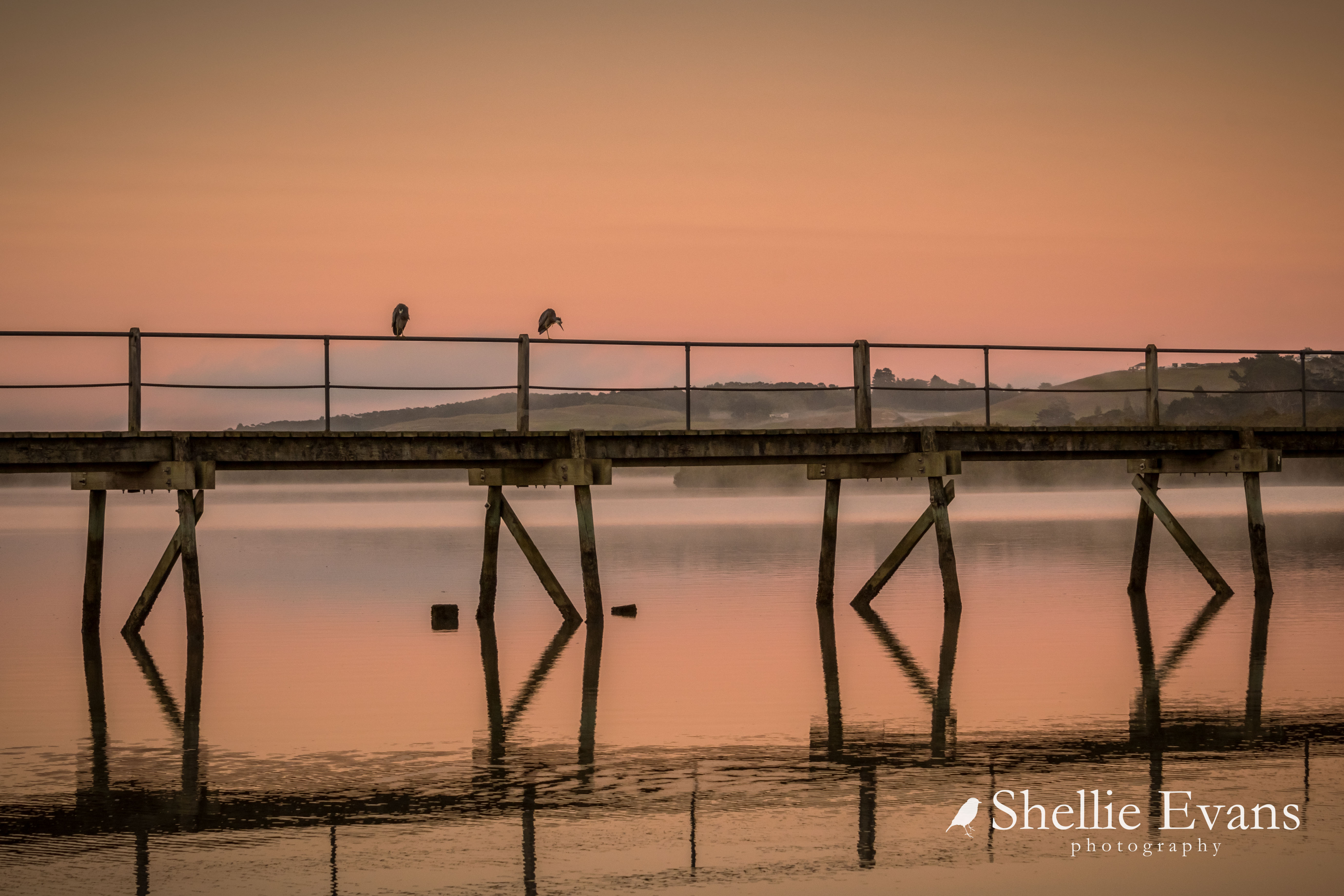
I wanted to take a sunrise photo of the Tinopai wharf which is about 2kms further down the road, I drove down to check it out...


And then picked the wrong morning to shoot it. Although I still captured the golden glow, I would have loved it had there been the cloud cover & colours of the sunrise up above in the mosaic. After an evening of great company, good food & fine wine I was a little slow in getting out the door in time to make it down to the wharf for that one. 


We stopped several times on our way down to Tinopai so I could add to my collection of country church photos. And this church was high on my list. 


The Parirau Zion Church is tucked down a lane off the main road. Since these photos were taken there is now a Parirau Church Restoration Committee who are fundraising to restore the church to it's former glory. The Zion Church was the the first permanent Anglican Church to be erected in the Parirau settlement in 1889. It replaced an earlier nikau (native palm) building and became the place of worship for the local Ratana congregation in the 1920s. 


Other churches (and a friendly mule) I captured during our journey down to Tinopai and around to Port Albert are below. Clockwise from top left are; the 1866-67 Matakohe Pioneer Church across the road from the Kauri Museum, St Michael on the Hill (1845) at Hukatere,  All Saints Church (1883) at Mititai, the Paparoa Community Church. And the final one is the Coates Memorial Church at Matakohe, opened in 1950 and the only church in NZ to be dedicated to a NZ politician; Joseph Gordon Coates (1878-1943) was a member of the House of Representatives for 32 years & Prime Minister from 1925-1928.


On our way to our next overnight camp at Port Albert we stopped at The Kauri Museum in Matakohe. 


We enjoyed our visit & had a good look through the many rooms & displays but felt we didn't quite do the visit justice. There were just so many rooms and nooks & crannies to explore with a lot of written information to take in too. It was another very hot summer's day and we were keen to get back on the road and to our next destination in the comfort of our air conditioned ute. This would be a great place to explore on a cold or wet day.


Our next stop was a freedom camping site at the end of the road at Port Albert, another settlement on the edge of the Kaipara Harbour but this time on the south side. We ignored our GPS which kept telling us to turn around and head further south & turn off the main highway at Wellsford. Instead we turned off at Te Hana and wove our way through some dodgy back country roads to Port Albert. 


The freedom camping area is right beside the harbour with another long wharf jutting out into the water.


But no marina this time just a handful of lovely old yachts & fishing boats anchored out in the main channel.


One of the reasons for stopping here was so I didn't have to cook dinner! No seriously I had read great reviews for the fish 'n chip takeaways from the Port Albert General Store, just up the road from the campsite. I can happily report that they were indeed excellent fish 'n chips. I wandered up the road to get them and then we sat outside under the awning eating them in the warm evening air as the sun went down. 


As you can see it was indeed a very hot day, and especially so with no breeze to speak of.


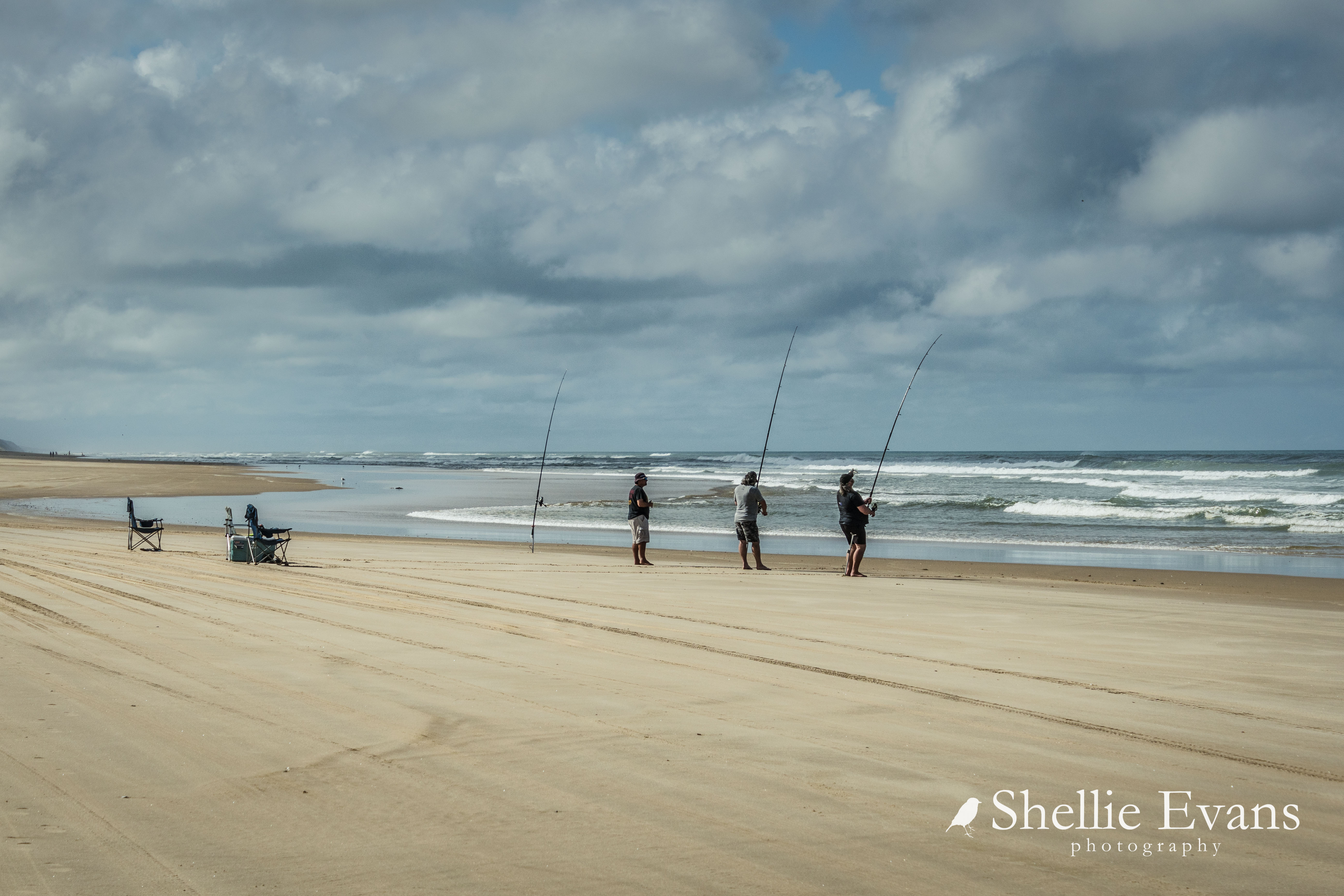
Locals came down to the harbour to fish & swim as the sun sunk below the horizon and temperature dropped a little. 


The next morning dawned clear and still with just a hint of mist rising from the water. It was going to be another hot summer's day.


Saturday, July 30

Dargaville & Ripiro Beach

 Here's another Northland post for you -

Ripiro Beach
From Kai Iwi Lakes we travelled on down to Dargaville stopping at the NZMCA Dargaville Park which is an interesting site located at the sharp end of a point between two rivers; the Kaihu River which joins the very wide Wairoa River. The park is just a short walk across the bridge into town so very conveniently located.

Dargaville NZMCA Park
On one of our 'exploring' days we drove over to Baylys Beach on the west coast to drive down Ripiro Beach which, as you can see from the sign, at 107km (66 miles) is New Zealand's longest driveable beach. Longer than the more well known 90 Mile Beach (which is only 55 miles long) in the Far North. 


We intended to exit at Glinks Gully as the tide wasn't suitable to carry on around the bottom of the Pouto Peninsula & exit at Pouto. We certainly didn't want to be trapped by the incoming tide on a remote beach or have to retrace our steps for many kilometres if we had had to turn around.

Baylys Beach entrance to Ripiro Beach
Being a Saturday the beach was quite busy in both directions...


...with many people surfcasting and families relaxing in the dunes.  


We passed quite a number of vehicles travelling up the beach in the opposite direction. 


And passed several areas where people had driven in to launch their boats & then parked up as high as possible to avoid the incoming tide. Unless you're a local or a regular visitor it would be hard to know where the entry (or exit) points are along the beach. Unlike the entry points that have settlements surrounding them many of these ones are stream beds, a break in the high dunes or are forestry tracks.


We slowed to watch a group launch their boat into the surf. David had kittens watching the ute back deeper & deeper into the salt water.


As most New Zealanders know our West Coast beaches can be treacherous to fishers & boaties alike even on relatively calm days. We breathed a sign of relief as they made it out over the breakers.


Ripiro Beach is also known as the Shipwreck Highway, it's the graveyard of dozens of early shipwrecks, some that still show themselves after adverse weather events & others that have long been lost to the elements or buried deep in the shifting sands. I kept a watchful eye on the edge of the dunes as we cover the kms, just in case I managed to spot one. No such luck.

Glinks Gully 
We exited the beach at Glinks Gully, a small settlement of baches tucked below a scrubby ridge with fabulous sea views but little shelter from the wild west coast weather. 


We drove along the 'waterfront' to a picnic area at the end of the short road to have afternoon tea before heading inland and up the peninsula back to Dargaville. We'll leave exploring the southern tip of the Pouto Peninsula for another time; there are huge sand dunes to explore, a campground & lighthouse to visit at the end which forms the northern entrance to the mighty Kaipara Harbour. 


On the return journey near Tikinui, we followed a dead end road which indicated we'd see the Wairoa River. We sure did, stopping at an old abandoned wharf overlooking a wide expanse of river...


... and a rickety walkway over swampy ground to a fishing boat moored in the mangroves.   


As is normal on our trips exploring, we stop so I can take photos of country churches to add to my collection and also any old or unusual buildings. There are several churches & this country hall along the peninsula's Pouto Road.


St Peters Church, Te Kopuru
Our next stop in Te Kopuru is when I see this wonderful cottage garden full to the brim of every kind of fishing buoy imaginable; flotsam & jetsam collected over many years. 


I'm sure this would be one of the most photographed houses in Northland if it was located on a main road and must give the owners much pleasure to see people stopping to view it. It reminded me of Owaka's Teapot World in the Catlins.


Not too far before Dargaville we passed Ernie's Park, I returned the next day to check it out (rather than foist it upon David after his long drive). There's a honesty box for your $2 at the entrance.


'Ernie's Park' is a long sliver of land located between a kumara farm on one side & a deep drainage ditch on the other from whence this family of grubby ducks emerged. They escorted me around the park for the rest of my visit.


It is a slightly run down park with a collection of kitsch, weird & slightly creepy displays, many items that have seen better days.


I did enjoy seeing the 'The Little Chapel', the smallest in NZ at 2x2 metres square, and now added to my church photo collection.


Ernie must have a fascination with 'long drops', there were several in the display.


I wasn't game enough to open the 'Weta Cave' door just in case there were weta in there or in fact it was another long drop with suitable mannequin ready to scare the living daylights out of me.


From the NZMCA Park I took a walk along the riverfront & then home back through town. There are many colourful boats moored at the boating club. In the photo below you can see the invasive Manchurian Rice Grass, a river pest plant in Northland that forms dense long-lived stands on land & water margins. It is thought the seeds arrived in ship's ballast in the early 20th century. 


The Wairoa River is Northland's longest river at 150km and was once used by kauri & flax traders. It's tidal for much of its length with a muddy bottom hence it's colour as it drains & fills from the Kaipara Harbour.


Looking back along the waterfront past the Band Rotunda to the junction of the two rivers & the NZMCA Park to the left in the trees.


And the park from across the Kaihu River.


The next day we headed south again crossing the Wairoa River bridge on the way out of town.