Tuesday 30 June 2015

The Big Snow- A Winter Whiteout

I arrived safely back in Winton last evening tired but happy after an epic 900kms round journey to the snow. I had an awesome three days and saw some amazing sights and beautiful scenery and even though I missed the hoar frost I’m so pleased I made the effort to visit. It might be another ten years before the McKenzie Basin sees a similar snow fall, I've heard that it was the heaviest dump Twizel has ever seen.

As you can imagine I have hundreds of photos to process so I’ve selected a few to post here and once I have the remainder sorted, I’ll upload them to my Flickr Albums and post a link to it in another blog post.

Sunrise, Tekapo River with Mt John in the background.


I went for a early morning walk from the motel before the sun was up and there were people walking around the Church of the Good Shepherd and the Sheepdog Memorial even at that hour! The stairs and ground around both were treacherous; the snow had compacted and formed solid ice. On these stairs the right hand side looks ok but in fact it was the most dangerous- with no hand rail and solid clear ice on every step. Even the ground in front was solid ice.


I took this one of the church on my way back after the sun had popped above the mountains, the safest place to walk was along the road as all the paths and walkways were ice and slippery.


I drove around to the NZMCA Tekapo Park where we stayed a few weeks ago. I had to leave the ute on the road and walk in through knee deep snow…crunch, crunch, crunch….the top had melted and then reset forming a crust over the powder snow underneath.


It took a bit of effort to walk down the drive to the park area. I saw snow-shoe footprints along the waterfront, that would be the way to go! Along with my footprints there were also plenty of rabbit footprints (and hungry rabbits running about). I’m glad we weren’t parked in here when the snow came overnight, we’d have got a hell of a fright waking up to this.


Lake Tekapo from the Tekapo Springs walkway.


While many businesses were cursing the snow, there were some reveling in it. Tekapo Springs hot pools were popular along with the tube park.


There’s no need for the synthetic carpet or snowmaking machine to line the run at the moment.


I found this interesting ice sculpture in the carpark- the snow has slowly slipped off the roof, curling on it’s way and then refreezing overnight.


Once I was happy that any black ice would have melted I left Tekapo for a slow wander back towards Twizel. This is Braemar Road near the Military Camp and just south of Tekapo, it may look driveable but the tracks are ice.


I was able to pull over into a few side roads and some driveways that had been cleared so I could take photos. I know it probably doesn’t look too bad but the cleared areas were often frozen snow and very slippery. And what you can’t see on this beautiful sunny winter’s day is the gale force wind that is blowing. In one case I couldn’t open the door against the wind and had to climb out the otherside.


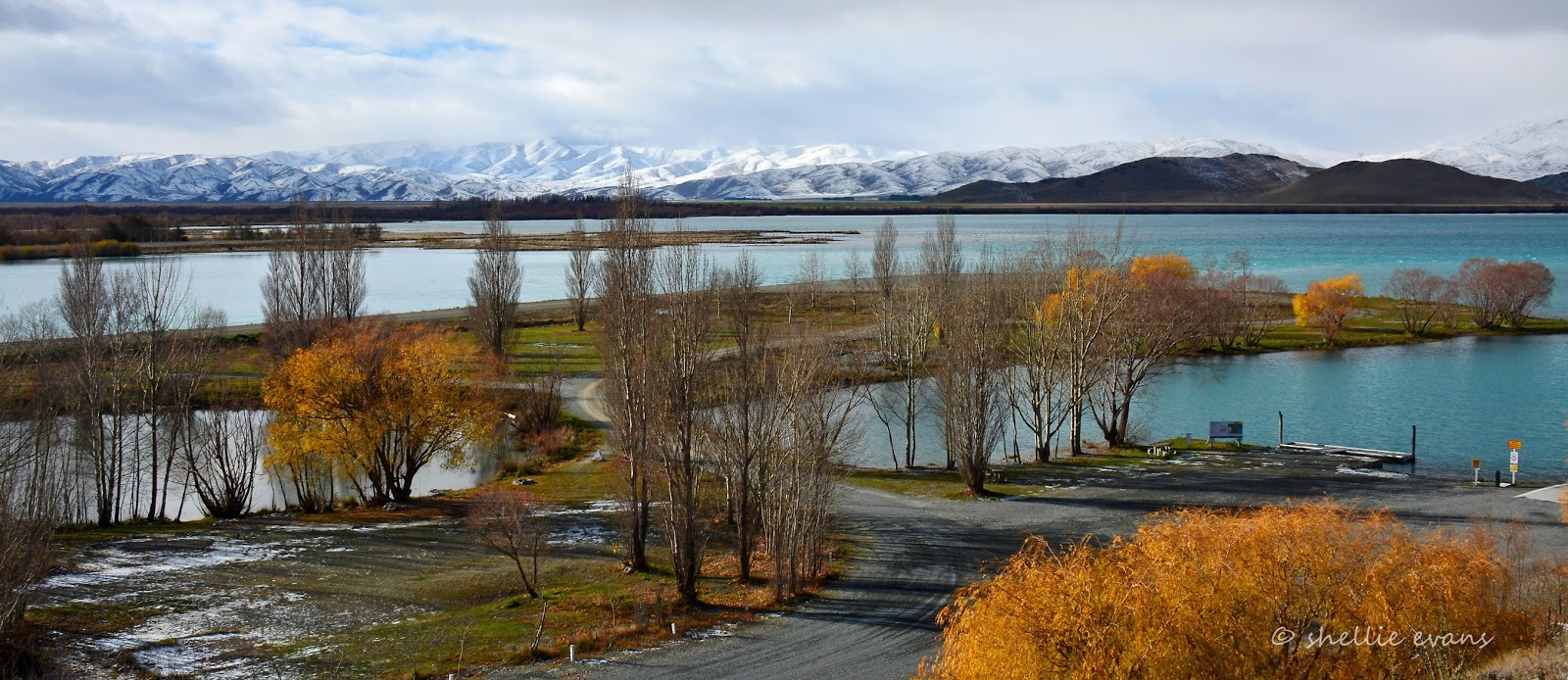
The Pukaki dam and canal just past the Lake Pukaki Mt Cook lookout.


I turned off at the bridge over the canal (you can see the bridge on the horizon in the photo above) and headed along the canal road around the back of Twizel.


Stopping at Loch Cameron which appeared to be just about frozen over. You can also see two guys on bikes on the right hand side.


They decided to check out how frozen the lake really was; slowly, cautiously inching their way out to the middle.


Before one guy bottled, turning tail and pedaling mad as, back to the edge quickly followed by his mate. I wonder if they heard a cracking sound.


A casualty of the big dump that not many would think about are the birds; on the main road between Tekapo & Twizel I passed over 50 dead magpies, a dozen harrier hawks and many blackbirds, all road kill. With very little food available they are feeding on other road kill and being hit themselves. I saw a truck hit six birds at once, they're not lifting in time and of course the vehicles can't swerve to miss them. 

I did feel sorry for the farmers and their stock. Ten days and counting with thick snow on the ground, the sheep were confined to a small flattened area where hay had been fed out. At least the sheep had wool to keep warm, it was the dairy cattle I saw huddled in deep snow with no shelter that looked unhappier. Perhaps these conversions are moving too far into the high country.


Muddy farm tracks snaked across the pristine white expanse leading from hay supplies to groups of stock holed up in their snowbound paddocks, 


Farm entrances were also muddy and icy, tractors being the main source of transport to the outside world.


How many guessed the source of these icicles in the last blog post?


A leaking farm irrigator.


And one last photo of the Old Iron Bridge again, this time without the shade on the bank. Pretty spectacular scenery don’t you think.


Well that’s it for now, I have so many others to share. Hopefully I can get onto them soon. And continue to catch up to date with the remainder of the blogs.


Saturday 27 June 2015

On the Road to the Snow- MacKenzie Country

Another interruption to the time line....

Yesterday I drove all the way to Tekapo to check out the big snow dump that fell just over a week ago. I was hoping the hoar frost that had been reported mid week might have stayed around but it looks like it's well gone. But still what a wonderful sight all that snow is. Here's a small selection of photos I took along the way.

Approaching Lindis Pass summit-


Of the cars that were on the road, two thirds were rental cars and motorhomes- some with no worries about pulling off the road into the snow and ice even when an abandoned car was in full view.


Lindis Pass Summit with the road cutting down through the centre, it's all downhill from here. 


Approaching Omarama where overnight temperatures fell to a bone chilling -21c last Tuesday night.


Another snow covered church! I'm on a roll. Actually I was very nearly on a slip-slide.....I stepped out of the car and onto a big sheet of ice and I just about went arse over kite. Tricky, I learn fast though- step on the powder snow and you're ok, step in the slush and you'll have wet feet, step on compacted snow that's turned to ice and you're a gonna.


I wonder if you can work out what is making these icicles on the fence? You'll have to wait for another blog post before you find out.


The Ohau B Canal camp where we were parked up just a few weeks ago.


There's no way anybody can get into the park at the moment, under the thick snow is ice and at the entrance, it's very slippery and compacted. And no, I didn't drive over all this, I backed the ute into a space off the canal road which has been graded.


Looking down the canal, there were even a couple of fisherman on the edge trying their luck. 


And here's a picture postcard, the old Iron Bridge (seen in the last post) now surrounded in snow. It was a little late in the day and the bridge is in shadow, tomorrow I'll stop again and get it without the shade. 


I couldn't go past the Mt Cook lookout without taking another shot (and the clearest view of the three visits).


Aoraki Mt Cook, Lake Pukaki and snow covered rocks.


Really, it's a wonder there aren't more accidents, the lookout carpark was covered in snow, slush and ice and yet most people just roared in, not slowing down at all, drove on right to the end and half 'slid' into a park. The cautious ones (me and one other) drove in and parked near the exit. Even getting out of the car was a mission, a sheet of ice again. I had to sidle around the back of the ute holding onto the edge all the way.


The snow is getting thicker, the outlook prettier....


Irishman Creek again, this time under snow


Ah-oh....road stop ahead. Just past the Tekapo Golf Course (try finding a golf ball in this lot) the road was down to one lane through this shaded section where it was mostly grit and slush but starting to ice up again as the temperature dropped in the late afternoon, -4c on the car temperature gauge.


While waiting for our turn to move, I got out to take a photo of the cars lined up and the river below. It wasn't until I heard voices that I realised these goons were calling for me to take a photo of them. Friends of Prince Harry perhaps....


We crawled the last 5 kilometres into Tekapo, the road was icing over quite quickly and still there were cars heading in the opposite direction with a long way to go before they were clear of the snow. In fact as I took the photo of the Omarama Church, the road sign for those heading south over the Lindis changed from 'Winter Driving Conditioins- Extreme Caution' to  'Chains Required'- I wonder how many have been forced to stop in Omarama for the night.


Who would have thought I'd have been back here so soon- Tekapo's The Church of the Good Shepherd......still with a bus load of tourists swarming over it.


A sunny day ahead and I'm looking forward to slowly making my way back to Omarama where I'll spend tonight. This adventure is all about exploring the South Island in all the different seasons, and that is what I'm doing, 'Out There' enjoying it!

And just a disclaimer- all photos that look like they were taken from a vehicle were taken while said vehicle was stopped, albeit in the middle of the road. There was such little traffic on the road that this was quite possible without endangering anyone or any vehicle. OK......David, Mum. Dad, Rachel.....?

PS to my followers, apologies for the extra emails, I had a hiccup with the posting!


Let it Snow

You’ll remember my blog interruption to report a magical overnight event while we were parked at Ohau B canal. Snow fell soundlessly during the middle of the night, the first snow of winter and a forerunner to the latest big dump.


I say soundlessly but I’m sure I could hear the soft patter of snow being blown against the side of the van later in the evening. It was bitter cold and very windy when I looked out but I couldn’t see a thing and certainly not anything white. With snow forecast & the wind hitting the van side-on we decided to pull the slide-out in so the awning over the top didn’t billow and bow and then fill up with snow when that arrived. You can see here, that the snow came from the back quarter coating the corner of the van and ute.


I got up, just as the sun rose, to a beautiful snow covered landscape outside. I headed out to capture the scene before too many people were up and about and disturbing the snow. A few vehicles had already crossed the bridge but the pedestrian strip was clean and smooth. And slippery. I crunched by way across the bridge and back again.


Once the sun rose above hill behind, the scene changed again, bright white and azure blue everywhere. That’s the other Ultima 5th-wheeler in the photo below.


Later in the morning we took a drive down the canal road towards Lake Benmore. The snow had already started to melt and I was keen to see how the much was on the surrounding mountains and farmland.


We came back past this farm just 45 minutes later, the snow was fast melting in the early afternoon sun.


Ohau C canal with Lake Benmore just coming into view on the right. The mountains in the background are on Black Forest Station, where we had lunch on our epic road trip to Haldon.


There’s a campground at the very end of the canal, next to where it enters Lake Benmore, nearly as large but not as spooky at the one over the otherside of the lake at the Haldon Boat Harbour. This large pond is in the centre of the campground.


Standing on the ridge behind the campground looking out over the boat ramp on the right, the pond on the left, the canal outlet centre middle and across the lake to Haldon campground in those trees in the centre.


And a close up; you can see that the ‘road from hell’ isn’t actually too far away as the crow flies but a very long way by road. That’s the Grampian Mountains behind with Hakataramea Pass in there somewhere.


There is another campground further down the lake edge but we decided we didn’t want to follow a wet and muddy gravel road to check it out, so after having a look around this deserted campground and deciding it would be quite a nice place to stay in the summer, we headed back up the canal road criss-crossing below and above the two power stations on our way. This is Ohau C Power station, you can see two guys fishing in front of their vans and a guy in a orange safety vest near the base.


We drove along the bottom being dwarfed by the penstocks which are humongous….


…and then back over the top, stopping to have a look over the edge where we could see over the power station to the canal outlet into Lake Benmore behind. I hate the sound of rushing water but I had to walk over a grille covered platform to get to the edge, far below my feet in the darkness was the scary sound of rumbling and turbulent water. Talk about walk on water, I skipped across the wide grille as fast as I could without looking down.


Safely back over the grille and onto the other side looking over the concrete edge to the penstock entrance, the view up the canal is stunning. I just can’t get enough of that beautiful azure blue.


Spot the difference? Different fishermen & vehicles. This is Ohau B Power Station further on up the canal and the exact twin of Ohau C having the same generating capacity and similar equipment. They were the last two of the eight Waitaki Hydro Scheme power stations to be completed, in 1985.


One last stop just a few steps from our canal campsite. This is the historic Iron Bridge over the old Ohau River completed in 1890. Crossing rivers was often dangerous for early travellers and drowning became known as ‘the New Zealand death’. Before this bridge was built, the Ohau river was crossed using a wire rope and cage. At first authorities were reluctant to replace the cage with a bridge as they were worried it would help the spread of rabbits.

The river now forms Lake Ruataniwha and the water is diverted into the canal….


…leaving just a large deep pool under the old bridge and for the short distance along the old river bed.


It’s beauty is overshadowed by the Lake Ruataniwha spillway concrete monstrosity which is just behind the old bridge (the main highway crosses over the top of the spillway)


Any excess water from the lake is released over the spillway and down this ‘new’ river bed which runs alongside the pool. It must join the old bed further down.


After the latest big dump of snow in the area, I suspect that the spillway might be put to use as soon as the big melt gets underway.

Stop Press......does this look familar? Look same, same but different? That's because it is! A deserted NZMCA Park at Ohau B canal. In case you're wondering, I'm on my own little road trip- I'm not a storm chaser, I'm a snow chaser! I've left David keeping the home fires burning and I've travelled all the way back to Tekapo for a couple of days to see what I can see. So far it's been snow, snow and more snow!


More to come soon...