Catch-up
From the Catlins we headed inland as we needed to be in Roxburgh for Waitangi weekend. I'd seen the Lions Club 4x4 safari advertised earlier in the year and put it in the diary 'just in case' we were in the area. At that stage we had no firm plans of where we'd be but as it worked out we were going to be passing through Roxburgh on our way to the next destination. We've been on several 4x4 safaris during our time on the road and have thoroughly enjoyed them, the most memorable one being through Nokomai Station & the Garvie Mountains. We still talk about the fun we had on that one.
 |
| Roxburgh Trotting Club |
 |
| Sunrise- Roxburgh Trotting Club |

For the first part of the safari we were driving through the 21,000 hectare (52,000 acres) Earnscleugh Station which stretches along Old Man Range from Fruitlands in the south to the Cromwell Gorge in the north and over the range to the Southland boundary.
Hmmm....we thought, this is going to be a dusty trip, hoping that it was just this section but knowing that it probably wasn't as it has been a very dry summer.

Our next stop was beside Earnscleugh Station's woolshed, where many made use of the loos and we listened to our leader as he explained the programme for the day & gave us a little history on the station. He was also going to be positioned in the middle of the vehicle line broadcasting on a dedicated FM radio station as we passed various points of interest along the way. This was a great idea but unfortunately it depended where you were in the line as to whether you heard him or not.

Many of us were fascinated with the farm's 'Bath House' which was parked near the woolshed.

Yes, I said 'parked' because it wasn't until you got up close to inspect it that you could see the Landrover inside. Complete with a bar & bar stools on the back, it was driven to local parties. If only walls could talk, I bet it could tell many a strange tale.

From the woolshed we headed north along the bottom of the range exiting out the actual entrance to the station near Conroys Gully.

Our next point of interest was the old Earnscleugh Homestead, but sadly (for me as a photographer & collector of social history photos) the planned stop was changed to a drive past as timing was of essence and there would have been too many vehicles & people to wrangle back on track.

Earnscleugh Station homestead was built in the 1920s and modeled on a mansion the then owner Stephen Spain saw in Uruguay. There is now a new homestead on another part of the station and sadly this one is unoccupied as it needs extensive & expensive renovations.
As we filed slowly through the front garden I jumped out of the ute and ran across to the grand entrance quickly snapping a few photos before having to clamber back in before the row of vehicles disappeared around the back of building where we also passed the staff quarters & stables built in a similar style.
NZMCA members may be interested to know that the Clutha Valley Area held a rally in the homestead's grounds some time ago, maybe they'll do that again sometime in the future (and let me know!).

From the homestead we headed along the back roads towards Fraser Dam Road passing these poor cyclists along the way. They must have wondered what on earth they had struck with so many vehicles passing them on a deserted back country road. They would have been covered in dust from head to toe by the time the last of the vehicles passed them, that's for sure!

Once on Fraser Dam Road we started the gradual and winding climb to the top of the range. Horse trekkers & cows stopping to watch the long procession pass by. We've actually driven the Fraser Dam Road before, which finishes at the dam. This time we passed the dam turnoff and took the Prospect Hill Track straight to the top.

At one stage the vehicles ahead all came to a stop which meant the photographers amongst us could jump out and take a few photos...

...looking down below us as the rest of the fleet wound their way up the range (remember to click on the photos to enlarge).


When the vehicles started moving again fairly quickly and I had to race back to the ute before David pulled away, it suddenly dawned on me they'd stopped to open a gate, one of many to be opened & closed during the day.

Near the top I managed to get the window down and take a photo of a hut tucked into a small gully, as we passed by. I didn't manage to take a photo of the sign telling me who it belonged to though.

At least there was a bit of a breeze at the top to cart the dust away, well a little bit of it anyway.

Just as we begun to wonder when we'd stop for a break we arrived at the top and parked up amongst the snow tussock and spiky Spaniards. People started heading to a style on the fence, and like sheep we all followed. And it wasn't until many of the men & a few ladies headed off in different directions towards the large rocky tors that we realised they were looking for somewhere to have a pee!
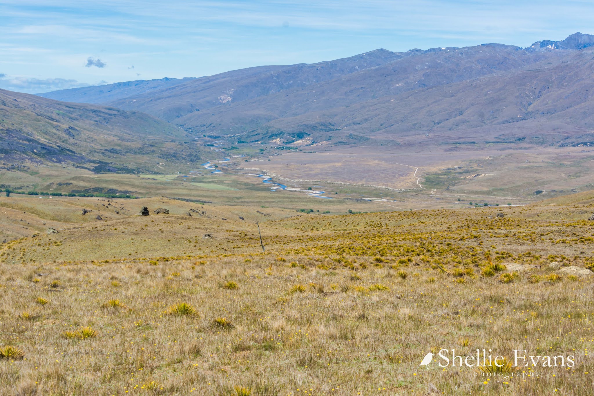
Once that was sorted we gathered in a group for another talk, it was very hard to hear the speaker from the back but I gathered we were overlooking the Earnsleugh/Fraser River valley in one direction & the top of Old Man Range in the other. And that during the 1800s Otago gold rush there were many small settlements spread across the surrounding mountain tops mining for gold.

Originally the safari was going to continue along the top of Old Man Range past the Obelisk but the scouts who'd checked on the route earlier in the week decided there were a couple of curly sections that may not have suited the 'shinnies' (street going 4x4 vehicles) so we had to re-trace our steps back down the range. Once at the bottom we stopped for our picnic lunch, many of us seeking out shade in what was a very hot day.

The day before the safari, motorhoming friends Linda & Scotty had stopped at the Trotting Club to say hello, they were staying down the road at another POP and were also going on the safari. We'd both been up near the front of the procession for the first half and after lunch we made our way back to Roxburgh and waited at the bottom of Coal Creek Road which was the meeting point before we tackled the next section.
At first we were the only ones there & we began to think we'd got it wrong. Then several others trickled in to wait and we wondered how long it would be before the full fleet arrived. After a short discussion we made an executive decision to head off up Coal Creek Road and onto Mt Hope Road to the top of the range and either wait up there for the others of continue on along the top.
This would give Linda & I a chance to stop and take a few photos, something we were both missing doing. We stopped several times as we climbed higher taking photos of the Roxburgh Dam, Roxburgh township and the Clutha River. I picked up the Trotting Club & the rig in one photo (top right).

On one of the stops, I zoomed in on the meeting area and saw that there was now a good number of vehicles waiting, it wouldn't be long before they pulled out and followed us up the road.

We pulled over again as we reached the top so we could get another shot looking down over Roxburgh and as I headed back towards the ute...

...I looked back down the road and saw that the posse was coming!

And in fact they were very close to catching us up. I ran back to the ute...

...and jumped in. After a brief discussion with Linda & Scotty we decided our rebellious streak was over (although David was keen to hit the throttle) and we pulled to the side to let the leaders past and then cheekily pulled back in line when a gap appeared.

The dusty 'road' had now turned to a dirt track which made for a much more pleasant experience and being such a clear day we could see for miles.

Across the Clutha Valley which was far below us, we could see the Knobby & Lammermoor Ranges, and somewhere out there one of favourite lakes, Lake Onslow.

We passed through Black Jack Station & Mt Benger Scenic Reserve as we travelled along the top of the range from Roxburgh to Ettrick.

There was great excitement & much gesturing to vehicles in front & behind when a Karearea/NZ Falcon flew past the procession at a fast rate of knots (top right, below) and then even more exclamations & gesturing when the front vehicles spooked a small group of seven wild deer who raced off across the tussock. I managed to grab a long distance shot as they hesitated for a moment before fleeing over the edge.

We haven't seen too many wild deer on our travels but a few years ago we saw a wild fallow stag on Mt Hope Road (where we started this section) when we drove to the top of the range. We'd seen it on the way up but it ducked out of the way, so on the way back down we had another look for him. I'm sure he thought he was well hidden.

After many gate openings across the top we started to head down off Mt Benger...

...into Ettrick

Here's a tip for you if you're travelling in a group and there are gates to open & close, if the first vehicle leaves a rock on top of the gate post when they open it, then tail-end Charlie knows to shut the gate. If there's no rock, the gate is left as it was, open.

Our hosts waited at the last gate and the exit into the valley, waving and thanking us for attending their fundraiser. We tooted our appreciation and then 66+ vehicles headed back into civilization and home (to wash their vehicle if they were lucky enough to have water, unlike us who had to wait until a suitable source was found).
We had a great day although we'd probably have forgone the Fraser Dam Road loop having done the road before and knowing how dusty it was.

Side note; I am asked often how we hear about the 4x4 safaris. There's no hard & fast directory for them. I usually stumble across them on social media or see them advertised on the side of the road as we pass through a town.
Many small town organisations; including primary schools and Rotary & Lions Clubs hold them as fundraisers. They are usually held during the first three months of the year, when the weather should be good & the tracks dry and while we've only done them in the bottom half of the South Island, I've seen them advertised nationwide.
I haven't been able to join the dots on the tracks up to & across the top of the ranges (not drivable or not public land according to Goggle) but have put markers to show the route taken.