April 10, 2017

Exploring South Otago- Part 1

Real-time

We're back in Central Otago now, ambling slowly towards Queenstown, where we need to be, to welcome family who we haven't seen in a long while, when they fly in from Australia for Easter. Our Winton family are coming to Queenstown too, so it's going to be fun weekend.

After we left Dunedin we stopped at Taieri Mouth for a few days, you'll remember that's where I shot the Southern Lights from. 

We stayed at a very popular NZMCA CAP (costs apply parking) stop-over owned by Keith and his very cute little dog Charlie (who took a liking to our outdoor mat). 


This was our view.....out the side window. Keith certainly loves his boats, he'd just bought the red one a week or so ago.


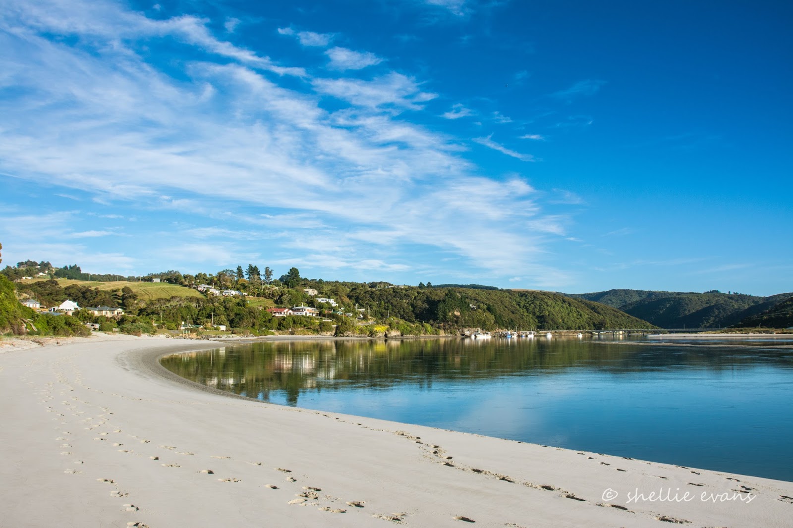
This was the view out the front...


...with this stunning beach and clear water just a few steps away from our van. This is the tidal estuary and mouth of the Taieri River, the same river that we've followed and crossed over at various times from its headwaters in the upper Maniototo right down here, to the mouth. 


The main reason we actually headed to Taieri Mouth wasn't because of the aurora (although that was a lovely bonus), it was because we wanted to revisit a tiny little island just off the mouth of the river; Moturata Island. We'd stopped here at Taieri Mouth over 3 years ago, not long after we arrived in the South Island. 

Moturata is a special nesting area where a number of sea birds breed, including Little Blue Penguins. The season is well over now but we were hoping to maybe see a few stragglers. Access to the island is via a sandbar that is only exposed 40 minutes either side of high tide. The tide was in our favour but we had to anxiously wait to see if the morning's fog withdrew before we made our way out to the sand bar. It was late morning before it had retreated enough for us to see the outline of the island ahead of us.


And then as we waded through the retreating tide, the sea fog rolled back in...


...until we couldn't see a thing. As we waded on we suddenly realised that the river mouth had shifted since our last visit. It had moved to the south side of the sand bar and was now roaring out into the ocean right there in front of us blocking our way to the island. And at the speed and turbulence it was passing by us, there was no way we were going to get across it. 


We walked to a narrow section of the river further back to check the other side out and to see if we could possibly come in from the north side on the next day's low tide. There looked to be a second mouth heading out to the north as well.  Keith told us later (we should have asked him first), that for the last few months there have been two mouths to the river, both quite shallow and causing concern for some of the fishing fleet tied up at the wharf, as they could only get out and back in at the top of a tide.

Disappointed we'd been foiled in our attempt to reach the island we headed home. Here's the link to see the photos of the Little Blue Penguins and gull chicks we saw when we did manage to get there on the last visit.

You wouldn't believe it but this was the clear view we had looking back at the estuary on the way home.


And yet looking to our left down the coast, the fog was still drifting in and out. Can you see the fogbow? And yes, a fogbow is a legitimate phenomenon- because fog water droplets are very small, fogbows have very weak colours or no colour at all, this is when a fogbow appears white, they're sometimes called white rainbows. This is the second one I've seen on our travels, the previous one was a lot clearer, you can see it at the bottom of this blog from Moeraki.


Our next stop on our meander back into Central, was at Milton, a small town on SH1, just before the SH8 turnoff to Central Otago and Queenstown Lakes. It's a town that most people pass through on their way to somewhere else. We stopped this time and stayed at the council run campground at Taylor Park, we had a couple of nearby places we wanted to explore and laundry to do (and at $2 a load it's the cheapest we've found on our travels). Nice clean facilities too.


The weather wasn't that great but we headed out anyway, our first stop was at Toko Mouth on the coast, 18kms east of Milton (half of them gravel).


Toko Mouth is time stood still, an iconic sleepy Kiwi beach settlement like they used to be. 


The tourist trail hasn't reached out here. Yet. But when it does they're prepared....just in case you need Specsavers. 


We walked out to the mouth of the river, this is looking back towards the settlement.


The beach is wild and rugged, a sign says it's unsuitable for swimming. Bull kelp litters the beach and waves crash around rocks further south.


There's a rustic collection of well loved cribs dotted in amongst the dunes and along the road.


Some overlook the estuary, and as befitting their superior location, come with extras although I think an extra fence wouldn't go amiss. 


I twisted David's arm and managed to convince him to carry on down the coast to complete a long loop back to Milton. I mean what's another 20kms of dust when you've already travelled over 10kms? The coast road was very undulating and actually wasn't that dusty....probably due to a thick salt spray coating!


Other than the small beach settlement of Wangaloa, it's mostly farmland along the way...


...and this rather dilapidated crib beside a small stream estuary.


We take a brief detour through Kaitangata (pop. 800) so I can grab a few shots for NZ Heritage. Kaitangata is on the left branch of the mighty Clutha River, just downriver from Balclutha and not far from its outlet. Kaitangata's recent claim to fame was a recruitment drive for new residents where they were offered employment and very favourable house buying packages.


We then headed north, back to Milton, passing what looks to be a great bird watching spot, Lake Tuakitoto, along the way. Weary from our afternoon's travel and keen to get home, we stop only briefly to check with our binoculars. There's plenty of water fowl on the lake; ducks, geese and swans, even a family of swans which is very late in the season, especially with duck shooting fast approaching. I'm sure plenty of other more elusive bird species would be lurking around the edges of this shallow lake.


To be continued... Part 2


April 05, 2017

High on a Hill- Larnach Castle

Real-time

After visiting Tunnel Beach we made our way back over the hill and down past St Clair Beach...


...stopping for a brief stroll along the promenade to the salt water pool and back again.


Then it was onto Highcliff Road, a white-knuckle road that runs along the top of the Otago Peninsula. Actually it's only white-knuckle if you let the views drag your eyes from the road and/or you meet nervous drivers coming the other way. 

The views up and down the harbour are spectacular. That's Dunedin city to the left, you can see the white roof over the Forsyth Barr Stadium, Mt Cargill is top centre, a small tip behind the tree covered hills at the front. Taiaroa Head is to the right, way back behind the small peninsula that sticks out into the harbour . Port Chalmers is across the water from that peninsula, just behind the small island (click photo to enlarge).


It was getting late in the day but I wanted to visit Larnach Castle while we were in the area, we may not be back this way again. It was $33 to visit the garden and take a tour through the castle or $18 to take a self-guided walk around the gardens. The castle part of the tour was due to close shortly after we arrived (4:30pm) while the gardens were open until 7pm.

This worked out well because I didn't really need a look inside, I was happy to just view the gardens. But what I really wanted was a shot of Larnach Castle without any people. Fat chance. People and tour buses! Why they needed to park their buses right at the front door I have no idea.


Foiled at the first attempt I thought I'd start my wander through the gardens. The Laburnum Pergola would look spectacular flowering in the spring and even better when it matures in a few years time.


I've seen the Laburnum Arch flowering at Bodnant Gardens in North Wales, it's a magnificent sight. Click on this link to see the Larnach Pergola flowering, it still looks beautiful.

Bodnant Gardens, North Wales
Beautiful 'goblet like' colchicum, aka autumn crocus are flowering under the laburnum and in the naturalized 'Field' next door. They bring back memories of our secret find at Cambrian near St Bathans in Central Otago.


The pergola leads to the 'Green Room' and 'Reflection Pool' which is also looking a little 'green'.


I head back to see if the people have moved on. No chance. At least the bus has gone.


I carry on towards the back of the Castle passing the Petanque court & creamery and finding myself on the 'Wishing Well Lawn' and 'Alice in Wonderland Garden'.


Next is a walk through the 'Perennial Border' garden where I manage to capture (as in photograph not catch) one of New Zealand's endemic butterflies, the Red Admiral.


On past the 'Cupola'- from the sailing ship 'Zealandia'- it was installed at the Castle in 1927...


...and back to the Castle where it looks like no one is in a hurry to move.


I check out the Ballroom Cafe where there are just a few people finishing their afternoon tea...


...and with nobody sitting outside, I have my fingers crossed that the buses have carted them away. 


Things are looking good as I make my way across the lawn in front of the 'Tapestry Garden' and cafe...


...and back to the Raised Lawn in front of the Castle. Darn! There are no people just the Castle's mini van!


So I do another lap, heading down to the 'South Seas Garden' and the magnificent views from the Belvedere (an architectural structure sited to take advantage of a fine or scenic view). Three tourists have hogged the view and can not stop raving about the scenery to each other (and anyone else within earshot). 


Here's a classic New Zealand scene; blue skies and blue seas framed by our native Christmas Tree, the Pohutukawa and in the centre another native, a young rimu tree.


The visitors are still extolling the virtues of the views from the Belvedere...


...as I carry on around to the back of the Castle once again, past Larnach Lodge and the old stables (both available for accommodation) and stop to check out the remains of the privy building where, along with horse manure collected from the nearby stables, methane gas was piped to the 'big house' and mixed with acetylene gas to power the Castle's chandeliers.


I head back to the front lawn, only to find one lone guy standing there staring in contemplation at the Castle.


I wait patiently and then finally everyone is gone and I can capture Larnach Castle in all its splendid glory....except when I look closely now at the photo, I can see the lone guy disappearing through the door!


In 1870 William Larnach chose this site to build his magnificent mansion. He was an Australian banker who came to Dunedin lured by the gold rush wealth. William lived in the Castle with three successive wives until 1898 when he took his own life in New Zealand's House of Parliament. Larnach's children (five from his first marriage) sold the property which then changed hands several times and was twice abandoned.

The current owners took over the derelict Castle and 14 hectares of wilderness in 1967 and have worked tirelessly since restoring the castle, and rediscovering and developing the gardens & grounds.


David leaving for work...


April 01, 2017

Tunnel Beach- Dunedin

Real-time

Tunnel Beach is a popular short walk just south of St Clair, a beachside settlement 8kms from Dunedin's city centre.


The first half of the 2km return walk descends 150metres and drops quite dramatically down the side of some pretty magnificent sea cliffs.


The return journey involves an equally dramatic gut-busting climb back out! 


The object of fascination is not as you may expect, this impressive natural limestone sea arch that looks very much like a tunnel...


No, Tunnel Beach's claim to fame lies at the bottom of that extra large rabbit hole...


Through a tunnel and down 72 steps to a secluded beach below. Tunnel Beach.


John Cargill, son of Captain William Cargill (known as the father of Otago), excavated a tunnel to this small cove with its boulder strewn beach in the 1870s...


...so the Cargill families could bathe in privacy away from the prying eyes of St Clair (some canvas screens would have been easier). Sadly the beach has a dangerous rip which drowned Cargill's youngest daughter.


It's also best to visit the beach at low tide, when the sand is exposed and you can explore the nearby fossil-filled cliffs.


The only residents of this rugged coastline were a flock of feral pigeons roosting atop a weather worn sandstone column above the beach.


A few people climbed to the top of the sandstone column that the sea arch is attached to to take selfies.


Others rested on the cliff edge above Tunnel Beach. I wonder how many people actually miss the narrow passage to the beach. There are no signboards pointing the way to the tunnel and if you didn't venture further down than the bench seat overlooking the arch you would fail to see the tunnel. And especially if you thought the arch was the tunnel.


I left David sitting on the seat and carefully made by way over to the archway outcrop. With hardly any soil and a continuous supply of salt laden air, a mat of tiny plants cling precariously to the sandstone. They remind me of the hardy ground cover on the walk to Slope Point in the Catlins, the southernmost point in the South Island. 


There's a large random fairy ring on part of the sandstone, there's no mushrooms here though. perhaps there's another fungus growing beneath sucking out all the nutrients. When you're standing near the ring it's easy to think it might be a weakness in the rock and about to fall out at any moment. Needless to say I didn't stand looking too long.


I climbed to the top of the column but forgot to take the selfie instead taking photos looking south...


...and north.


The resting group of friends had been replaced by a couple who are on their bellies peering over the edge. I guess when the beach, known as Dunedin's most romantic, is not accessible, then this is the next best thing. Thankfully it's not called Lovers Leap....that's further up the coastline.


It was a tough haul back up to the carpark....count 50 steps, stop, lean on the fence, take big breaths, take in the view, gasp a hello to people striding it out downhill, take another 50 steps, stop, lean on the fence, pretend to take a photo.....you get the idea. I did it so you don't have to! 

Some people have no fear- click on the photo to enlarge