Thursday, May 17

A Lighthouse & A Big Tree- East Cape; Part 2

Catch-up

Continuing on from Part 1

Once we moved the gathering of horses on from the entrance to the lighthouse walk, it was head down bum up as we set off at a steady pace...


  ...to climb the 800 steps to East Cape Lighthouse. Someone has helpfully carved our progress into the steps; '150' (Really? Feels more like 250), 'There's 301 to go' (I've lost count by now and also read it as, I've done 301 steps and still have 500 to go. Bloody hell!) and finally '800, you did it! (thankyou kind person for your encouragement!). We pass fellow RVers, Angelique, Ken & Louell on their way down- they're staying at Moreporks Nest as well. David plods on, one foot after the other, steady as she goes...


...until we finally arrive at the top. The lighthouse is a popular attraction, many tourists make the pilgrimage to the top to be one of the first in the world to see the new day's sun rise over the eastern horizon.


The East Coast Lighthouse- 14 metres high, 154 metres from sea level and fully automated in 1985.


The views from the top are magnificent; looking south along the coast towards Gisborne...


...east towards East Island (imagine living on that tiny rock as the lighthouse keepers family did in the early days)...


...and west over farmland, with the lighthouse carpark and old buildings in the centre bottom of the shot.

The cloud formation provides some great leading lines for my photos.


We were disappointed to see how rundown the reserve around the lighthouse had become since our visit in 2011. The information panels that once told about the wildlife and East Island had been smashed along with a nearby seat. Rubbish had also been thrown in the bush and over the edge. Idle hands while people wait for the sunrise perhaps?


We headed back down to the carpark, passing a several groups of people coming up the stairs. At the bottom, a large group of Chinese tourists are talking excitedly to some of the horses who are standing by the track. A couple of the children are holding handfuls of grass and they ask me if they are allowed to feed the horses. I show the children how to hold their hands flat to feed them and left them having their photos taken. I also warn them not to go behind or try to touch the foals. I bet they decided that feeding the horses was the best experience that day!


We head back to Te Araroa, stopping to have a late lunch over looking the sea. There are a number of old derelict houses along the coast road, the one on the right doesn't looked to have changed at all in the 7 years since our last visit.


Just to prove that the signs are there for a reason...


...and that cattle, like the horses in the previous blog post, like to cool off on the sand too.


Back in Te Araroa we check out Te Waha-o-Rerekohu, New Zealand's oldest and largest pohutukawa tree which stands in the corner of the local school grounds. Te Ara, The Encyclopedia of NZ says the tree is thought to be around 600 years old but the sign says 350yo so who's right is anyone's guess. Still, it's a pretty impressive tree, its more than 21 meters tall and 40 meters in diameter at its widest point (click on the photo to read the sign)


This should give you some perspective, it's a massive tree!


The day wouldn't be complete without another horse encounter; we come across this little fellow just down the road from Moreporks Nest, he was happily wandering down the middle of the road but when he spotted us coming he made a break for it and trotted off down a driveway.


Sunday, May 13

Moreporks & Horses- East Cape; Part 1

Catch-up

We left Waipiro Bay and rather than back-track to Te Puia Springs we took the loop road back to the main road. It was only about 8kms but it was narrow, potholed and dusty. David very nearly turned around after 2-3kms but I convinced him we only had a short distance to cover before we were back on the highway.

We called into Ruatoria for lunch and supplies and then continued on, stopping in Tikitiki to take photos of another beautiful historic church. St Mary's Anglican Church is well known due to the beautiful Maori carvings and panelling inside but unfortunately the church has been closed to the public for many years so I'm unable to show you the interior. 


St Mary’s was completed in 1926 as a memorial to the local Ngati Porou soldiers who fought and died in the First World War. Standing high on the hill behind the church is the cenotaph.


There are Te Araroa signs all the way up the coast so I had to post at least one on here. Those that have been following my blog for awhile will know that I've posted many Te Araroa signs from the South Island's remote and sometimes snowed in interior in the past.  Of course those signs are for Te Araroa, New Zealand's Trail or the Long Pathway- the roughly 3000km walking trail from the top of the North Island to the bottom of the South.

This sign post is for the real McCoy- Te Araroa, the East Coast village. It's a pity that the trail doesn't pass through here, it would add a whole lot of money to the local economy but also a whole heap of kilometres to the trail.


Tikitiki is another tiny East Coast settlement with just a few houses and a number of long empty commercial buildings. It says a lot for the area that the only businesses that look to have survived are the RSA (with post boxes) and a barber's shop! Although that looks to have shut down too.  


Our next stop is at Moreports Nest in Te Araroa. This will be our home base for the next few days. We've finally reached the top of the East Coast and the most eastern settlement in New Zealand.


Moreporks Nest is a hidden gem and well worth an extended stay. They offer backpacker accommodation inside the homestead, tent sites on the front lawn and a large parking area at the entrance for self-contained RVs at $15 a night per van. And it lives up to its name; Moreporks gently  (or otherwise) 'more...pork' you to sleep from the pines up behind the campsite every night.

The 130 year old colonial home was originally situated in Gisborne, where it was once occupied by nuns and operated as a school. It was shifted to Te Araroa in 1985 and is slowly being restored to its former glory. A section of the top storey was removed when it arrived and is now one of the whanau's homes down the road.


There's a great communal kitchen and BBQ area at the back of the main house and laundry, toilets & showers available too. It's also one of the very few places around the coast where you can fill up with water; and lovely spring water at that. Most people are on tank supply and water is a valuable commodity for the locals. 


I do feel very sad for Moreporks Nest though, they are about to loose a fair bit of their trade. This is not good for any East Coast business where it is a daily struggle to survive. And the reason? There is a new NZMCA Park about to open just half a kilometre down the road, the digger was parked up ready to attack the paddock a few days after we left.

Te Araroa village is not very big and I know that having the NZMCA Park in town is going to bring a lot of other business to the settlement but sadly it's also going to take some away from Moreporks Nest. I hope people will still support Moreporks, it's a lovely place with charming hosts.

Site of the new Te Araroa NZMCA Park
Of course our first day of exploring was out to East Cape and the lighthouse. We first visited the lighthouse back in 2011 when we did a quick three day loop in our car from Tauranga up the Eastern Bay of Plenty, round the Cape and down to Gisborne, then back home through the Waioeka Gorge. David recalls the number of steps involved and is reluctant to commit to climbing them again. He comes along for the ride anyway, all 22kms and much of it gravel.


It's a beautiful sunny, calm autumn day but you can see from the hillside how ferocious the wind blows out here along the Cape road. The last time I saw bush sculptured like this was in South Westland on the West Coast near Haast. 


I get excited when, just as the road leaves the coast for a short distance to cross a river, I think I spy some horses on the beach. We turn around and head back and sure enough, there are horses resting on the sand near the water line. Two of them are cooling off by actually laying on the wet sand, did you spot them? 


The East Coast is well known for it's free-running horses, they're not actually wild horses although some appear to be wild by nature. They belong to local families and have either broken free from their paddocks (where fencing is not the best) or have been set free to roam at will and caught again when they're needed for breeding or riding. 

I took this photo a couple of days later when I headed back to the beach to see if I could find the horses again. This time there were a few extras in the group.


This photo was also taken on that second trip, as you can see the weather was turning but it made for a great moody shot.


About 6kms from the Cape we stopped to check out a very 'rustic' campground with one of the best views in the country.


East Coast Campground is really just a random, half finished building in a paddock with very few facilities. I'm sure the vision was there at the beginning- the Gisborne District mayor even opened it back in 2005- but it seems to have petered out over time. 


Now all it really is, is just a stunning place to park up for a night or two (self contained of course). I love the directions to the honesty box; arrows on the door frame leading in from outside up the edge and over to a slot in the wall!


We're nearly to the end of the road and ahead of us I can see East/Whangaokeno Island which sits just 2kms off  the Cape. The lighthouse and keepers house used to be on this island (a very lonely place for a family) but was shifted back to the mainland in 1922 because of access problems, earthquakes and landslips.


Around the next corner we can see the lighthouse high atop Otiki Hill, the sign ahead warns of cattle, perhaps that should have been horses.


Though these horses are all behind the flimsy fences that hold them all in the one large paddock...


...that contains all the old lighthouse keepers buildings.


There are horses galore of all different ages from new born foals, yearlings and mares (many seeming to be in foal too). 


A couple of the mares had two youngsters of different ages following along. I counted over 48 horses in total! They all seem to have come from a similar bloodline; a paddock full of chestnuts, palominos, creams and champagne horses. I didn't see a stallion amongst them although there must be one very near! I didn't look too hard though. 

I spoke to one of our hosts back at Moreporks later, asking her what happens to all the horses on the Coast. She told me that East Coast horses are actually highly sort after when they have horse sales because they breed them tough and they have a lot of stamina. I'd have to agree with that!


I could have stayed and watched the horses for ages, especially this little cutie; she kept close as Mum gently rocked back and forward near a pole. It wasn't until Mum stepped away that I realised she'd been scratching her bum on a broken clothes line pole! Don't you dig the foal's little punk-rocker mane tuft.


There was no point in delaying the obvious though, the time had come to tackle those steps, all 800 of them. And surprise, surprise, David decided he might as well climb them too, as I knew he would.


To be continued...


Monday, May 7

Beach Hop North- Another Wharf & Another Bay

Catch-up

From Anaura Bay it's just 30kms to Tokomaru Bay where we visited another very long historic wharf, this one in need of some tender loving care too.


Tokomaru Bay wharf is 366 metres long; the condition of the concrete and rail length of the wharf isn't too bad but it may be too late to restore the wooden piles and missing deck in the dog leg at the end which is closed off with a chain-link fence. 


Just above the wharf there are a number of derelict and old buildings associated with past industry in Tolomaru Bay; the old freezing works...


and the NZ Shipping Company store and offices (click the photo to enlarge), amongst others.


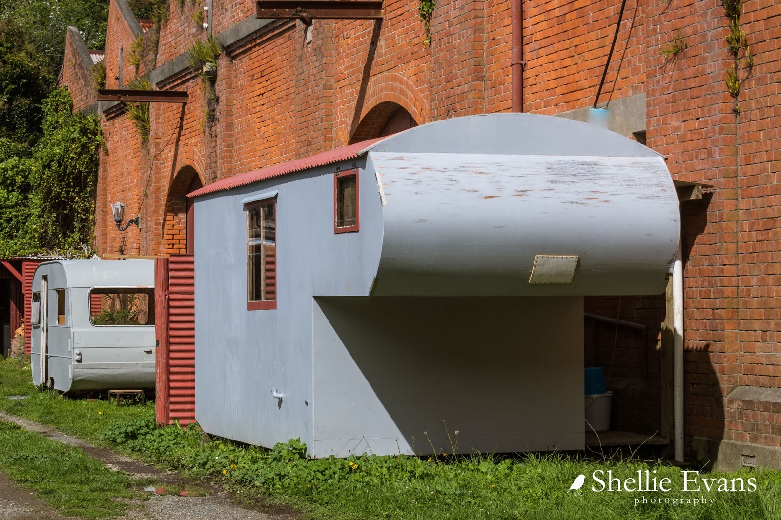
Anyone looking for a new 5th-wheeler? 


Tokomaru Bay is also on the Gisborne District Council camping permit list; there are two areas, a north site and a south site (see the map below) and at both sites there are several areas along the beach front where you can stay but many are across the road from residents houses. I always feel a bit mean parking in their view though it wasn't going to be a problem for us this time as we were heading further on to another bay for the night.

Tokomaru Bay- North Camp
Before we left Tokomaru we made a quick stop back in the village so I could take a photo of the historic St Mary's Church built in 1884. What a lovely little church, very rustic and very kiwi with corrugated iron walls and roof.


Our next destination is just north of Te Puia Springs but we were talking too much and trying to decide if the large pond on the side of the road just north of the settlement was in fact the 'spring' that we missed the turnoff and had to travel a few kilometres before we could safety turn around and head back to the side road. And the road to our next camp site is no different to all the other side roads we've taken; narrow, winding, with plenty of blind corners and dropping quickly to the coastline.

Te Puia Springs Hotel
Waipiro Bay is a another tiny forgotten settlement that has seen better times, it also has a number of abandoned buildings.  


Waipiro Bay also has a beautiful church with the most amazing view out over the bay; St Abraham's was built in 1926. I smiled when I saw the flowering Myrtle tree in the corner, normally I wouldn't have a clue what tree it was but I know where there is a similar sized one taking pride of place in the centre of a garden, pruned and shaped to perfection by Dad.


And as is the case with most of the churches on the East Coast (and in many others areas too), they are part and parcel of the local Marae. I've said to David a few times that I would love to make a project out of photographing all the beautiful Wharenui/Meeting Houses we pass on our travels. Often they can't be seen clearly from the road so I'd need to get permission to shoot them and that would be a bit of a hassle.

Meeting houses and woolsheds, they'll be on my next 'obsession' list, when I've finished shooting churches and swing-bridges!


David comes looking for me, I've left him up on the road near the Trading Company ruins. It was just going to be a short walk down to the church to take a couple of photos but I'm taking longer than usual and he's worried he's blocking the road with the rig (it's not like it's Piccadilly Station or anything, we haven't seen another vehicle since we turned of the main highway).

I try and take any photos as soon as I get the opportunity because nine times out of ten Murphy's Law kicks in; either the weather turns to custard, we take a different route out when we leave, vehicles park in front of the subject or a number of other reasons and I miss the chance to get a good shot. So I get the church photo out of the way before we head to the camp site.

The road turns to gravel and it's now looking more like a dirt track. We worry about where it leads as we climb a short rise and then turn hard right towards the beach, will we be able to turn around. Have we in fact got the right place.


The road turns to mud as it climbs another rise right above the beach and we see a car is waiting for us to pass before it can proceed. David winds down the window and asks if there's a McDonalds up here. That breaks the ice and the guy, who must have been wondering what on earth was coming over the rise towards him (probably thinking mad buggers!) has a large smile on his face and points us in the direction of the grassy reserve ahead. 


Except we drive right on by the reserve and across the ford, thinking there might be another camping area further up. There are no signs at the first area.


Once across the ford we realise that there are no more grassy reserves and the road ends not too far ahead. There's also no turning areas so there's nothing for it but to back up. Hence the reason I'm out of the ute and directing David back across the ford (and taking photos!) 


We find a reasonably level spot right on the edge overlooking the beach... 


...with magnificent views to the right... 


...and left.


With, once again, the whole place to ourselves. Where are all these campers we've been hearing about in the North Island?  


We're still worried we haven't got the right place as there are no signs, although there is a concrete tank toilet near us. The council pamphlet shows the camping site is back up the road- on the little flat patch of  grass you can see in the top photo below but when I check it out later it looks like a squatter has set up camp and claimed the area for himself. 

I check for photos on the internet and find a few with caravans and motorhomes parked up along the reserve where we are. Someone has conveniently (for them) removed the sign that I see in a photo which was next to the toilet.


We're now happy and we settle down for the day. Later on I catch 'Nigel Mo Mates' having a happy hour swing. 


It's a fiery start to the day next morning; after a slow start to the day, we pack up and head off again, inching our way closer to East Cape.  Waipiro Bay is the last of the Gisborne District Council  permitted freedom camping sites heading north and the final one we stay in. Within a couple of weeks, this and a few of the other permit sites will be closed for winter; I'm sure I can hear a collective sigh of relief from the locals.