July 30, 2022

Dargaville & Ripiro Beach

 Here's another Northland post for you -

Ripiro Beach
From Kai Iwi Lakes we travelled on down to Dargaville stopping at the NZMCA Dargaville Park which is an interesting site located at the sharp end of a point between two rivers; the Kaihu River which joins the very wide Wairoa River. The park is just a short walk across the bridge into town so very conveniently located.

Dargaville NZMCA Park
On one of our 'exploring' days we drove over to Baylys Beach on the west coast to drive down Ripiro Beach which, as you can see from the sign, at 107km (66 miles) is New Zealand's longest driveable beach. Longer than the more well known 90 Mile Beach (which is only 55 miles long) in the Far North. 


We intended to exit at Glinks Gully as the tide wasn't suitable to carry on around the bottom of the Pouto Peninsula & exit at Pouto. We certainly didn't want to be trapped by the incoming tide on a remote beach or have to retrace our steps for many kilometres if we had had to turn around.

Baylys Beach entrance to Ripiro Beach
Being a Saturday the beach was quite busy in both directions...


...with many people surfcasting and families relaxing in the dunes.  
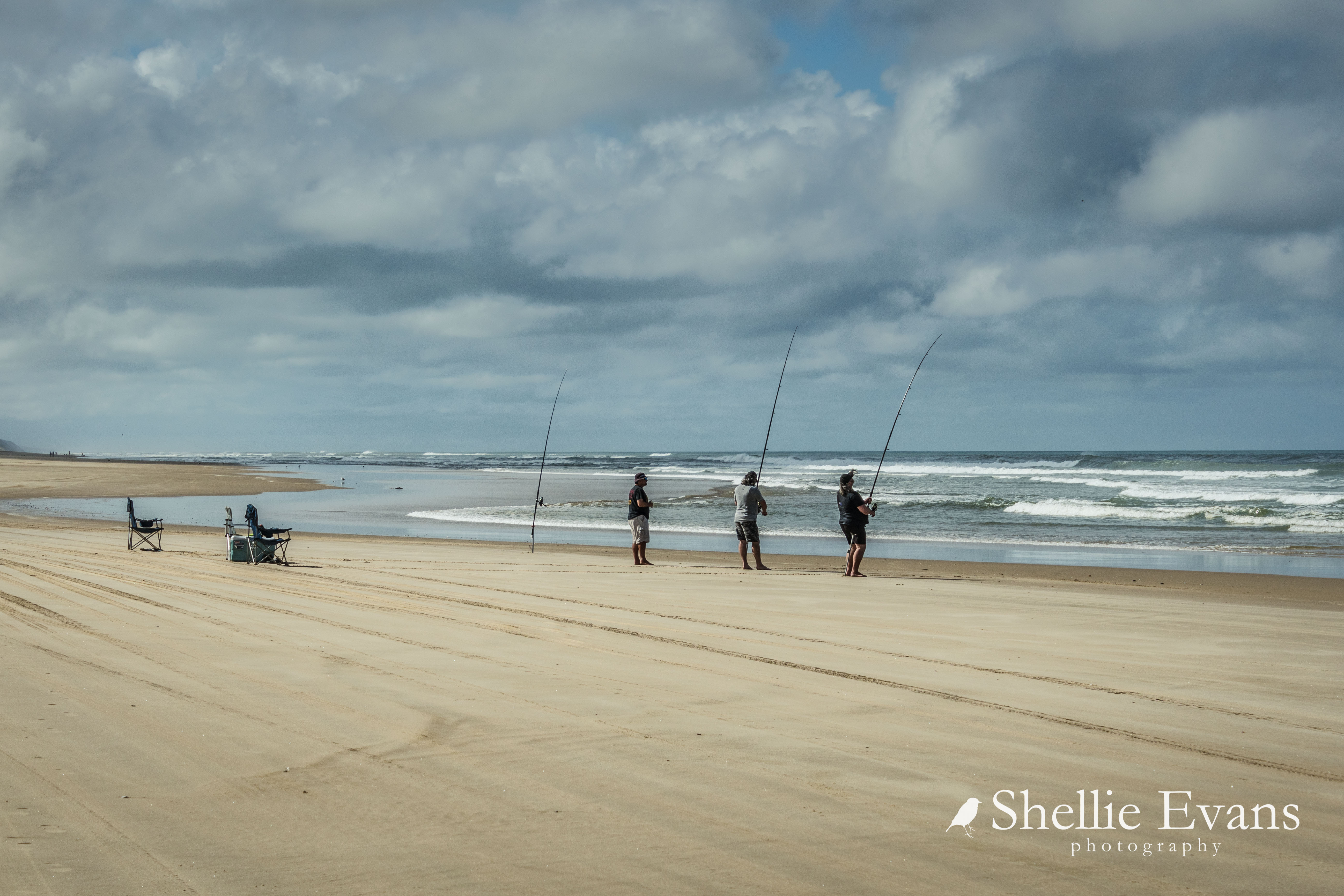

We passed quite a number of vehicles travelling up the beach in the opposite direction. 
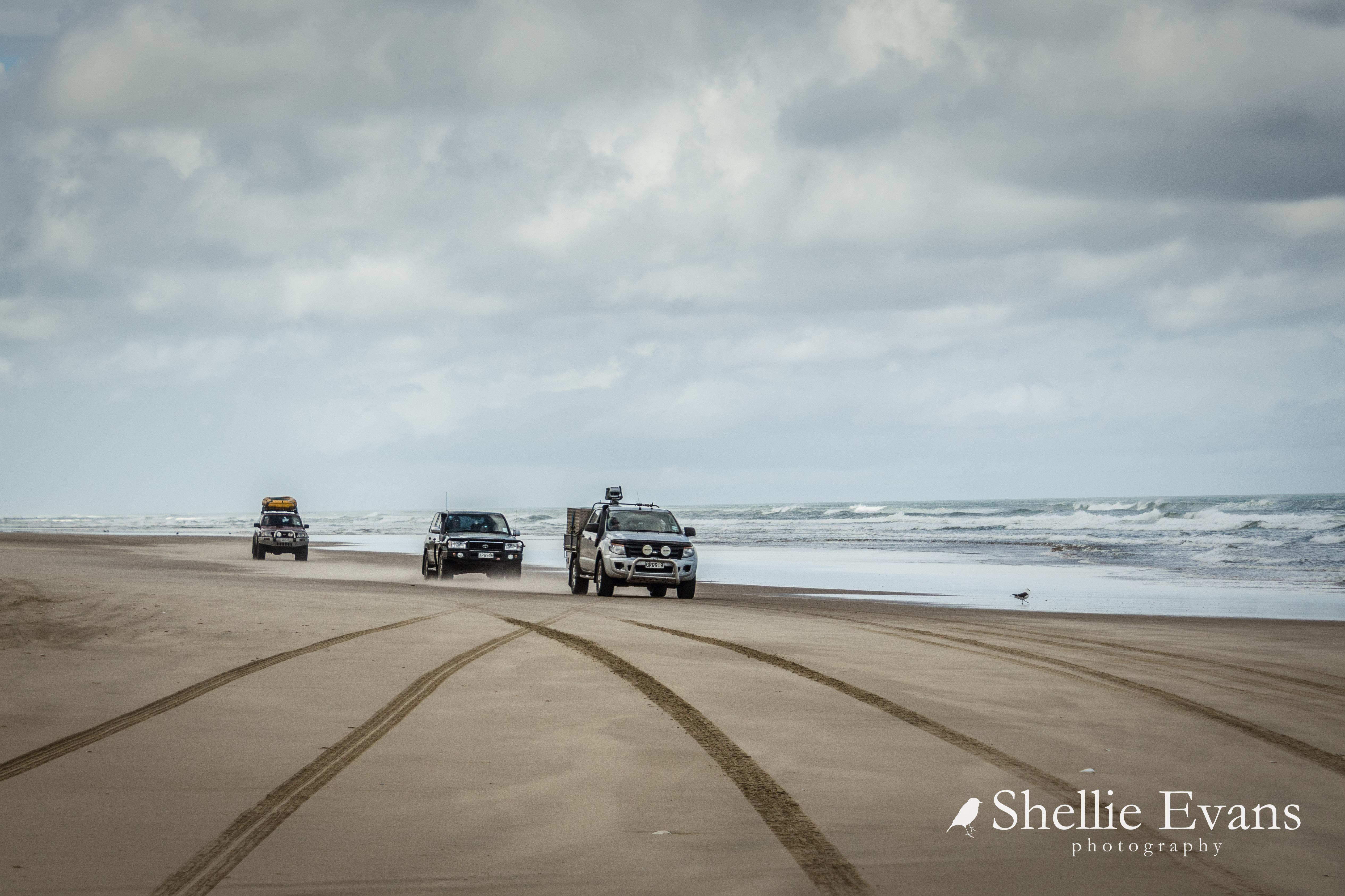

And passed several areas where people had driven in to launch their boats & then parked up as high as possible to avoid the incoming tide. Unless you're a local or a regular visitor it would be hard to know where the entry (or exit) points are along the beach. Unlike the entry points that have settlements surrounding them many of these ones are stream beds, a break in the high dunes or are forestry tracks.


We slowed to watch a group launch their boat into the surf. David had kittens watching the ute back deeper & deeper into the salt water.


As most New Zealanders know our West Coast beaches can be treacherous to fishers & boaties alike even on relatively calm days. We breathed a sign of relief as they made it out over the breakers.


Ripiro Beach is also known as the Shipwreck Highway, it's the graveyard of dozens of early shipwrecks, some that still show themselves after adverse weather events & others that have long been lost to the elements or buried deep in the shifting sands. I kept a watchful eye on the edge of the dunes as we cover the kms, just in case I managed to spot one. No such luck.

Glinks Gully 
We exited the beach at Glinks Gully, a small settlement of baches tucked below a scrubby ridge with fabulous sea views but little shelter from the wild west coast weather. 


We drove along the 'waterfront' to a picnic area at the end of the short road to have afternoon tea before heading inland and up the peninsula back to Dargaville. We'll leave exploring the southern tip of the Pouto Peninsula for another time; there are huge sand dunes to explore, a campground & lighthouse to visit at the end which forms the northern entrance to the mighty Kaipara Harbour. 


On the return journey near Tikinui, we followed a dead end road which indicated we'd see the Wairoa River. We sure did, stopping at an old abandoned wharf overlooking a wide expanse of river...


... and a rickety walkway over swampy ground to a fishing boat moored in the mangroves.   


As is normal on our trips exploring, we stop so I can take photos of country churches to add to my collection and also any old or unusual buildings. There are several churches & this country hall along the peninsula's Pouto Road.


St Peters Church, Te Kopuru
Our next stop in Te Kopuru is when I see this wonderful cottage garden full to the brim of every kind of fishing buoy imaginable; flotsam & jetsam collected over many years. 
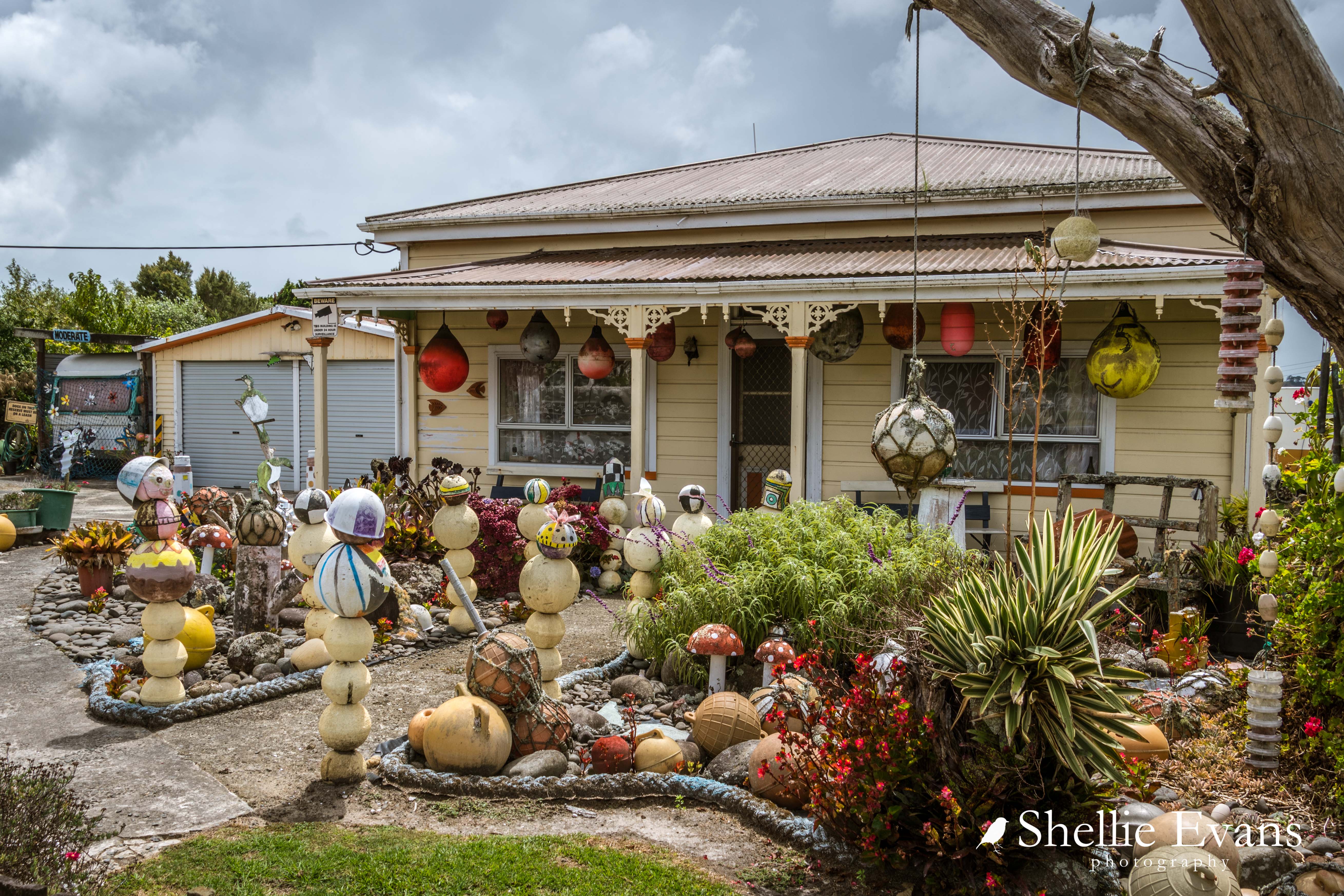


I'm sure this would be one of the most photographed houses in Northland if it was located on a main road and must give the owners much pleasure to see people stopping to view it. It reminded me of Owaka's Teapot World in the Catlins.


Not too far before Dargaville we passed Ernie's Park, I returned the next day to check it out (rather than foist it upon David after his long drive). There's a honesty box for your $2 at the entrance.


'Ernie's Park' is a long sliver of land located between a kumara farm on one side & a deep drainage ditch on the other from whence this family of grubby ducks emerged. They escorted me around the park for the rest of my visit.


It is a slightly run down park with a collection of kitsch, weird & slightly creepy displays, many items that have seen better days.


I did enjoy seeing the 'The Little Chapel', the smallest in NZ at 2x2 metres square, and now added to my church photo collection.


Ernie must have a fascination with 'long drops', there were several in the display.


I wasn't game enough to open the 'Weta Cave' door just in case there were weta in there or in fact it was another long drop with suitable mannequin ready to scare the living daylights out of me.


From the NZMCA Park I took a walk along the riverfront & then home back through town. There are many colourful boats moored at the boating club. In the photo below you can see the invasive Manchurian Rice Grass, a river pest plant in Northland that forms dense long-lived stands on land & water margins. It is thought the seeds arrived in ship's ballast in the early 20th century. 


The Wairoa River is Northland's longest river at 150km and was once used by kauri & flax traders. It's tidal for much of its length with a muddy bottom hence it's colour as it drains & fills from the Kaipara Harbour.


Looking back along the waterfront past the Band Rotunda to the junction of the two rivers & the NZMCA Park to the left in the trees.


And the park from across the Kaihu River.


The next day we headed south again crossing the Wairoa River bridge on the way out of town.


June 12, 2022

Flight To The Lights

I wrote an article for the NZMCA magazine which was recently published so now I can share this incredible once in a lifetime experience with you (if you haven't already read it of course!). I haven't forgotten the next part of the Northland blog either, that's up next.

Oh. My. Goodness. 

I have just had one of the most incredible (& highly anticipated) experiences of my life. Early last year I was invited by Viva Expeditions to join them on a ‘Southern Lights by Flight’ journey to view the Aurora Australis from within the auroral oval, flying thousands of kilometres south of New Zealand towards Antarctica. 

After a couple of Covid related postponements my dream finally came true and on April 1st (I was hoping the date wasn’t ominous) I joined over 250 other enthusiastic passengers on an Air NZ 787 Dreamliner for a 10 hour return flight over the Southern Ocean.

Led by  Otago Museum director and astronomer Dr Ian Griffin- who organised the first-ever commercial flight to see the Southern Lights in 2017- the flight also included astronomers, astro-photographers and Antarctic Academy Director Miranda Satterthwaite. 

A ‘Pre Flight Mission’ was held  during  the afternoon before our flight where we toured the International Antarctic Centre and listened to & watched  presentations from Ian & Miranda who explained in detail,  information about our flight and what we could expect to see once we reached the auroral zone including information on the Aurora Australis itself. 

Photography workshops where also held with the astro-photographers assisting  guests with handy hints and tips on how to best photograph the aurora and also to help with camera settings for the flight.


Aurora flights are timed around the spring & autumn equinoxes when the aurora display is at its brightest. Thanks to a phenomenon called the Russell McPherron effect, auroras are known to be more frequent and brighter than usual in spring and autumn. 

Close to the equinoxes the alignment of the interplanetary magnetic field and Earth’s magnetic field is such that the two opposing fields can cancel each other out. This creates holes in Earth’s magnetosphere through which particles from the solar wind can flow, giving rise to auroras when they interact with the atmosphere. 

The flights are also planned around the moon phase, a bright moon restricts aurora visibility, so flights are timed close to a new moon when the sky is dark.

Once checked in & through security we had a pre-flight meet & greet near our boarding gate and as 7pm approached we made our way to the aircraft, excitement building in anticipation of the flight of our lives. The Dreamliner is the plane of choice because of the large portholes which makes for better aurora viewing. 

Casting an eye over the Departure Board I see that our flight, NZ1914, is flying to Christchurch. An unusual sight as all the listed departures are to other New Zealand cities. Not us; Christchurch to Christchurch with 10hrs lost in the middle somewhere. And I can’t wait!

There are various seating options available but essentially if you travel in economy, you & your neighbours in the row, swap seats every 20-40 minutes during the aurora viewing period. 

But don’t worry, we flew for 6 hours with the aurora on show so there was plenty of time to view the Southern Lights & in fact towards the end only the most obsessive aurora watchers were left ‘standing’, many others had retired to the middle rows or were just happy to listen to what others were seeing.

We departed Christchurch just after 7pm, flying up through the cloud cover and catching the last glow of sunset on the horizon as we headed south-east towards the Antarctic Circle, aiming for Latitude 64 & what is known as ‘magnetic midnight’. 

Though our ultimate flight path would depend on where the aurora was found. Magnetic midnight is the time of day when the magnetic poles align between the Sun and the Earth; it's said to be the optimum time for viewing auroras.

Full in-flight service is available on the flight (dinner, snacks & breakfast) and we’d only just finished dinner- about 2hrs into the flight- when an excited call came through from the flight deck to inform us that the aurora had been spotted on the horizon.  

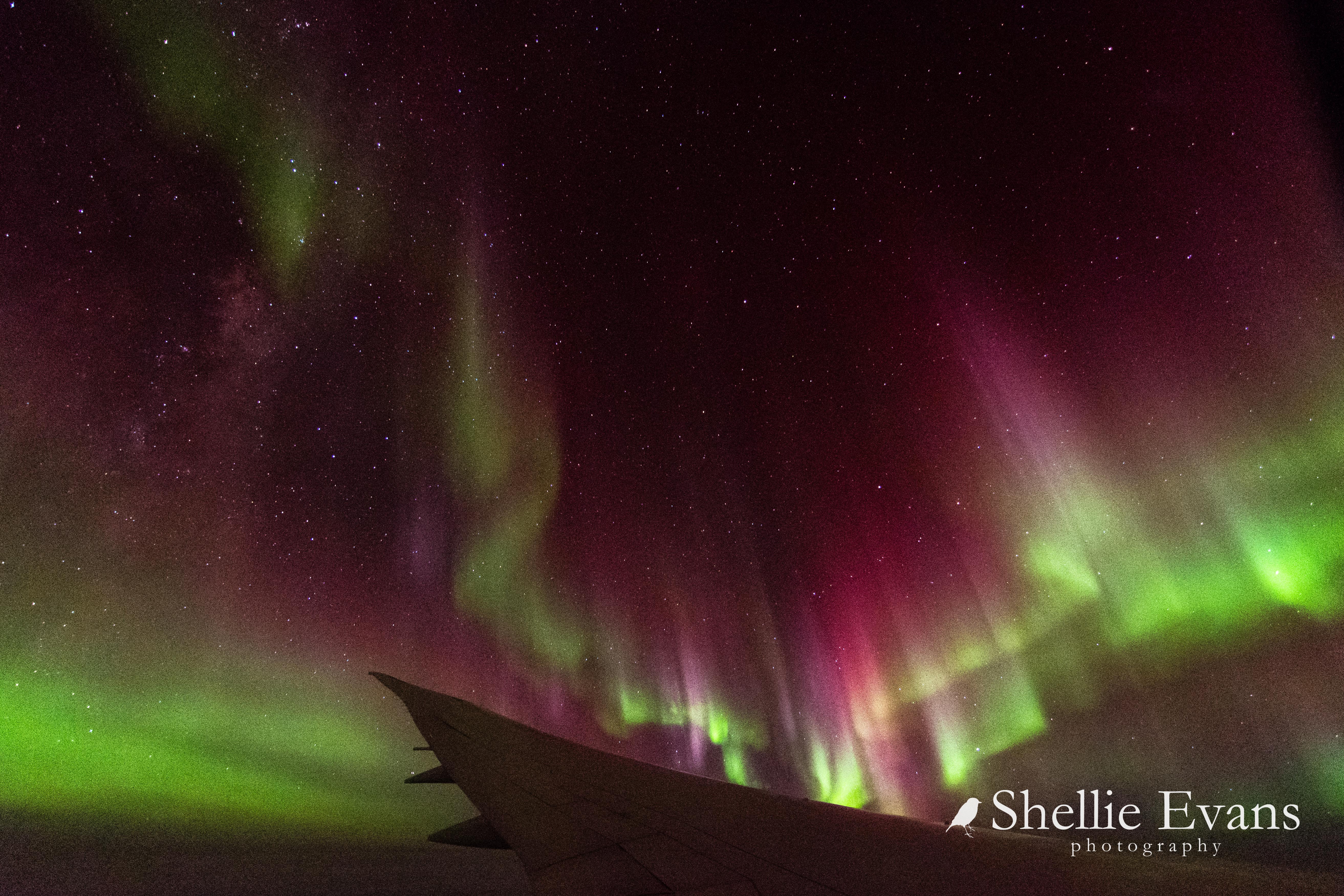
I leaned into the window trying to shield the camera from the cabin lights & clicked a couple of photos off just to be sure they weren’t fibbing & sure enough two bright green auroral bands appeared on my camera’s back screen. There was a hurried rush around the cabin to clear the trays and turn the entertainment screens & interior lights off. 

The most important thing to do to view an aurora is to allow our eyes to adjust to the darkness. It can take up to 20 minutes for our pupils to fully dilate and even a glimpse of bright light for just a few seconds will set your dark adaptation back several minutes. This is why there is complete darkness in the cabin of the aircraft and also why people with cameras need to have them ready to go before the flight. 

To enhance the aurora viewing experience even further the plane has permission to fly in 'stealth mode', with all outside navigation lights turned off. Of course there are no other planes within thousands of kilometres; we’re the only ones flying around a dark empty sky on some crazy mission looking for an incredible light show. 

In the cabin around me the excitement was palpable as we approached the aurora and then, with everyone seated, cameras ready & eyes adjusted to the darkness, we entered one of nature’s most stunning, magnificent & unforgettable displays of power. 

For 6 hours we flew under, over & through the aurora, weaving our way back & forward over the Southern Ocean, crossing the International Dateline numerous times, the pilots often banking the plane, left & right so both sides were able to view the depth & height of the display. 


The star trails you can see in some of my photos weren’t caused by a slow shutter speed as is usually the case, the trails are caused by the banking plane, lovely graceful movements. 

We flew directly beneath a corona several times- the crown or centre of an aurora burst- the ultimate position to be to watch a burst of activity. I was lucky enough to capture the side of an exploding display a couple of times. 

And I know what  many of you will be thinking as you read this, ‘ Yes that’s all very well, but can you see the aurora with the naked eye?’  And the answer? Hell yes, you sure can! 

Though our eyes aren't sensitive enough to see the bright colours that show on the camera screen & in photos, you can sometimes see a hint of green & pink, with younger eyes seeing more colour. 

I could certainly see the huge shimmering curtains and pulsing waves as the aurora moved about, along with shooting beams reaching from far below us to high into the heavens above. An aurora becomes visible when high-energy particles from the sun rain down on Earth. 

As these particles get closer to us, they interact with the Earth’s magnetic field and this channels them in the direction of both magnetic poles (hence only seeing the aurora close to the South or North Poles). As the particles are accelerated downwards, they hit atoms in our upper atmosphere (ranging from 90km to 700km high) and this process results in a glowing field of excited gas. 

This is what gives us an incredible natural light show and the range of colours;  oxygen causes the fluorescent green and yellow colour of the aurora (the most common), nitrogen the blue and red colours and sometimes pink, while neon turns the aurora orange.

After what felt like a very short time but turned out to be six hours later, the pilots did a final bank, the aircraft turned & we headed for home leaving dancing beams & a bright green band far behind us. I was still clicking photos as the cabin lights came back on and the plane filled with chatter & the lovely aroma of coffee & breakfast which was soon to be served.

What more can I say? If you hadn’t already gathered as much, I had the most amazing, incredible experience ever, and I would highly recommend the trip to anyone who would like to take a unique, once in a lifetime trip to witness one of the world’s most magical phenomena. 

No worries if you’re not a photographer either, Viva, with the courtesy of the astro-photogs on board, supplies copies of the best photos for all the passengers to download. So you can sit back, relax  & enjoy the show of your life. 

For an aurora chaser like myself this was the ultimate nirvana & guess what? I get to do it all again. I’ve been invited back for a September flight to help out with the photography (update- the fully booked September 2022 flights have been cancelled as Air NZ need their planes for international flights after Covid 19, here's hoping the flights in March 2023 go ahead.
ETA- In fact the March 2023 flights didn't go ahead either & since then, there's been no mention of any further  flights
).


Shellie was a guest of Viva Expeditions

May 19, 2022

Boulders, Beaches & Big Trees- Northland's West Coast; Part 2

Continuing on from Part 1

Rangi Point Sand Dunes & entrance to the Hokianga Harbour
Two well known tourist destinations, Opononi & Omapere villages are on SH12  near the entrance to the Hokianga Harbour, both have beautiful sand beaches that can be accessed from the road side. 


Across the harbour at North Head, huge golden sand dunes dominate the landscape. Sandboarding  the dunes is a popular activity,  charter boats can supply boards and take you across to the dunes from the Opononi Wharf. 


Opononi became world famous in the mid-1950s when a bottle-nosed dolphin named Opo made friends with the locals and stayed in the harbour until her untimely death several months later. 


Thousands of New Zealanders flocked to see her, some driving  hundreds of kilometres over gravel winding roads to say hello, swim & play with her.  A bronze copy of the original commemorative statue of Opo straddled by a young boy stands in the main street & it’s still popular to have your photo taken alongside her. The original stone statue is now in a local museum.  

On our way south we stop at a Pakia Lookout to say goodbye to the Hokianga Harbour and head on down the coast, coastal views are now replaced with the magnificent kauri trees of the Waipoua Forest. 

Pakia Hill Lookout
The drive through the forest is an experience in itself. The towering forest canopy closes in overhead forming dark green tunnels and huge ancient kauris have formed natural gateways where vehicles must slow to pass through. 

The road edges are fringed with emerald green mosses & luxuriant ferns fronds, it’s cool and damp inside the forest and the outside temperature takes a dive.  

Waipoua Forest is the largest remaining tract of native forest in Northland and it’s also the home of Tane Mahuta, the country's largest kauri tree, which is approximately 2,000 years old and still growing. A short five minute walk through the cooling shade of the forest leads you to the awe-inspiring sight of the majestic Tane Mahuta. 

Love my wide angle lens; makes me appear very tall!
It’s hard to comprehend how big he is until you stand beneath him; it’s nearly 18 metres to the first branch, 51 metres to the top and with a 4.4 metres diameter, it’s clear to see why Tane Mahuta is called 'The Lord of the Forest'.  A  boardwalk & surrounding wooden fence protect the tree from disturbance, kauri have sensitive surface roots that can easily be damaged. 

To get a full view of Tane Mahuta, you can move further along the track, which then leads to another viewing platform. I had my wide angle lens so was able to capture most of Tane Mahuta from directly beneath him.

Taken from the 2nd platform, further away
A boot wash at the track entrance is to protect Tane Mahuta & his fellow brothers & sisters from kauri dieback which has already killed many of the large kauri in the forest. 

The Waipoua Campground (#423) is a great place to base yourself if you’re wanting to explore the local area & forest. 

It’s a basic campground set in amongst the bush beside a river, the bird life is prolific and kiwi can be heard calling at night.

Waipoua River
Further south and just 35 minutes from Dargaville are the Kai Iwi Lakes, a sparkling turquoise jewel in the crown of Northland’s natural attractions. 

Lake Taharoa, Kai Iwi Lakes
Kai Iwi Lakes, there are three, are white sand freshwater dune lakes created over 1.8 million years ago when they were formed by the accumulation of rainwater in depressions of sand. 

Promenade Point Campground, Kai Iwi Lakes
Underlying ironstone prevents the water from leaking away. The lakes have no known natural inlets or outlets, their main source of water is rain, and with a sand base the water is crystal clear. 

Lake Taharoa is the largest of lakes, it’s fringed by pure white sand and when the sun is shining the lake is a vivid blue & looks to have been dropped into place from a faraway tropical island. All that is missing are the waving palm fronds.

There are two camping areas at Lake Taharoa and they are both looked after by the Kaipara District Council; Pine Beach Campground (#430) at one end is the busier camp, it has powered & non-powered sites, toilets, showers and a playground and it’s also more exposed to the hot summer sun. 

The stunning white sand beach is popular with day trippers, many come with their boats & assorted  water toys.


The pine trees that give the camp its name have now gone and natural vegetation is slowly filling in the gaps.

Sunrise with silhouetted dead old man pines behind Pine Beach camp
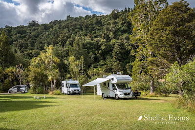
Promenade Point Campground (#427) at the other end of the lake is a more relaxed camping experience with large grassed areas and sites in amongst the lake side bush. 


It's where we spent several gloriously hot late summer days, and had the place to ourselves once the Waitangi Weekend crowds left.

There are shallow areas ideal for swimming at both camps and along the edges of the lake off the Taharoa Domain Road between the camps; you can also fish for rainbow trout or paddle a kayak. Hiking & biking tracks also circle the lakes.


I climbed the hill behind our camp ground to capture the sunset. The photo below is looking back over Lake Taharoa with our camp on the finger of land below the track & the Pines camp at the far end of the lake.


The view from the top of the hill looks out over farmland to the Tasman Sea beyond and a typically stunning west coast sunset.


To be continued...