Showing posts with label frozen. Show all posts

July 31, 2019

Hunting for a Hoar Frost- Mackenzie Country; Part 2

Real-time

Continued on from Part 1  where we were parked up at the Ohau B canal NZMCA Park near Twizel.

But sadly there's still no hoar frost or even remnants of one so it's time to head home and see what tomorrow brings...

Tomorrow brings a fabulous sunrise.

Beautiful colours over Ohau B Canal
I'm up well before the sparrows, it is bitterly cold outside and a heavy frost is fast settling on the rig but when I look out and see the cloud formations overhead I know it's going to be a spectacular sunrise. Now I have to hurry to get to the top of the small hill behind our camp site before it's too late.


I throw on layer after layer of warm clothes, finger-less gloves and woolly hat, grab my gumboots, and camera and rush as fast as I can up through the long grass on the side of the hill, dodging deep rabbit holes and large rocks as best as I can in the dark gloom. There are a couple of tracks but I haven't time to find them as I can see shafts of brilliant orange streaking through the sky above already.

The wispy fog looks like cobwebs draped over the power pylons.
I knew before I reached the top of the hill I was in for a tough photo shoot, I'd left my tripod and head torch behind! I can't see the camera settings easily and it's so dark I'll not be able to shoot any long exposure shots (which are all of them until the sun comes up) without my tripod. 

1) The sun rises over the fog in the Mackenzie Basin
2) Pink tinted lenticular clouds above Lake Ruataniwha Spillway
3) Looking south over the salmon farm
I don't have the energy to race back down to the van and then get back up the hill in time. Luckily there's a concrete column on the top of the hill (it's used to measure movement in dam walls), and with the help of a flattish rock I manage to balance my camera on the top of them to shoot. I find out later that only one in about 4 shots has no blur. I bet the camera was slowly slipping on the icy surface.

1) Aoraki/Mt Cook  peeps over the top to greet the morning sun
2) With Ben Ohau Range as the backdrop, fog settles over Lake Ruataniwha.
3) As the sun climbs higher the colours turn from reds & orange to a brilliant yellow
After a suitable time and enough photos for me to think I have at least got a few of the early sunrise, I decide I will have to high-tail it back down the bank and back to the van to get my tripod. And put on another pair of socks, I'm already wearing two pair but gumboots and an icy frost do not go well together. This time I walk along the canal and head back up the unofficial 4WD track to the top, it's a steeper climb and now very slippery because the frost has settled.  And the temperature has dropped even further due the wind chill factor as a stiff breeze blows in.

Looking south over the salmon farm- just two vans in for the night
The colours are now soft oranges & mellow yellows. Now that I have my tripod set up, I attempt to do some light trails using the red tail lights of a few dozen vehicles that pass by below me. They're on their way to catch those elusive salmon further down the canal.  And then would you believe it, my battery runs flat and I've left my spare in the van! So off I head back to the van once again and then I traipse all the way back up to the top for the third time, just in case there are a few more photos left out there. Because I know if I don't I'll wish I did (if that makes sense!).


Needless to say, I now make sure I have my tripod ready to go along with my backpack packed with headlamp, spare battery, extra socks & gloves, snack & water,  no matter what the weather forecast is for the next morning. 


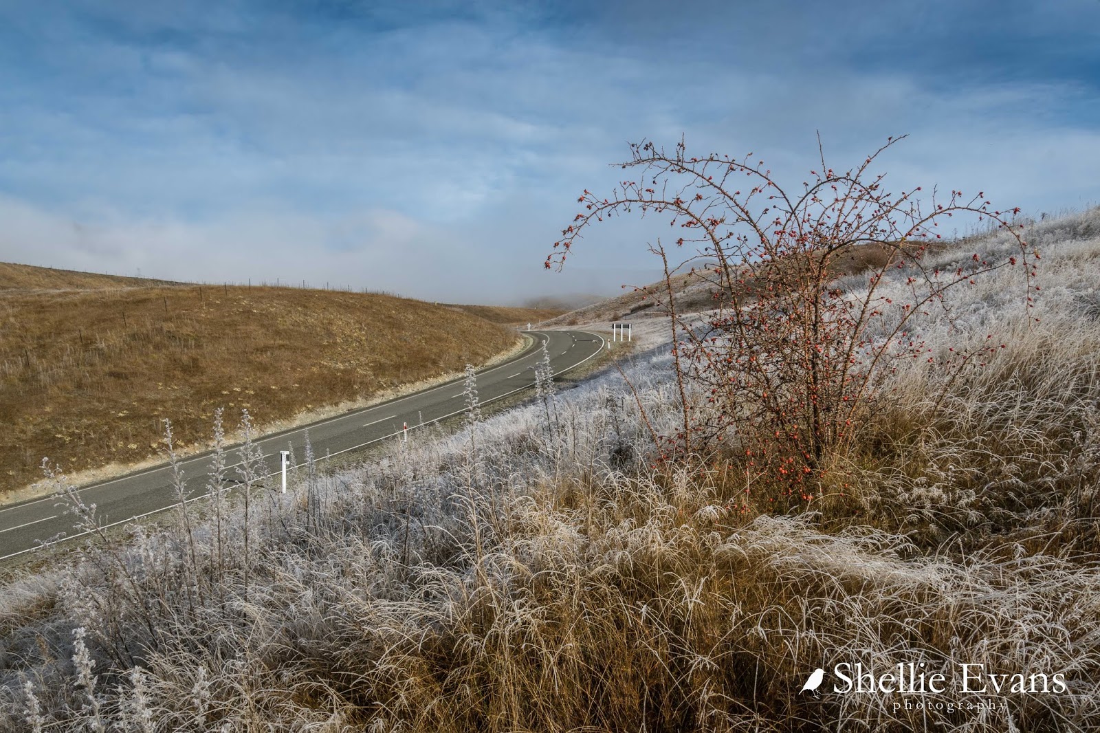
When I finally stagger back to the rig the frost has well and truly settled over the ute & 5th-wheeler and long grass on the hillside is dripping with icicles. The makings of a mini hoar frost. 


Later in the morning I decide to head down to Lake Benmore again, just in case.  It's cold enough and if there's fog down there, the ice crystals could be building up. You never know...

I stop above Ohau B power station and climb up the fence line...

...so I can check out the Ohau River that runs parallel with the canal all the way down to the lake. There's fog off in the distance...


...and it's hanging about over the canal and the fishermen & women still trying their luck with the escaped salmon. 


While I watched, the fog rolled back in and that got me a little excited.


If there was fog up here, there was sure to be fog down at the lake. I carried on down the canal and was excited to see more fog over Ohau C Power Station which probably meant it reached all the way down to the lake too. 

There are two ways around each power station, one road crosses over the top of the dam and the other runs behind the station and in front of the penstocks. The lower road at Ohau C does a large sweeping curve down to the lower level and it's this one I take, it'll get me to the lake quicker.


Except that half way down and I pull to a quick halt when I see through the departing fog some matagouri and briar bushes covered in ice crystals in a nearby paddock.


A hoar frost has formed for sure but there are only a few bushes. I take a few shots as quick as I can because already the sun is reaching through and water is dripping off the bushes.


I don't know why but I decide to head over to the  river on the other side of the power station instead of down to the lake and as I got near I could see the fog retreating out of sight over the lake.


I pulled over to check on the river and couldn't believe my eyes- the fog has gone and left behind a ribbon of  trees laden in ice crystals!


I have finally found myself a hoar frost!


It might not have been the blue sky, heavily laden white crystal shot I've been looking for but it would do me just fine......for now.


The term "hoar frost" comes from the Old English meaning of frost resembling an old man's beard. Frosts and hoar frosts form when the air and objects are at or below freezing and while normal frost forms when the air is relatively dry, the air must be quite moist for hoar frost to form (helped along by fog). The ice needles of hoar frost can become several inches long in extreme cases and form on the sides of and beneath objects, as well as on top.

The bright red rosehips on the briar bushes look like jaffa sweets from a distance...


...up close, they are soft and disintegrating as they defrost- perfect bird food during the harsh winters (although not so good that the birds then spread the seeds which is why the high country is covered in briar bushes).


These photos aren't the best because now that the fog has departed, I'm looking straight into a hazy sun.


A pond near the river is frozen solid and I decide to drive down to it and see if I can get some close up shots of the trees


By the time I twist & bump my way along the river track, smashing through large puddles of frozen water and avoiding others full of mud, I can see that the frost is fast melting...


...and when I finally reach the pond it has just about gone. That's it. For a brief 30 minutes I was in awe of Mother nature and in seventh heaven. I can go home now. Bucket list photo, done & dusted (although there's still a blue sky shot on there).


I find my way back up to the canal road, stopping briefly to take a photo of the canal bank covered in frost and now melting in the sun.


Back past the fisher people still trying their luck and now basking in the weak sun...


...and back to camp where the sun is only just reaching over the hill and onto the frosted grasses that I clambered up this morning.


Later in the afternoon I decide to take another drive around to Lake Ruataniwha 'just in case'. But when I stop at a gap in the trees I can see that there's nothing happening down there today and I turn around and head back home. 


August 24, 2017

Lake Coleridge Loop

Catch-up

One of the reasons we wanted to stay at the Rakaia Gorge campground was so we could do some exploring in the Lake Coleridge basin.  Now that we were back in Methven is was just a short drive back through the gorge, up to Windwhistle (don't you love that name) and then onto the lake road; 30km of lovely sealed road through to Lake Coleridge.

I took this photo at the top of the road out of the gorge, the gorge is tucked around the corner of the hill, middle left. You can see the road leading down to the gorge in the background. And that is Mt Hutt behind.


We pass the entrance to Terrace Downs Resort and championship golf course along the way; I'd always wondered where it was. That's two extremes in accommodation just a few kilometres apart; camping down in the dip or top notch luxury up on the terrace! I know where I'd rather be.....in winter anyway! Just joking.


The road follows the Rakaia River inland, all the way to the Lake Coleridge village, but unfortunately there are only a few places that you catch a glimpse of it across the farmland.


There's an excellent information board on the side of the road with a map and listing accommodation, activities and walks that can be done in the area (click to enlarge).


Like the Ashburton Lakes, there are also quite a number of smaller lakes up this valley too. We'll have to come back and explore more in the summer, today we're only going to be touching the bottom end of Lake Coleridge.


Another photo opportunity presents itself at Dog Box Corner, I have no idea of the origins of the name but the 'box' looks like it could be used for the pickup or dropoff of supplies. Perhaps it's a take on the historic Dog Kennel Corner in the MacKenzie Country.


Lake Coleridge was the New Zealand Government's first hydroelectric power station, it was in an ideal location because of it's proximity to the growing city of Christchurch. There's a good display of historic items from the station and also a excellent information board on the reserve at the entrance to the carpark. 


Lake Coleridge is 170 metres above the Rakaia River, so only gravity is needed to bring water from the lake through to the power station and then emptying into the Rakaia River below.  Construction started in 1911 and with over 400 employees at its peak, it took 3 years to complete in what was a wild and bleak landscape. The station was built on a glacial moraine (shingle) which had never been achieved before. The winters were harsh, and a small village of permanent huts was built for the workers and then once they had moved on, power station staff and their families moved in. Today, with most of the power station automated, the village's permanent population is small and the residents are mostly there for the lifestyle and recreation in the area. 

Harry Hart, a power station superintendent, was interested in New Zealand's forestry potential and experimented with planting exotic trees, particularly conifers, around the village. The collection grew large and was diverse enough to be called an arboretum. Many trees are still standing and visitors can learn about some of them on the Harry Holt Arboretum tree trail. 


We drove past the power station, over the outlet canal, down an overgrown track and through several deep ice covered muddy holes until we found the edge of the river where we sat on the tailgate and had our lunch.


Here's a pano of the view up river (click to enlarge)- I've said this before; we certainly find ourselves some awesome spots to have lunch.


After lunch we wind our way up the hill above the power station, passing through the arboretum and stopping to take a photo of the view out over the river, half way up.


The pine forest gives way to farmland and this expansive view down the Rakaia valley and the backside of Mt Hutt. 


I zoomed in on the river here where you can clearly see the how braided it is before it narrows down to pass through the gorge.


We headed over the hill and down towards Lake Coleridge, passing several road repair vehicles on the way. The road has just been graded and several trucks and a roller are filling in potholes on a connecting road. 


And what do you know? We cross the Te Araroa Trail once again! 


It's a surprise to see divers in the lake, I bet they have super heavy duty wetsuits on, the water is freezing! It would seem that a Christchurch dive company use the lake for their dive courses- that's my type of diving; no chance of sharks!


Nearby a small fast inlet whirlpool takes water from the lake into the penstocks and off down the hill to the power station.  


The power station is moderate in output by today's standards, feeding the national grid with a maximum of 40 megawatts. Water stored in the lake is also used for irrigating farms on the Canterbury Plains.


I was a little disappointed that we couldn't explore further up the lake (on both sides)- there is a lot more you can't see from this small area- but it was getting on and we wanted to take the back country road over to Lake Lyndon. It exits onto the main highway over Arthurs Pass to the West Coast.


The road is just over 14kms long, there are several reasonably narrow sections but nothing out of the ordinary in our opinion and we'd take the 5th-wheeler across it if we had to, and the conditions were right. On this day there were several icy patches and I'm sure the clay base would be a slippery mess if it was wet or raining but in dry weather, it would be fine. 


Eventually we arrived at the bottom end of a frozen Lake Lyndon which, at this time of the year, is in the shadow of the mountain by the same name, Mt Lyndon all day. The only sign of life in this bitterly cold frozen landscape is a car parked at the lodge across the lake and a pair of spur-wing plovers protesting at being disturbed.


We stop further down on the edge of the road and I challenge David to a rock throwing competition. To see who can be the first to break through the ice, we lob huge rocks at the lake and they bounce and skid across ice until eventually David manages to puncture through. And it would seem that we were not the only big kids to try this, the ice is littered with rocks and very few holes.


There's a freedom camping area at the top end of the lake, it's never really appealed due to it's proximity to the main highway and the last time we came through here, the lake was bone dry, the area barren and hot. We stop this time for a quick cup of tea and then headed off, over Porters Pass back through Springfield, Sheffield, Glentunnel and Windwhistle to complete the loop and then back through the gorge and home to Methven.