Showing posts with label longest. Show all posts

Wednesday, November 21

Footbridges and Fine Sands- Part 1

Catch-up

While in Whangarei we drove a loop out to and up the coast exploring all the little bays and beaches along the way. It was a good 20kms of narrow winding road before we caught a glimpse of the sea and our first stop was at a lookout. A misnomer if ever there was one because the trees were blocking most of the view. There was nothing for it but to carefully climb the steel ladder up onto the tiny platform of a crows nest where the view was slightly better; here looking south towards Whangarei Heads. An older couple who stopped behind us had no way of seeing the view and drove off very disappointed.


The Tutukaka Marina was the next port of call, and a very quite place that was, not a soul in sight nor a boat on the move. The last time we were here we came in from the sea to refuel. 


Next came the first jewel in the crown of the golden sand beaches heading up the Northland coast; Matapouri Bay...


...where, being school holidays, there were several families enjoying the beach and swimming. I had wanted to walk around to the 'famous' Mermaid Pool, out on the reef behind the headland but the tides were wrong and I wasn't too sure how long I had. Next time maybe...


We carried on up the coast stopping beside a picnic table at Sandy Bay for lunch just as the sun disappeared behind the clouds and a chilly wind forced us to wrap up. A surf school kept us entertained while we ate our lunch.


We headed inland from Sandy Bay, the road winding uphill and very narrow in places until we reached the Whananaki South Road where we turned right and headed down and back out towards the coast. I was thrilled to catch sight of a seventy or so endangered Pateke/Brown Teal resting on the edge of a tidal stream as we neared the Whananaki Estuary. Pateke are restricted to several Northland & Coromandel sites where predator control is active.


The road finished at an overgrown gravel turnaround and I'm sure David wondered why on earth we were here.


At 395 metres this is the longest footbridge in the Southern Hemisphere; we're on the south side of the bridge and it's 13kms of narrow gravel road to the north side. 


The bridge is also part of the Te Araroa Trail, we keep criss-crossing the trail as we move north.


Of course I have to walk the bridge there and back just to say I've done it so I leave David bird-watching. This is looking south back towards David. The house on the left belongs to one of the 'famous in New Zealand' Peters families; Whananaki South is Winston Peters childhood home, he and his 10 siblings were bought up on a farm in the district and still have homes and baches in the settlement.


Not far now as I approach Whananaki North and cross over the river, it would have been good to have seen the estuary at high tide with water covering all the mudflats.


Looking back to the south...


...and down-stream, across to the beach side settlement of Whananaki South...


...which I took from the high point on the bridge. A young mother and her son followed me over, he told me Mum was showing him where she grew up and how she had to walk to school over the bridge each day. He was more keen on going to the beach for a swim.


The bridge in it's entirety....well nearly, I've missed the north end.


Just a short way back up the road we took a side road out to the Whananaki Recreation Reserve where there's another beautiful white sand beach.


Here's a great tip for the campers amongst my readers; freedom camping is allowed in the DOC run reserve for self contained vehicles...


...and the best bit is that the site doesn't appear on any camping apps! So you're likely to have the place to yourself. Out of the high season of course, I suspect that this would be a traditional family camping spot for the locals over the summer holidays.


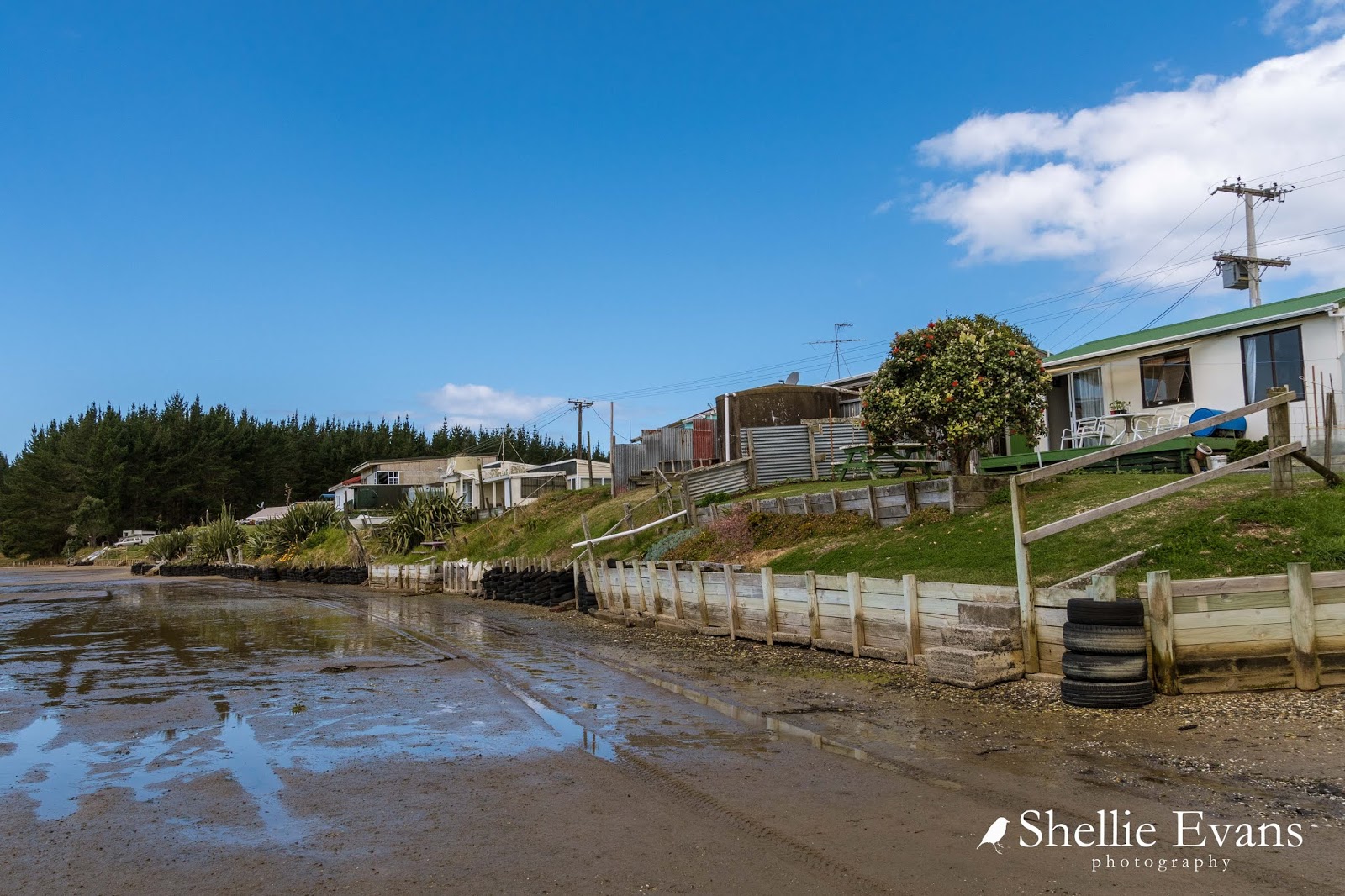
We had afternoon tea sitting on the tailgate in the warm sun and then spent half an hour retracing our steps and re-driving the last few kilometres when I realised my lens cap was missing. It wasn't until after about the sixth stop and search, including the mudflats in front of the Whananaki South baches, that I found it. In my pocket! I'm sure I double checked that before the call went out.

We headed off back to the main highway and home to complete the loop.

Here are the two churches I added to my collection; this one was way back at the beginning of the trip, just out of Whangarei; the Pehiaweri Maori Church near Glenbervie...


...and this one, the Holy Name of Mary Church in Hikurangi; I love the shadow the Phoenix palm fronds cast across the front of it.


To be continued... Part 2


Tuesday, April 24

Beach Hop North- Only in Tolaga Bay

Catch-up

Just a short 20kms from Losiels Beach and we arrived at our next camp site; Tolaga Bay also known by it's Maori name Uawa. Uawa is also the name of the very wide river that flows down from the ranges behind and splits the bay in two as it flows into the sea.


The driftwood sign sits on the dunes overlooking the beach (I had to prop up one arm of the U for my photo shoot)...


...which is just across the road from the freedom camping area. And what a great site this one is. There are several large mown bays along the road with plenty of space, along with another area up by the toilet block behind where we're parked. The front bays have post and rail surrounds, the ones along the road behind me have small hedge rows and trees.  


Like many once thriving and prosperous towns around the East Coast, Tolaga Bay township has seen better days. Though there's one building that really stands out as you drive along the main street (which is also the main highway north). The historic Tolaga Inn is huge and certainly makes a statement sitting on it's prime site corner. The inn was built in 1930 after the original 1880s hotel was destroyed in a fire.


Designed by the French-Canadian architect Sholto Smith, the inn is a classic example of the Tudor House design he became famous for. Tolaga Inn is one of just 100 buildings Smith designed for New Zealand (he lived here for 16 years) and one of only two commercial buildings he designed in this style. Many of his designs were done for wealthy Aucklanders back in the 1930s and several Remuera & Epsom homes are still standing (and still occupied by wealthy Aucklanders!) 


There aren't too many streets to explore in Tolaga Bay but while seeking out the two local churches to photograph, we came across this delightful sight just off the main street.

Only in Tolaga Bay #1 - two little piglets taking themselves for a walk


Only in Tolaga Bay #2 - a mobile tattoo parlour parked in the main street.


But of course there really is only one thing that comes to mind for many when you mention Tolaga Bay- the Tolaga Bay Wharf. 

Due to the isolation and rugged countryside along the East Coast, the only way for many years to get product and produce (farm & forestry) in and out of  the towns, was through coastal shipping. 


Tolaga Bay is shallow so a very long wharf had to be built, at 600m it was in fact the longest wharf in New Zealand for many years. It's since been overtaken by Bluff's Tiwai Point wharf  which is 1500m long. The Tolaga Bay wharf was built in the 1920s and the last cargo ship called by in 1967. 


Since then the wharf had deteriorated quite considerably until a trust was set up and funds raised to restore it. The wharf is now one of the major tourist attractions along the coast. I took these photos on our last visit back in 2011, the concrete rails have now been restored You can see the repairs in some of the photos further down.


We were running late to get to Gisborne on that last trip (after spending too much time at East Cape) and I was disappointed I wasn't going to be able to photograph the wharf in daylight. We arrived just as the sun was setting but what a thrill to find that the white cliffs behind the wharf were this beautiful golden colour. It was a brief moment in time, the sun was gone within minutes of our arrival.


I visited the wharf several times during our latest stay, hoping to catch the different moods and to capture a repeat sunset performance but unfortunately it was a different time of the year and the sun wasn't so intense. I still managed some great shots though, and that's what it's all about; not trying to replicate old memories just capturing new ones instead!

Only in Tolaga Bay #3 - When the local yobbos photo-bomb your wharf shot...


Just as I was lining up the wharf- it's quite hard to get the full length in on my usual lens so I had just changed to my wide angle lens- this Subaru wagon containing two young ladies raced down onto the sand and did a perfect doughnut right there in front of me.

I went to have a chat with them and found out they were waiting for these two who were collecting mussels off the pilings. It wasn't the warmest weather, in fact the wind was very cold and the guys came back shivering and shaking with just a few dozen. They offered me a few (which I declined because they actually didn't have that many), and they told me they were off to cook them on the BBQ.


While I was waiting for the sun to go down I walked to the end of the wharf...


...where a handful of people were fishing. I talked to an old Maori lady who told me she'd been there since 7am this morning. Seven am! It was now about 6:30pm, very cold and windy and with a rain storm approaching from across the ocean. She told me she'd probably stay another hour or so. Now that's dedication, and she hadn't had much luck either. She told me she usually caught snapper, the odd John Dory, an occasional kingfish and one day a crayfish! 


Only in Tolaga Bay #4 - this fisherman had the right idea, have a little snooze while you're waiting for the big one. 


I raced back along the wharf to the beach when I spotted the sun moving towards the horizon (the sun sets very quick when you're doing a 600m dash!) but there were only subtle colours this evening. 


And I have to add a note here- just for those that are keeping track of my 'trips' - I fell off a driftwood pile in my scramble to get down to the sand and scraped my shin badly.  I managed to hobble off like nothing had happened after spotting several people watching. And it's still giving me grief!


Even though I missed a spectacular sunset I did manage a very moody sunrise the next morning... 


....grabbing a few shots before heavy rain arrived and we hunkered down inside for the day.


In keeping with the our special national day of remembrance tomorrow- ANZAC Day, April 25th- here's my last photo from Tolaga Bay.  Lest we forget. 


Tuesday, October 4

Beach Hop South- Herbertville & the Pipi Bank

Real-time

Not far from Porangahau and on the way to our next beach destination we pass an iconic NZ tourist attraction, a place that unless you've in the area, is a very long way from nowhere. At 85 characters, this is the longest place name in New Zealand (and some say the world but that is often disputed). It belongs to a small unassuming hill on private farmland and luckily there is a signpost and information panel letting you know you have arrived, otherwise you might just drive straight on past!


I had a couple of goes at pronouncing it and it wasn't actually too hard if I broke it down into syllables or known words- although I'm guessing I didn't break them down or pronounce them correctly, but still I gave it a go. The Maori name translates to "the place where Tamatea, the man with the big knees, who slid, climbed and swallowed mountains, known as 'landeater’, played his flute to his loved one."  Locals simply call it Taumata Hill.


I'd been waiting to visit our next destination since we started the beach hop south. I've never been to Herbertville but I feel like I know it very well. 


Life time family friends of Mum & Dad lived in Herbertville for over 20 years, they owned the hotel and the campground and also had (and still have) a few properties in the village. By all accounts I think the village should have been renamed Sunnexville because according to the current owners of the hotel, the Sunnex family were very instrumental in helping the settlement survive and thrive. 


We met Lorraine & Art Bloom, the current owners, when we stopped in for a coffee. The couple have turned the old hotel into a combined bar, restaurant, cafe & small general store. They also have accommodation available and I have the feeling that their establishment would be a hive of activity over the summer months. 

You might remember the courtesy car from the Patangata Hotel early on in our Beach Hop, well this is Herbertville's version. For real! Apparently as part of the conditions of their liquor license a courtesy car must be available. It all makes sense now, we've seen some rather random and unusual courtesy cars in our travels but I think this one takes the cake! 


Anyway, I'm getting ahead of myself because before we visited the village we drove straight on through and out the other side to the beach, and then followed the gravel road down the coast a few kilometres until we reached Pipi Bank Station- what a cool name for a farm. For my overseas readers, pipi (pronounced pip-ee) is a shellfish that lives deep in the sand along many of NZ's beaches and which can be dug for at low tide. Cooked and eaten in pipi fritters! They are often packed together in dense patches, hence 'Pipi Bank'.


I had called ahead to the Station to ask permission to camp along the foreshore. Permission was granted as long as we didn't mind that the station's cows and calves were grazing the area and we didn't have a dog. I'm afraid no dogs are allowed at any time of the year.


We drove right to the end of the road checking out the numerous suitable camping areas and decided on one not far back up the road after turning around- it was reasonably level, close to the ocean, and had a minimal amount of fresh cow pats. It would seem the cows preferred these areas too.


In the winter we usually park so our slide-out is facing the view, that way we can sit at the table and watch the activity or take in the scenery from the warmth of our van. In the summer we usually have the door facing the view, then we can sit outside drinking (sometimes literally) in the spectacular views and enjoying the summer sun. I can't wait for summer because my bedside window is on the door side and I like to have it open to hear the sound of the ocean waves or a river passing close by.

That is Cape Turnagain, a prominent headland, on the other side of the bay. The cape was named by Captain James Cook in 1769, he sailed south to this point before deciding to turn and head north around New Zealand, hence the name.


And, it's not always the ocean view we see out the window. When you're out in the middle of nowhere it's a surprise to suddenly see a vehicle roaring past. Perfect and purposely fitted out for fishing I'd say. And in fact we later learnt that it was Lorraine & Art from the hotel- they were heading for the rabbit wall to check out the fishing. The rabbit wall is a wall of rocks on the beach which were put there to stop the rabbits from getting through. Though I'm not sure from what direction.


What a fantastic place to stay, we had the whole place to ourselves (well nearly if you don't count the local shepherds and fisher-people tearing by), wild, remote and rugged we both felt immediately at home. I went for a few walks down the beach at low tide.


Once I'd spotted a couple of rooks landing on the beach and I was hoping to catch them off guard by creeping along in the dune grasses, but we all got a fright when I stumbled upon them digging under a log. Rooks are quite common in the Hawkes Bay area but these are the first I've seen on this trip. 


I followed them up the beach for awhile but they always spotted me coming and flew further on. In the end I gave up and just took photos of the beach.


I found a number of mussel nurseries on the large rocks exposed at low tide, some interesting rock formations and the remains of  a vehicle tucked under a sand bank.


I walked home, back along the road...


...passing a few neighbours keeping a wary eye on me along the way.


And in fact every time I stepped outside or went for a walk I felt a hundred eyes following my every move...


I loved this little guy, that's him above trying to hide behind the road marker, he was giving the marker a hard time,  backing off and then running at and butting it as hard as he could. Except of course it kept bending over. It would bounce back and hit him in the face and he'd try again.


I hid behind the ute and he crept up on the van at one stage but then his mother saw me and called him and he raced off, kicking his heels up on the way.


When we returned to the village to check out the hotel, I took a few photos along the way- this is the memorial to the Herberts, early settlers after whom the town is named.  


In the late 1800s/early 1900s Herbertville used to be a thriving community. It had a large hotel, several shops, a police station and a blacksmiths. Schooners were beached on the vast expanse of shallow sandy beach on high tides and passengers and cargo unloaded. The ships would be refloated on the next high tide and carry on up the coast. Horse drawn coaches then made their way towards Dannevirke, 68km away. A memorial stands on the side of the road for past settlers; I think the cemetery is long gone, I couldn't see it anywhere.


The angle is a bit off here, there was a fence in my way, but it's interesting seeing the occupations and ages of past residents. This was just one side of the memorial (remember to click on the photos to enlarge)


The campground is pet friendly and also has 'permanent' sites which at $2500 for unlimited nights, per year, would make an excellent base for those that live on the road fulltime.


I love this bach, I could quite easily own this cutie.


And this old woolshed makes another excellent subject.


On our way home I stopped to take a photo of this grand old lady, the Burnview Station homestead. Burnview Station is just before Pipi Bank along the coast road.


We hadn't lingered in Herbertville as we actually had an appointment to keep- yes, in this most remote place we were due visitors! Lynn & Max have an Ultima 5th-wheeler too and have been following my blogs for a long while. The most amazing thing is that, Lynn had to drive over from Kimbolton in the Manawatu and collect Max who works at Weber and then come on out to Herbertville. They must have been really keen to see us- that is a bloody long way on very winding roads! 


It was great to meet them both, and we were treated to a some lovely goodies too. I didn't think the home-kill lamb chops would have looked quite the part in this shot, but they sure were tasty too.


Before we left the beach we drove to the top of the hill up the road. There's a track that goes all the way to Akitio, the next beach on our list south. Of course we wouldn't tow the 5th-wheeler over this track(although the bit we did cover would have been ok) but we wanted to see if the gate between the Akitio Station and Pipi Bank Station was open- we'd heard people do use the track with permission. The gate had a huge big padlock on it so there was no access to the uninvited today. 

Quintessential New Zealand- cabbage tree, surf beach, farm track, Ford utility (Ok, I put that in there for the Holden lovers). The view back down to the beach.


We had a lovely relaxing time at Pipi Bank but eventually it was time to head onto our next beach. 

Of course there were a couple of stops along the way; this family cemetery which is still being used by the Franklin family.


And a photo stop (only) at another country pub, the Wimbledon Tavern.