Showing posts with label spillway. Show all posts

Thursday, April 14

Benmore Dam- the Business End

Catch-up

We wanted to do one more tiki-tour before we left Omarama. A trip to check out the mighty Benmore Dam which was only about 15km down the road from us, on SH83 heading towards Kurow. 

We'd checked out the smaller dams and hydro canals that zig-zag across the MacKenzie Basin many times over, we'd visited the power stations at the top and bottom of the Tekapo Canal and the three on the Ohau Canal, we've been to both sides of the canal at the top of Lake Benmore, so now it was time to check out the business end of Lake Benmore.

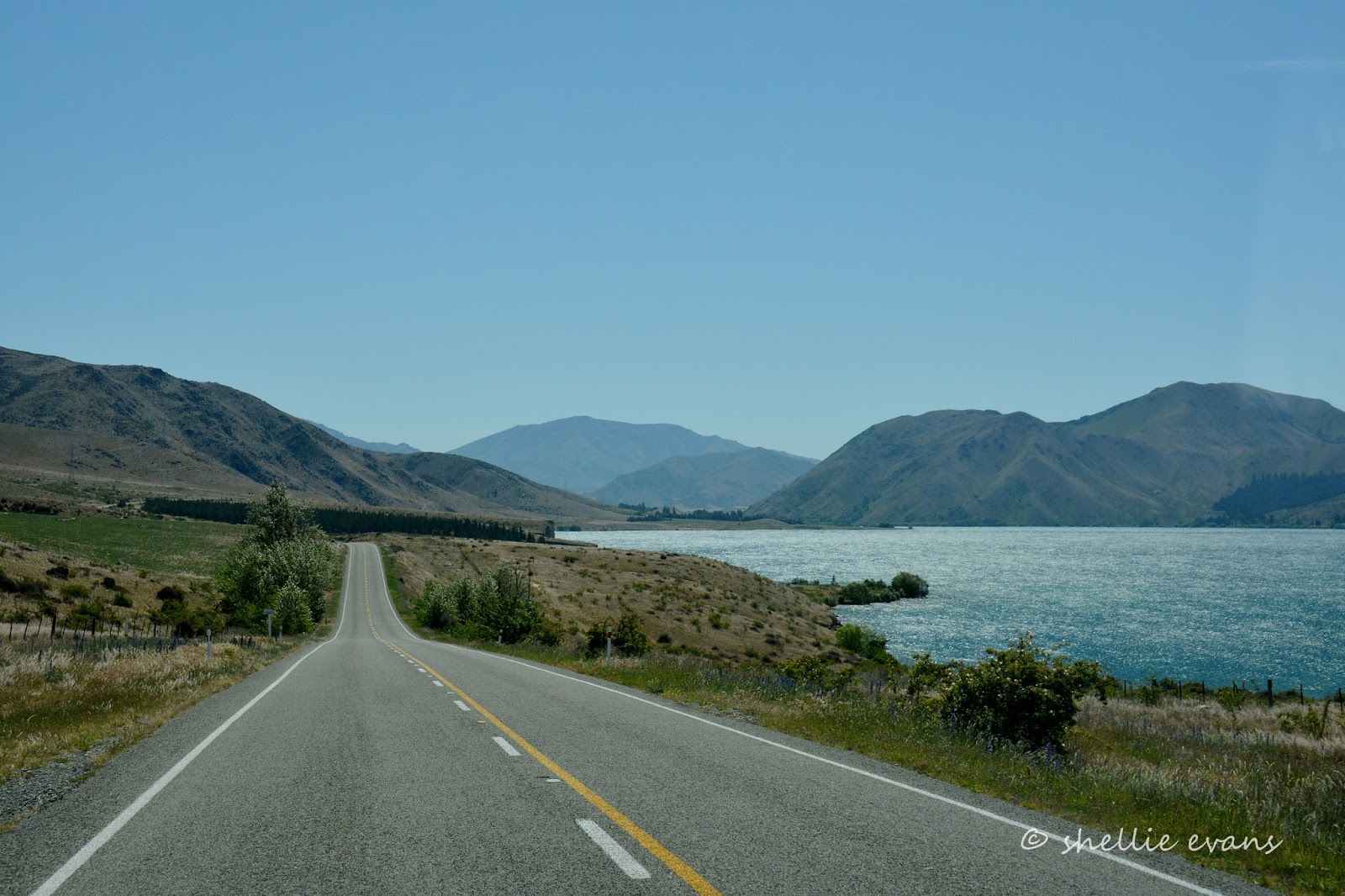
It's not long down the road before we come over a rise and see a lake ahead of us. This is Lake Benmore, not the main body but an arm that heads west just before the dam. Lake Benmore is New Zealand's largest man-made lake; it's 74.5 square kilometres with a 116 kilometre shoreline. It holds 1.5 times more water than Wellington Harbour.


Tucked into the corner of this part of the lake is Sailors Cutting, with a very popular campground, boat ramp and a sheltered boat harbour.


We turn off at Otematata- a town, like Twizel, that grew as a result of the camp that formed there in 1957 to house the workers constructing the dam. At the height of it's growth in 1964, the town had a population of 4,166. The dam was commissioned in 1965. Otematata now it has around 250 permanent residents with a large increase over summer as holiday makers set up camp nearby and around the shores of Lake Aviemore, which is downstream from Benmore.

We pull into a gravel patch below the dam- here's a panoramic shot which is 4 photos stitched together- I make work for myself, I should just use my phone for pano shots.


The Benmore Spillway is about 500 metres long and 55 metres wide on average, it can discharge an amount of water 10 times the amount of the river flow. water flowing down the spillway is deflected at the bottom into a wide arc to dissipate its energy before entering the river.


We headed up to the lookout, stopping to take the obligatory photo at the entrance to the power station.


I was a little disappointed with the trees growing below the lookout as they hadn't been chopped or trimmed so the 270 degree view was interrupted at regular intervals with pine tree spires.


I managed to avoid them by zooming in on the Waitaki River below the dam, the dam wall road is at the bottom of the photo. Isn't the colour scheme amazing? Typical Central Otago country. And yes the water was that colour, imagine what the view would be like in autumn when all that green would be a brilliant shades of gold. 


The lake behind the dam wall, there's even a tiny house boat tucked into the willows in the corner below us. 


We drove across the dam wall. Correction. David drove across the wall, I walked...


...so I could take photos looking down over the penstocks...


...and along the wall. Check out how huge that is, there are cars parked down the bottom there, to give you some perspective.


Benmore Dam is 110 metres high, 832 metres long at the top (no wonder it took so long to walk it), 448 metres at the bottom, and 11 metres wide at the top.


Benmore Dam is one of the largest earth dams in the Southern hemisphere and the power station is New Zealand's second largest hydro power station (after Manapouri which we visited early in our journey), with a generating capacity of 540 megawatts (720,000hp). 


David decides I'm walking too slow and drives back over to pick me up, giving me a chance to grab another photo for the blog header. Actually, he realises that it's a long way over, and it's hot outside, so comes back over to collect me.


The top of the spillway- wouldn't it be great to see that flowing. The spillway can cope with 3,400 cubic metres of water per second. Imagine riding that in a kayak or wake board.


There's another lookout beside the spillway on the far side, the shutes really are huge. Again, you can see a vehicle parked up on the top for a size comparison. The driver of the vehicle was working away somewhere deep inside the spillway workings, banging and crashing about. He also had his radio playing real loud. 


Large pylons marched away up the rocky hill behind carrying off their valuable booty. 


Benmore straddles two provinces; the spillway is on the Canterbury side of the Waitaki River and the powerhouse on the Otago side of the river. Further down the river is wide and there are many whirlpools, eddys and shallow bays reaching back into the willows. 


We carry on down the north side of the river...


Right round both sides of the lakes and along the river are dozens of interesting camping spots. Small and large grassed areas, some right beside the road, others tucked behind trees and right on the waters edge. There are also plenty of permanently parked caravans waiting patiently for their owners to return either for the new fishing season &/or summer. 

Of course most of the best spots have been taken by permanents but there are still more than a few ideal spots to park up for a few days. We will have to return here with the 5th-wheeler when the fishing's good.


It's not long before the river turns into the next lake, Lake Aviemore, another man-made lake with a dam at the bottom, all part of the overall Waitaki hydro scheme. The lake wasn't that appealing on our visit, as a howling gale was whipping straight down the lake.


I spotted a sign on the other side of the road, and we pulled up to take a look. Deep Creek looks just like it says, a very deep pool; there's boat access and it reaches way back up a narrow ravine behind. Obviously a creek must feed it, up the back somewhere.


Finally we're approaching the Lake Aviemore dam and Aviemore Power Station.


We cross over the dam and I can see off in the distance the third man-made lake of the scheme; Lake Waitaki. Water from the three MacKenzie Basin lakes; Tekapo, Pukaki & Ohau, pass through eight power stations on its journey from the Southern Alps to the Pacific Ocean, there's just one more power station after Aviemore and that's Waitaki at the end of the next lake. All eight power stations are operated from a control centre in Twizel.


We head for home, up the south side of Lake Aviemore....

...with one last stop to take a photo of this lovely old woolshed. 


Hmm......I'd love to do a tour taking woolshed photos....


Sunday, August 23

Morning Glory Spillway & Cambrian

Ten kilometres east of St Bathans is the Falls Dam, a rock-fill dam that was built in 1934 (another Depression era irrigation scheme) by damming the Manuherikia River at the top of a narrow gorge, the river’s headwaters start high up in the snow covered Hawkdun & St Bathans Ranges and flow through the Manuherikia Valley before its confluence with the mighty Clutha River at ‘the bend’ in Alexandra.

We turn off the road and head up a gravel track alongside the river for 5-6 kms…. 


…entering the bottom end of the dammed gorge. We pass four old chimneys on the banks of the gorge not too far from the dam wall. We check them out and decide that there were two identical houses on the site at some time in the past, possibly construction workers houses. Looking over the edge of the narrow track on our way down to the dam wall we can see a tiny power house tucked in under the wall.


But what makes this dam more interesting than most is it’s unique spillway, this is a morning glory spillway. I am assuming it’s name comes from the morning glory flower that looks very similar, the flower’s white veins mirrored in the fins of the spillway. Unfortunately there was no spill happening, I guess we’d have to come back when the spring snow melt happens to see water pouring over the edge and down the hole.


There was locked gate with a “No Entry” sign which would have been easy to climb, but frankly deep dark holes like that scare the bejesus out of me so I quite happily stayed on the right side of the fence. Unlike a family who arrived not long after us, they climbed the gate, walked to the edge and peered in. And I’ve seen photos of people standing on the concrete leaning over the railing right on the edge of the hole. No thank you!


On our way back to camp, we stopped at the top of the hill overlooking the St Bathans settlement, the snow covered Mt St Bathans and the Blue Lake, on this day looking very grey and uninviting.


We had a few hours left in the day so we carried on past the Domain Campground and down the road to check out one more tiny village before we headed off to Ranfurly. You might remember in my St Bathans post I mentioned the rivalry known locally as “The War of the Roses”, between the Irish settlers (Catholic) at St Bathans and the Welsh settlers (Protestant) here at Cambrian.


Known as Welshmans Gully during the 1860s Otago gold rush, it was later renamed Cambrian, the Latin name for Wales. It would seem that some call it Cambrians and others Cambrian, I couldn’t find out which is correct or if in fact both are OK to use, as the old wooden school, built in 1873, was closed. History and information boards on the settlement are displayed inside.


Cambrian is now a tiny creative community, sculptures and other artistic works of art are dotted along the short main street (the only street). And not too many people know, but Cambrian is also the home of Graham Sydney, the well known NZ artist who made the Maniototo famous with his paintings of the vast dry plains, tiny abandoned buildings & the surrounding mountains and ranges.


The locals love their old homes and especially the restored mud-bricked cottages. There are a few newer homes and cribs(holiday cottages) and some still to restore.


I thought the sign on the gate of this cottage said ‘Beware of the Dog’ and I was thinking that’s a bit weird there are no fences to keep it in. Until I moved closer to see that it said ‘Beware of a Hug!’


A lovely rest area has been developed at Cambrian Common Forest. There are dozens of trees, including Redwoods which will be here for many years, a sign encourages visitors to wander amongst the  snowdrops and emerging bluebells.


I found this lovely cottage which I’d be happy to live in, it's my kind of house. I’m not so sure I’d like to live in Cambrian though. It’s a sleepy little settlement off the beaten track at the base of the Dunstan Mountains where I’m pretty sure the winters would be fierce.


There’s a stone cairn at the entrance to the village, commemorating 150 years settlement of the area and the original cemetery beside it, with just the one enclosed gravesite and an old marker post all that is left.


We had one last stop on the way home so I could take a photo of this very old and unusual shaped woolshed.


And then back to the Domain to see if the next day brought better weather…I don’t think so.


Saturday, June 13

The Road to Nowhere - Part 2

Well that’s not quite right, it did go somewhere but not after a bloody long way!

Once we'd finished exploring the deserted camp at Haldon Arm, Lake Benmore we started thinking about heading for home. But which way? The thought of a 60+km trip back over the same road wasn’t too appealing.

In my map book, a road left the campground in the opposite direction, it branched a little further on where one road followed the Tekapo River all the way back to Lake Tekapo & home, the other road followed the Pukaki River to Lake Pukaki. The Tekapo River route was 40kms long but then it looked like there wasn’t an exit at the other end- imagine that, driving all that way and not being able to get out. The Pukaki road looked to be about 20kms and then another 30kms along the main road back to Tekapo. We decided to drive the Pukaki River route.

As we pulled out of the camp, the road (I use the term loosely) was all gravel and rocks. Hmmm….this should have been a warning, but we thought maybe it was just like this at the beginning and it might smooth out a little once we moved away from the lake.


Well it did, but not much. I know you’ll be sitting there thinking that doesn’t look too bad, but believe me it’s a bumpy ride. I felt like we were following the ‘Rabbit Proof Fence’, which of course we were. I wondered what covered this land before rabbits & briar bushes were introduced?


After a few kilometres we arrived at the split in the road. Mr TomTom kept flashing us a warning ‘No Road, No Road, turn around at the next possible place’- we should have heeded his warning.


But once again we thought, surely this will level out a bit more now that we’re in the open and, hey, there’s even a road sign pointing the way.


I was a little worried when I saw on the map that we’d have to ford the Tekapo River and not knowing how deep or wide it might be, we might have been in a little trouble. It was a relief to find a narrow steel bridge over it.


It was about now that we thought perhaps we should turn around, at least the 60km gravel Haldon Road was smooth and reasonably straight. But we were already about 5kms into the journey and hey, there’s only another 15 or so to go. I’ve said it before & I’ll say it again, I know a lot will be thinking 5kms is not much, but when you’re only travelling at an average of 10-15kph it’s a bloody long way.

Oh look, there’s Mt Cook! Not much further now. Yeah right.


In case you’re wondering about the colour difference in the photos- some are taken through the green tinted front screen of the ute while others are taken when we’ve stopped for a breather (and to rest our sore posteriors after all the bumping about).


The road went on and on as we eagerly counted down the kilometres. The rocks didn’t get any smaller and in some places got even bigger. The fence also went on and on, it intrigued me to see that rocks were lined up all along the bottom of the fence- to stop rabbits burrowing underneath- but from which side I wasn’t sure. And I wonder whose job it was to stack miles and miles of rocks.


The track (I’ve taken to calling it a track now- my butt is starting to ache) came in close to the river bed on numerous occasions- usually as the rocks got bigger. This is a huge river bed, a couple of hundred metres wide but a river bed with no water. A bit weird, and I’m not sure if it ever has water in it. Of course the water that would have once filled this river has been diverted into a hydro canal. Perhaps in early spring when there’s a lot of snow melt there is a overflow down here but looking at the scrubby plants growing in the bed I don’t think it would be much anyway.


Ahead of us on the horizon I can see a chimney, it’s not hard to spot given that other than the few wildling pines it’s the tallest thing around for miles. But where did it come from, it looks totally out of place. This is the Pukaki Inn chimney. The chimney is all that remains from one of the original accommodation houses in the area. When there was a river running past. It’s thought to have been constructed in the 1920s and it’s still another 7kms from here to the Pukaki Spillway & the main road so I guess unless you’re biking or 4WDriving, not too many people would get to see this. Another hidden 'gem'.


The track climbs to a high point above the river bed and out on the edge of a cliff I find that it’s a long way down. I needed my little stickman to be down there to give you perspective. Ooh….look there’s the chimney back there, to the left of that grove of trees. This was once a massive river.


This must be the oddest sign I've seen on our travels- but first, I’d like to know how they managed to get this far.


As you can see the rocks never got smaller, it was a long and bumping ride. Of small consolation was that there was no dust. A very small consolation. We began wondering what would happen if we had a puncture. One would have been OK, but what about two? I told David he'd be the one walking for help.


And then finally ahead of us we could see the Pukaki Spillway with a stream of tiny cars passing along the top; the main road traffic. There was a deep pool of turquoise water at the base of the spillway but no flow (of course) downstream.


One hour 30 minutes and 20kms later we finally popped out onto the main road and that magnificent view (and our first on this trip) across Lake Pukaki to Aoraki Mt Cook.


I said to David- ‘Next time I want to see Mt Cook, could we take the main road?’


While I wouldn’t say we’re glad we did that trip, I couldn’t say we’d rather we hadn’t either. The first half was great, the lake stunning, the views spectacular. Whereas the second part was interesting (for the first couple of kilometres anyway) and somewhere not too many people would have travelled.