Showing posts with label tram. Show all posts

August 18, 2016

Napier- A Refreshing Walk

Real-time

We've had a busy time in Napier although if you asked 'doing what?', it would be hard to answer. We've both been busy catching up on lots of small jobs on our computers and the vehicles... ours and Mum & Dads'! It's a great feeling when you cross items off your 'to do' list, although it seems I have been adding jobs to the top as fast as they're dropping off the bottom because the list looks just as long as when we arrived.

Snow still on the Kawekas this past week
It's been typical sunny and warm Hawke's Bay weather this past week or so but the big storm hit us not long after we arrived in Napier, with snow, rain and power cuts. I had a chuckle though, it was bucketing down outside, the wind was atrocious, snow had closed the Taihape & Taupo roads (a rare event, especially the Napier-Taupo) and the power was off for the second time in a few hours. 

My sister Gae & brother-in-law David, were visiting from Whangarei and we were having a small family gathering later in the evening. I went inside (we're parked beside the house) to see how they were all going- to be greeted by a miserable lot sitting in the dark, wrapped up in extra clothing, with no heating, no coffee, no breakfast, no TV and no way to cook for the party. I returned to my diesel heated van, to drink my coffee and eat my bacon & eggs while listening to my favourite music. Just another day for us, don't know what the fuss was about! Luckily the power did come back on later in the morning.

It rained solid for a good few days and by the time it stopped some of us were suffering from a dose of cabin fever, so Gae, David(BIL) & I headed to Ahuriri for a walk to blow away the cobwebs. While we were waiting for a friend to join us, I wandered down to Perfume Point to take some photos of the murals painted on the side of the lighthouse.

'Marine Protected Areas' by Aaron Glasson
The 'Sea Walls: Murals for Oceans' street art festival was held back in March. Over 30 large murals have been painted on walls around Napier. Their aim is to highlight marine environmental issues relevant to the local community. It was my intention to photograph them all before we left Napier, and I have managed to do just that later in the week. But I'm only going to show a few here, the ones we passed on the walk. I'll do another blog with the others later on.

We headed off down the boardwalk past East Pier Hotel...


...along the front of The Boardwalk Restaurant where waves from the weekend storm has left sand, seaweed and driftwood across the path.


Some hardy paddle boarders were riding the waves a little further along Hardinge Road.


And we passed another mural- Endangered Maui's Dolphins- on a wall at Napier Port.


It was very cold with a bitter wind blowing as we turned onto Marine Parade but it was lovely to breathe in the fresh sea air. It was lucky Gae borrowed Mum's big thick jacket even though it nearly swallowed her up. While these Northlanders are well used to rain, they'd forgotten how cold it can get in the Bay. 


Well, it's not quite New Brighton Pier but Napier's new viewing platform looks pretty cool against a brooding sky and rough ocean.


It's probably just as well it doesn't reach any further than the high tide mark because I can imagine the problems it would have caused with people using it as a launching platform to swim from. The waters off Marine Parade are dangerous enough at the best of times, let alone when there's a storm a brewing.


And at least the view back over the beach and along Marine Parade is one we've never seen before. 


We make our way back to the road passing two old favourites along the way; the Tom Parker Fountain and Pania of the Reef.


We head towards Shakespeare Road to walk back over Bluff Hill. The 1909 old County Council building is now a luxury boutique hotel, this was one of just two significant buildings that survived the devastating 1931 earthquake.


I spot another mural tucked beside a nearby carpark- Plastic Pollution Affecting Sea Turtles


We stop beside a familiar building, the old Cabana Hotel at the bottom of Shakespeare Road. Gae, Jill and I all went to Napier Girls High School which is just up the hill. The Cabana Hotel had a very rough reputation in it's day and any girls walking into town at lunch time or after school had to walk the gauntlet past the public bar which was usually full of drunken dropouts and sailors from the boats in port.


We carried on up Shakespeare Road, a walk we would have done dozens of times during our teenage years, even though Gae & I caught a school bus from the farm to school in our early years, and then later, rode our motorbikes or drove our own cars. We were the lucky ones, you were only allowed your own transport if you lived out of town. But we often had a pass to walk into town for various appointments or shopping.


We passed the Naked Witch, which, according to Jill, in 'famous in Napier'. I wonder if it has anything to do with a certain notorious lady who lived her final years in Napier, loved purple and was a self-proclaimed witch.


We head down the other side of hill back towards Ahuriri, and I catch a quick glimpse of Napier Girls over the top of the old dairy, a shop I saw the inside of a few too many times.


We pass this unusual tiny little house tucked into the cliff at the bottom of Shakespeare Road. Its been there for a long while but none of us know it's history.  


The many houses of Scinde Island (Bluff Hill) and Ahuriri, most built before the 1931 'quake and when water surrounded the hill, and Ahuriri was a busy port.


Gae does her best impression of a 1930's flapper beside the historic Tram Shelter near Battery Road in Ahuriri.


In 1911, the council installed an electric tram system that linked Ahuriri to downtown Napier, the service ended after the earthquake but the well-preserved tram shelter still stands and murals in keeping with Napier's Art Deco theme have been painted on the walls of the building.

We carry on along Waghorne Street, an area steeped in history, where new apartments sit alongside tiny old fisherman's cottages and industrial warehouses. Ahuriri was one of earliest settled areas of Napier when the harbour at Iron Pot was the site of Hawke's Bays main port.


We say hello to Dulcie's owner as we pass, she's having a few battery problems, poor girl.
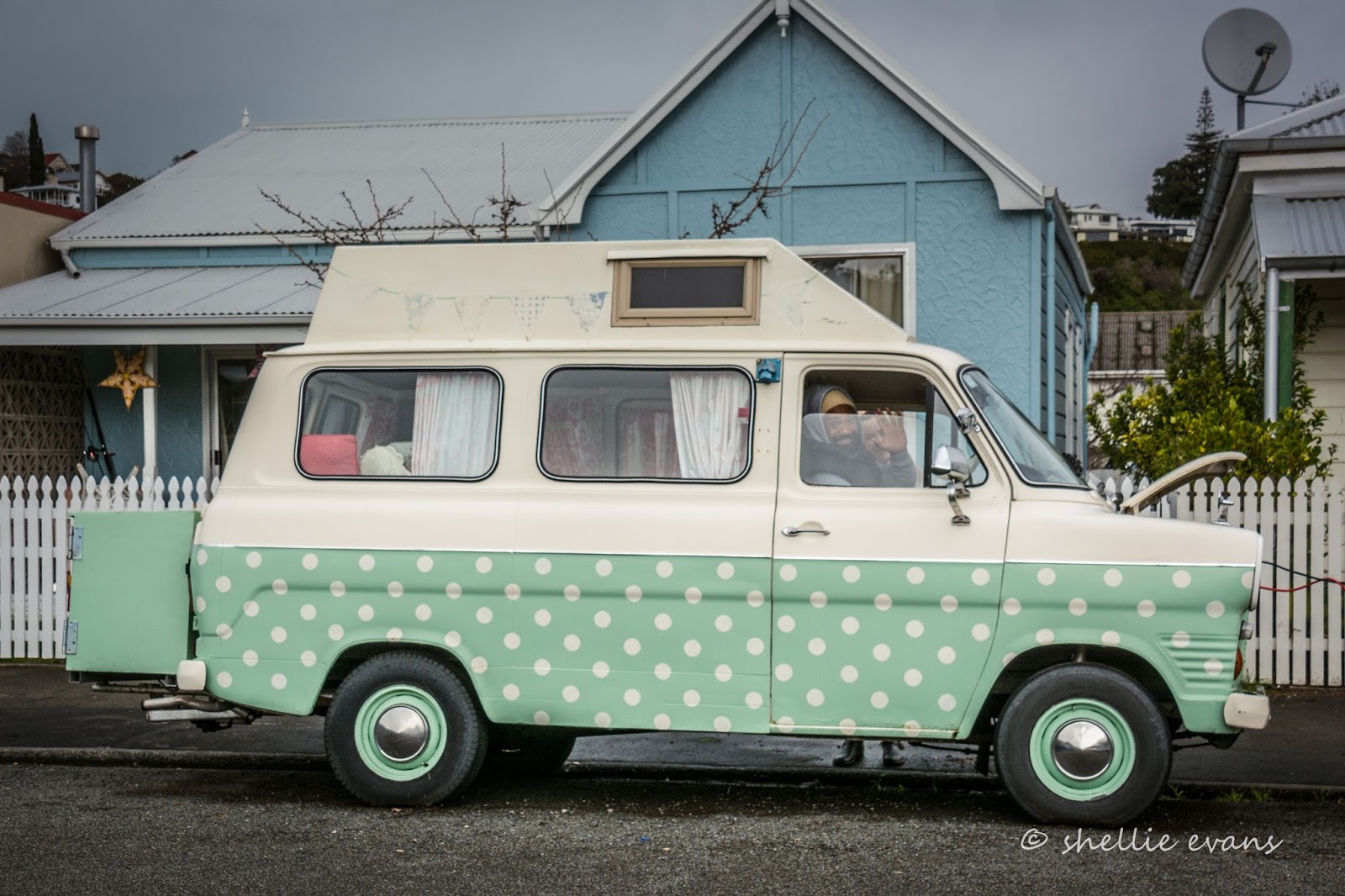

The things you see along the backstreets...


One of the old fishing cottages...


Another Sea Wall on the side of the Navigate Hotel & Apartments- Bryde Whales & Fishing Ships


And a final wall for now, in amongst the shops and cafes of Ahuriri village- NZ Endangered Marine Animals


We cut back up Barry Street to the waterfront and the cars, passing the restored facade of the Ellison & Duncan building with it's quirky window murals.


The original building was designed by Louis Hay as part of the reconstruction of Napier following the 1931 earthquake. Louis Hay also designed the nearby iconic National Tobacco Company building.


Back at the carpark we say goodbye to Jill and head home, happy with our walk and feeling very refreshed.


August 07, 2016

A City Rebuilding - Christchurch; Part 1

Catch-up

We've visited Christchurch numerous times since we've been on the road, staying at the NZMCA Park at Weedons which is about 20kms from the central city. We've driven through and around the city many times, along broken roads dodging oodles of orange cones, past crumbled buildings and vacant lots, down deserted overgrown suburban streets, and as the city slowly rebuilds, visited the many new shopping centres and commercial buildings in the suburbs. But I've never taken a dedicated walk through Christchurch's devastated central city. 

Until this recent visit, I always felt like I would be intruding, being ghoulish in visiting the scene of so much heartache. But now, over five years on from the devastating February 22nd, 2011, Christchurch Earthquake, it was time to take that walk and explore a city rebuilding. 


Of course the first stop had to be at one of the most recognisable symbols of the earthquake, the remains of the iconic Christchurch Cathedral in Cathedral Square. Once the heart and soul of the city, the Cathedral and the Square are shadows of their former selves. (Remember to click on the photos to enlarge)


The support structure at the front of the church was put in place after the earthquake to protect the magnificent stained-glass 'Rose Window'. Unfortunately it acted like a battering ram in the June 2011 earthquake which was then followed by a more powerful aftershock. The Cathedral is one of the many buildings in the city that are in limbo; awaiting insurance &/or court outcomes as various groups fight for the right to rebuild, or demolish and move on.  


I decided to take a tour on the tram first, to get an overall picture of the city and, more importantly, try to get my bearings. I was having a little trouble recognising many of the remaining buildings.


We once had a factory (rotational moulding water tanks) in Riccarton which we visited two or three times a year, often staying in the central city at the Heritage Hotel.  I was happy to see that the Old Government Building where the Heritage is located, was up and running again after having its quake damage repaired. Unfortunately the Heritage's main tower building which was beside the OGB didn't survive the quake. 


I was lucky enough to share my tram ride with a very well-known and much loved Christchurch character; the Wizard, a real, live, walking, talking tourist attraction...


...whose familiar doubled ended Volkswagen, I found parked in its official council carpark...


...at the top end of New Regent Street with its Spanish Mission revival style. New Regent Street was the only remaining heritage streetscape left in Christchurch after the February quake. Owners & tenants worked together to restore the buildings which have a Historic Place Category 1 Status.


I was a little sad to see how much progress had been made on "The Piano- Centre for Music & Arts" building, in the new performing arts precinct, and beside New Regent Street. Purely selfish reasons of course...


The Piano has covered up a beautiful piece of street art; 'The Ballerina', by my favourite street artist OD (Owen Dippie) who has in the past painted many beautiful murals around Tauranga & the Mount (his home town). I was lucky enough to shoot the ballerina just as work started on the Centre for Music & Arts last June. It's the only subject I have photographed inside the central city, because, as is the norm with street art, I knew it would be gone before long. You can see more of OD's work on one of my earlier blog posts by clicking this link.

Take a bow Christchurch
I did a circuit on the tram but didn't use the hop-on, hop-off option at any of the 17 stops, I decided it would be easier to walk some of the circuit afterwards taking photographs- through glass and around people moving about is just about impossible. I got off at New Regent Street...


...and followed the tram through Cathedral Junction...


...out the otherside and back around Cathedral Square...


...past the Cathedral once again, where there was still a steady stream of visitors viewing and photographing the ruins...


Past a couple of soapbox preachers and the local 'boys' playing chess...


...up over the Avon and along Worcester Street, past the shored-up 'Our City- O Tautahi', a Grade 1 historic building awaiting restoration. Originally the first council chambers, the Queen Anne style building was built in 1887. That's the old Rydges Hotel in the background, awaiting repair after a long standing insurance dispute.


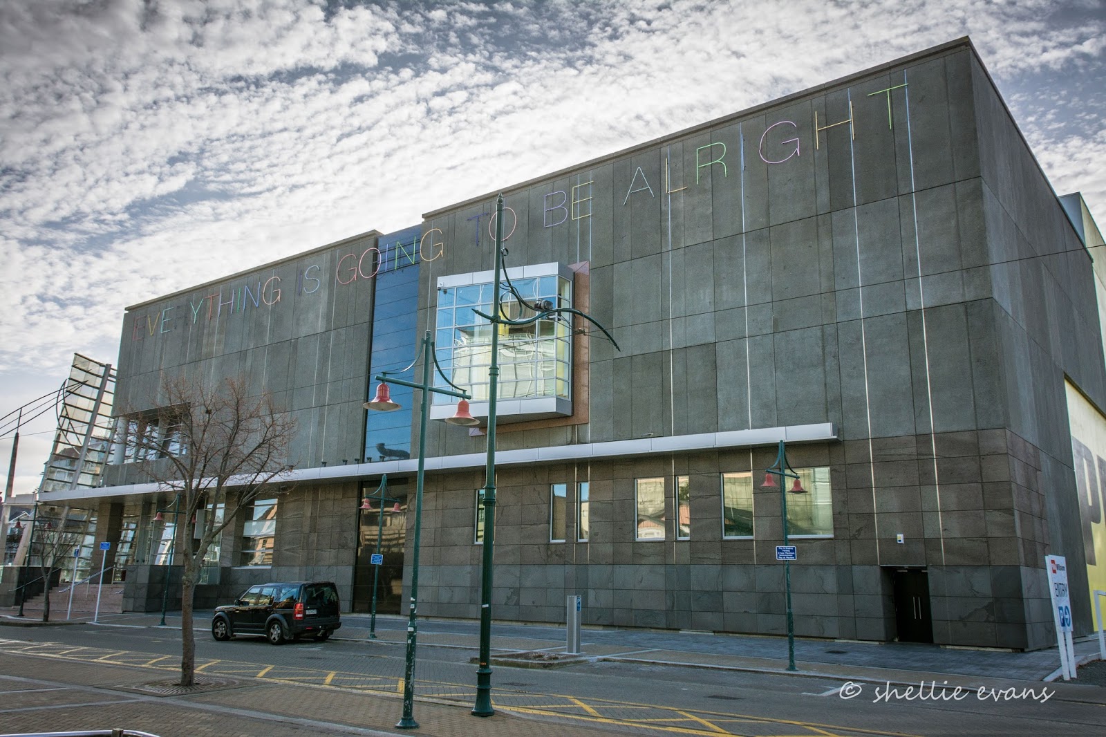
A little further on down Worcester Street is the Christchurch Art Gallery- Te Puna O Waiwhetu with Martin Creed's 46 metre neon artwork and very poignant message "Everything is Going to be Alright" blazoned along one side of the building (it lights up brightly at night). 


This magnificent building came through the quake virtually unscathed (the concourse had to have it's floor re-leveled ) but was only re-opened to the public last December, nearly five years after the event. It was used by Civil Defence, SARs and the NZ Defence Force and became the co-ordination centre for the official quake response. 


The building's intact & distinctive glass facade was beamed around the world as media gathered on the forecourt for press conferences and live updates.

The large 1.7 tonne 'bronze bull atop a grand piano' once stood for 30 days as an art installation on an empty site in Madras Street. It became a symbol of hope in an earthquake-ravaged city and was eventually purchased for the gallery through a public fundraising campaign.


I wanted to check out a recent addition to the art gallery's 'Outer Spaces' art works- the rather creepy 'Quasi'  hand and face sculpture by Ronnie van Hout (and yes, it's named after the quasimodo character from 'The Hunchback of Notre Dame'). The 5m tall giant hand with a slightly grim face peers down on the city from a rooftop corner- you can see it on the far left in the photo two above.


I left the art gallery behind (I'll visit inside another day) and headed back up Worcester Street, back over the Avon and turned right down Oxford Terrace past the old Public Trust Office; another building battling for its life within the courts.


And past buildings that are just beginning their life. Oxford Terrace's The Strip will once again be the hub for the city's hospitality, with two levels of bars, restaurants and outside courtyards looking out over the Avon. 


Here's an artist's impression of what it'll look like once completed; a far cry from the original and sometimes infamous Strip, with it's tightly packed restaurants, bars and nightclubs in and amongst the many historic old buildings which mostly collapsed in the quake or were demolished soon afterwards. 


And looking back down Oxford Terrace...


The terraced seating beside the Avon River would be a lovely place to rest and watch the world go by....although, as my mother used to say, 'sitting on concrete will give you piles'. I think they need cedar wooden slats to make it more comfortable. I have a sneaky suspicion the ducks think it's rather nice too.


I carry on until I reach the Bridge of Remembrance which had been off-limits since the quake while a three-year strengthening and repair project was completed. It reopened on ANZAC day this year.


Across from The Bridge of Remembrance is the Cashel Street Mall, and like the buildings of Oxford Terrace, many of the malls's historic buildings collapsed during or were demolished after the quake. It's here on the corner of Oxford & Cashel that I feel a little melancholy and a sad sense of loss for the city, it's hard to reconcile this part of the old city with the city I see in front of me today. 


To be continued.... Part 2