Tuesday, May 10

Winton to Queenstown- Lake Hayes

Real-time,  two blog posts for the price of one today! We are out of range tucked up beside a tiny little lake just out of Queenstown (tucked up out of the weather too, we hope) and have come into town to get a few supplies and upload a couple of blogs.

After a ‘slight’ detour down to Winton two weeks ago, we said goodbye to the family on Friday and headed north again, back towards Queenstown. We had a lovely time but needed to leave them to it after their extremely busy first week back at school and work after the holidays.The weather was great, very mild and sunny for this time of the year and with spectacular sunrises and sunsets nearly everyday.


We took a picnic lunch to Dunsdale Reserve on one of the perfectly sunny days. The reserve is located in the Hokonui Forest Conservation Park a few kilometres inland from Hedgehope on the Winton to Gore highway. After passing through a pine forest on a typical forestry road of gravel, mud and corrugations, it was lovely surprise to find a beautiful green open park at the end of a the road, surrounded by native bush with a small river on the boundary. Self contained freedom camping is allowed here and I’ve heard that it’s a very busy place over the summer holidays. Today there was just one house truck and us.


There’s an easy 1hr return walk up one side of the river, passing a small waterfall on the way and through an open burn at the far end before returning down the other side of the river. Ollie managed to spot a large trout sheltering under the bridge at the top of the walk which spurred him on just in time, as he was getting tired.


The kids also had fun locating as many different birds as they could (when they stopped long enough to watch and listen) and there were plenty; fantails, tomtits, brown creepers, bellbirds and wood pigeons swooping and diving high above the trees. The bush is in mast this year and covered in a mass of colourful berries, both high and low, providing plenty of food for both birds and pests alike.  The red berries are on a pittosporum, the  translucent orange berries are hanging from the Myrtaceae shrub and the red berries with black caps in the two bottom photos are on Kahikatea trees.


For a bit of variety when we left Winton we took a different route, crossing the Oreti Plains through Wreys Bush, up to Mossburn, onto Five Rivers and then back onto SH6 through our favourites country towns of Athol & Garston and then on along the edge of Lake Wakatipu. It was about 20kms longer but the roads were nice and straight and with hardly any traffic.

We stopped just south of Athol at the old Fishermans Retreat Tea Rooms. I saw the autumn colours were just starting turn when we passed on our way south two weeks ago, so I was hoping they were still showing. The Tea Rooms look abandoned but just after I’d finished taking a few photos, smoke twirled up from the chimney and a fat ginger cat came out of the undergrowth towards me. Somebody must be living out the back.


With no strong winds and mild weather, many of the trees were still in their beautiful autumn colours. Behind the tea rooms are a row of ramshackle cabins, obviously where fishermen used to stay while fishing the local rivers (trophy trout rivers)- that’s the cabins in the top left photo. We continued on, stopping briefly at Athol so David could check a couple of things in the van. Never one to miss an opportunity, I quickly took some autumn shots of Athol’s St Bartholomew Church.


It’s a quick and…I was going to say smooth trip through the Devils Staircase alongside Lake Wakatipu, but that would be fibbing- the road along the lake is extremely lumpy with plenty of dips and rises where subsidence has been repaired. It felt like we were riding a roller-coaster!


Our destination is beautiful Lake Hayes, located in the rolling countryside of the Arrow Basin between Arrowtown and Queenstown. The lake is surrounded by golf courses, luxury houses, vineyards and lifestyle blocks. The Remarkables once again form a backdrop to some stunning scenery.


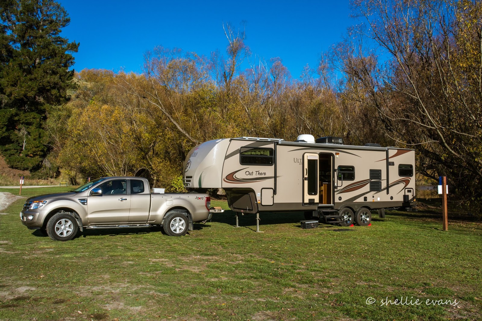
Lake Hayes has a small area where freedom camping is allowed for two nights only, and only between the signs. You can see the one beside us and the other one is at the far end. It’s also well known (or should be) that the Queenstown Lakes District Council rigidly police their freedom camping bylaw and rangers check the sites regularly.

There’s a walking (and cycling) track right around the lake which takes about 2-3 hrs to complete. It must be like the Mount walking track; it’s very popular and used regularly by locals for their daily exercise. A continuous parade of cyclists, walkers, pushchairs and dogs pass by our camp site. It’s very pleasant under the willows at the waters edge where there’s also a number of kayaks, canoes and paddleboards passing by.


By late afternoon a steady stream of sleeper-vans, campervans and motorhomes arrive to stay the night. The allowed space isn’t that big and would comfortably hold around 10 vehicles. By night fall there were 19 vans squeezed into the space, with a few of the smaller vehicles out the back under the willows. The two motorhomes to the right of us were outside the sign and I was worried for them. They have tried to park correctly but there is no space left (that’s when you need to find another park….or go to a campground). I know of someone that was fined for parking just outside the sign here.


There were also at least 10 other vehicles parked up for the night elsewhere in the reserve. They were either choosing to ignore the rules or were oblivious to them. More fool them. I’m not sure whether I slept through the visit on the first night or the ranger didn’t come but I know he came the next night at some un-Godly hour shining his torch on every vehicle and writing down registration numbers and checking self-containment stickers. I bet those that where elsewhere in the park woke up blissfully unaware that their numbers had been taken and a $200 fine was awaiting them when they returned home or returned their rental vans.


I was up early to catch the sunrise and found an old favourite down on the lake edge; two Australasian Crested Grebes calling to each other as they dived and fished in the shallows.


Sunrise over The Remarkables, you can see the ski field access road zig-zagging up the side- a bit of a necessary blight on the landscape.


Clouds gather over Queenstown at the end of the lake and a rainbow forms a perfect bow over the lake.


The pink sunrise glow quickly disappeared to be replaced by darkening storm clouds and big spots of rain. Thankfully it didn’t last long, which was just as well, as we only had one day to do one of our ‘must do’ road trips before we had to move on.


While we were getting ready for the day- I was cleaning my camera on the sofa and David was cooking his breakfast- I felt the van move. When I looked up, a woman had stepped up to our top step, and was holding onto the handrail, posing for a photo! The bloody cheek of it.

We often have people (mainly tourists) taking photos of the van or themselves in front of or to the side of the van but have never had someone be this rude, especially as our door was open (the screen door was closed) and we were inside. She got a short shift from me, I opened the door and said “EXCUSE ME….”  as she nearly fell off the step. Another lady came rushing over apologising profusely and then asked if she could have a photo taken! I was lost for words.

A group of about 15 people had arrived in three Jucy people mover rentals (thank God they weren’t sleeper vans), sped into the gap between our vans, tumbled out of all the doors, took dozens of photos down on the water front and under the willows, posing this way and that and then spread out around the remaining motorhomes taking photos. Then they all piled back into the cars and roared off. So keep your eye out for a marauding pack of shutter happy tourists who have no idea of personal space! I tell you, life on the road is never dull.


The rest of the day was taken up with a exhilarating drive through Skippers Canyon and visit to the remains of the Skippers gold field.


But you’ll have to wait for that blog, it deserves it’s own post.


It was another stunning sunrise the next morning but it soon clouded over.


We’d also had our two nights and it was time to move on. It’s a pity the council don’t allow three nights at Lake Hayes, this would give people two full days to do their activities. We still have a few things to do but we’ll wait until we come back through after we’ve been down to Glenorchy and Kinloch at the bottom of the lake.

We stopped at the top of the hill so I could take one last photo of what was left of the autumn colours. The willows have just about shed all their leaves and being such a dull day the colours weren’t so great.


Thursday, May 5

Booming Beauties

Real-time

Can you guess what is hiding under the branches? They (there are two of them) are very well camouflaged...


No? Then try this one, where you can some tail feathers. 


These are two gorgeous and very rare, critically endangered Kakapo chicks; a female and a male (males are bigger). Pearl was her name and  I can't remember what the male's name was. That's Pearl with her head up below.

We are now in very elite company. With just 123 adult birds left in the world, there are very few people who will ever see a living Kakapo, let alone three living Kakapo!

The Kakapo is a large, flightless, nocturnal, ground dwelling parrot that is endemic to New Zealand. A combination of traits make the Kakapo unique among its kind; it is the world's only flightless parrot, it's the world's heaviest parrot, it's nocturnal and herbivorous, has no male parental care and is also possibly one of the world's longest-living birds.

'Hey, who's that taking my photo?' 


You'll remember that we were lucky enough to visit Sorocco when he was in residence at Zealandia in Wellington, doing his bit as ambassador for his species. Well, when a blog post arrived from DOC telling me about the chance to see Kakapo chicks in Invercargill every weekend during the month of May, I jumped at the chance to visit them. The ten oldest chicks will be re-located back to their predator-free island homes during June and this was a chance for the public to view some of them and support the Kakapo recovery programme.

And because last Sunday was the first day of May and the first day of the tours, we were amongst the very first people to do the tour. The timing was perfect as we'll be gone by this weekend. 


DOC has a Kakapo rearing unit located in a large non-descript, unmarked, office building near the old rail station in the city. The rearing unit takes over incubating and hatching the fertile eggs, which have been collected from the nesting females, on their island hideaways. Then the youngsters are hand-reared until they are old enough to survive by themselves, back on their island sanctuaries.

During this breeding season, 46 chicks have hatched with 36 surviving, making it the best breeding season since the recovery programme started 25 years ago. The chick numbers won't be added to the overall tally until the young birds reach 6 months old and are out of danger.


The only problem with the visit was that no cameras were allowed. With only 10 people at a time in the display room and only for a very short time, if everyone had a camera trying to take photos (I know what it was like with Sirocco), it would detract from the experience. 

David was very good though and explained to one of the rangers, that I take photos for DOC and asked if they might allow an exception for me. Rachel ran back and got my camera out of the car and they allowed me to take a quick few shots before the next group came through. I knew the light was very dull  (Kakapo are nocturnal after all) with definitely no flash allowed. And by now the chicks had moved under cover so these aren't the greatest shots, they're very noisy (grainy) due to the extremely high ISO, but at least I have a record.

I reckon the male looks like an alien of some sort in this shot with his 'roman nose'. Aren't they just the cutest babies with their wayward downy fluff.  I wish we had longer with them but before we knew it, time was up and we had to move on to let the next group through. Just under 200 people visited the chicks on the first day and I'm sure there will many more taking up the offer over the next few weekends. What can I say, it was a privilege and an honour to once again be in the presence of these fascinating birds. At $2 a ticket it was more than well worth it too; they could have charged $20 and I would have been first in line.


Tuesday, May 3

Rob Roy Glacier- Mt Aspiring National Park

This one's a catch-up but not a catch-up from way back (I'm still working through those), this one is from our time staying at Glendhu Bay, Lake Wanaka in early April. I've had the photos ready to go but have only just found the time to write the script.

There was one more walk we wanted to complete before we left Wanaka-well there were two, but I decided after seeing dozens of cars parked in the Roy's Peak carpark, and along both sides of the road everytime we passed the trail head, that we'd give that one a miss. We could do without a picket line of people plodding up and down a steep track (famous last words), which climbs to over 1500 metres and takes 6-7hrs to complete. This, and the fact that the very steep 16km(return) zig-zag track has no cover and needs to be walked on a clear day to make the most of the views. And of course with a clear day comes the hot and draining sun. Roy's Peak can wait for another time....maybe (I think I just talked myself out of it altogether!).

The walk we did want to do was the Rob Roy Valley Track to view Rob Roy Glacier in the Mt Aspiring National Park. The track starts at the Raspberry Creek Carpark which is 54km from Wanaka town (44kms from Glendhu Bay) with the last 30kms being gravel. 

The last time we were in Wanaka we started up the gravel section but turned around after a few kilometers as it was very corrugated with a lot of muddy pot-holes. It was also early winter with snow on the surrounding mountains, this time it was late summer so we were hoping for a better go at it. As we've found on other gravel roads the first kilometre or so is always badly corrugated and it was the case with this one too. But once we passed through that, the road was smooth and firm and very easy to drive, as we headed up the wide Matukituki River Valley plain.


The surrounding mountains rose dramatically from the valley floor and the scenery is spectacular.


Ahead of us we catch glimpses of Mt Aspiring as the cloud lifts, separates  and settles again. We can see a couple of glaciers but are unsure if any of them are Rob Roy. We still have about 25kms to travel.


There are a number of large farm stations located up the valley and we pass over many cattlestops and a lot of cattle and sheep grazing along side the road. There are also a number of farm buildings, woolsheds and this cute newly painted hut set back off the road a way...


...with a very steep mountain as a backdrop. The tiny white dots scattered over the mountainside are sheep.


The road cuts in close to the Matukituki River on a number of occasions and then it narrows right down as we come to the first of 13 fords, 6kms from the end of the road. The sign also warns us that it's now a 'back country' road and to proceed only if the weather & road conditions allow. For the next couple of kilometres the road is narrow with the river on one side and tall dark cliffs on the other.


We pass Cameron Flat where the East Branch of the Matukituki River flows down from a distant valley. We're then following the West Branch of the river through another wide river flat passing the Wishbone Falls (very apt name) along the way. There's a short 10 min walk to the falls but we'll have to settle for a drive past. We have bigger fish to fry today.


I spot a swingbridge ahead of us. Now we do have to stop for this one. I have a growing photo album of swingbridges (in fact any bridge) and this one is a beauty. The track that leaves from here heads to the junction of the west and east branches of the river. The water is crystal clear, aqua blue and no doubt very cold as it flows straight off the nearby mountains.


As I headed back to the ute happy with my photo shoot, I spot a line of cars approaching from down the road. I hurried across the grass, dodging sloppy cow pats as I ran, beckoning David to quickly pull forward to collect me- it would be slow going following this lot through the fords. Ever the polite driver, he stayed put. They rumbled past. We'd only seen one vehicle all the way in and that was parked near the first ford, where the heck had all these come from?


We still had 4kms to travel and many fords to cross and we are now tail-end Charlie to a small convoy of mainly rental vehicles carefully making their way through the fast-flowing fords. Some of the fords were reasonably deep and a couple very bumpy, another had a huge wash out through it, with plenty of mud. 

I'm not sure I'd be happy bringing a rental in this far especially the bigger motorhomes we saw in the carpark (where you can camp in self-contained vehicles). I'd hate to be caught out in the carpark if it rained though. It looks like the water gushes down from the steep mountainside beside the road and out to the river washing mud and debris across the road and filling the fords to overflowing.


Finally we could see Raspberry Creek Carpark ahead of us and what a surprise there was as we pulled in. Three large areas already nearly full of vehicles at 11am, with toilets and shelters, information boards and people milling about. 


We took our time getting our gear together, letting the 'crowds' depart ahead of us, before we crossed the stile and headed off up a farm track alongside the river.


The track passed through a huge paddock where the cattle were accessing pasture on both sides of the river, crossing back and forward at leisure. As a fisherman, David was none too pleased with this, but high country farms are excluded from fencing their waterways, because a) water degradation is minimal, b) costs would be massive (for little benefit) and c) aesthetically, miles of fencelines would destroy out high country landscapes. 

Looking back towards Raspberry Creek Carpark                                                               
It's not long before we see a swingbridge ahead of us...


and the start of the track proper.


We cross the bridge and disappear into the bush, beginning a steady climb upwards, all the way to the bottom of a glacier hanging off the side of a mountain. It's not too long before we reach a large clearing (and a seat) with magnificent views up the Matukituki valley. Across the braided river a farm track runs along the edge, this is also the beginning of the tramping track into the heart of Mt Aspiring National Park and access to Mt Aspiring itself.


Even though our native forests are evergreen, they still shed their leaves on a regular basis, just not all at once. This Southern Beech decides to give a show of autumn colours at the right time of the year.  


The track is rather steep and narrow with plenty of rocks and tree roots along the path, and a couple of rock slides which we carefully cross taking note of the sign that says 'no stopping for 50 meters'. 

The track hugs the base of a ridge as we follow the Rob Roy Stream up through a narrow gorge towards it's source. It's a steady climb and we're not the only ones taking regular rest stops along the way. It's a relief when the track levels out occasionally, and once our target comes into view, it's easy to stop and take in the view while catching our breath.


Ahead of us we can see Rob Roy Glacier, the mountain looks very close but we know from experience, they always seem a lot closer than they actually are. The tracking app on David's phone tells us we still have a couple of kilometres to hike.


We're getting closer to the glacier and unfortunately so is the sun. It's dropping towards the ridge and straight into lens view. I make the most of it here, closing down the aperture (f/25) so I can get a sunburst. The rest of the time it's a pain in the butt and I get lens flare through many of my shots. If anyone is thinking of walking the track, it would be best to leave early in the morning when the sun is still rising and highlighting the glacier as it moves overhead. These were taken around 1:30pm in early April.


It takes us 90 minutes to reach the lower lookout, 30 minutes more than indicated; some of that can be attributed to me taking plenty of photos but much of it was taking rest breaks. And while we're both not super fit or young, I sometimes think DOC understate their track times especially for the average tramper.

By the time we reached the lower lookout, a group of young people (who overtook us at great pace, chatting ninety to the dozen) were taking up all the bench seats and filling the view. I squeezed in between them and took a quick photo and carried on. I'm sure people would be tempted (it was a fleeting thought for me too) to call it quits here, turn around and head back down. Don't. There is so much more to see from the top lookout and it's 'only' another 30 minutes and 1km further on.


We press on, still climbing steadily, and all I can think of is 'at least it's downhill on the way home'. That is until we come to another huge rock slide and there's a steep wooden staircase up one side of it and then down the other, right down nearly to water level. 'I'm not looking forward to climbing back up that later' I think. In fact I don't recall it on the way home. Down at water level the glacier doesn't look to be getting any closer and there are a few people sitting on rocks in the middle of the stream just soaking in the views.


The track finally breaks out above the bushline and we know we must be getting near. We can see the dirty blue ice of the glacier face and also that it's spread over the mountainside for quite a distance. We can also see what looks like a thin stream of water falling off sheer rock face to the side.


A little further on and the thin stream of water is in fact a waterfall with a massive long drop. I don't think you can see it here, but there are tiny dots in the bush near the base of the falls; they are people!


We finally reach the upper lookout where there are a number of information panels and lots of people. We can see a number of glacier waterfalls cascading off the walls around us and into the valley below, all making their way towards the Rob Roy Stream. One waterfall in particular is backlit for just a few minutes by the dropping sun.


Ahead of us is Rob Roy Glacier, that's the dirty coloured ice pack, to the left and right, looking like it might just slide off the mountain at any moment.


The glacier looks more  horizontal than vertical as it also reaches far off to the left across the mountain side as well.


Here's a bad panorama which will give you a rough idea of the mountain, waterfalls and glacier layout (click to enlarge).


There are dozens of people scattered about; down in the stream bed and and higher up the rock slide. We  climb higher ourselves and find a comfy rock to sit on, to take in the views and eat our lunch. It's warm and relaxing sitting in the sun which will soon disappear; we can see the shadow creeping across the rocks towards us. 


We explored around us a little bit and saw a few Rifleman/Titipounamu in the bushes nearby. It was not until I was on my way down that I saw a poison drop sign with the photo of a Rock Wren on it. There are Rock Wrens here and we missed them?! Darn a wasted opportunity.

David left ahead of me, I wanted to stay a few more minutes as the sun was just about to drop out of sight. But in the end, after seeming to speed across the sky while we were sitting there, it took an age to disappear and I couldn't wait any longer. 


I stopped to grab a couple of shots back up the valley, as I ran down the path and then put my camera in my backpack (a very rare occurrence),  so I could balance better when my feet got ahead of me during the descent. While I tried not to run, once you're underway, the momentum seems to carry you on faster and faster. The air was chilly now so it was nice to build up a bit of warmth. People were still making their way up towards the glacier.


I caught David up, he has the right idea, supporting himself with a walking pole- I find it hard to carry a pole and a camera so rarely take mine with me. I passed him and carried on down to the clearing to wait for him. It was lovely to sit in the sun once again and take in the amazing landscape and patterns forming in the soft late afternoon glow on the moraine wall across the river.


David arrived and we carried on towards the swingbridge...


...arriving exactly 1.5hrs after leaving the top lookout. DOC got the time right for the descent!


It was now 4:30pm and the sun's shadow was chasing us across the paddock towards the carpark. Shark Tooth Peak (2096m) was still bathed in sunshine.


The cattle- cows with large playful calves at foot- were scattered along the farm track and still crossing back and forward through the river. I'm sure many of the tourists walking the track would have enjoyed being so close to farm animals (there were sheep also in the paddock), although I saw a couple of groups walking very wide around the cattle on the path.


It was just after I took the shot below of a classic New Zealand scene- mountains, sheep and a river- that I stepped in a rabbit hole and stumbled forward, nearly regaining my composure before actually falling flat on my face, whacking my cheekbone on a flat rock (lucky it wasn't a wet cow pat), twisting my ankle and wrist as my other arm reached out to save my camera from hitting the deck! That winded me good and proper. 

I didn't get much sympathy from David either to begin with- he was just about to say 'not again, you clumsy galoof ' , when he saw that I was actually hurt. I hobbled back to the carpark, secretly thankful I saved my camera from sharp thump on the ground but cursing my painful wrist and cheekbone. Both took a few days to settle down and I had a number of bruises as momentoes. Fancy walking all that way on a reasonably difficult track to fall over in the soft grass, 100 metres from the carpark! As David would say 'It could only happen to me!'. 


Back at the carpark I take one last photo before carefully removing my boots and collapsing into the seat, keen to head off back home. But not before crossing back over 13 fords, 15 cattle stops (I counted them) and nearly wiping out a vehicle coming the other way! I know some people expect to complete this visit in a few hours but it's more likely a full day excursion, we left Glendhu Bay at 10am and arrived back home at 6pm.


I always feel good after completing a walk, and the Rob Roy Glacier walk was no exception, but I'd have to say it was one of our least liked walks. I think we're getting very spoiled on our travels seeing such a range of landscapes and wonderful sights. I'm sure others would think this was an amazing hike and so easily accessible to most people, but I actually enjoyed the road trip in more than the walk itself. Selfishly, I also didn't enjoy sharing the track with so many people.