August 01, 2017

Godley Head Defence Site, Christchurch

Catch-up

From Lake Opuha we headed to one of our regular NZMCA Parks; Weedons on the southern boundary of Christchurch city where we were welcomed by a number of stunning sunrises. 


This was one of the sunrise views looking south, away from the rising sun. It was quite strange with a distinct band separating fluffy cloud from the blue sky beyond.
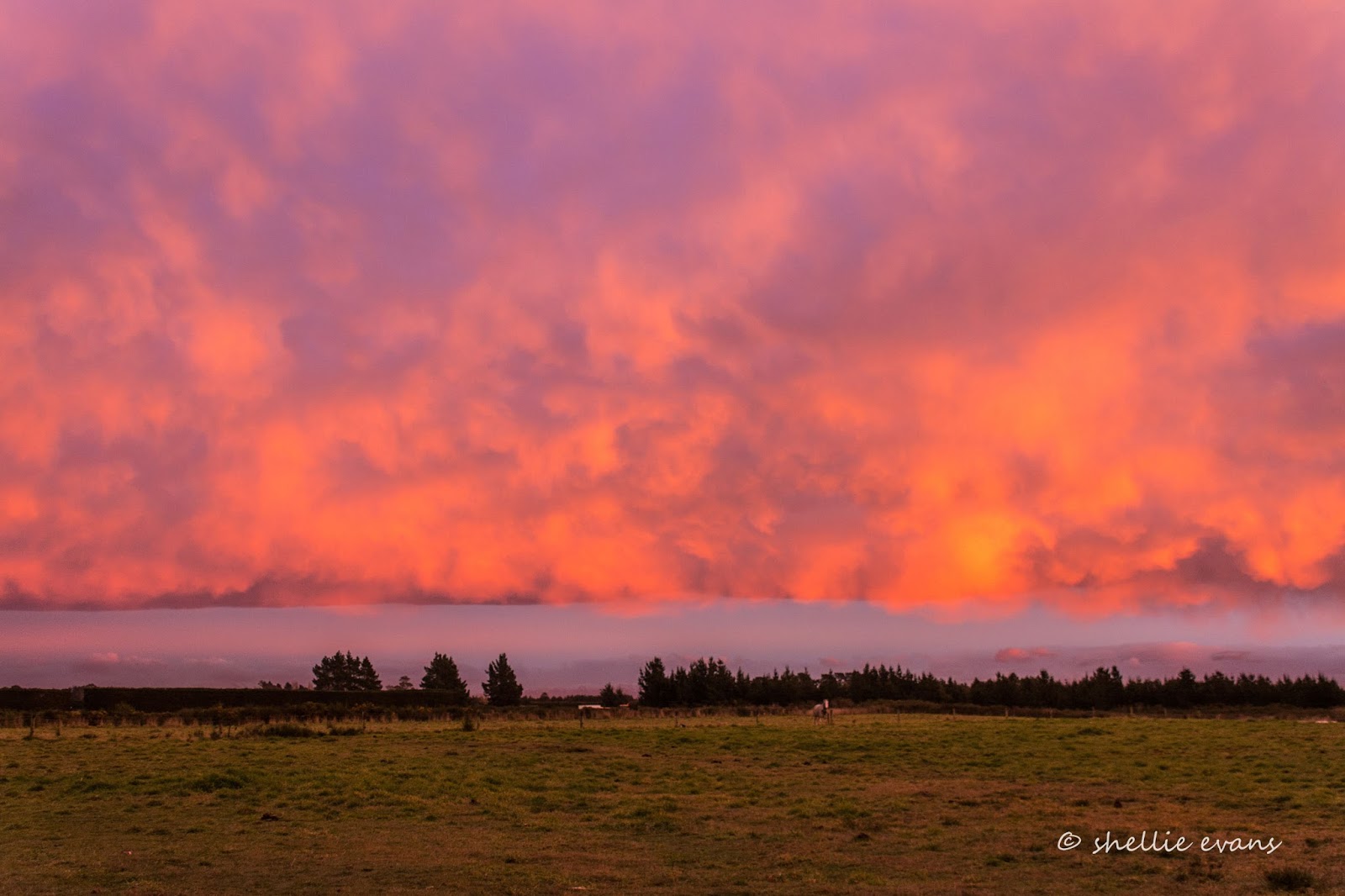

Of course spectacular sunrises are usually followed by an overcast or rainy day and so it was the case for most of our time in Christchurch. 


We've visited Christchurch numerous times but usually use our stay as a rest period and to catch up on chores in the city. I was hoping for a sunny day when I headed off to explore Sumner Beach, a coastal seaside suburb 30kms away on the eastern side of  the city and also to do a tiki-tour to Godley Head and travel the Summit Road on the Port Hills overlooking Christchurch.

Sumner Beach & Cave Rock
It was not to be though, instead a smoky haze hung over the city on a bitterly cold day. At the top of a short steep drive up Evans Pass Road, I stopped to take a photo overlooking Sumner below and across to South New Brighton and New Brighton. You can see the New Brighton Pier poking out into the sea in the middle distance.


The views along the Summit Road are spectacular, so close and yet so far from the bustling city below. I'm heading to Godley Head Park at the tip of the northern side of the entrance to Lyttelton Harbour. It's a 10km drive from Sumner to Godley Head and while the road is narrow, it's sealed all the way and not a particularly difficult road to drive; just don't get distracted by the views, it's a very long way down. And watch for oncoming traffic, it's mostly one way.

You can see part of the road cutting along the top of the hill in the photo below. There are a couple of sharp switchbacks in the Evans Pass Road that you'd need to watch in a bigger vehicle- we wouldn't probably be able to get our fifth-wheeler around them. 


I stopped often to take in the views. In the photo below one of the many walking and mountain bike tracks that criss-cross the Port Hills can be seen, this one is between Godley Head and Taylors Mistake. Across the secluded Taylors Mistake Bay are the earthquake sacred cliffs of Scarborough Hill and beyond that, Sumner Beach. 


The road weaves its way from one side to the other along the top of the headland, this is looking down into Lyttelton Harbour on the inside, the port and township of Lyttelton are tucked around the corner at the far right. The harbour entrance is to the left and across the water is Diamond Harbour.


Godley Head is the most complete WW11 coastal defence site in New Zealand today. It's now a public park administered by DOC (Dept. of Conservation). Click on the photos to enlarge if you'd like to read more.


The plotting room, miniature range & engine room buildings are still located on the hillside above the entrance to the harbour.


It really was a bitterly cold day with what I'm sure was a sub-zero wind chill factor, so it was a surprise to see people as mad as me visiting the park. I passed a guy carrying a load of photographic gear on my way down to the buildings. He told me he'd been doing a photoshoot, I found his model still at the buildings, she was taking a few selfies herself, and freezing in the process. 


I've included a photo of each of the buildings with their information board because I know there are a few people out there who'd like to read about the background (remember to click on the photo to enlarge).

The Battery Plotting Room-


The latrines would have had the best views in the whole base-


The Engine Room- 


This was the most fascinating building, like a big boys game of Battleships (which I guess it was)
The Miniature Range-


Back near the carpark were a collection of hatches, pipes and shafts-


Perhaps one of my readers will know more about these- 


Further towards the tip of  Godley Head and overlooking the ocean are the remaining buildings from the Military Camp. It is also now a DOC Camp and would be a great place to stay in the summer, especially with all the walking and biking tracks that weave their way up, down and over the headland. Bookings are essential; once your fees are paid you're sent the combination number for the lock on the gate. Dogs on a lead are welcome too. 


 I walked down to the handful of buildings; some are well looked after, others not so much.


The battery compound was closed off, the two photos of the small grey gun emplacements above are part of the compound that I took through the fence.


I also took this photo (black & white) looking across the Lyttelton Harbour entrance to the headlands that form the north side of Banks Peninsula.


Back in the ute, with the heater turned up to full, I headed back towards Evans Pass Road (the lower road) but carried on along Summit Road. Can you can see a small white dot? That's a car coming down the road. 


I stopped a few more times to take photos, the haze over the city hadn't improved but the wind had picked up considerably. The Avon and Heathcote Rivers flow through the city and empty into the estuary here.


With so many walkers and bikers in the Port Hills I'm sure this is a welcome relief to passersby. Supplied courtesy of a resident on Summit Road.


I was hoping to drive right along the Summit Road and drop down into Lyttelton but it was closed beyond Mt Pleasant Road so I drove back down to sea level and headed home (I believe it was closed initially because of the earthquake but now permanently, to allow a safer environment for bikers and walkers in the area).


July 24, 2017

Lake Opuha Reflections

Catch-up, mid June 
A blog short on words, long on photos!

Lake Tekapo township on a very cold and frosty early winter's morning. 


After a very cold night at Lake Pukaki we had an even colder night at the NZMCA Park in Lake Tekapo. It was -5c outside at 9am, a very cold and miserable morning when the sun isn't shining!


I crunched my way through the frost laden grass to the lake. The dozens of water puddles dimpled across the rocky mud flats were frozen solid. 


In the other direction, looking towards the Southern Alps, the mist rose from the warmer lake water. Black Swans & Canada Geese huddled together in groups along the shoreline.


We had stayed hitched up once again so as soon as we had the van ship-shape we pulled out, heading north and taking it very carefully over Burkes Pass in case of black ice. We had another lake to visit, one we hadn't stayed at before but had passed nearby many times, on our way into and out of the MacKenzie Basin.

Lake Opuha is a 700 hectare man made lake built as an irrigation reservoir for the surrounding farmland in the Fairlie basin. The lake is located 12kms from Fairlie and is very popular in the summer for fishing, boating and watersports. There are three freedom camping areas located around of the lake.  


We checked each one out and decided on the Hayes Road camp at the top of the lake. We were once again the only silly buggers camping and had the place to ourselves.


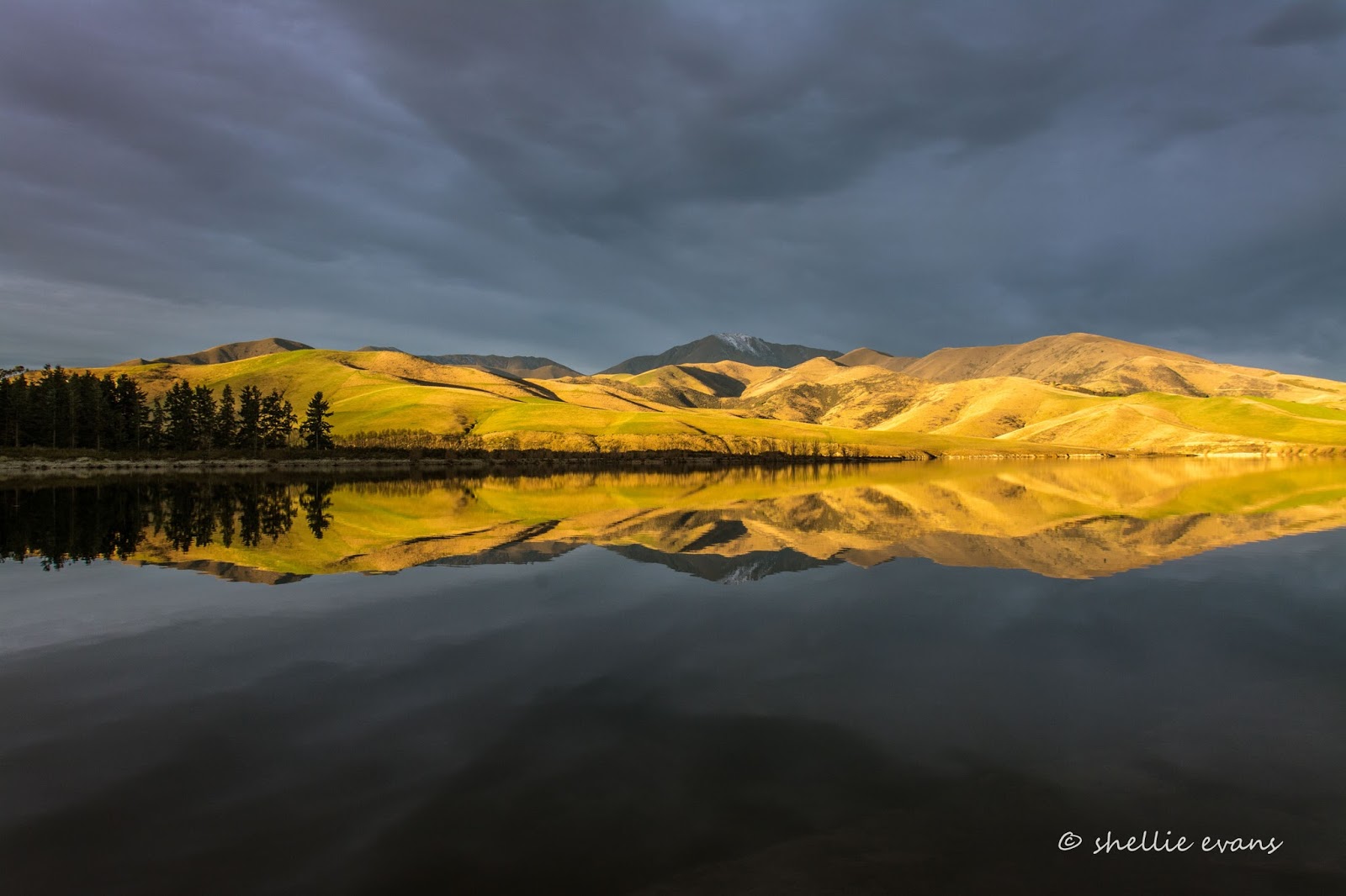
It was very cold and very still outside- perfect for some winter reflections on the lake. (Remember to click the photos to enlarge them.)


The Two Thumb Range separates Lake Opuha from Lake Tekapo.


The sun made a brief appearance through a gap in the darkening clouds, just as it was due to disappear behind the mountains.


The new autumn grass on the  hills across the lake turned a beautiful emerald green in the golden glow.


The golden hour, that hour before the sun sets has the most perfect light for photography.


It's too hard to choose, I love them all!


Half an hour later the setting sun turned the cloud formation above into an amazing ripple of white, gold and grey.


 And then it was gone. A perfect reward for enduring a very cold day. 


July 20, 2017

'Out There' at Lake Pukaki

Catch-up; mid June, 2017

Continuing on with the theme of taking our time while making our way to Christchurch, and staying at a number of freedom camping areas that have been on our radar for some time, we left Ohau B Canal and headed for Lake Pukaki, just up the road. 

Beside Lake Pukaki near Tekapo B Power Station
There are a number of free camping areas along Hayman Road which is on the eastern side of the lake but I have a particular one in mind. It involves driving under the penstocks of the Tekapo B Power Station. We've been through here a number of times before, but not with 'Out There' on the back. There's plenty of room but it's still quite daunting when you approach narrow tunnels or low bridges because it seems, from inside the cab, that the beams are right there above your head and about to smash into the van.


Not far past the power station I locate the entrance to the camp site. I head down the track with the walkie talkie to check the access, you soon learn in this game to check out the unknown, there's nothing worse than getting to the end of track to find that there's no turning. It's a good chance to take my camera with me too!


I radio back that it's fine, in fact one of the better tracks we've encountered. David slowly makes his way to the open area at the end, although it's a bit tight round one of the bends. 


We decide on a site that looks a little more sheltered, and also private if anyone else arrives (ha! that's a laugh, no one else is mad enough). We spend an age in the freezing cold chill of the afternoon trying to get  'Out There' level. It doesn't worry me if there's a bit of a lean but it's one of David's pet hates and being the perfectionist that he is, we have to get it perfect every time, even if we're only there for one night! 

Most of the time it's a piece of cake and we're done in a few seconds flat. Other times it's a pain in the butt and especially if it's wet or boggy underfoot. That's when the blocks skid as David goes to drive up onto them. Then we have to start over again, and sometimes, again and again (changing the position or adding a packer to the block) until we either make it or actually make too big a mess and have to move anyway. Oh what we'd do for self-levellers. Although we've seen them disappear into the mud too, refusing to be sucked back out when the owner has gone to leave. Such are the joys of winter RVing.


Finally we have it level but David's still not happy, we're not unhitching tonight and now the 5th-wheel is under strain because the ute is angled on the uneven ground. I've also forgotten to check the TV reception and guess what? We don't have any! The pine forest beside us is blocking the signal from the north. There's nothing for it but to shift over to the point, where we go through the whole process again. And this time I check the reception first!


The hydro lakes are all very low at the moment, and lower than usual for this time of the year although I guess they'll be starting to fill now with all the snow melt and rain that has fallen over the last couple of weeks. 

If those clouds weren't at the far end of the lake you'd be able to see  Aoraki/Mt Cook right in the middle there.


We manage to catch the last of the afternoon sun (from inside the van as it's too cold outside). And then it's not for long because it soon drops behind the mountains across the lake.


Later on I head out to take some sunset photos. I find a track through the pines to a point on the other side overlooking the lake and am delighted to see that Mt Cook has made an appearance and is living up to her Maori name Aoraki- 'cloud piercer'. 


We wake up to a very heavy frost and even colder temperatures and not for the first time thank our lucky stars for our diesel heaters. The early cloud disappears to reveal a stunning sunny blue sky day....but no sunshine reaching into our little patch. It doesn't take us long to decide to head out in search of some warmth.


We pass back under the penstocks and take a left up the hill to the head pond- often called the Fish Bowl or just 'the Bowl'.


The 'Bowl' is a very large pond at the southern end of the 26km long Tekapo Canal, it's where the water is held before it disappears down the penstocks to the power station below.


The 'Bowl' is a favourite (and no longer secret, sorry guys) fishing spot of many including a few of our feathered friends; here a Little Shag/Kawau Paka keeps a look out from a prime spot, the one and only pole in the middle of the pond. 


David had a quick look but decided he'd had his fill of fishing for awhile so we headed off up the canal, past the salmon farm to the end of the road. Well, to the end of the drivable road, you used to be able to travel right to the end and rejoin State Highway 8 but it was closed off a few years ago and now only walkers, fishers and cyclists (on the Alps2Ocean Cycle Trail) can use that section. 


We crossed the bridge and parked up on the canal to have some lunch, there's room to turn around for bigger rigs on both sides at the end, although it's a tight turn onto the bridge and it involves a bit of reversing if you head to the far side of the canal.


After lunch we head back down the road, turning the heads of people fishing along the canal as we go. I'm sure some people get a heck of a fright to suddenly see us approaching them on a narrow road. You can see it in their faces 'where the heck did that come from?', and we're not even a very big rig.

This is a big rig! We stopped in at the power station to say goodbye to friends Roz & Pete, we'd seen them at Ohau B and knew they were shifting to this camp site today. They have the right idea, sun all day here! Although it looks like they were getting a top up from that pylon behind.


And from their camp site we can see ours across the way; on that far point where the pine trees end.


There was one more place I wanted to visit before we made our way to the NZMCA Park at Lake Tekapo for the night. This is one of my favourite places in the South Island and one we've visited numerous times; Patterson Ponds. The ponds are hidden in the bare but colourful willow trees on the right in the photo below, that's the Tekapo River you can see down the other side. This can also be one of the most barren and windswept places and can look quite uninviting much of the time. 


But catch the ponds on the right day and it's a photographer's dream. And apparently there are also a few monster wily Browns in the connected ponds as well, we've seen a few fish but nothing too big. Click on the link above to learn more about the ponds.


I wanted to see if the ponds were frozen, I've seen them in autumn and in spring and also when the nearby, usually placid, Tekapo River was a wild torrent and the ponds were flooded. 

If you look closely in the photo above you can see that they are indeed frozen...or partly frozen. I took the photo from the Tekapo Canal Road, we're now at the top end of the canal about 8kms from where it exits Lake Tekapo.


I left David to turn the rig around up on the road while I clambered down the steep sides of the canal bank to the ponds below. There are 10 or so ponds and I managed to check half of them out before the shadow of the canal wall caught up with me and the ponds.


CSC (certified self contained) freedom camping is allowed amongst the ponds but it's only suitable for small vans, preferably 4WD, the track down is very rough and covered in large rocks and boulders and there are plenty of deep potholes in places too. I've always wanted to stay here, there's an area near the end of the road up on the canal road that would do for bigger rigs but I'd want to do it in summer when it's warm and there's no wind; it can howl a gale through here.


Once I'd finished taking photos I head back to where David's patiently waiting for me, making my way back up the walls. There are two, a flat gravel track separates them and believe me they are really steep with lots of loose gravel. There's also plenty of briar bushes to snag you. I use the dozens of rabbit holes as foot holds as I weave my way through all the obstacles back to the rig. We head off to get settled in at Tekapo before the suns sinks below the horizon and the bitter cold sets in once again.