Catch-up
Just a few hundred metres down the road from the Lowburn NZMCA Park in Cromwell is the 45th Southern Parallel, the line that marks the halfway point between the Equator and the South Pole.
 |
| Click the photo to enlarge |
I've passed the sign and carpark many times, it's on SH6, the main Cromwell-Wanaka highway. And everytime I think to myself 'I must do that walk....one day'.

Most of the time when I'm passing it's a hot summer's day and when I glance up the track I think to myself, 'no thankyou, not today'.

But finally the time has come, today is the day. It's a blue sky day and about minus 4c in the shade! The 2km loop track starts by going straight up the face of Sugarloaf Terrace, a glacial outwash terrace (outwash is the meltwater that flows from a glacier). A few hundred steps make the climb a little easier...

...although tucked into the shade of a narrow gully, they are covered in frost today so I have to tread carefully.

A well placed seat welcomes the weary at step #364 (I'm trusting in the sign because I lost count at about 160).

The road noise disappears and passing vehicles are shrinking as I climb higher and higher.

Finally the top is in sight...

...and I take another photo looking out over Lake Dunstan to Northburn on the other side. Taking photos is a good excuse to take a breather....I'm sure I have a photo from every dozen steps.

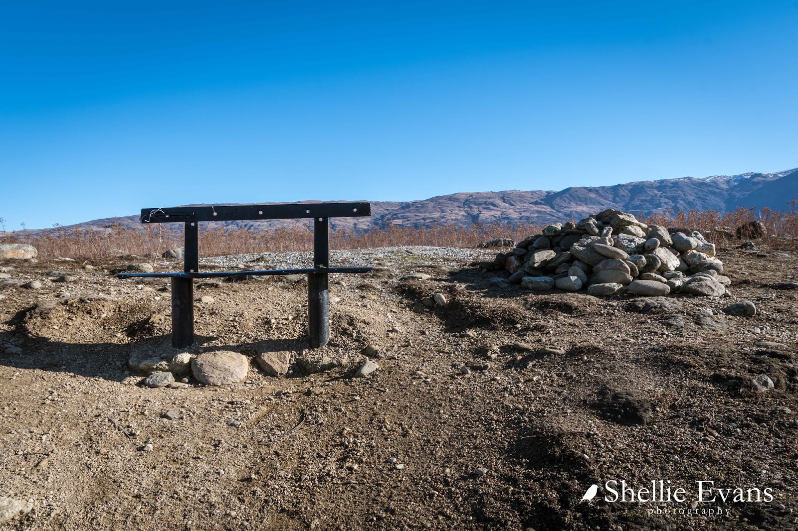
501 steps later and I reach the top where there's another seat and a pile of rocks. I think regular walkers must carry one of two down the steps to fill in gaps or pack against a loose step as they go.
There's a chilly wind blowing and even with the sun it's very cold on the top of the terrace. I head to the edge to check out the view.

The vegetation is very alien up here. What looks like a paddock of cow pats is actually the alpine plant Raoulia, commonly known as 'vegetable sheep'. Often the plants are 60-70cm (1-2 feet) high and they form densely compacted hard cushions, hence their name as they look like sheep from a distance.
But this particular species of Raoulia are low growing and instead form large very flat mats. They are hardy plants that enjoy dry conditions and will take over at the expense of other vegetation especially where rabbits are a problem and have cleared the land of other plants.


Across the lake are the vineyards on Northburn and the Northburn tailings tucked in there somewhere, that's another walk I will do the next time we're in Cromwell.

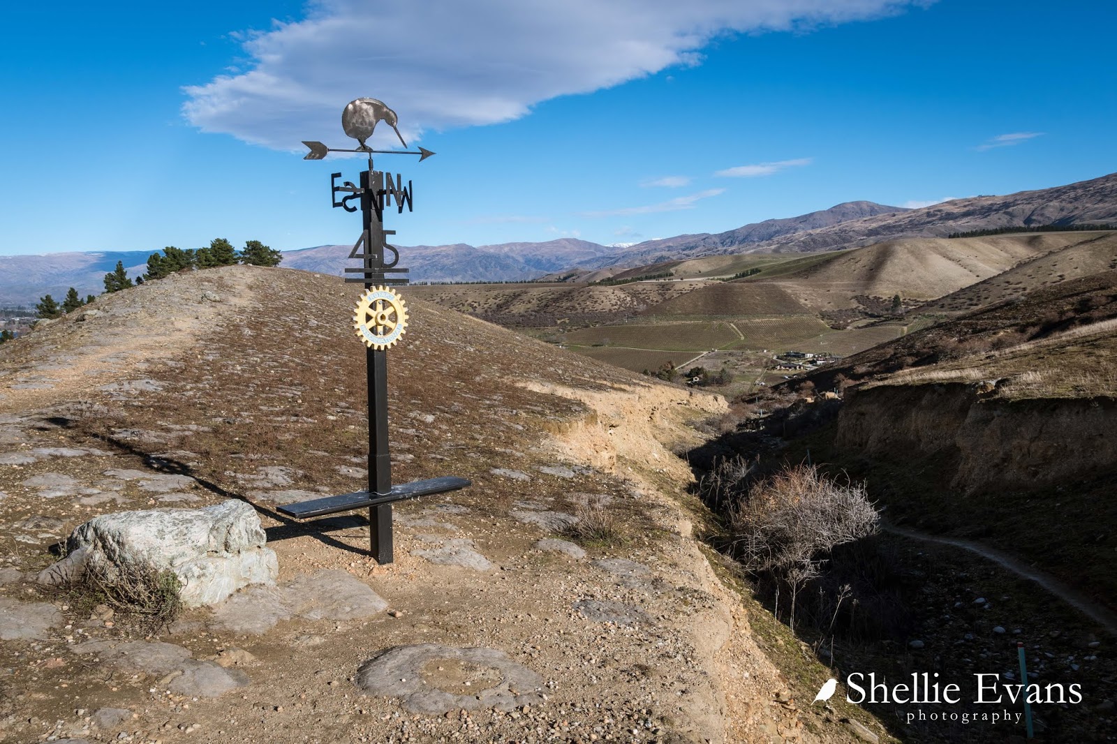
To my right and at the far end of the lake is Cromwell. The 45th Parallel marker pole is just ahead of me too.

The row of pines in the photo above, grow up the edge of Sugarloaf, which if viewed from below at Lowburn Inlet, looks like a small hill. The pines are over the right hand edge (photo taken in 2014).


...until I reach the marker pole. The track then drops down a narrow gully, which is in fact part of the old gold mining escavations and is full of tailings...
...but I continue on along the top until I reach the trig station at the top of Sugarloaf.

This is what I wanted to see. Lowburn Inlet below...


And at the top of the inlet is the new Lowburn housing development on the slopes below Lowburn Terrace. I think I need to come back up here in autumn.

And here is a panorama of Lowburn, this is 6 photos stitched together. I saw a similar photo of this view on a building in town and that made my mind up that I needed to do the walk on this visit.

From the trig there's an unofficial track down the side of the terrace...

...and back into the gully and mining tailings...

From there it was down to the Inlet...

...and then back along the lake front and home.

Done & dusted and not that bad afterall!
I just adore the South Island, it's scenery is just so different to the rest of NZ.
ReplyDeleteI have never been here but it looks great. Next week i will be going to the other one the 45th Parallel North that halfway between the equator and the North Pole :). I will post a picture of i can.
DeleteWe love it too, we're now honorary South Islanders, we spend so much time down here! :)
ReplyDeleteGreat post thank you & excellent photos showing the views. Looking forward to hiking it. Think there maybe snow up there at the moment :)
ReplyDeleteThanks for commenting & I'm pleased you've enjoyed the blog. The walk is a hidden gem and so close to town. I think the initial stair climb puts people off but it's not too bad if you take your time. And the views more than make up for the effort. Snow would be an added bonus!
DeleteWhat time of day do you recommend going?
ReplyDeleteYou'll get shadows somewhere no matter what time of the day, the earlier the better in summer, due to the heat.
Delete