Catch-up
The next few blogs are going to be a bit of a photofest (so don't forget to click on the photos to enlarge them) due to the fact that we spent seven days at one of my favourite Central Otago locations...
 |
| Blue Lake, St Bathans, Central Otago |
... the tiny man-made Blue Lake at St Bathans. We set up in the nearby DOC Camp...

...once we managed to squeeze through the gate.

This is out third visit to the DOC Camp and once again we have it to ourselves. The Blue Lake and St Bathans village are just a short walk away (on the left up behind the ute).
We woke to fog on a couple of mornings but we mostly had beautiful sunny blue sky days with several heavy frosts. We still had to wrap up warm when venturing outside as the temperatures hovered around 4-5c for most of the day before dropping back into the negatives again once the sun set. Our diesel heaters certainly earnt their keep, keeping us toasty warm during the day.

A St Bathans' rugby scrum-

The DOC Camp is beside the St Bathans Domain where the rugby goalposts (from a bygone era) are still standing. A mob of sheep were being held in the paddock for a few days before being shifted to the St Bathans Station woolshed to be shorn. A large tractor & silage trailer did the rounds every morning dropping silage for these sheep and another lot across the road.

The snow dusted Mt St Bathans is a prominent feature in this quiet back corner of
Manuherikia Valley.
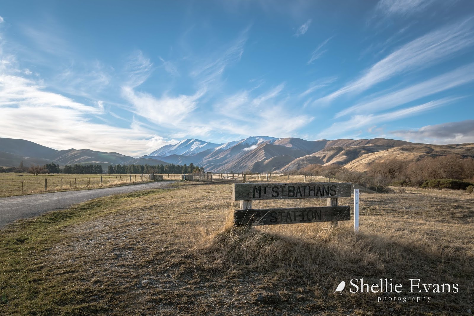
Further down the road another mob of sheep that belong to a different station are being wintered over in a strip feed paddock. These are hardy merinos and in this light (late afternoon) they certainly blend into their surroundings.

And on another day they still blend in, this time with the soil. The snow covered Hawkdun Range forms a backdrop to the valley.

Present day St Bathans, now part of the Otago Goldfields Park administered by DOC, is a remnant of an old gold mining town originally named Dunstan Creek. The historic Vulcan Hotel is at the centre of the village; it's also for sale if anyone fancies themselves as a publican.
The shamrock on the front facade is a relic from the times of rivalry between the mainly Irish settlers from St Bathans and the Welsh settlers from Cambrian just down the road. The rivalry was known locally as “The War of the Roses” and at one time the acrimony between the villages was quite bitter. In the 1990s the hotel was put into a trust with shares owned by locals who lease out the hotel. There is also purported to be a friendly ghost in Room 1 of the hotel.

Gold was discovered here in 1863 and over 2834 kilos of gold was extracted from the three largest mining operations. By 1864 1000 people lived in Dunstan Creek with a further 1000 in surrounding area including around 50 Chinese miners who lived in caves excavated in the local cliffs.

Dunstan Creek was changed to St Bathans in 1866 after miners requested the original name, given by the first surveyor of the district, be re-instated. By the late 1860s St Bathans was well established with 15 hotels, a number of gambling and dance halls and many businesses. Nowadays the Vulcan Hotel is all that remains of the hotels.
This is one of the most unusual Post Office building I’ve seen in a small town, and rather an imposing one at that. This one opened in 1909 and replaced an earlier small ‘dog box’ that began business in 1864. The building is now owned by DOC.

St Alban of the Martyr Church sits up on a slope overlooking the 'Glory Hole'. The original church blew down in a severe gale in 1870 and it’s replacement met a similar fate in 1883 (the wind must really blow in these parts).

Frederick Dalgety, founder of the stock and station agency Dalgety & Co, and then owner of Hawkdun Station bought the quarter acre section on which the church stood. He then arranged for a new church to be shipped out in sections from Britain, one of the first prefabricated buildings in New Zealand. He imported every item for the church including altar cloths and kneelers. And yet looking at the church and it’s corrugated iron exterior you would swear it was totally kiwi.

It's amazing the things you find when you're walking the streets of a deserted village.

Of course the main subject of my visit was the Blue Lake. Before gold was discovered at St Bathans in 1863, the 120 metre high Kildare Hill stood where the Blue Lake is now located.

The hill was named after their home country by the Irishmen who made the original find. Sluicing whittled the hill down to become first the Kildare Basin, and as it sunk further it became known as the Glory Hole, celebrating the riches it yielded.

The Kildare Hill Claim became the site of the deepest hydraulic elevating operation in the world, an operation that would eventually turn a 120 metre hill into a 68 metre hole over 800 metres long.

The hydraulic elevator acted like a giant vacuum cleaner, sucking water and gravel out of the pit to where it could be worked for gold.

Mining was halted in 1934 because the sides of the pit were getting too close to the town and once abandoned, the Glory Hole filled with water that became a striking blue colour, due to the high mineral content of the surrounding tailings. Hence today’s Blue Lake. Although much of the colour has been lost now that the minerals aren't leeching quite so bad.


These photos were taken on the first evening when I thought I'd just drive up and reacquaint myself with the lake and just maybe the conditions might be right. And how right they turned out to be. On arrival there was a gentle breeze, if you look at the photo at the beginning of the blog you can see the slightly ruffled water.

I took a few shots from the top of the cliff near the carpark and then drove down to the lake edge and from there watched as the breeze departed and the lake became a millpond.

I quickly drove back up to the top and hurried along the path that winds it's way in and out of the tailings to the far end of the lake. And because I knew from previous visits where the best spots were to catch the reflections, I was able take a few short cuts right to the edge of the cliffs which involved in some cases, carefully climbing a slippery slope of wet tailings. Luckily I was wearing gumboots as anything off the gravel path was either a muddy bog or thick gluggy clay.

I had to hurry from one spot to the next as the sun dropped behind the mountain range and the light began to fade.

Eventually I gave up on the chase and headed back to the carpark, stopping in the middle of the narrow stream that rushes down the edge of the reserve. No matter how hard I tried I could not budge the clay, in the end I had to rip some leaves off the Lamb's Ear and scrape the sticky stuff off, my hands immersed in the freezing water.
As I headed back up the path I caught sight of one of the buildings in the village catching the last of the winter sunshine. What I love about this photo is the fact that this cute little cottage is in fact the side profile of the second storey of the post office!


