Showing posts with label coast. Show all posts

April 29, 2018

Beach Hop North- Kaiaua & Anaura Bays

Catch-up

The weather still hadn't settled after a wet and windy day at Tolaga Bay but we decided to head off anyway, it was just a 10km hop, skip & jump to our next camp at Kaiaua Bay, another freedom camping site that is on the Gisborne District Council permit.

Kaiaua Bay, East Coast
The road into the bay was once again a narrow winding country road; although this one really was narrow in a couple of places where wash-outs had taken out the roadside. I've only just noticed the width of our lane in this photo!


A gravel road runs along the front of the bay with a narrow grassy strip separating it from the beach. A long section of the strip is available for camping although much of it is uneven. 


Pam & Gerald (relatives we'd been with in Gisborne) were heading here when they left Gisborne but had reported back that they'd only stayed one night due to the weather; they had been wind and sand blasted and the motorhome had rocked and rolled all night. It is a very exposed site sitting up on the sand bank above the crashing waves. It was still raining on and off , blowing a gale and quite bleak outdoors so we decided we'd head on too. 


The next camp in our sights was just another 21kms further on and it's NOT on the Gisborne District Council camping permit. There are two campsites at beautiful Anaura Bay, one a commercial campground and the other a DOC camp. 

As with the other secluded bays we've visited, the road in is relatively short, 6-8kms, narrow and winding. Anaura has a short sharp climb to the top of the hill before a winding descent down into the bay. We stopped so I could take a photo at the top of the climb but the day was still overcast and murky....so we also stopped on the way out, so I had a sunny day shot for the blog.


The ground underfoot at the DOC camp site was very boggy with a few muddy tracks where people had attempted to drive and a lot of surface water laying across the large site; it was still raining off and on. Gumboots on, we squelched our way through the grass looking for a relatively dry area to park.


One of the tracks led through a gate out onto the sand bank beside a small lagoon. I checked out the signs at the gate and with nothing mentioned about not being allowed to camp out there, I beckoned David to drive on through. 


It was the perfect spot to park; high and dry with good drainage through the sand, and with great views over the lagoon and out to sea.


After we'd set up camp (you can just see the rig through the trees below) David went for a walk and came back in a fluster. 'Didn't you see the 'No Camping sign?' he asked me. I swear I didn't, I told him about the dog and tsunami signs but.......can you see it?


We made an executive decision and decided to stay put. Which is not like us; although we moan and grumble about some restrictions we come across in our travels, we usually conform to the norm (I say usually but there have been a few times we've bucked the system, though those stories are for another day). 

We decided we couldn't be seen from the camp and we'd already watched a couple of campervans arrive and leave after deciding not to drive in through the muddy entrance. So we justified it in our minds that we'd likely be the only ones in the camp for the night, and hey, we just couldn't pull ourselves away from the view! 


It was not till much later (after the rain had stopped) that I had a wander around camp and back to the entrance where it also mentioned not to camp on the otherside of the fence. Oops....we lived dangerously for a night.


Anaura Bay was deserted, we saw just a couple of people walking along the beach later in the day and that was it, we had the place to ourselves. There are groups of  homes and holiday baches dotted along the road including a cluster in the corner of a small headland just up from the campground.


Where there also looks to have been/still is a farm homestead in behind an overgrown mass of huge trees and thick bamboo bordering the dunes, where hidden in amongst the greenery, I spotted an abandoned tree hut.


A strange thing happened on our doormat just before sunset; hundreds of tiny NZ mud snails came out of the long grass spreading themselves out across the mat and all over our Crocs. Once it was dark, they were gone.


Clearing skies and a rainbow short on colour were the last signs of rain just as the sun went down.


I was up early the next morning to catch another one of those magnificent East Coast sunrises...


...and it didn't disappoint. This time reflected in the lagoon as well, the sky and water were a blaze of fiery reds and oranges.


Even for me, the queen of sunrise shots, this one was nothing short of spectacular.


The oranges and reds were soon replaced with beautiful yellows as the golden globe poked it's head above the horizon...


...and behind me, as the dawn became day the pink hues of sunrise slowly disappeared...


...along with the lingering cloud to reveal a perfect blue sky day; one that was sure to bring people out and about. It was time to remove ourselves from our gorgeous but illicit little camp site.


We stopped near the commercial camp (which is in the old school grounds) on our way out of the bay to check the marker stone that commemorates the bicentenary of  British explorer James Cook making landfall in Anaura Bay on 21 October 1769.  


We had a slow trip out to the main road after coming up behind this chap as he tootled back to his farm totally oblivious to the us crawling along behind him. No matter, we're travelling in East Coast time now.  This is what we love about travelling the back roads, you never know what you're going to see next. 


September 14, 2014

Anatori - The End of the Road ; Part 2

....continuing on from Part 1

Back on the road after lunch, we’re now passing through farmland and following the coast all the way.


The views are spectacular and the road often on the edge of the seacliffs.


It's not long before I see a cluster of houses on the hill ahead of us and assume we must nearly be at Anatori and the end of the road. And in fact we are but what I don’t know is that the houses are on the other side of the Anatori River. A river you have to ford, the track carries on for a few more kilometres but a 4WD is suggested for that stretch.


We head up the last hill and pass through a beautiful grove of Nikau Palms, I can never get enough of Nikau, they are probably my most favourite NZ plant, I love their tropical look and they remind me of our old property in Tauranga where I had my own Nikau grove, 17 planted in amongst our native garden. Although mine were mostly Kermadec Nikau, they grow a lot faster.


Finally we’re heading down into the Anatori River valley where there is a small hive of activity and a little ‘tent’ city of caravans. More whitebaiters! And these ones are set up for the duration too. We can see the 4WD road heading up the other side of the hill and we’ve been pre-warned; “Don’t cross the river while they’ve got their nets out otherwise you may get abused”.


We pull up in the gravel patch and David wanders out to one of the whitebaiters to have a chat while I take a few photos. I catch up with them and the guy tells us no one has had much luck so far (but we’re fast learning the lingo & this is a standard response). Although he does say the river is very low and it certainly looks that way, not a typical west coast river that’s for sure. He tells us that he built the hut, he brings the gear in each season and knocks it up for them all to use, it has a pot belly fire inside and solar power. I can imagine Happy Hour tucked up in there would be nice and cosy. That’s his net all set up (bottom right), I like his bucket holder.


There’s a few rustic baches down at river level but it doesn’t look as though any of them have people staying.


It’s getting late in the afternoon now and while we would have liked to have crossed over the river and driven the track a short distance, we decide it’s best to head home. Our whitebaiter friend said it wouldn’t have worried him if we had crossed, he’s used to it as there are a few cars a day coming and going. He also tells us that when the tide is low the best drive is along the beach in both directions for about 10-12kms. “But don’t get caught by the tide, otherwise you’re a gonna”

So it’s back on the road again, with a short stop for me to rescue a lamb on the wrong side of the fence, man do they move fast, after running back and forward along the fenceline I finally managed to grab him when he got stuck trying to squeeze through the wire. He was pretty pleased with himself once he hit the deck bouncing and dancing across the paddock. A good deed done for the day.


And one final stop when we spotted one of the white herons resting on the old wharf at Mangarakau on the Westhaven Estuary. You can see the soft feathering of the breeding plumes at it's tail. This heron should be making it’s way south to Okarito on the West Coast, where they breed & nest, very soon.


September 05, 2014

Archway Islands

The Archway Islands are just off Wharariki Beach at the top of the West Coast (but still within the Golden Bay area), just below Cape Farewell and  not far from Farewell Spit. The beach and islands are part of the Puponga Farm Park as is Cape Farewell and the land surrounding the bottom end of the Spit.

The 1021 hectare Puponga Farm Park is managed by the Department of Conservation and provides a buffer zone to the Farewell Spit reserve. Stock numbers of Romney sheep & Angus cattle are kept to a minimum with historic sites & rare native vegetation fenced off. Any future farm development is limited in order to protect the special features of the area and to allow the public to continue to enjoy the many walking & mountain bike tracks over the farm and along the coast.

From the carpark it’s an indicated 20 minute walk to the beach; we climb a small hill, cross a stile and follow the sandy track through a couple of paddocks and a small section of coastal forest.


As we near the beach the sand track widens and ahead of us we can see huge sand dunes. The path skirts around the edge of a tannin stained stream and heads up the back side of the dunes where it becomes a hard slog walking in the deep and soft sand.


Once at the top an amazing view opens up, the sand it smooth & bright off white (why did I forget my sunglasses!) and just behind the breaker line we can see an island (but no arches).


It’s still hard work crossing the sand so we stick to the ridge where it’s a little firmer. That, plus David didn’t want to destroy the beautifully smooth expanse of pristine white sand down to the water’s edge!


As we move further along the island becomes two and finally we see two arches in the first island. Unfortunately the sun is in the wrong position and the islands are not as clear as I would like.


David has finally found his way down to the water’s edge, he wandered off in the other direction checking for seals and birds on the headland at the top of the bay.


There’s another small arch in the headland at the bottom of the bay.


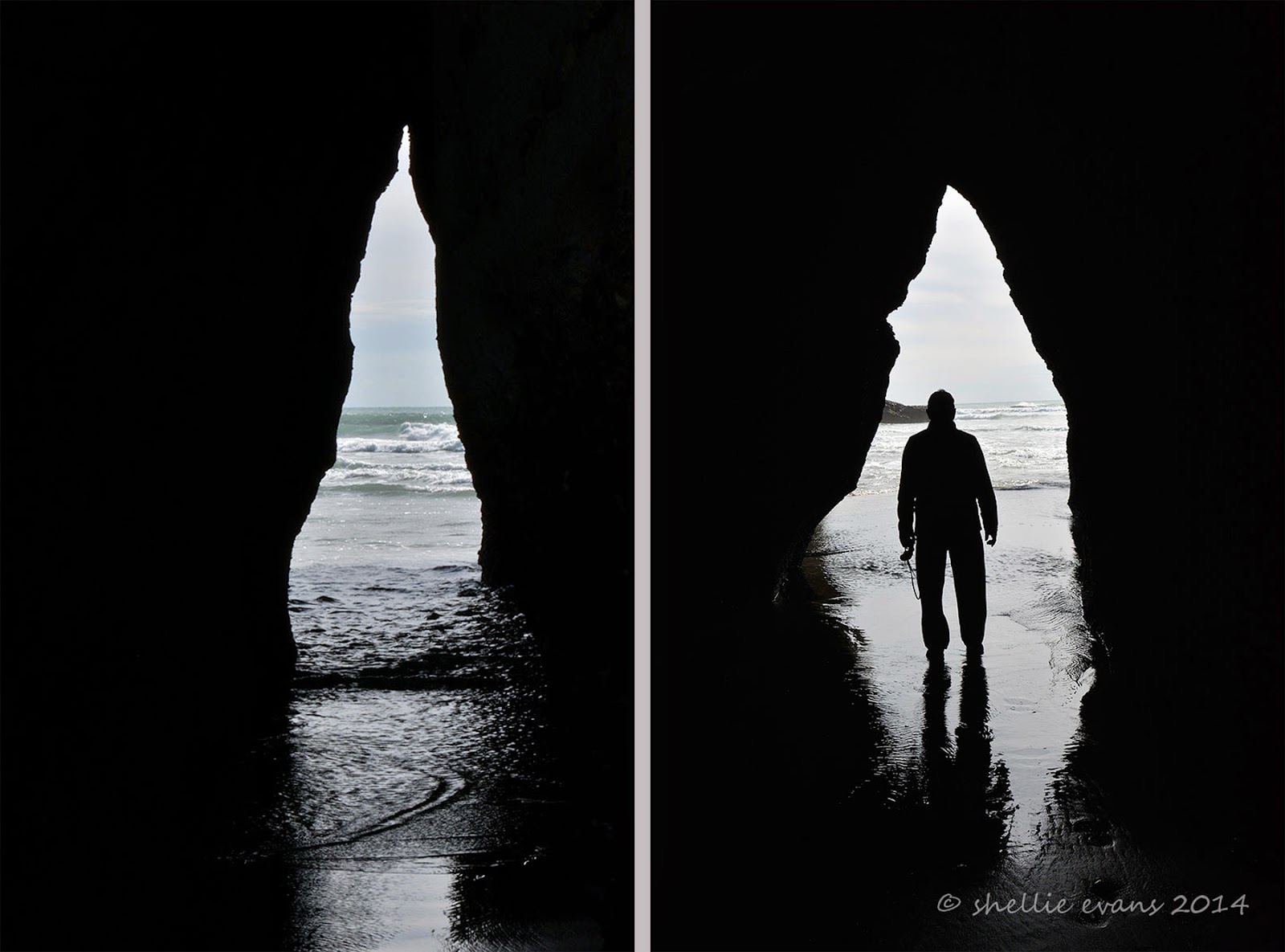
The coastline is very dramatic here at Wharariki beach, along with the islands and archways, there are wave worn cliffs with caves & odd shaped rock stacks. The tide was on it’s way out which allowed us to walk inside this cave. It was devoid of life obviously because it gets beaten up with the wave action at high tide.


The cave is also larger than it looks.


But nowhere near as large as the one around the corner where David checks for skeletons! 


But only finds a large sand bank wall at it’s head and a few full sized dead trees plus a lot of diftwood.


These sea caves would make great shelters if you were shipwrecked, or caught in the rain on your walk. But only as long as it was low tide.


Further on along the beach there’s a “small” outcrop of rocks and I see a couple walking back towards us, we’d seen them earlier having lunch on a log near the beginning of the beach. I speak to them and they tell me that the tide isn’t out far enough for them to get around the rocks so they are walking back to the carpark the way they came.


We continue on and hope by the time we get there we’ll manage to get through, the tide drops very quickly along this coast. We find an archway in the rocks that would be an ideal exit point & even though it looks shallow enough, when a wave crashes in it roars up the narrow channel. And when we catch a glimpse around to the side we see that there are more rocks to clamber over and the pools around them are deep.


We decide to see if there’s a way up and over the rocks and dunes behind and find a narrow overgrown track up through the scrub which then leads down to a slippery sand covered smooth rock face with a big drop off to the beach below. It must have been used a few times by people caught out by the tide and we find a way down further along the slippery rock. Once over the other side we see that there are a multitude of rock stacks and limestone islands with more arches.


And most important of all, looking back we can see that the second island has now revealed it’s huge arch. Wow! What an impressive sight, made all the more impressive because of our scrambling through the undergrowth to get here. Those other people don’t know what they missed.


But I really need low tide as I can’t get out far enough to get the whole arch in view. You can see how far the tide drops by the height of the shellfish on these rock stacks in front of me. No wonder the usually rough west coast wave action has worn the soft rock into so many unusual shapes.


I leave David waiting on the rock bank where we have finally located the orange triangles that indicate the DOC walkway back to the carpark via the longer circular route. We’d been looking for the entrance as we approached the end of the beach as we’d decided not to return back via the dunes. We had walked quite a distance down the beach to have the arches revealed, not something that was pointed out on the information boards back at the start. I wonder how many people just walk the 20 minutes to the beach & think that’s it, as lovely as that view was.


I weave through the rock formations until I manage to find a clear view of the second Archway Island.


And that’s when I hear voices and find another couple trying to find a way through the rock arches back up the beach from where we’d come, they had walked the loop in the opposite direction. I told them about the track over the back of the rocks and left them taking photos under this huge arch.


I moved back to where David was waiting and took one last photo before we disappeared into the bush behind the dunes. It was good that there are people in this photo, it’s gives you great perspective.


Once through the bush we’re out on the farm again and we follow the fenceline up a hill catching sight of the tall red marker posts attached to the fence at strategic points indicating we’re on the right track (pun intended!) At the top of the hill and beside one of the ‘dune’ lakes, Nikau Lake, the islands come into view.


I find a high spot; a bull’s stomping pit (no bulls in sight) to catch the Archway Islands clear of the treeline. Absolutely stunning! And I’m now glad we walked the circuit anti-clockwise as this view would have pre-empted the magnificent islands and the slow reveal of the arches we had from the dunes and beach.


It was another 3kms back to the carpark through undulating farmland, along the way we passed the maternity ward! Well actually we passed through the maternity ward; sheep giving birth right beside us on the track (and not batting a eyelid; them not us), I chopped the back end off that photo TMI!. Others were mothering their babies who looked a little startled to see us but were quickly distracted by the smell of milk. Spring is definitely sprung on the west coast of the South Island.

 
Along the way we passed a second small lake aptly named Dune Lake, these lakes have been formed as separate ice ages and dune movement have disrupted the drainage systems from the low hills behind, some lakes have become swamps, others have dried up completely.

High on a ridge a dying Cabbage tree, one of our most distinctive and much loved trees, gives a stark profile for my photo and a sad reminder that the disease, ‘sudden decline’, is still claiming old & mature Cabbage trees around New Zealand.

Finally the valley opens up and we see the carpark off in the distance. What an awesome walk, well worth doing and one of the best we’ve done on our travels. I’d highly recommend it, just make sure the tide is on it’s way out, I would say leaving the carpark an hour before low tide would be perfect timing. And if you’re a photographer coincide the low tide with late afternoon and the sun will be in the perfect position to light up the islands and the arches.


And I just might have to head back there before we leave so I can get those islands in the right light……watch this space!