Showing posts with label puponga. Show all posts

Sunday, September 7

Farewell to Old Wharves

On the way home from the Archway Islands we stopped to do the short 5 minute walk to Cape Farewell; the carpark was the end of a road we had passed earlier in the day and still part of Puponga Farm Park.

Cape Farewell is the most northerly point on the South Island and is located just west of Farewell Spit. It was named by Captain James Cook in 1770 - it was the last land seen by his crew as they departed on their homeward voyage.


The sun would now be perfect to shoot the Archway Islands but it’s totally in the wrong position for the Cape (hence the sun spots on my lens). I just can’t win! Morning, with the sun rising would be perfect here! I know that the Farewell Spit tour stops here on the way to the Spit & I’m hoping that when we do the tour I’ll be able to get some better shots.


It’s fascinating seeing all the coloured rock layers in the cliffs that surround the Cape. There are a number of faultlines running through the area & I wonder how long the arch will last; a few dozen years or hundreds of years or perhaps thousands? Although it’s a wonder it is still standing, what with the wave action and earthquakes.


While standing on the platform looking over the edge we could hear seal pup cries from far below. It took a few moments to find them, frolicking about in the water and resting on rocks. One pup was having fun all by himself surfing in on the waves; he’d surf in, swim back out under the waves and surf back in again.

We walked up the hill a short way and looked over the edge of the cliffs as far as we dared. If we brought the grandkids here, they’d be tied to our sides!  “ Hey look Nana, I can do roly-polys down the hill!” Oops. Plop!


The walk up to Pillar Point Lighthouse looked far too strenuous, I think I can safely say we won’t be saving that for another time!


And with that, we can now say we have visited both the most northerly & most southerly points of the South Island. This is Slope Point at the south end of the Catlins which we visited back in January.


And now for a few random shots from the road trip;

Near the Cape carpark,  the iconic New Zealand Cabbage tree (alive this time).


This friendly peacock greeted us at both ends of the Archway Island walk. He was looking for hand-outs, poking his head inside the car door as soon as I opened it and following me around when he saw I was eating food. It’s hard to believe how magnificent the colours & patterns are on a peacock, how can nature produce such finery.


You’ll remember the whitebait couple we found beside the tiny stream on our way to the Arches? We had stopped to see this flock of Royal Spoonbills (Kotuku Ngutupapa), numbering 27 (or 28, we couldn't quite decide), this is the largest flock of spoonbills we’ve seen on our travels. They were very obliging and I was able to move in quite close. That was until I slipped off the log I was quietly sidling along on my behind. Then they took flight.


The tide was all the way out by the time we made our way home along the Golden Bay shoreline and the sand flats fully exposed, making for some interesting colours and patterns.


We stopped at Puponga (near the beginning of the curve to Farewell Spit), where I’d seen a sign post indicating there was an old wharf somewhere nearby. With the tide out the piles of the old Puponga Wharf were now exposed. The Puponga Wharf was used early last century by colliers to cart coal away from a number of mines in the area.  Because of the shallow bay the wharf was over half a mile long and was thought to be the longest in the Southern Hemisphere at the time. And even with it being so long, the channel had to be constantly dredged to give access to the 1000 ton ships. Eventually silting in the bay overtook the wharf, the mines closed and the piles from the wharf have slowly rotted away.


While I was taking photos of the wharf piles I could hear a low rumble off in the distance. Far out on the edge of the of the water I could see tiny little specs moving about. David had seen the movement too and was looking through the binoculars. I zoomed in on them to see that there were a couple of jeeps and half a dozen quad bikes towing trailers about. This is a zoomed in shot.


It was then that we realised that they must be harvesting cockles commercially. I’d seen a programme awhile ago on Country Calendar and when I checked it out I found that a company based nearby were collecting "Littleneck Clams" or what we used to call cockles. The harvesting looked pretty intrusive, a scoop collecting the mud, transporting it up a small conveyor belt of sorts, spitting out the cockles into a bin on the back. The quad bikes had a row of trailers on the back with the fast filling bags. This is the zoomed in shot now heavily cropped! And that's part of Farewell Spit in the background on the left.


And finally here are two more old decaying wharves. That shallow Golden Bay has a lot to answer for!

This is the old Collingwood Wharf, it’s located on the ocean side of the town, by the 1930s the wharf was “high & dry” (this is at near high tide). A new wharf was then built on the inside of the town in the estuary but that also silted up fast and by the mid 1940s could no longer be used commercially.


Back towards Takaka is the tiny settlement of Onekaka which was once a major industrial area. During the 1920-30s local iron ore was turned into pig-iron and iron pipes at the Onekaka Ironworks and shipped from Onekaka wharf. Between 1922 and 1935, over 80,000 tons of iron was produced, with up to 180 men being employed. These rusting & rotting piles are all that remains of the wharf built by the Onekaka Iron & Steel Company.


There are other remains of old wharves in the area which I haven’t managed to visit. Yet.


Friday, September 5

Archway Islands

The Archway Islands are just off Wharariki Beach at the top of the West Coast (but still within the Golden Bay area), just below Cape Farewell and  not far from Farewell Spit. The beach and islands are part of the Puponga Farm Park as is Cape Farewell and the land surrounding the bottom end of the Spit.

The 1021 hectare Puponga Farm Park is managed by the Department of Conservation and provides a buffer zone to the Farewell Spit reserve. Stock numbers of Romney sheep & Angus cattle are kept to a minimum with historic sites & rare native vegetation fenced off. Any future farm development is limited in order to protect the special features of the area and to allow the public to continue to enjoy the many walking & mountain bike tracks over the farm and along the coast.

From the carpark it’s an indicated 20 minute walk to the beach; we climb a small hill, cross a stile and follow the sandy track through a couple of paddocks and a small section of coastal forest.


As we near the beach the sand track widens and ahead of us we can see huge sand dunes. The path skirts around the edge of a tannin stained stream and heads up the back side of the dunes where it becomes a hard slog walking in the deep and soft sand.


Once at the top an amazing view opens up, the sand it smooth & bright off white (why did I forget my sunglasses!) and just behind the breaker line we can see an island (but no arches).


It’s still hard work crossing the sand so we stick to the ridge where it’s a little firmer. That, plus David didn’t want to destroy the beautifully smooth expanse of pristine white sand down to the water’s edge!


As we move further along the island becomes two and finally we see two arches in the first island. Unfortunately the sun is in the wrong position and the islands are not as clear as I would like.


David has finally found his way down to the water’s edge, he wandered off in the other direction checking for seals and birds on the headland at the top of the bay.


There’s another small arch in the headland at the bottom of the bay.


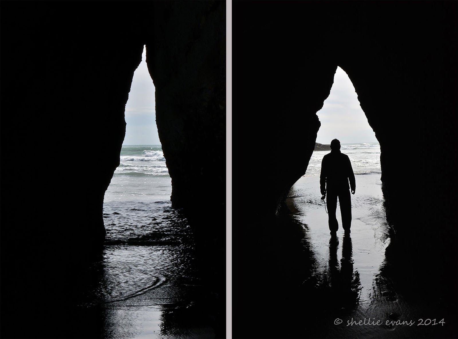
The coastline is very dramatic here at Wharariki beach, along with the islands and archways, there are wave worn cliffs with caves & odd shaped rock stacks. The tide was on it’s way out which allowed us to walk inside this cave. It was devoid of life obviously because it gets beaten up with the wave action at high tide.


The cave is also larger than it looks.


But nowhere near as large as the one around the corner where David checks for skeletons! 


But only finds a large sand bank wall at it’s head and a few full sized dead trees plus a lot of diftwood.


These sea caves would make great shelters if you were shipwrecked, or caught in the rain on your walk. But only as long as it was low tide.


Further on along the beach there’s a “small” outcrop of rocks and I see a couple walking back towards us, we’d seen them earlier having lunch on a log near the beginning of the beach. I speak to them and they tell me that the tide isn’t out far enough for them to get around the rocks so they are walking back to the carpark the way they came.


We continue on and hope by the time we get there we’ll manage to get through, the tide drops very quickly along this coast. We find an archway in the rocks that would be an ideal exit point & even though it looks shallow enough, when a wave crashes in it roars up the narrow channel. And when we catch a glimpse around to the side we see that there are more rocks to clamber over and the pools around them are deep.


We decide to see if there’s a way up and over the rocks and dunes behind and find a narrow overgrown track up through the scrub which then leads down to a slippery sand covered smooth rock face with a big drop off to the beach below. It must have been used a few times by people caught out by the tide and we find a way down further along the slippery rock. Once over the other side we see that there are a multitude of rock stacks and limestone islands with more arches.


And most important of all, looking back we can see that the second island has now revealed it’s huge arch. Wow! What an impressive sight, made all the more impressive because of our scrambling through the undergrowth to get here. Those other people don’t know what they missed.


But I really need low tide as I can’t get out far enough to get the whole arch in view. You can see how far the tide drops by the height of the shellfish on these rock stacks in front of me. No wonder the usually rough west coast wave action has worn the soft rock into so many unusual shapes.


I leave David waiting on the rock bank where we have finally located the orange triangles that indicate the DOC walkway back to the carpark via the longer circular route. We’d been looking for the entrance as we approached the end of the beach as we’d decided not to return back via the dunes. We had walked quite a distance down the beach to have the arches revealed, not something that was pointed out on the information boards back at the start. I wonder how many people just walk the 20 minutes to the beach & think that’s it, as lovely as that view was.


I weave through the rock formations until I manage to find a clear view of the second Archway Island.


And that’s when I hear voices and find another couple trying to find a way through the rock arches back up the beach from where we’d come, they had walked the loop in the opposite direction. I told them about the track over the back of the rocks and left them taking photos under this huge arch.


I moved back to where David was waiting and took one last photo before we disappeared into the bush behind the dunes. It was good that there are people in this photo, it’s gives you great perspective.


Once through the bush we’re out on the farm again and we follow the fenceline up a hill catching sight of the tall red marker posts attached to the fence at strategic points indicating we’re on the right track (pun intended!) At the top of the hill and beside one of the ‘dune’ lakes, Nikau Lake, the islands come into view.


I find a high spot; a bull’s stomping pit (no bulls in sight) to catch the Archway Islands clear of the treeline. Absolutely stunning! And I’m now glad we walked the circuit anti-clockwise as this view would have pre-empted the magnificent islands and the slow reveal of the arches we had from the dunes and beach.


It was another 3kms back to the carpark through undulating farmland, along the way we passed the maternity ward! Well actually we passed through the maternity ward; sheep giving birth right beside us on the track (and not batting a eyelid; them not us), I chopped the back end off that photo TMI!. Others were mothering their babies who looked a little startled to see us but were quickly distracted by the smell of milk. Spring is definitely sprung on the west coast of the South Island.

 
Along the way we passed a second small lake aptly named Dune Lake, these lakes have been formed as separate ice ages and dune movement have disrupted the drainage systems from the low hills behind, some lakes have become swamps, others have dried up completely.

High on a ridge a dying Cabbage tree, one of our most distinctive and much loved trees, gives a stark profile for my photo and a sad reminder that the disease, ‘sudden decline’, is still claiming old & mature Cabbage trees around New Zealand.

Finally the valley opens up and we see the carpark off in the distance. What an awesome walk, well worth doing and one of the best we’ve done on our travels. I’d highly recommend it, just make sure the tide is on it’s way out, I would say leaving the carpark an hour before low tide would be perfect timing. And if you’re a photographer coincide the low tide with late afternoon and the sun will be in the perfect position to light up the islands and the arches.


And I just might have to head back there before we leave so I can get those islands in the right light……watch this space!