Showing posts with label fishing hut. Show all posts

Thursday, February 23

Awesome Onslow- Central Otago

Real-time

This must be one of the longest times I've gone without posting a blog, and I do feel a little guilty but it was also lovely to relax and enjoy a break. I didn't waste time though, I've managed to process a whole heap of photos and have them ready for various blogs. This one just to let you know where we've been; I still have a few catch-up blogs to post soon.

We're now in Alexandra (Central Otago) catching up on a few chores after a week of glorious weather and wonderful isolation at one of our favourite 'must re-visit' lakes. And this time with the 5th-wheeler on the back. 

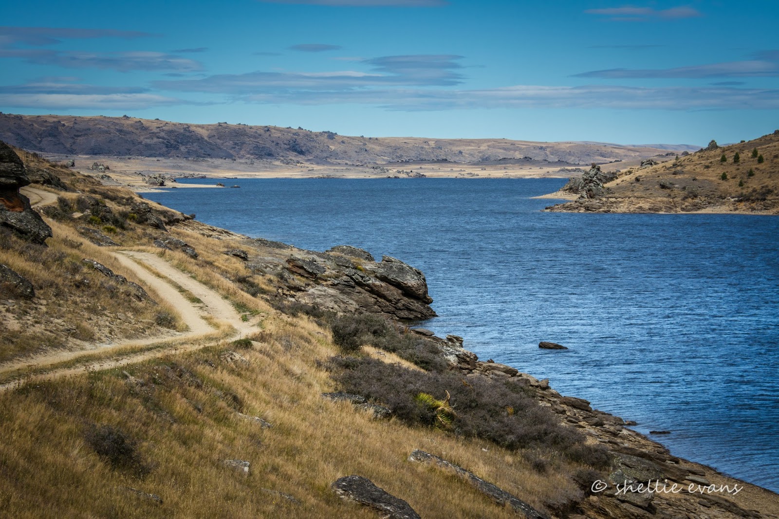
Lake Onslow is situated in high tussock grasslands, 25kms east of Roxburgh at the northwest end of the Lammerlaw Range. The lake freezes and the snow can be deep for weeks on end over winter. The road in, is clay with a rock base and it's very slippery after rain.  It can also be very dusty but we were lucky, light rain a few days prior had settled the dust without giving us any issues although there were a couple of boggy patches.


It was a slow and steady climb out of Millers Flat until we reached the first plateau and turned onto Lake Onslow Road. There we met the country version of a traffic jam. Two farmers having a chin-wag. In fact the one heading in our direction was the farmer who farmed from the Clutha River down at Millers Flat all the way to Lake Onslow. 


He asked us if we'd mind waiting for 10 minutes or so as they were moving a mob of sheep from the lake area to the home paddock for crutching. And sure enough, it wasn't long before the leaders appeared over the brow of the road.


2000 sheep turned- jumping, running, pushing, pooing and baaing- into a paddock just ahead of us; they were taking a short cut to the bottom. I really wanted to creep up the side to get the ribbon of sheep coming over the hill behind but was only allowed to get this close. Never mind, the wait was worth it, we got a good tip from Mr Farmer.


Once the sheep passed we continued on, now slowly climbing up Mt Teviot (851m). I can tell you the photos don't do the climb justice. It's just as well the zig-zag road ahead is a farm track, our road heads to the left around the bend.


Once we reach the top of Mt Teviot, the contours of the land and the views are spectacular- tussock as far as the eye can see intermingled with the green of a forestry block and the fodder crops and pasture lands of high country farms. 


This is looking down the road we've just climbed and back towards the Clutha River valley


We skirt around the side of the Mt Teviot and Lake Onslow finally comes into view, filling a large shallow depression in the tussock plateau. It's all downhill from here and much longer than you would think, it's also an equally tough climb out when you leave the lake.


The area where the lake now is was once known as the 'Dismal Swamp', the lake was created in 1888 by the damming of the Teviot River for a gold claim far below the range at Roxburgh. The flow from the lake is now used for irrigation and hydro-electric generation.


And proving once again that it's not what you know but who you know, Mr Farmer had told us to use the 'top gate' as there was a washout near the bottom gate and we wouldn't get through. We wouldn't have been able to turn around easily either. 


So it was straight down a grassy track to the lake front. David took great delight later in the week asking a couple of visitors towing caravans in, how they faired through the wash out and then asking them why they didn't use the 'expressway'!


The next task was finding a level site, there aren't too many places available as most of the ground slopes towards the lake and it's also covered in great clumps of tussock.


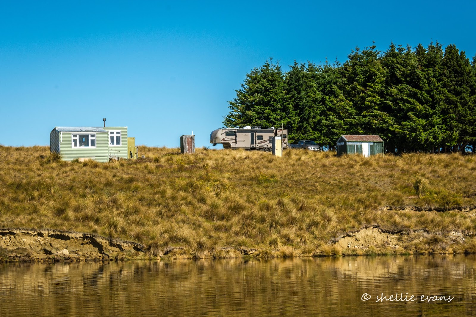
We found a spot behind the fishing huts and with a view of the lake...


...although we had to block the down side up quite a way which meant a big step up into the van. It was also protected from the wind a little, by two shorts rows of trees, the only trees for miles.


If we'd had a key we'd have even had our very own long-drop! Not.


There's just a dozen or so cribs spaced along the ridge on a point above the lake, not far from the river outlet and boat ramp. The last time we visited we never saw another soul, we had the whole place to ourselves for the day. 


This time there were two or three hut visitors during the week and a handful of boaties each day. Lake Onslow is a 'secret' brown trout mecca and when the cicadas are hatching it's game on. The cicadas were late this year (due to the crappy weather) and had only just started hatching during our last few days.

This one 'got away', we were going to keep it but then David decided he'd release it. He got it out of the net and held it up for a photo and it leapt out of his hand, hit me on the arm as it flew past and back into the drink. We didn't feel so bad knowing it was going to be released anyway. 


As you can see we had perfect weather and not before time. There was not a drop of rain in seven days, although we were fogged in until mid morning on a couple of days, the cause of some very low (4c) overnight temperatures. The fog sooned burned off revealing a perfect millpond and warm temperatures. David had the Takacat up and ready to go as soon as we arrived and he spent most days out on the lake fishing.


The old and the new...


And the beautiful...sunrises and sunsets were spectacular.


Lake Onslow is not for everyone, I think you have to be a fisherperson, a photographer or just love solitude to enjoy this stunning area. It's wouldn't be everyone's cup-of-tea........(that's a ploy to stop the crowds from invading) 


The dam outlet
We set the koura pot (fresh water crayfish) most nights and had excellent results and big crays too. I had to be brave and dunk them in boiling water to kill and cook them. I'm a bit of a wuss like that and I very nearly decided to release the first catch of about a dozen crays when David wasn't looking. But I gave myself a stern talking to, I'm not a vegetarian and where the heck do I think my protein comes from! I still felt bad about it, but cheered up considerably when we had lovely cray tail entrees most nights. They taste just like prawns.


Reluctantly, after seven nights and with rain forecast (which hasn't eventuated), we packed up and headed out, back up the grassy track...


...and down the road which was now as dry as a bone and belching dust like there was no tomorrow.


Once we reached the turnoff to Millers Flat, we thought 'what the hell, we're covered in dust now we might as well add a few more layers', so we carried on, travelling right along the top of the plateau and dropping down to Roxburgh instead of  Millers Flat, adding another 12kms of dust to the rig. Not one of our brightest decisions!  


More from the Dismal Swamp soon.


Wednesday, February 8

A River Destination- Southland

Real-time

I still have a couple of blog posts from the Catlins to do but thought while I have an unexpected internet connection, I'd let you know where we've been during the last week and over Waitangi weekend.


In a huge contrast to last year's Waitangi weekend, this year we swapped people for sheep (and sandflies). This was the view out our back window. The rest of the flock weren't so keen and gave the van a wide berth, although, going by the hoof prints and poop, I suspect they checked every inch of the van out while we were sleeping. 


The river was running very high, but not as high as it had obviously been not long before we arrived. We could see evidence of where the river has flowed over the banks and across the floodplain behind us. I told you it's been raining in Southland for all of summer.


If we'd heard anything more than a few soft splatters on the roof we'd have been hitching up and pulling out of there, quick smart. 


It was quite spooky once night fell, hearing the rush of water passing by just metres from the door. You wouldn't want to go sleep walking...


The river level slowly dropped over the next couple of days revealing a badly eroded river bank and great clumps of dirt and turf laying in the shallows. 


Although still quite murky, colour returned to the water and while I spotted a couple of trout checking out the new clumps of dirt in their habitat, David had no luck fishing along the banks.


'So, where are you?', I hear you shout. Well, we're parked on the side of a river in Southland. Not just any river either, this is the mighty Mataura River....190km long and famous for it's brown trout. 


We're parked along the Mataura's middle reaches, about 25kms inland from Lumsden, at the end of the road, at a place called Cattle Flat. The farmland that surrounds our camp site is owned by Cattle Flat Station and permission must be sought from the manager to camp alongside the river. Take note of the house number (1385) on the sign so you can call in on your way past- it's about 8kms back down the gravel road if you don't. 


I had a toss up with my conscience about making this site public- one of the first times I've struggled with whether I should post it or not. It's such a great area, complete isolation (well nearly) and not too far off the beaten track. But it has in the past suffered from abuse by freedom campers, hence the reason permission to stay must now be obtained. Vehicles have to be CSC and dogs are not allowed unless they have been treated for sheep measles (please don't let me down folks, thanks kindly).

Sunset at Cattle Flat
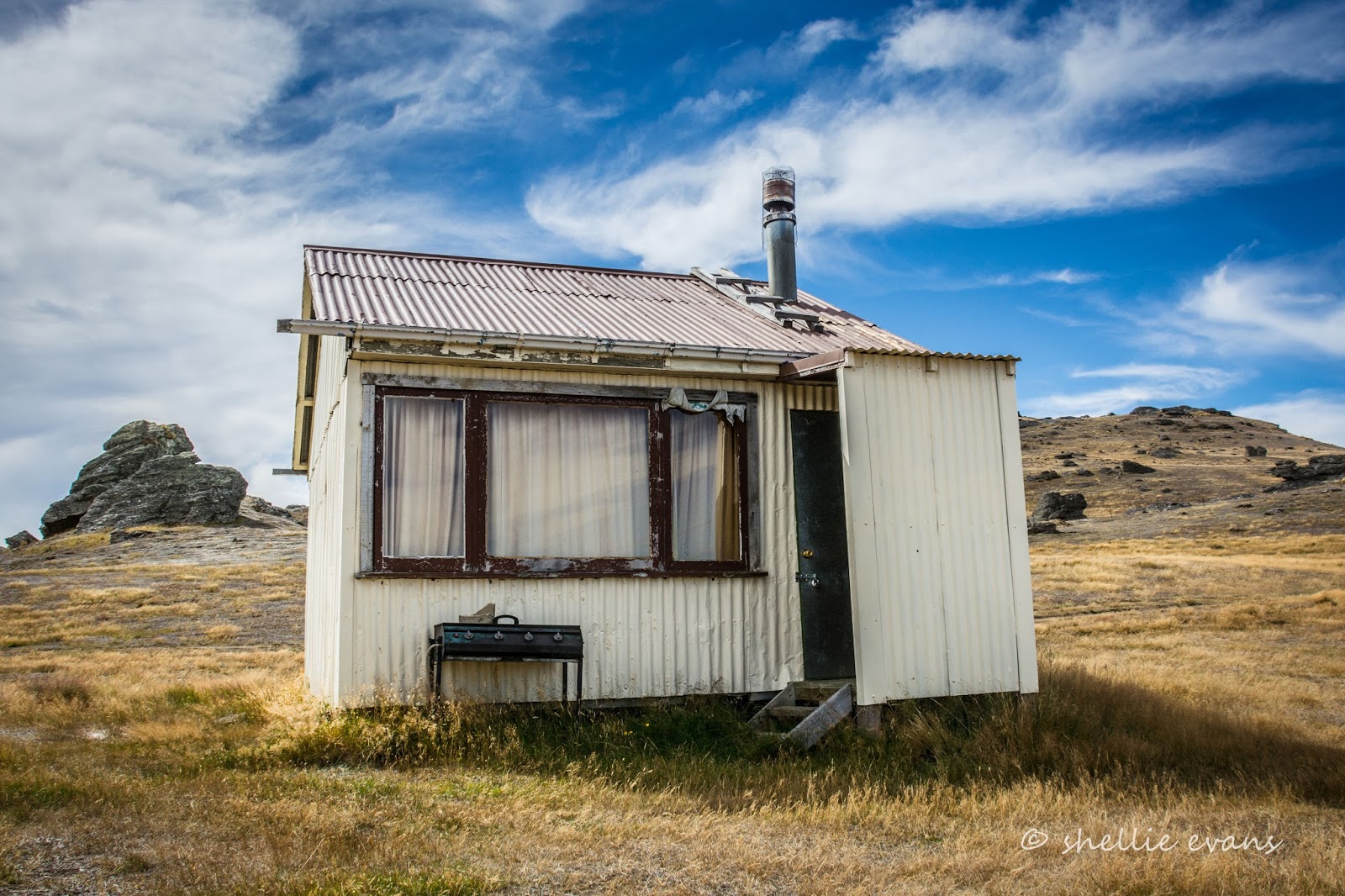
There's a charming surprise at the end of the road- a well maintained collection of fishing huts- and the reason the road is open to the public. Well, the huts and a bush reserve on conservation land. Please also, don't camp in front of the huts.


The huts have been passed down through the generations and I believe that they can't be sold (although I think that is a moot point). Unlike many other huts we've seen on our travels these are all in good repair and look like they'll outlive their current owners many times over.


There are even a couple around the corner...


and more alongside a stream that runs through the reserve. We had a little hiccup with this stream- we were collecting lovely crystal clear water for our tank from here....that was until I went for a walk and found one very smelly & bloated sheep lying across the middle of the stream a few hundred metres upstream. Eeuw.....yuk!

David drained our tank and we refilled it with water collected 20 metres above the sheep. I guess ignorance is bliss when you don't know what's around the corner. It's just lucky we don't drink our tank water, I guess you never can be too cautious though.


We stopped to talk to the owner of this crib on our way past- actually David stopped to talk to him while I took photos of the huts. The guy was very keen to show us his mobile BBQ- great Kiwi ingenuity there, and his hot-tub with gas heating system attached. A rotationally moulded foam filled hot tub too (our old industry).


One of the Cattle Flat's attractions for me was the fact that some of our favourites places along SH6; Nokomai Station (where we did the 4WD Safari), Athol & Garston are just over the mountains behind us. The rounded mountain at the back of the valley is East Dome, one of the three Domes (the other two being West & Mid) that form a triangle around that area.


The Mataura flows past those settlements and through Nokomai before passing us here at Cattle Flat and continuing on down past Gore, eventually exiting into the vast Fortrose estuary at the bottom of the Catlins. I wondered how long it would take for water that passed us at Cattle Flat to reach the mouth; going by the speed of the 'eels' passing by, not long at all. The 'eels' were similar lengths of dark smooth driftwood caught up in the flood waters that floated by in a never ending conga line. We couldn't decide why they were all mostly of the same length, like they'd been fed through a bean slicer somewhere. I do know though, that somewhere downstream, there's a whole heap of kindling building up.


The weather was mostly fine and warm, which was a relief after all our bad weather. It cooled down and clouded over most afternoons with the threat of rain. But in the end it was the wind that got to us; we left a day earlier than planned. The prevailing westerly swept down the valley and shook and battered us about for hours on end for a couple of days. And then we had one bad night when we had to pull the slide-out in to ease the strain on the van and the constant rocking and rolling. A shame, but that weather continues to put the kibosh on our summer.

We still had a great stay and thoroughly enjoyed the solitude. The crib owner and his wife were the only other people we saw during the first three days and we only saw them the once.


Out our back window again- the extend of activity once the holiday weekend arrived, when people replaced sheep for a very short time. The cribs are lined up along the road behind the macrocarpas.


Where to next? Not too far away and onto another 'flat'.


Tuesday, September 6

Upper Manorburn Dam- Central Otago

Catch-up, Mid March 2016

I bet the title fooled you. Thought we were back in the South Island didn't you? No. we're still parked up in sunny Napier where finally, I've been able to begin sorting through some of the photos from earlier in the year when we were on the move so much that I couldn't keep up with the blog posts. I still have a few too many folders to sort but I'll try and get a few posts done with the interesting stuff; some are too good to miss. So here's the first one...

You may recall we were staying beside the Manuherikia River in Omakau and it was from there that we did a number of day trips exploring the wider area. One was to the Serpentine Church, way past Poolburn Dam on Rough Ridge, followed by another long day to Upper Manorburn Dam a few days later. The dam and it's sister, the Greenland Reservoir, are located on the same ridge 700metres above sea level and just a little closer to Alexandra. In photos on the church link above, you can see them both far below us from a high point where we stopped on the Serpentine track.

The upper Manorburn Dam is not to be confused with the Lower Manorburn Dam- both are sometimes referred to as the Manorburn Dam but there's quite a few rugged kilometers separating them (see the map at the bottom of the blog)- the more well known lower dam is just outside Alex and is often used for ice skating in the winter. We visited it on another tiki-tour.....

Lower Manorburn Dam
To access the Upper Manorburn we left the river at Omakau and headed over into the Ida Valley...


...following the same road to the bottom of the valley, as we did to get to Poolburn Dam and the Serpentine, but turning off just before we reached Moa Creek. I managed to get a photo of an old stone cottage that we must have passed a dozen times before, this time I made sure I shouted 'Stop!!' before we'd roared past. It's such a shame to see so many around the area in such a state of disrepair.


We left the gravel 'highway' behind and hit the dirt track, weaving up to the top of the plateau...


...where we stopped for a look around. I't's dry and barren for as far as the eye can see, with little in the way of plant life except for a splash of yellow through a gully where a flowing stream is keeping the willows alive. Can you see David in the top photo? He was off searching for lizards when I shouted out 'Car coming!'- you can see it just coming through the rocks at the back in the middle. David had left the ute parked on the road, so he was racing to shift it (the fastest I've seen him move for a long time). I don't know why though, they could have skirted around the ute, given the terrain.


The car passed and disappeared out of sight...


...down the long and winding road. They obviously got fed up with the drive because we came across them heading back up the road a few kilometres later. I suspect the driver of the flash white car wasn't enjoying playing dodgems with the cow-pats that littered the road- those little black dots are cattle.


Twenty kilometres later we spied a small grove of greenery ahead of us...


...a few fishing huts and a sign indicating that we'd finally reached our destination, although we couldn't see the dam and didn't know whether to take the left or right turn.


We went left and made our way over a rather rough patch of track and then rounded a bend to find the dam wall right ahead, in front of us. 


We parked up by the wall (see the ute above?) and I wandered back down the track to shoot the huts. 


I never pass up an opportunity to capture the shots when I'm right there. You soon learn if you leave it for later, the light or the weather will have changed. And if the conditions have changed for the better by the time I pass back by, I then get a second chance to get some decent shoots.


We carried on down the track and around the edge of the dam...


...until we came across a few more huts and a couple of cars with empty boat trailers at a place called Gravel Beach. 


I love the fishing huts we're finding on our travels, they have so much character...


...and the best possible views.


At the far end of the dam (which has approx 14kms of shoreline), a gorge called The Narrows joins the Upper Manorburn to the Greenland Reservoir. 


We found a sheltered spot to have some lunch; in front of a tiny hut and in the lee of a large rock out of the cold wind. 


As we sat in the peace, quite and solitude we heard a faint buzz way off in the distance which quickly grew louder and louder as a small speed boat came into view. Fisherman on their way home.


They were still loading the boat on the trailer as we passed back by Gravel Beach. The dam level looked to be very low.


Dark cloud was rolling in as we neared the dam, lucky I took those hut photos earlier.


We stopped beside the outlet stream... 


...so David could check for trout.


None were spotted......can you see David's head in the photo below?


Then we stopped beside the spiny (and lethal looking) Spaniard plants at a high point further along the road. Spaniards, also know as Speargrass are an alpine plant; this whole plateau would be covered in snow numerous times over winter. 


And then it was one last stop before leaving the track behind to look for lizards in amongst the rocks again. We're actually looking for the very rare Otago Skink which is only found in Central Otago and then in very limited numbers and select areas and habitats. They are magnificent creatures growing to a length of about 300mm and are about 3-4 times the size of the skinks we usually find (on the right). We saw them on a visit to the Orokonui Ecosanctuary near Dunedin and ever since have been keeping an eye out for them. One day we'll strike it lucky.


The view over our shoulders as we scrambled amongst the rocky tors looking for lizards was spectacular, all the way up the Ida Valley to the the Hawkdun Range behind. A range made famous by Grahame Sydney's paintings.