Showing posts with label manorburn. Show all posts

Tuesday, September 6

Upper Manorburn Dam- Central Otago

Catch-up, Mid March 2016

I bet the title fooled you. Thought we were back in the South Island didn't you? No. we're still parked up in sunny Napier where finally, I've been able to begin sorting through some of the photos from earlier in the year when we were on the move so much that I couldn't keep up with the blog posts. I still have a few too many folders to sort but I'll try and get a few posts done with the interesting stuff; some are too good to miss. So here's the first one...

You may recall we were staying beside the Manuherikia River in Omakau and it was from there that we did a number of day trips exploring the wider area. One was to the Serpentine Church, way past Poolburn Dam on Rough Ridge, followed by another long day to Upper Manorburn Dam a few days later. The dam and it's sister, the Greenland Reservoir, are located on the same ridge 700metres above sea level and just a little closer to Alexandra. In photos on the church link above, you can see them both far below us from a high point where we stopped on the Serpentine track.

The upper Manorburn Dam is not to be confused with the Lower Manorburn Dam- both are sometimes referred to as the Manorburn Dam but there's quite a few rugged kilometers separating them (see the map at the bottom of the blog)- the more well known lower dam is just outside Alex and is often used for ice skating in the winter. We visited it on another tiki-tour.....

Lower Manorburn Dam
To access the Upper Manorburn we left the river at Omakau and headed over into the Ida Valley...


...following the same road to the bottom of the valley, as we did to get to Poolburn Dam and the Serpentine, but turning off just before we reached Moa Creek. I managed to get a photo of an old stone cottage that we must have passed a dozen times before, this time I made sure I shouted 'Stop!!' before we'd roared past. It's such a shame to see so many around the area in such a state of disrepair.


We left the gravel 'highway' behind and hit the dirt track, weaving up to the top of the plateau...


...where we stopped for a look around. I't's dry and barren for as far as the eye can see, with little in the way of plant life except for a splash of yellow through a gully where a flowing stream is keeping the willows alive. Can you see David in the top photo? He was off searching for lizards when I shouted out 'Car coming!'- you can see it just coming through the rocks at the back in the middle. David had left the ute parked on the road, so he was racing to shift it (the fastest I've seen him move for a long time). I don't know why though, they could have skirted around the ute, given the terrain.


The car passed and disappeared out of sight...


...down the long and winding road. They obviously got fed up with the drive because we came across them heading back up the road a few kilometres later. I suspect the driver of the flash white car wasn't enjoying playing dodgems with the cow-pats that littered the road- those little black dots are cattle.


Twenty kilometres later we spied a small grove of greenery ahead of us...


...a few fishing huts and a sign indicating that we'd finally reached our destination, although we couldn't see the dam and didn't know whether to take the left or right turn.


We went left and made our way over a rather rough patch of track and then rounded a bend to find the dam wall right ahead, in front of us. 


We parked up by the wall (see the ute above?) and I wandered back down the track to shoot the huts. 


I never pass up an opportunity to capture the shots when I'm right there. You soon learn if you leave it for later, the light or the weather will have changed. And if the conditions have changed for the better by the time I pass back by, I then get a second chance to get some decent shoots.


We carried on down the track and around the edge of the dam...
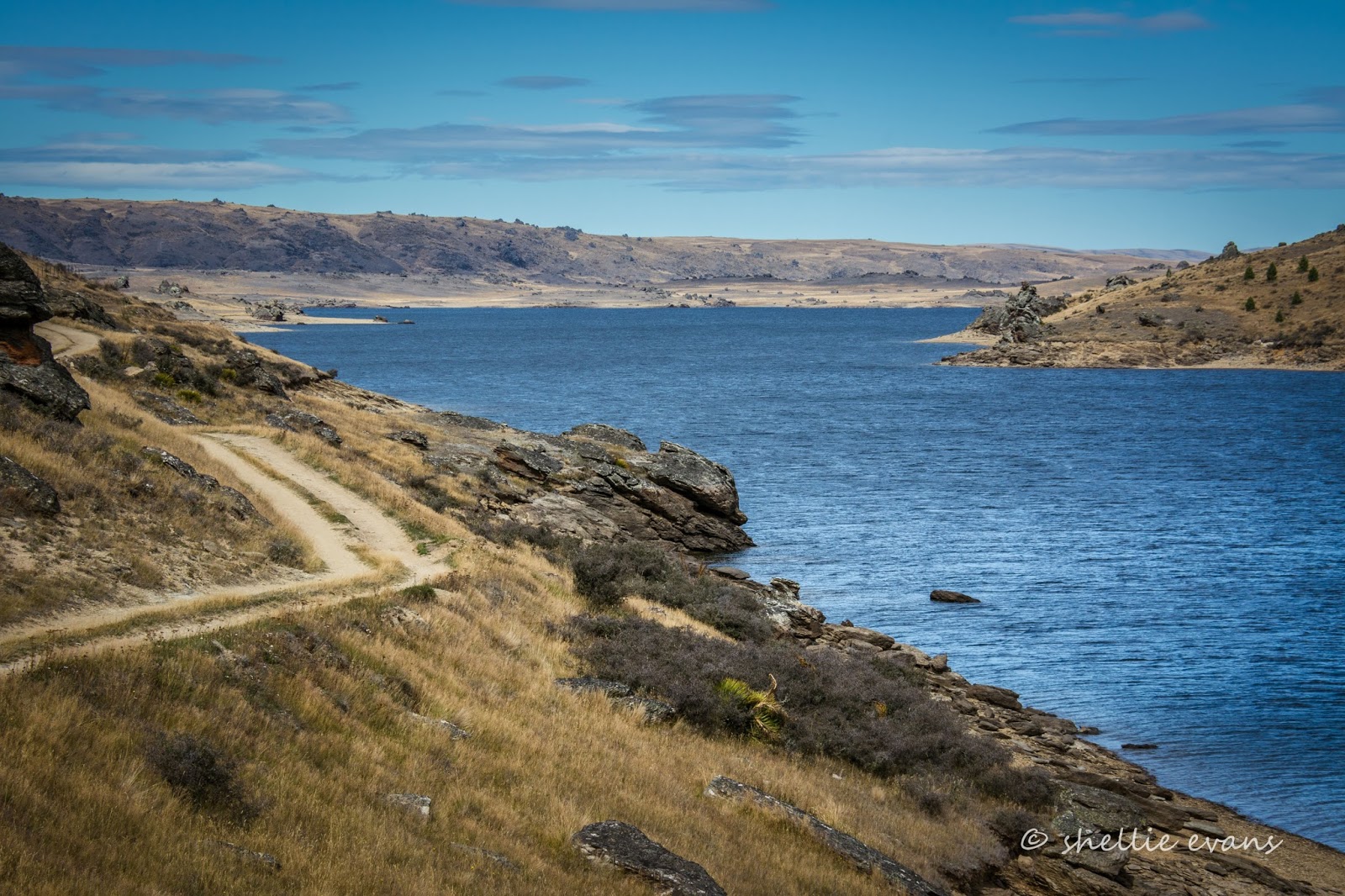

...until we came across a few more huts and a couple of cars with empty boat trailers at a place called Gravel Beach. 


I love the fishing huts we're finding on our travels, they have so much character...


...and the best possible views.


At the far end of the dam (which has approx 14kms of shoreline), a gorge called The Narrows joins the Upper Manorburn to the Greenland Reservoir. 


We found a sheltered spot to have some lunch; in front of a tiny hut and in the lee of a large rock out of the cold wind. 
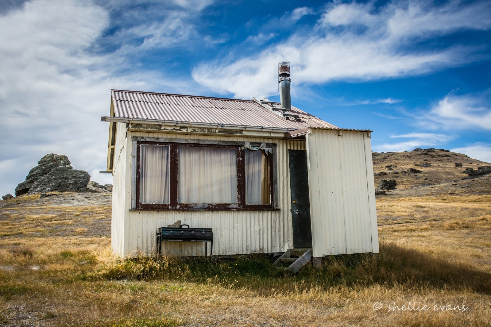

As we sat in the peace, quite and solitude we heard a faint buzz way off in the distance which quickly grew louder and louder as a small speed boat came into view. Fisherman on their way home.


They were still loading the boat on the trailer as we passed back by Gravel Beach. The dam level looked to be very low.


Dark cloud was rolling in as we neared the dam, lucky I took those hut photos earlier.


We stopped beside the outlet stream... 


...so David could check for trout.


None were spotted......can you see David's head in the photo below?


Then we stopped beside the spiny (and lethal looking) Spaniard plants at a high point further along the road. Spaniards, also know as Speargrass are an alpine plant; this whole plateau would be covered in snow numerous times over winter. 


And then it was one last stop before leaving the track behind to look for lizards in amongst the rocks again. We're actually looking for the very rare Otago Skink which is only found in Central Otago and then in very limited numbers and select areas and habitats. They are magnificent creatures growing to a length of about 300mm and are about 3-4 times the size of the skinks we usually find (on the right). We saw them on a visit to the Orokonui Ecosanctuary near Dunedin and ever since have been keeping an eye out for them. One day we'll strike it lucky.


The view over our shoulders as we scrambled amongst the rocky tors looking for lizards was spectacular, all the way up the Ida Valley to the the Hawkdun Range behind. A range made famous by Grahame Sydney's paintings. 


Tuesday, April 5

Seeking out the Serpentine- Part 1

Real-time

Well that's done and dusted. I can finally tick off one my bucket list 'must see' places in New Zealand. The lonely & isolated historic Serpentine Union Church is located 35kms from civilization (our river camp at Omakau), deep within a vast plateau in the Rough Ridge mountains in Central Otago. The church was also at the top of my 'to photograph' list, to add to my collection of country church photos.  


Long Valley Ridge Road (a misnomer if ever there was one- these are not roads but dirt tracks) leaves the Old Dunstan Road, another rough track that snakes across the top of the ridge, not too far past Poolburn Dam. All these routes are summer 4WD driving only- Rough Ridge is closed during winter with locked gates at all entry points from the beginning of June until the end of September- though you can go as far as Poolburn Dam during winter if the road is dry. It is a cold and hostile environment up on the plateau and snows regularly during winter.

And even through summer, driving any of the tracks should only be attempted after a long dry spell, unless you are a true 4WD driver and not driving a 'shiny' like us. The rock and clay dirt tracks turn very slippery and puggie soon after rain. 


It's also wise to have an accompanying vehicle just in case of any emergency. We were able to get good phone reception for about a kilometre, mid-way through the trip and along the ridge at the highest point, but it would have meant a fair hike and a costly recover had we had any issues. The last vehicles to pass through the area had been 3 days prior (according to the visitor book at the church). 

Well, that's the disclaimer out of the way, so don't say you haven't been warned.

It was going to be a long day for us, we left Omakau at 10am and didn't return until 7pm. Of course we were already familiar with the 14km road into Poolburn Dam, this being our third visit; one just a few days before when we took our visitors on a tiki-tour and then last July when we slipped and slid our way there to be rewarded with the spectacular scene of a frozen lake with beautiful blue & white swirls.

Today we  saw our first boat on the dam, a dinghy with two guys heading off to set their koura pots (fresh water crayfish), a scene I doubt that is repeated anywhere else in New Zealand.


Once across the other side of the dam wall we turned left and headed into new territory, along the Old Dunstan Road, also know as the Old Dunstan Trail; a route used by gold miners in the 1860s to gain quick access from Dunedin to the prosperous Central Otago goldfields.


At one of our early gate stops we came across this Swamp Harrier Hawk. At first we were unsure of why it didn't lift off and I was able to get quite close before it became aware of us. I backed off when it started bumbling about and when I uploaded the photos I can see it had a bung eye but otherwise looked quite healthy. Due to the lack of rabbits we saw on the trip and the poison signs on the gates, we think it could have been secondary poisoning. We couldn't do anything for it and it was still there when we returned later in the day. Poor boy(or girl).


There are no road signs so it pays to have a good idea of where you're heading as there are a number of tracks leading off the 'main' road. We leave Old Dunstan Road here and head right, down Long Ridge Valley Road, according to our map and a couple of tracking apps we have on our phones. There is a Serpentine Road that leaves Old Dunstan at the other end of this section of the trail, near Styx, which you might be tempted to take. Don't. It's a rough true 4WD track.


There are at least a dozen gates to open and close on the way in, which means by the end of the day I'd done 48 gate actions; no wonder there was so much dust on my rubber floor mat. And many of the openings weren't as smooth as these ones. I wonder who decided a split gate was a good idea; I'd pull one side to and then have to race to grab the other side and pull that shut before the first side swung open again. My arms just weren't wide enough to reach both together. Well that, and the fact that I was wrestling to hold my camera as well....


Beside one of the gates was an old stock holding pen that had seen better days. 


We stopped often to take in the immensity of this stunning landscape- big skies, rocky tors, tussock and spikey Spaniard stretch as far as the eye can see in all directions.


The road bumps and winds it's way along the top of the plateau occasionally dropping down into a hollow. A hut symbol was marked on one of our maps and as we'd already been travelling for about an hour along Long Ridge Valley Road, we were beginning to think it might have marked the church instead. We'd convinced ourselves it was going to be the church so when we came over a brow it was a big surprise to see a tiny hut off in the distance....and then wonder how much further the church was.


This is Oliveburn Farm Hut, the cutest and most well kept hut we've come across on our travels.


The rough-cast concrete hut was built in the 1940's and would have been used as a rabbiters hut and probably for musterers too – it has the tiniest little porch, two bunks, plates & cutlery, a small sink and bench with chairs to sit at. And there are even a few supplies in the cupboard. At least we had somewhere to walk to, to spend the night, if we did break down! 

Wouldn't it be great if all these back country huts were similarly well looked after and respected by visitors.


We carried on along the track, David loudly wondering, after seeing the road disappear over a crest far off in the distance, when on earth we were going to get there!

Half an hour later and I open the final gate into the Serpentine Scenic Reserve. And we breath a sigh of relief. Even with maps and a good idea of where we were going it's quite disconcerting having no marker points on the road to say you're heading in the right direction. And on a map five kilometres might as well be 50 when you're driving on a slow bumpy dirt track.


The ungrazed tussock is thick and luxuriant in the reserve and alas, the track still wanders off into the distance. Dare I say it, but it also becomes a lot more bumpy and rutted, due I think to the fact, that any 4WDs and trail bikes have had to stick to the track rather than take shortcuts as they have done on the grazed areas coming in. 


Five minutes later and there's great excitement (on my part) when we can finally see over the side of the plateau and far out over a valley to our right.


A zoomed in shot reveals what looks to be the outskirts of Alexandra in the Manuherikia River valley with the Clyde Gorge cutting through the range behind (well that's what I'm thinking anyway).


And there off to our left, if you look very carefully, is the target of our tiki-tour; the historic Serpentine Church located in a vast plain of tussock (centre left, click on the photo to enlarge).


And in this zoomed in shot you can see the track behind winding it's way down to the church and the gold mine tailing pile in the foreground with a smattering of tussock growing on the nutrient poor rocky surface.


Far across this spectacular view is the "Dismal Swamp", Lake Onslow, one of our favourite dams which is accessible from Roxburgh on another dry weather track. Did you see it in the photo, two above, out to the right? There is a rough 4WD track from Lake Onslow to Serpentine but it's not recommended for anything other that true 4WDs. We knew we weren't going to be that far from Onslow but didn't realise that we'd actually be able to see it from here.


Before we head down to the church we check out the ruins of the old miner's cottages nearby (in the centre in case you miss them).


There's a walking track (1 hour return) below the cottage ruins which leads to the remains of the old Serpentine Gold Mine stamper battery and water wheel, both of which are (apparently) in excellent condition due to being recently restored. In 1882, the battery was located at the top of the ridge to crush ore from the mine. It was moved to it's current site in 1890 but the mine didn't live up to expectations and the battery was abandoned in 1891.


We decide we don't have time to walk to the battery, plus it's far too hot and it looks to be a steep climb back up afterwards. I'm a little disappointed as I doubt we'll be back this way anytime soon.

Behind a large rock I find another memorial plaque for someone who spent a lot of his life fishing and hunting in the area (we regularly find memorial plaques in remote and scenic spots). 


We climb to a high point above the cottages...


...where we can see back to the road and the parked ute...


 ...and out in front of us there are more dams in the sweeping vista-

The Greenland Reservoir...


...the Upper Manorburn Dam (Greenland flows into Manorburn). A track heads across the barren landscape towards the Manorburn. The battery walking track leaves it to the right a little way along, and sweeps around the valley to the battery and then down to the bottom where the mine tunnel is located.


We explored the road to the Upper Manorburn Dam, a few days before this trip (blog post still to come on that). The Manorburn Dam road, like Poolburn, is accessed from the top of the Ida Valley. 

And here are Geenland and Manorburn dams together-


And off behind us we can see Poolburn Dam, which actually doesn't look that far away as the crow flies, but is about 15kms and a couple of hours by dirt track.


Poolburn looks like a large puddle in the mountains in this zoomed shot.You can even see some of the huts on the far side. At a high point on top of another rock we had a 360 degree view of all four dams- what an amazing sight! 


And here's a bad pano shot showing three of the dams; this is four photos stitched together- from left to right, Greenland to left of the rock, Manourburn in the middle and Poolburn in the far distance at the right. Lake Onslow is out of shot to the left. And did you spot David coming up  towards me? Click to enlarge the photo.


I could have easily spent more time soaking in the spectacular views and checking out the small alpine plants and quartz showing in the rocks but it was time to move along, we still had a distance to travel even though we could now see the church.


The road made a frustrating wide sweeping curve around the ridge above the church... 


...before finally dropping down into the depression where it's located. Going by the state of the last 200-300 metres of the track the snow must settle and the rain pool here for days on end (in case you have been wondering, the green colour tint between some photos is caused by taking them through the windscreen).


And finally,  hours, 12 gates, 35kms and umpteen photos later we arrived at the remotest and highest altitude (over 1000m) church in New Zealand. The Serpentine Union Church, opened during the winter of 1873, but never saw many services. 


It was said of the first service that the minister was late in arriving (probably due to the weather). The congregation after waiting some time, adjourned to the nearby hotel for refreshments and had been drinking heavily by the time the minister arrived. When the service finally opened with a well known Psalm the, by now lively, congregation demanded an encore! The minister was not at all impressed, cut short the service and said he would never return. 

The church later became a miners cottage, the porch was added at this time.


Part 2- What's inside & what's in store...