Showing posts with label serpentine. Show all posts

Wednesday, April 6

Seeking out the Serpentine- Part 2

Continued on from Part 1

After arriving at the historic and isolated Serpentine Union Church on a beautiful sunny afternoon I spent the first ten minutes or so rushing around taking photos. Just in case. Just in case the thick bank of cloud approaching from the horizon behind reached us before we'd finished having lunch. I didn't want to come all this way for the weather to suddenly ruin my blue sky day. 


The first thing I noticed as I approached the porch was a great swarm of blow-flies buzzing about. I then noticed a couple of large rabbit holes in the mound of dirt that held the porch poles. And from out of them came more flies. Eeuw yuk. There was obviously something dead inside one of the holes and most likely a rabbit of two. Not pleasant at all and just as well I couldn't see the bodies. 

I have a feeling that they were either poisoned (there were poison signs on nearby gates) or the calicivirus has taken hold again. I also suspect the the sick hawk we saw back at the beginning of the trail may have dined on a poisoned rabbit. It must also be the reason that we saw not one rabbit on the road in, very unusual for this area of Central Otago.


Back to the church- the iron roof is held down by wires weighted with large rocks tied to the ends, it was obviously once thatched as remnants of thatch are still visible from the inside. The chimney has long gone from the back corner and iron patches the hole left behind.


I was a bit worried opening the door as to what I was going to find inside- dead rats (or worse still, live ones), dirt floor full of burrows, someone hiding behind the door, well you never know what surprises await you with old buildings. But I was pleasantly surprised to see a wooden floor and various pieces of authentic furniture- whether they are original or not I have no idea. I've included a number of the photos from the inside in this post; I thought I'd do my bit for social history and upload them as there is very little on the web about the church, other than the standard 'little church, big sky, heaps of tussock' photo.

A centre strut and cross beam have been added to support the roof. There's a raised platform (chancel) at the front of the church from where the minister would have conducted his sermons.


I suspect the coal range was added when the church became a miner's cottage. The wetback (if there was one) and chimney have been removed and the gap re-stoned. The iron sheets on the outside protect this corner.


There are a few old bottles on the window sill (and a couple of Speights cans), and a wooden cupboard on a box in the corner.


David opened its door for me (well, there might have been a body inside). Of course there was nothing so exciting, just an interesting collection of old tools, tins and other relics and a few large spiders. 


An old wooden bench seat didn't look too inviting and was a bit wonky on its legs.


David filled in the visitors book which sat on the dusty table, the last entry was 3 days prior. He also decided to give the floor a sweep with the broom that was propped up beside the door; the floor was covered in thick dust and dirt. I had to stop him quickly as a swirl of choking dust rose and nearly obliterated my view as I took photos.  


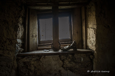
Two old shoes...


A couple of old wire wove beds fill a couple of the corners.


A brief history of the church has been engraved into a gothic arch shaped piece of ply. I hate to admit it but we failed to spot the engraving- it was very dark inside the church, most of my inside photos were taken at a slow shutter speed to let in the light. Or perhaps there was just too much dust swirling about- but it wasn't until I uploaded the photos that I saw writing on the board. Click on the photo to enlarge.


Outside, and its another photo of the Serpentine Church- a tiny stone building in a vast and isolated landscape. Pretty amazing really.


The only signs of life on the plateau as we drove through were a large a number of hawks soaring far above us, a few sheep off in the far distance, the odd pipit with a death wish; running and jumping ahead of us...


And dozens of beautifully patterned skinks sunbathing on the warm stones in the church wall. I knew they were native NZ skinks but was unsure of the species, so posted an observation on the NatureWatch NZ site for identification. Here's the response I received-
Good find! There are two different species in these photos. The first and third pictures are of a McCanns skink, Oligosoma maccanni, and the second picture is of a southern grass skink, Oligosoma polychroma 'clade 5'.

We're keen to find an Otago Skink, which are very rare and only found in Central Otago. They are very large lizards by NZ standards and can grow to around 300mm in length. We've only ever seen them at Orokonui Eco Sanctuary on the outskirts of Dunedin.

And here's one final photo of the Ranger in front of the church.


We spent about an hour soaking in the scenery, the warm sun, checking out the church, taking photos and having a late lunch on our favourite seat; the ute's backdoor. Reluctantly we decided we'd better get going before it got too late in the afternoon.

Beyond a closed gate near the church and heading east we could see a rough 4WD track, it climbed up through the tussock before disappearing over a hill off into the distance. We knew that this track would be rough for about a kilometre before it met the old Serpentine Road, but if we could manage it, it would mean we wouldn't have to retrace our steps back over Long Ridge Valley Road. If we took this track we'd then be able to complete a big loop and either return via the Old Dunstan Road or head down into civilization through Styx, into the Maniototo and home via the main highway.

It started off well enough, just a couple of small boggy patches to cross and a relatively straight run along the tops of the ruts. It may not look like it from these photos but the narrow ruts in the track from the church (in the background) to here were quite deep. I had to walk (run) ahead directing David so he wouldn't drop a tyre off into a rut and belly out. Our walkie-talkies were invaluable!


A little further on and the going got a lot tougher- a bigger bog patch that we were unwilling to cross. You never know how deep they're going to be or what's in the bottom of them- this one had a metal spike sticking out and a few mudguard remnants on the side. Bog trophys from past excursions by others through the interior. We also don't have very knobbly tyres and they were already full of mud and very slippery.

David eased the ute up the side, towards the tracks that earlier vehicles had used to avoid the bog. In the end the angle just got too acute for us to feel comfortable- our motto is 'sticky side down, shiny side up' and we wanted to stay that way! First the towbar, then the rear bumper were dragging on the rut ridges behind. David got out to check...


And then decided to see what was in store ahead if we did get through this part- that's him, a tiny dot on the horizon. he came back to say it was marginal, there was another rough patch up the side of hill but also another track that others had formed beside it, still rough but not as bad. 


In the end we decided 'discretion was the better part of valour' and we'd have to return via the way we came. Being by ourselves, late in the afternoon, with no phone reception, driving a 'shiny' and a vehicle which we rely on for our lifestyle, made the decision in the end. It was borderline comfort zone for both of us, but I can see how people can and do push the limits. We kept saying "but just over the hill and we'll be back on a relatively easy track", the lure of a new road was hard to ignore. I've since heard that the Serpentine Road is just as bad; it's not used nearly as much as the Long Ridge Valley Road and when it is, it's by true 4WDrivers- we'll have to check that out from the other end.

And here's what the track can look like, no wonder the ruts are so deep! -


After a twenty point turn and a popped mudguard (very hard to turn on a narrow deeply ridged track) David carefully drove back towards the church. We heaved a big sigh of relief when we got back to the gate. We knew the road ahead.


Without the stops to explore and take photos, we made it back to the Serpentine Reserve gate in half the time.


And then it off across the plateau travelling on a road that seemed alot bumpier than before. Perhaps it was because we are travelling at a slightly faster pace, keen to get the miles behind us before the sun dropped into view ahead of us.


We did stop a few times; once to check out an airstrip (shown on one of our apps) which was down a side track- it was a relatively bare and bumpy strip of earth covered in short tussock stumps and pitted with rabbit holes. I doubt much would land here, perhaps it's a top-dressing refill point or somewhere they carted in fence supplies for the new fences and gates that criss-cross the area.


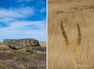
I still carried my camera out for every gate opening; you never know what might take your eye. Like these Spaniard spikes beside a rock and poking out of the tussock. 


Finally, 1 hour and 40 minutes after leaving the church we're closing the gate on the Old Dunstan Road- this same same distance this morning, took 3 hours. We're within sight of Poolburn Dam...


...which looks absolutely stunning in the late afternoon light (6pm)...


We found the guys from the dinghy this morning sitting out in the sun enjoying the peace and quiet and their very own 'happy hour'.


Half an hour later and we're heading down into the Ida Valley which is looking mighty green compared with our visit last winter. The Rough Ridge dams are doing their work.


Then up and over Raggety Range (still love that name), stopping one last time to take a photo overlooking the Manuherikia  River valley and Omakau outskirts. It looks amazing in the light of the setting sun (7pm). If I hadn't felt so worn out after our 9 hour tiki-tour, I would have returned to the lookout with my tripod and captured some panoramic shots. That'll have to wait until next time. I have a feeling Poolburn hasn't seen the last of us.


And that was the road, there and back, to the Serpentine. Another amazing day, enjoyed well off the beaten track. It was time to follow suit and enjoy a long cool drink.


Tuesday, April 5

Seeking out the Serpentine- Part 1

Real-time

Well that's done and dusted. I can finally tick off one my bucket list 'must see' places in New Zealand. The lonely & isolated historic Serpentine Union Church is located 35kms from civilization (our river camp at Omakau), deep within a vast plateau in the Rough Ridge mountains in Central Otago. The church was also at the top of my 'to photograph' list, to add to my collection of country church photos.  


Long Valley Ridge Road (a misnomer if ever there was one- these are not roads but dirt tracks) leaves the Old Dunstan Road, another rough track that snakes across the top of the ridge, not too far past Poolburn Dam. All these routes are summer 4WD driving only- Rough Ridge is closed during winter with locked gates at all entry points from the beginning of June until the end of September- though you can go as far as Poolburn Dam during winter if the road is dry. It is a cold and hostile environment up on the plateau and snows regularly during winter.

And even through summer, driving any of the tracks should only be attempted after a long dry spell, unless you are a true 4WD driver and not driving a 'shiny' like us. The rock and clay dirt tracks turn very slippery and puggie soon after rain. 


It's also wise to have an accompanying vehicle just in case of any emergency. We were able to get good phone reception for about a kilometre, mid-way through the trip and along the ridge at the highest point, but it would have meant a fair hike and a costly recover had we had any issues. The last vehicles to pass through the area had been 3 days prior (according to the visitor book at the church). 

Well, that's the disclaimer out of the way, so don't say you haven't been warned.

It was going to be a long day for us, we left Omakau at 10am and didn't return until 7pm. Of course we were already familiar with the 14km road into Poolburn Dam, this being our third visit; one just a few days before when we took our visitors on a tiki-tour and then last July when we slipped and slid our way there to be rewarded with the spectacular scene of a frozen lake with beautiful blue & white swirls.

Today we  saw our first boat on the dam, a dinghy with two guys heading off to set their koura pots (fresh water crayfish), a scene I doubt that is repeated anywhere else in New Zealand.


Once across the other side of the dam wall we turned left and headed into new territory, along the Old Dunstan Road, also know as the Old Dunstan Trail; a route used by gold miners in the 1860s to gain quick access from Dunedin to the prosperous Central Otago goldfields.


At one of our early gate stops we came across this Swamp Harrier Hawk. At first we were unsure of why it didn't lift off and I was able to get quite close before it became aware of us. I backed off when it started bumbling about and when I uploaded the photos I can see it had a bung eye but otherwise looked quite healthy. Due to the lack of rabbits we saw on the trip and the poison signs on the gates, we think it could have been secondary poisoning. We couldn't do anything for it and it was still there when we returned later in the day. Poor boy(or girl).


There are no road signs so it pays to have a good idea of where you're heading as there are a number of tracks leading off the 'main' road. We leave Old Dunstan Road here and head right, down Long Ridge Valley Road, according to our map and a couple of tracking apps we have on our phones. There is a Serpentine Road that leaves Old Dunstan at the other end of this section of the trail, near Styx, which you might be tempted to take. Don't. It's a rough true 4WD track.


There are at least a dozen gates to open and close on the way in, which means by the end of the day I'd done 48 gate actions; no wonder there was so much dust on my rubber floor mat. And many of the openings weren't as smooth as these ones. I wonder who decided a split gate was a good idea; I'd pull one side to and then have to race to grab the other side and pull that shut before the first side swung open again. My arms just weren't wide enough to reach both together. Well that, and the fact that I was wrestling to hold my camera as well....


Beside one of the gates was an old stock holding pen that had seen better days. 


We stopped often to take in the immensity of this stunning landscape- big skies, rocky tors, tussock and spikey Spaniard stretch as far as the eye can see in all directions.


The road bumps and winds it's way along the top of the plateau occasionally dropping down into a hollow. A hut symbol was marked on one of our maps and as we'd already been travelling for about an hour along Long Ridge Valley Road, we were beginning to think it might have marked the church instead. We'd convinced ourselves it was going to be the church so when we came over a brow it was a big surprise to see a tiny hut off in the distance....and then wonder how much further the church was.


This is Oliveburn Farm Hut, the cutest and most well kept hut we've come across on our travels.


The rough-cast concrete hut was built in the 1940's and would have been used as a rabbiters hut and probably for musterers too – it has the tiniest little porch, two bunks, plates & cutlery, a small sink and bench with chairs to sit at. And there are even a few supplies in the cupboard. At least we had somewhere to walk to, to spend the night, if we did break down! 

Wouldn't it be great if all these back country huts were similarly well looked after and respected by visitors.


We carried on along the track, David loudly wondering, after seeing the road disappear over a crest far off in the distance, when on earth we were going to get there!

Half an hour later and I open the final gate into the Serpentine Scenic Reserve. And we breath a sigh of relief. Even with maps and a good idea of where we were going it's quite disconcerting having no marker points on the road to say you're heading in the right direction. And on a map five kilometres might as well be 50 when you're driving on a slow bumpy dirt track.


The ungrazed tussock is thick and luxuriant in the reserve and alas, the track still wanders off into the distance. Dare I say it, but it also becomes a lot more bumpy and rutted, due I think to the fact, that any 4WDs and trail bikes have had to stick to the track rather than take shortcuts as they have done on the grazed areas coming in. 


Five minutes later and there's great excitement (on my part) when we can finally see over the side of the plateau and far out over a valley to our right.


A zoomed in shot reveals what looks to be the outskirts of Alexandra in the Manuherikia River valley with the Clyde Gorge cutting through the range behind (well that's what I'm thinking anyway).


And there off to our left, if you look very carefully, is the target of our tiki-tour; the historic Serpentine Church located in a vast plain of tussock (centre left, click on the photo to enlarge).


And in this zoomed in shot you can see the track behind winding it's way down to the church and the gold mine tailing pile in the foreground with a smattering of tussock growing on the nutrient poor rocky surface.


Far across this spectacular view is the "Dismal Swamp", Lake Onslow, one of our favourite dams which is accessible from Roxburgh on another dry weather track. Did you see it in the photo, two above, out to the right? There is a rough 4WD track from Lake Onslow to Serpentine but it's not recommended for anything other that true 4WDs. We knew we weren't going to be that far from Onslow but didn't realise that we'd actually be able to see it from here.


Before we head down to the church we check out the ruins of the old miner's cottages nearby (in the centre in case you miss them).


There's a walking track (1 hour return) below the cottage ruins which leads to the remains of the old Serpentine Gold Mine stamper battery and water wheel, both of which are (apparently) in excellent condition due to being recently restored. In 1882, the battery was located at the top of the ridge to crush ore from the mine. It was moved to it's current site in 1890 but the mine didn't live up to expectations and the battery was abandoned in 1891.


We decide we don't have time to walk to the battery, plus it's far too hot and it looks to be a steep climb back up afterwards. I'm a little disappointed as I doubt we'll be back this way anytime soon.

Behind a large rock I find another memorial plaque for someone who spent a lot of his life fishing and hunting in the area (we regularly find memorial plaques in remote and scenic spots). 


We climb to a high point above the cottages...


...where we can see back to the road and the parked ute...


 ...and out in front of us there are more dams in the sweeping vista-

The Greenland Reservoir...


...the Upper Manorburn Dam (Greenland flows into Manorburn). A track heads across the barren landscape towards the Manorburn. The battery walking track leaves it to the right a little way along, and sweeps around the valley to the battery and then down to the bottom where the mine tunnel is located.


We explored the road to the Upper Manorburn Dam, a few days before this trip (blog post still to come on that). The Manorburn Dam road, like Poolburn, is accessed from the top of the Ida Valley. 

And here are Geenland and Manorburn dams together-


And off behind us we can see Poolburn Dam, which actually doesn't look that far away as the crow flies, but is about 15kms and a couple of hours by dirt track.


Poolburn looks like a large puddle in the mountains in this zoomed shot.You can even see some of the huts on the far side. At a high point on top of another rock we had a 360 degree view of all four dams- what an amazing sight! 


And here's a bad pano shot showing three of the dams; this is four photos stitched together- from left to right, Greenland to left of the rock, Manourburn in the middle and Poolburn in the far distance at the right. Lake Onslow is out of shot to the left. And did you spot David coming up  towards me? Click to enlarge the photo.


I could have easily spent more time soaking in the spectacular views and checking out the small alpine plants and quartz showing in the rocks but it was time to move along, we still had a distance to travel even though we could now see the church.


The road made a frustrating wide sweeping curve around the ridge above the church... 


...before finally dropping down into the depression where it's located. Going by the state of the last 200-300 metres of the track the snow must settle and the rain pool here for days on end (in case you have been wondering, the green colour tint between some photos is caused by taking them through the windscreen).


And finally,  hours, 12 gates, 35kms and umpteen photos later we arrived at the remotest and highest altitude (over 1000m) church in New Zealand. The Serpentine Union Church, opened during the winter of 1873, but never saw many services. 


It was said of the first service that the minister was late in arriving (probably due to the weather). The congregation after waiting some time, adjourned to the nearby hotel for refreshments and had been drinking heavily by the time the minister arrived. When the service finally opened with a well known Psalm the, by now lively, congregation demanded an encore! The minister was not at all impressed, cut short the service and said he would never return. 

The church later became a miners cottage, the porch was added at this time.


Part 2- What's inside & what's in store...