Friday, April 21

Ettrick Farm Stay- Central Otago

Catch-up- and I'm getting further behind because suddenly we're with family again and busy, busy! 

It's not every day a mob of sheep runs past your rig while you're sitting on the step having a cup of coffee...


And it's not everyday a pack of farm dogs sit obediently nearby while their master has a cuppa with you either. Well, six of the seven dogs sit obediently, the seventh, that little cutie with the big feet, front left, is still learning the ropes. 


Jack, the huntaway pup wanders off wondering where his human Dad has disappeared to (his real Dad is the dog he's watching on the right). Jack checks out the yards, chews on a few sticks and comes over to me for lots of pats. Although when he sticks his head under one of his mates as they lift their leg, he's no longer welcome and he can't understand why. He looks at me a little perplexed as I shoo him away as yellow liquid drops off his lovely long eyelashes and his big roman nose.


We've stopped at another NZMCA POP #8872 (park over property) but not just any POP, this POP is hosted by our friends Prue & Harry. It's on their home farm at Ettrick, a small settlement just east of Roxburgh, and known as a great apple growing area. 

There's Jack at the back, not following instructions again!
In fact there's a huge apple orchard belonging to a neighbour behind the shelterbelt.  Later in our stay Prue drives me over to the orchard and we whizz through a maze of apple trees, bumping along the rows in her little 4WD, dodging bins and pickers and stopping to pick a few different varieties of apples along the way. I come home with a huge bag of apples, so many I have to give a few away later in the week.


Prue and Harry are very active NZMCA and local area Clutha Valley members, it's how we met them. They were hosting the first Warbirds Over Wanaka show we went to (and probably the second but we stayed down below on another farm for that one), then they hosted both the Arrowtown Autumn Festivals we've attended and also the Omakau Cavalcade just the other week. It was Pru who saw me with my camera at the first autumn festival and asked if I'd like a helicopter ride to take photos of the rally. 


What a wonderful place to spend a few days on our way to Queenstown. It was lovely to just stop and relax for a time, catch up with Prue & Harry, share a happy hour or three and more than a few laughs.Prue & Harrys' son now runs their large family farm out the back of Ettrick, up on the range behind, near Moa Flat but Harry is still very active in helping out there and running his home farm here.

If I had been ride fit I could have gone with Harry to help with the mustering that they were doing at the Run, which is even further back on the range (and actually not that far from Piano Flat as the crow flies over the mountains). Oh how I would have loved to have gone for a ride, I might not have been able to walk for a week, but it would have been so worth the discomfort.


This is Bo as in Mr Bojangles, he looks a little sad because his Mum went to golf and left him on his own. He wandered down to say hello and made himself at home on our mat. I took him back to the garden after an hour or so thinking he might not know the way (yeah right). But the next time I looked out he was back on the mat. As soon as he heard Prue's car coming down the drive later in the day he perked up and did a little dance on our mat until she spotted him. 


I was thrilled to find a black NZ Fantail/Piwakawaka flitting about catching sandflies that were gathering around the outside of the van. This is a black morph fantail and they are quite rare making up only about 5% of the total fantail population, most fantails are pied.  Black fantails are usually only found in the South Island. 


I left David pottering about the van while I went on my own little tiki-tour over the hill to Moa Flat one day. I love the things you find along the road when you're in no hurry. I stopped to take a landscape shot over some rolling hill country when I had that strange feeling of being watched.

It didn't take me long to spot this fellow in the grass by a gate. As soon I made eye contact with him he high-tailed it out of there. With no houses in sight for miles, I'm sure he was a wild cat, although he was fluffier than most we've seen on the road.


A little further on I stopped to talk to some horses...


...including this cute little foal who wasn't too sure about me leaning over the fence...


...she just wanted to get on with dinner.


Moa Flat is more a place name for an area than a settlement, there are mainly farming families nearby but they are obviously very proud of their place in the world.  I spied this Moa sculpture and Moa sized egg beside the road. For my overseas readers, Moa are an endemic extinct NZ Bird and were once the tallest bird in the world, standing 4 metres high. Prue told me later that the locals often dress the sculpture in relevant themes; Christmas, Guy Fawkes, Easter, even their rugby team colours when there's a match on.


I carried on south towards Heriot, leaving the high country farms behind and dropping down into a beautiful lush green valley, stopping to take this pano as it opened up before me (click photo to enlarge). That's the Blue Mountains along the back of the valley and towards the right hand end is the small West Otago township of Tapanui. 

State Highway 90 runs right through the valley joining Southland to Otago, it's the usual route we take to Central Otago from Winton when we go via Gore, exiting at Raes Junction. Now that I know this road is sealed all the way to Ettrick, it'll be a handy short cut with the 5th-wheeler on the back.


Heriot is as I imagined it, a one horse town a little worse for wear. When I mentioned to Prue that I was heading to Heriot (who even knew there was a Heriot in NZ) she did look at me like 'Really?'


But I was happy, I'd done some exploring, added another couple of churches to my collection...

Heriot Community Church
and captured a few more old buildings for Heritage New Zealand.


Afterwards I headed home, back over the same route, stopping to take this photo just before dropping back into Ettrick. The range across the Clutha River valley at the back is the same one we crossed on our way to Lake Onslow a few weeks ago.


Friday, April 14

#Sew Love

Real-time

We were leaving Lowburn (near Cromwell) this morning, on a cold and dreary day, when suddenly this bright ray of sunshine caught my eye. 

Meet Sarah...


and her cute as a button campervan 'Cecil' with his eye catching hashtag paint job. 


Sarah is on a mission, this creative and enthusiastic lady is nearing the end of a South Island tour 'solar sewing'; she holds sewing workshops at op shops and markets where she teaches others how to make cool items from preloved clothes and materials.  Sarah remodels or sews new items using old fabrics which are cheap and sustainable, and if bought from op shops helps other good causes too.


Sarah has also found a ready supply of customers at the many camping areas she stays at- alterations, repairs, hems, she'll do them all for you. Now that is enterprising, how many of us carry a  sewing machine around in the back locker. She runs her machines totally on solar power coming from the bank of solar panels she has on the roof of Cecil. Looking after the environment is a top priority for this lovely lady.


I'm sure Cecil has many more lovingly made adornments inside to go with the wraps Sarah has crocheted for him on the outside.


Here Sarah's #Sew Love website if you want to learn more about her philosophies or want to check out what she is up to next.


We certainly meet some interesting people on our travels, and when you least expect it. I left Sarah with a sage piece of advice- don't spend too long sitting on cold concrete bench seats otherwise you might get piles!

I'll be back soon with a couple of blogs I skipped to bring you this one, 'hot off the press'.


Wednesday, April 12

Exploring South Otago- Part 2

Real-time

Continued on from Part 1

The weather didn't improve for our next day's exploring either, but at least it didn't rain. The Sinclair Wetlands have been on our 'must visit' list for awhile, but it seemed each time we were in the area we were heading somewhere else fast. It wasn't the best season to visit the wetlands but if we didn't check them out now we may not be back this way for a long while.


The Sinclair Wetlands form a 315 hectare portion of the much larger, nationally important and regionally significant, Lakes Waihola and Waipori wetland complex which are fed by several waterways.


In the early farming days most of the Taieri Plains wetlands were drained and converted to farmland with just the two lakes and their swamps left. Part of the Sinclair Wetlands was also farmed but from 1960 under the ownership of the late Horrie Sinclair farming ceased, along with the pumping out of water. 


In 1984 Mr Sinclair gifted the wetland to Ducks Unlimited NZ, a wetland conservation group. In 1986 a Queen Elizabeth II National Trust covenant was registered and in 1998 the property was returned to Ngai Tahu as part of the Ngai Tahu Claim Settlement Act. 


The wetland is run under a trust and visitors, for a gold coin donation, are welcome to wander along several tracks.


The longest track leads to the only two islands in the wetland, Lonely & Ram Islands. From these there are 360° views over a massive expanse of wetlands reaching all the way over to the lakes behind. This photo is looking back to the visitors centre and entrance. Many conservation groups and the district's schools help with the clearing land and the planting of thousands of plants. 


The bird life was a little light on the ground probably due to the fact that it's autumn and they're all off preparing for winter or hiding under the reeds away from the cool weather. Although it was disappointing to be passed on the track by a small dog running here, there and everywhere, and then by it's owners casually strolling along behind. No dogs are allowed at the wetland and certainly no dogs not on leads! I did (politely) have my say, I doubt it made any difference. 

I would have been upset had I been tracking this Fernbird/Matata through the flax when the dog came past, it took several minutes to stalk before I managed to grab a photo, unfortunately not a clear one. The elusive and secretive Fernbird, referred to as the 'swamp sparrow' by our early settlers, is a delight to watch stealthily creeping away from danger through the undergrowth.


The wetland flora contained an amazing number of Nursery Web Spider webs. Nearly every flax clump, bush and reed had a small compact web with a large scary spider guarding its precious cargo. Most scurried away but this lady stayed put. Females have a leg span of six centimetres or more and are much larger than their male counterparts. 


The Wetlands has a small camping ground available which would be great if you're wanting to go birding at the best times; early morning or late evening. It has just 4 sites with optional power, and there are showers and toilets available.


It also has the best camping registration board we've seen on our travels. This would solve the problem many sites have when there are a limited number of sites available. There's no arguing who has dibs on a spot if you've paid your fee and signed in your name and then gone for an explore in your vehicle. A caretaker lives nearby and I guess he'd rub out your name if you forget to when you leave.


Our next destination is a good 20kms inland, 20kms of winding, gravel road climbing slowly up through native bush into the hinterland and on to Waipori Falls. It was another place I'd had marked down to visit along with Lake Mahinerangi which was a lot further on and up on a plateau. Someone had given me a tip that the lake was a good bird watching spot. I'll never know because by the time we got to Waipori Falls we'd had enough of gravel winding roads.

The road followed the Waipori River Gorge for most of the way (the river feeds the wetlands down on the plains)- half way up we spotted a dam wall down below the road.


And if I hadn't seen the water flowing down the spillway I would have sworn that there was no water behind the dam, it was so dark and still. It's not surprising then, that Waipori means 'dark water' in Maori.


This is a first for us, giving way at a water storage silo, it's usually a one lane bridge or a washout.


Eventually we arrived at the falls carpark and one of the four power stations on the river system; Waipori #2. We hadn't found anywhere on the trip up where we could pull over and have lunch beside the river so we thought we'd have it in the reserve before walking to the falls. 

After travelling all that way and not seeing a single person it was a shock to find a guy mowing the lawn across the road from the small reserve. More so because of the noise, our peace and quiet of being miles from anywhere was shattered by this guy whizzing around in front of us at full speed while we ate our lunch sitting on the ute tailgate. 


After lunch, and now with two mowers roaring around (one had come down the road from the hill above) we headed off up the short track to Waipori Falls (also known as Crystal Falls), a track that was very narrow, rocky and quite muddy. What a disappointment that turned out to be. 

The track ended at a small platform, we could hear falling water somewhere in front of us but couldn't see a thing through the undergrowth other than a small pool directly below us. I climbed under the rails and down to the pool and there, if you looked carefully, was a tiny section of the falls that obviously came from way up above. I tell you, if I was a tourist on a busy travel itinerary, I'd be pretty peeved off driving all this way to see this recommended attraction.  This would have to have been the most uninteresting walk we've ever done.


We headed back to the carpark only to find that the mowers had been replaced by two flamin' noisy weed-eaters! No listening to the birds today.


We drive off up the hill to check out a few roof tops I'd seen through the bush. It was a surprise to find quite a little settlement nestled amongst the trees including this old fire station building...


and the village hall...


The narrow moss covered road zig-zagged up the hill and around and back down again, past several houses, some of them occupied. This was once a busy settlement established in 1902 to house workers building the hydro electric scheme on the Waipori River (originally used to power Dunedin, 60kms away) . It's now a rather sleepy bolt-hole for a few people who obviously enjoy the isolation.

I said to David I think it had to be one of the most remote places to live that we've visited. I'm sure if you were wanting to hide from the law, it would be a very long time before they tracked you down to here. And yet if you look at the map below you'll see that it's just a hop,skip and jump from Dunedin airport.


We decided not to carry on to Lake Mahinerangi as it was another 15kms of winding road and then we'd have to retrace our steps all the way back home afterwards. 

Once we arrived back at Henley on SH1 (and not too far from our last stop at Taieri Mouth) we crossed over the highway and took a short back road to Waihola, finding this abandoned cheese factory...


...and this unusual front paddock ornament...


...and one more Taieri River Bridge. The Taieri River meets the Waipori River here and they both flow on together for a short distance before flowing through a gorge to Taieri Mouth.


So that was South Otago, down and dusted for us. It's not an area I'd rave about but I'm glad we decided to explore it a little.


Monday, April 10

Exploring South Otago- Part 1

Real-time

We're back in Central Otago now, ambling slowly towards Queenstown, where we need to be, to welcome family who we haven't seen in a long while, when they fly in from Australia for Easter. Our Winton family are coming to Queenstown too, so it's going to be fun weekend.

After we left Dunedin we stopped at Taieri Mouth for a few days, you'll remember that's where I shot the Southern Lights from. 


We stayed at a very popular NZMCA CAP (costs apply parking) stop-over owned by Keith and his very cute little dog Charlie (who took a liking to our outdoor mat). 


This was our view.....out the side window. Keith certainly loves his boats, he'd just bought the red one a week or so ago.


This was the view out the front...


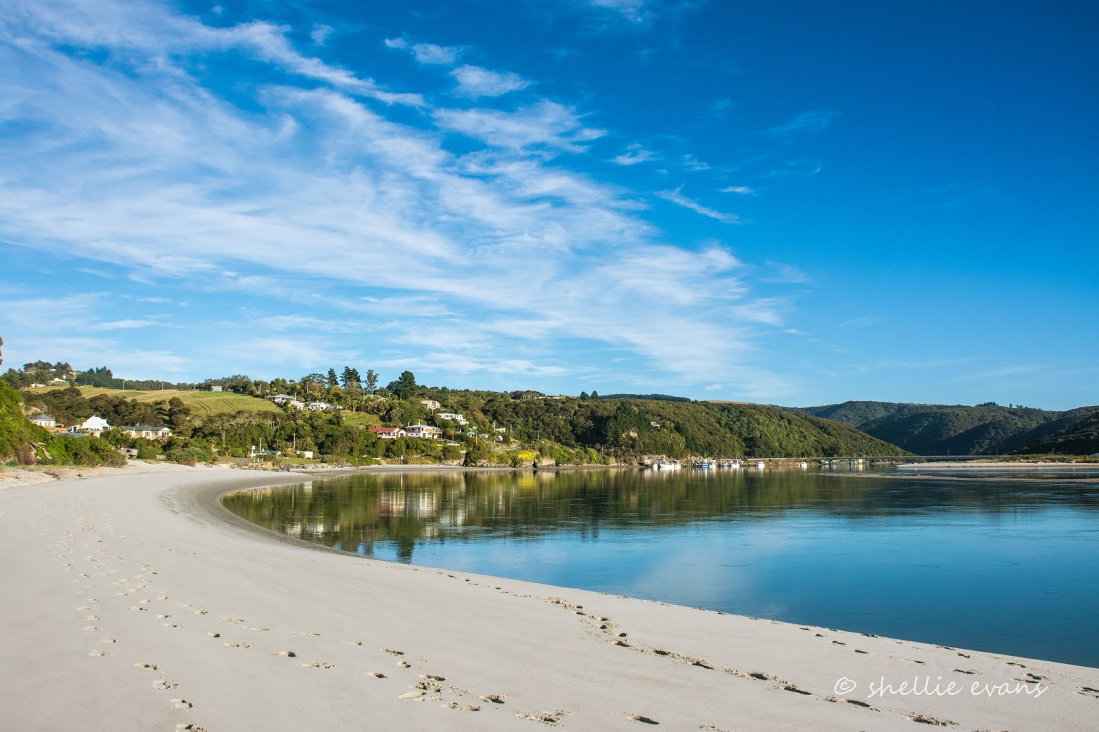
...with this stunning beach and clear water just a few steps away from our van. This is the tidal estuary and mouth of the Taieri River, the same river that we've followed and crossed over at various times from its headwaters in the upper Maniototo right down here, to the mouth. 


The main reason we actually headed to Taieri Mouth wasn't because of the aurora (although that was a lovely bonus), it was because we wanted to revisit a tiny little island just off the mouth of the river; Moturata Island. We'd stopped here at Taieri Mouth over 3 years ago, not long after we arrived in the South Island. 

Moturata is a special nesting area where a number of sea birds breed, including Little Blue Penguins. The season is well over now but we were hoping to maybe see a few stragglers. Access to the island is via a sandbar that is only exposed 40 minutes either side of high tide. The tide was in our favour but we had to anxiously wait to see if the morning's fog withdrew before we made our way out to the sand bar. It was late morning before it had retreated enough for us to see the outline of the island ahead of us.


And then as we waded through the retreating tide, the sea fog rolled back in...


...until we couldn't see a thing. As we waded on we suddenly realised that the river mouth had shifted since our last visit. It had moved to the south side of the sand bar and was now roaring out into the ocean right there in front of us blocking our way to the island. And at the speed and turbulence it was passing by us, there was no way we were going to get across it. 


We walked to a narrow section of the river further back to check the other side out and to see if we could possibly come in from the north side on the next day's low tide. There looked to be a second mouth heading out to the north as well.  Keith told us later (we should have asked him first), that for the last few months there have been two mouths to the river, both quite shallow and causing concern for some of the fishing fleet tied up at the wharf, as they could only get out and back in at the top of a tide.

Disappointed we'd been foiled in our attempt to reach the island we headed home. Here's the link to see the photos of the Little Blue Penguins and gull chicks we saw when we did manage to get there on the last visit.

You wouldn't believe it but this was the clear view we had looking back at the estuary on the way home.


And yet looking to our left down the coast, the fog was still drifting in and out. Can you see the fogbow? And yes, a fogbow is a legitimate phenomenon- because fog water droplets are very small, fogbows have very weak colours or no colour at all, this is when a fogbow appears white, they're sometimes called white rainbows. This is the second one I've seen on our travels, the previous one was a lot clearer, you can see it at the bottom of this blog from Moeraki.


Our next stop on our meander back into Central, was at Milton, a small town on SH1, just before the SH8 turnoff to Central Otago and Queenstown Lakes. It's a town that most people pass through on their way to somewhere else. We stopped this time and stayed at the council run campground at Taylor Park, we had a couple of nearby places we wanted to explore and laundry to do (and at $2 a load it's the cheapest we've found on our travels). Nice clean facilities too.


The weather wasn't that great but we headed out anyway, our first stop was at Toko Mouth on the coast, 18kms east of Milton (half of them gravel).


Toko Mouth is time stood still, an iconic sleepy Kiwi beach settlement like they used to be. 


The tourist trail hasn't reached out here. Yet. But when it does they're prepared....just in case you need Specsavers. 


We walked out to the mouth of the river, this is looking back towards the settlement.


The beach is wild and rugged, a sign says it's unsuitable for swimming. Bull kelp litters the beach and waves crash around rocks further south.


There's a rustic collection of well loved cribs dotted in amongst the dunes and along the road.


Some overlook the estuary, and as befitting their superior location, come with extras although I think an extra fence wouldn't go amiss. 


I twisted David's arm and managed to convince him to carry on down the coast to complete a long loop back to Milton. I mean what's another 20kms of dust when you've already travelled over 10kms? The coast road was very undulating and actually wasn't that dusty....probably due to a thick salt spray coating!


Other than the small beach settlement of Wangaloa, it's mostly farmland along the way...


...and this rather dilapidated crib beside a small stream estuary.


We take a brief detour through Kaitangata (pop. 800) so I can grab a few shots for NZ Heritage. Kaitangata is on the left branch of the mighty Clutha River, just downriver from Balclutha and not far from its outlet. Kaitangata's recent claim to fame was a recruitment drive for new residents where they were offered employment and very favourable house buying packages.


We then headed north, back to Milton, passing what looks to be a great bird watching spot, Lake Tuakitoto, along the way. Weary from our afternoon's travel and keen to get home, we stop only briefly to check with our binoculars. There's plenty of water fowl on the lake; ducks, geese and swans, even a family of swans which is very late in the season, especially with duck shooting fast approaching. I'm sure plenty of other more elusive bird species would be lurking around the edges of this shallow lake.


To be continued... Part 2