This one's going to be a long one! I had so many photos, it was hard to choose but hopefully these will give you a good overview of the Molesworth Road. I'll include a link at the bottom of the post to my Molesworth Flickr Photo Album if you'd like to see more and read some of the information panels.
Continued on from Part 2-
Finally, it was time to drive the Acheron Road- more commonly known as the 'Molesworth Road'- a 59km gravel road through Molesworth Station, New Zealand's largest farm at 180,787 hectares which also has the country's biggest herd of beef cattle, numbering up to 10,000 over winter.
We'll be driving the road there and back because a) we can't tow the 5th-wheeler through to the DOC camp at the other end; no towing or vehicles over 7 metres are allowed on the road, and b) the road is actually closed at the other end due to a bridge washout at the Clarence River.
 |
| Ward Pass- looking down over the road we've just climbed |
Half way up and across the road from the Mt Chisholm summit track, we stop to read the first of many information panels along the road. This one is all about Bill Chisholm, you'll remember he was the farm manager that turned the station into a profitable business.

We stop at the top of the Pass and David reads the 1080 poison information sign. This is where the gates were locked, with security guards on duty during the helicopter drop.

We head down the other side of the Pass and into Isolated Flat, a 250 hectare outwash plain formed by glacial sediments which were deposited by glacier meltwater a very long time ago. It's a steep drop over the side of the road and I'm not so sure those electric fence standards and single wire are enough to hold you back if you fall off the side!

At the bottom of the Pass we cross the Acheron River which we'll follow all the way to its confluence with the Clarence River at the other end of the road. Hence the correct name of the road; the Acheron Road. We'll also pass over several smaller rivers that join the Acheron on its journey south.

The route the road takes through the 'interior' was used by Maori over 600 years ago, it was rediscovered by early settlers in the 1850-60s and used by Marlborough pastoralists to move stock (much cheaper than importing animals from Australia) to newly established Canterbury runs.
The actual Acheron Road is relatively new, it was built in the late 1960s to enable installation of the high voltage cable that connects the South and North Islands.
 |
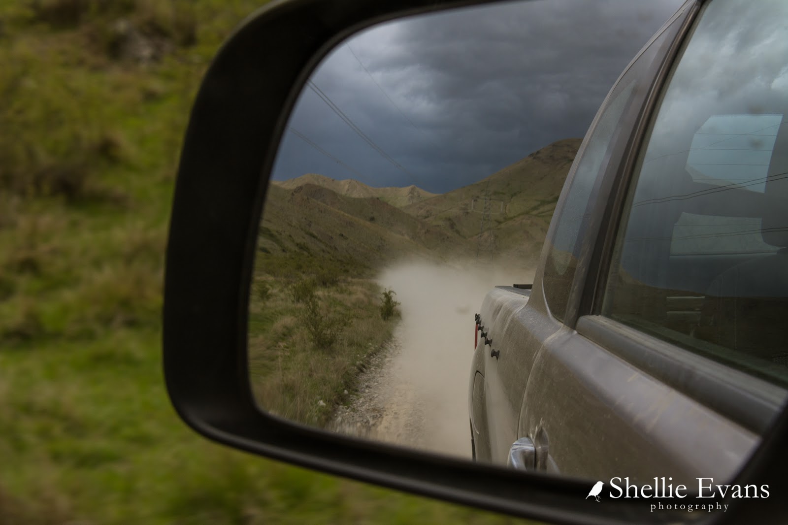
| David checking to see what is underneath the approaching dust cloud |

The next river we cross is the Saxton, there's a tramping track up the river valley to the Saxton Hut nearby. A short section of the road passes through the private property of Muller Station just before the river. You'll recall the entrance to Muller Station was way back on the Awatere Valley Road, at the gate, 10km before we arrived at Molesworth. It too, is a very large station.

As we approach the far end of Isolated Flat we see yet another vehicle approaching, the fourth so far.

We start the climb up to the top of Isolated Saddle and stop at the top to take in the views. We can see the last vehicle's dust cloud at the far end of the valley and the shiny ribbon of the Acheron River wending its way around the edge of the mountains. Briar bushes smother the side of the hill while native matagouri provides a bit of shelter for the cattle down on the flat.

There's another information panel and a 1hr tramping track to the top of Mt Augarde at the Saddle. We spot a hare hiding nearby and also find another lonely memorial plaque (we've found so many on our travels in isolated places- lonely but stunningly beautiful places to remember a loved one), this one has been placed on a rocky outcrop beside the Saddle. It remembers a man who was the 'maker of many roads'.

From our vantage point we can also look south down the other side of the Saddle towards Red Gate and the Severn River. I don't know why but I had the feeling we would be heading right at the junction you can see at the bottom of the hill.

But no, that was Red Gate, a private area of Molesworth Station. The Tarndale Track leads to the historic Tarndale Homestead, built from cob in 1874. We headed left around the edge of the hill and over the Severn River.
Another track leaves our road on the other side of the river; the Severn to Sedgemere 4WD Track is only open during Jan/Feb. Lake Sedgemere is on the far extremities of Molesworth Station, on the St Arnaud/Wairau/Hanmer Springs Road also known as the Rainbow Road. We visited Lake Sedgemere when we 'did' the Rainbow Road a couple of years ago. It's hard to believe that just over the mountains from where we are at Molesworth is St Arnaud and the Nelson Lakes.

Ahead of us we can see a tiny red roof; the first of several shelters along the road.

This one has a spectacular view overlooking the confluence of the Severn & Acheron Rivers.

We decide to have morning tea at the picnic table and then spent a few more minutes reading the information panels. There's a large photo of the station men, horses and dogs and I recognise a much younger farm manager on his Grey horse. He had told me, when I'd spoken to him earlier, he'd been on the farm for over 20 years.

The road follows the Acheron River as it narrows down through a small gorge, the water is crystal clear and a beautiful sea-green colour. I have the urge to raft along this stretch of water.
Those wild gooseberry bushes I spoke about in an earlier blog are intermingled with the briar bushes right along the edge of the road.

Its while I'm taking photos of the gorge that I spot 1080 bait scattered on the ground near my feet; we've obviously stopped inside the drop zone, the 6km stretch that took in part of the road. We also find a few pellets on the road itself; the checkers obviously missed them. David carefully removes them- it wouldn't be good for them to get stuck in a tyre and carried away to the outside world.
When I was talking to the farm manager earlier about the poison drop, he told me he wasn't pro-1080, he was anti-TB, and unfortunately 1080 is the only effective way to rid the high country of the possums that carry TB which infects his herd. It's a hard one...

The next river we cross is the Yarra and I thought that was in Aussie!

We stop once again at the top of a small climb, where there's an active rock slide that looks to have taken the road out on a few occasions. We're high above the river...
 |
| David, always on the lookout for deer |
...and can see a bridge and another tiny red roof ahead of us (centre right).

This is Pig Trough Suspension Bridge, one of three built by the NZ Electricity Dept in the early 1980s to provide access to the pylons across the river. The other two were washed away in floods. The unusual name came from the wild pigs that were often seen around a soak hole in nearby Pig Trough Gully.

Once we leave the bridge, the road is all very similar as it follows the river and the pylons through the narrow valley.

It's an easy drive through to the last gate and another bridge.

This is the Lower Acheron Suspension Bridge and it's just a few metres from where the Acheron joins the Clarence River. The historic stock bridge was built in 1945 by students from Canterbury University's Engineering School. It replaced an older dilapidated bridge which was used to move up to 30,000 sheep from St Helens Station across the river after mustering, a task that would have taken a few days as that bridge was only one sheep wide.

The brief given to the students for the new bridge was to build a bridge 'to support a man on a galloping horse'. The bridge was only used for a few seasons before St Helens Station amalgamated with Molesworth, which only grazed cattle.
 |
| Just around the corner, the Acheron joins the Clarence |

We continue on up one last incline to find that we have finally reached the end of the road. Ahead of us we see familiar territory; across the Clarence River is the Hanmer Springs Road and the (now) broken Clarence River bridge. The bridge is as far as we came just a couple of months ago, delivering a car to the bridge for some kayakers we met back towards Jacks Pass and Hanmer. To the right we can also see the DOC ranger cabin and the green grass and willows of the Acheron DOC Camp.

From our viewpoint we can follow the Clarence River heading off east towards the coast along the other side of the Inland Kaikoura Range and I spot another red roof (we missed that shelter on our earlier Hanmer trip and we'll not be able to get to it today).

I also spot, and zoom in to check, a bus in trouble far below us (see it above, middle right), it looks to have slipped off the track or bottomed out as it's crossed a ford. Unfortunately, with the main bridge out of action, we can't get to him to offer any help. And with no cellphone reception or any people about, the driver will have a long 22km walk back to Hanmer Springs.

We carry on down to the camp to check out the bridge and also the historic Acheron Accommodation House, built in 1862 and the oldest building on Molesworth. Sadly it suffered major damage in the Kaikoura earthquake and is fenced off, and not likely to be accessible again for the foreseeable future.

Past the Acheron House the road drops down to river level, we head towards the bridge to check out the flood damage.

So this is what stood between us and a romantic night in Hanmer Springs! Originally we were going to drive through to Hanmer, stay the night and then return to Cob Cottage camp the next day instead of driving there and back on the same day.

It was actually quite a shock to see how much damage was caused by the September flood, the approach road and abutment to west side of the bridge is gone. This is the bridge that is causing all the problems for people who have been taking or were wanting to take the Molesworth Road as an alternative route from Picton to Christchurch (or visa-versa) rather than driving the 7-8 hour Lewis Pass Alternative Route.
Personally I think the flood damage has been a blessing in disguise, apparently last summer there were dozens of suburban drivers and inexperienced overseas tourists driving the route and causing a number of problems for the farm.

We had heard that some vehicles have been fording the river (against advice) and there were a couple of places where we could see tracks but the water was quite deep and fast flowing with heavy loose shingle. You'd have to be pretty confident and have a dedicated 4WD vehicle to risk it. Perhaps as summer approaches the levels will drop some more and it'll be easier to ford. I know that Molesworth are keen to have the repairs done sooner rather than later, they get many of their supplies from Hanmer rather than Blenheim. Indications were that the bridge would be fixed by December; I very much doubt that.
Here's a photo of the bridge in early September when we were on the other side of it. It was washed away not long after our visit. At least we have been able to join the dots on the complete circuit however convoluted our travel has been- from St Arnaud to Hanmer on the Rainbow Road (there and back), Hanmer to Clarence Bridge (several times), and The Molesworth Road (there and back).

We drove back up to the DOC Camp to say hello to the Camp Host but he wasn't there- I wondered why in fact there was a host at this end of the camp. He was going to have a very quite summer as no one would be coming over from Hanmer and I doubt many would come through from our end.
We found a spot in the shade on the lower camp level to have a late lunch, and were bombarded with hundreds of sandflies. You can't win; it's either hot sun or cool shade & sandflies; welcome to summer!

After lunch we headed off, back up the road towards home...

With all the interest points and photos sorted on the way down, it was a fast trip back up the road although I said we'd have to stop for a short break and a cuppa at some point. David decided he'd stop at the halfway, 30km mark; it turned out to be just a kilometre short of the shelter overlooking the Severn & Acheron Rivers, so we drove on to there and had our cup of tea sitting on the step of the shelter.


Back on the road, we spotted one of the vehicles from this morning heading back towards us near Red Gate. This time he wasn't in such a hurry and stopped to say hello. It turned out that he worked for Silverfern Farms (a giveaway when you saw the big fern on the side of his car) and he'd just paid a business visit to Muller Station. He told us he lived in Hanmer and was using the closed Severn-Sedgemere 4WD track to move between the districts. He had a key to the gate. Lucky bugger!

We stopped again at Isolated Saddle; I wanted to take a few photos now that the clouds had moved in. Clouds add interest, take away harsh shadows and soften the photos.

From the Saddle I could see a tiny speck of fluro orange halfway along, on the side of the road. It turned out to be a sign and in a culvert beside it were two DOC workers. These were the guys staying at the Molesworth Ministerial when I visited it with our camp host. I asked them if they and their dinky digger were moving to a bigger job down the road when they were finished!

We bid them farewell and carried on, passing another vehicle heading, in what would seem like, the wrong direction. It turned out that this was the new camp host (I like his wheels) for the Acheron DOC camp, that was why no one was home when we stopped to say hello. And one of the other vehicles we'd passed this morning had been the old host leaving. Talk about a busy road!
We had one last stop at the top of Ward Pass, the rain had settled over the Inland Kaikoura Range, a stark difference to the blue sky we saw this morning (seen in the very first photo).

And then is was down the other side, through the home paddocks and back to camp after an awesome drive through Molesworth Station. We left camp on the dot at 9am and arrived back home at exactly 4pm, it took 7 hours to travel 120km, that included stopping at all the interesting places along the way along with photo and snack stops. The Acheron Road turned out to be in much better condition than the road up the Awatere Valley and nowhere near as difficult to drive, it is afterall through a relatively flat river valley. But it's also not a road to be rushed.

Click this link to see more photos from Molesworth.
Thank you! I have been thoroughly enjoying reading your posts and seeing the photos on Molesworth!
ReplyDeleteThanks for commenting Kiwitales and I'm pleased you enjoyed your virtual visit to Molesworth! :)
DeleteGreat writings and photos about Molesworth! Glad to see your blogs about this area that had caught my eyes and fascinated me years ago. So far I've never come across such detailed and interesting articles about Molesworth! Last year I wanted to include it in my autumn itinerary but soon found out it would be closed by then. So we headed south instead and guess what, we ran into you in Glendhu Bay...
ReplyDeleteSerendipity! See what we would have missed out on.
DeleteGlad you enjoyed an in-depth visit to Molesworth too. Perhaps you can include it in your next visit to our shores. I would suggest driving it from Hanmer to Blenheim, just because that Awatere Valley road will kill your enthusiasm if you come in from the other end! :)
So much great information here, Shellie. These three posts will need retreading several times. Thank you.
ReplyDeleteThanks Kiwiquilter, please it helped you :)
Delete