Showing posts with label fruitlands. Show all posts

January 26, 2020

A Seriously Long Road Trip

Catch-up (Mid September, 2019)

While we were staying with our Southland family in Winton during September, I had the bright idea of doing a road trip to photograph the 'blossoms' in the fruit orchards of Central Otago. Never mind that it would be a 400km round trip and I was going by myself, it's no hardship at all as I love driving and I love being able to stop and take photos where and when I like. Not that David doesn't stop for me, but with the rig on the back it's often not possible or practical.

I left Winton at 7am in the cold pre-dawn light and enjoyed the quiet roads as I headed north passing through Dipton, Lumsden, Athol and Garston before making my first stop just north of Garston at my favourite woolshed...


...just as the sun reached over the nearby hills dispersing the fog that had settled in the valleys overnight.


Then it was on past Kingston around the edge Lake Whakatipu and up the 'Devils Staircase'; a winding cliff hugging road that is often bumper to bumper traffic with tour buses and tourist vehicles on the way to or coming back from Milford Sound (a 600km, 10hr round trip from Queenstown, and not one that should be undertaken lightly).


I drive through Frankton and head into the Kawarau Gorge. My next stop is at the historic 1880 Kawarau Suspension Bridge, the birth place of AJ Hackett's commercial bungy jumping. I stay long enough to watch a couple of jumpers; one extremely keen to do it, screaming and laughing with delight from the moment she stepped onto the platform, the other screaming and crying with fear!


Next stop in the gorge is at the Roaring Meg power station lookout. The Roaring Meg Stream tumbles down from the mountains above passing through two small power stations before exiting into the Kawarau River.


And the last stop in the gorge is at another favourite spot, a gravel pit that's a good stand-in for a lookout up the gorge.


And here's a comparison shot; I took this photo just a month later when spring was well on the way to turning the gorge a brilliant green.


My make-do lookout is just across the river from the replica Chinese village at Gees Flat, part of the Gold Fields Mining Centre. Sluiced terraces, tailing piles and the remains of huts can still be seen along the nearby steep edges of the gorge.


Once out the otherside of the gorge I'm approaching my blossom destination, Cromwell, 200km from home.  But after all that, there are not too many fruit trees in blossom in the orchards along the main highway, they have either finished flowering or the blooms are past their best. 

I can see several orchards smothered in pink blossoms away from the road but have no way of reaching them. Eventually I find a few trees and take some photos. I decide to carry on to Alexandra, 30kms away, another big fruit growing area in Central.


I grab a coffee & muffin from my favourite cafe in Cromwell, Fusee Rouge, and drive around to the Old Cromwell Town Lookout, above the confluence of the Kawarau and Clutha Rivers, to have them.


Then it's off through the Cromwell gorge towards Clyde...


...but not before I stop to check out the memorial plaque to the miners who first discovered gold here in the 1886 Dunstan gold rush.


I continue on to Clyde where I cross the Clutha River below the Clyde Dam bypassing Alexandra town centre because I know there are plenty of orchards along Earnscleugh Road on the opposite side of the river to town.


And I do find a few orchards in flower but I'm strangely not inspired, it's now the middle of the day and the light is harsh and I fail to get creative. Again I take a few shots and carry on my merry way east, I have plan...


I take a side road through Conroys Gully, it comes out at Butchers Dam on the highway heading east. I pass- what I think is a pear orchard in full blossom- just below a snow capped Old Man Range.


I stop at an unusually quiet Butchers Dam, there are no motorhomes or campervans at any of the freedom camping areas around the dam; it's just me and a few shags drying out on the nearby rocks on this chilly, blue sky, late winter's day.


Next stop is the old cob cottage at Fruitlands where some nosy cattle keep an eye on me from the paddock behind. Perhaps they think I have food for them. Much of the livestock in Southland and Otago is strip-fed over winter which means that after they have eaten the crop back to bare earth they have nothing to forage on while waiting for the next crop strip to be opened up or hay or silage to be delivered.


There are the remains of several other cob buildings nearby, this one looks quite substantial, it could have possibly been a homestead or a hotel.


I've decided to try the Roxburgh orchards for blossom. I'm driving further east and I know rather than retracing my steps, I can do a loop and head back to Winton by turning off at Ettrick, heading over the top of the hills past Heriot to Tapanui on to Gore and then across to Winton. 

Roxburgh has many roadside stalls which sell freshly picked fruit during the summer season, most are closed up as I pass by. Still more have disappeared altogether and others have been left to the elements while climbing creepers look to have swallowed a few too. 


There are a few orchards in blossom and this time they are more accessible...


...although once again the majority of them are white. The pink blossoms I do find are spent, pink must flower earlier than the white.


The afternoon is marching on but I do a quick calculation on distance & time and decide I'm going to carry on to Lawrence, 60kms further east from Roxburgh. There's another attraction that I'm aware of, it's only open for five weekends during spring and this just happens to be one of those weekends. But I do need to hurry along as the place I intend to visit closes at 4pm. 

The historic Hart's Black Horse Brewery at Weatherston, just outside Lawrence, is not only well known for it's ruins...


...it's also famous for the hundreds of thousands of daffodils that are planted over the nearby hillsides.


The daffodils were first planted in 1895 and it was thought that over 1 million bulbs were planted during the first few years, covering 10-15 acres of hillside behind the brewery. No expense was spared and  prices as high as £100 were paid for single bulbs from the Netherlands. Incredible when the average wage was only around £5.

People came from far & wide to see the daffodils when they were in bloom, the flowers were also picked by school children & sold for charity. In 1912 the first train excursions from Dunedin came; 2 trains of 13 carriages each organised by the Dunedin Horticultural Society.


More recently a charitable trust was formed with the aim of preserving and developing the site, which had fallen into disuse and disrepair. In 2005 the daffodil fields were once again opened up to public display, the first time in 50 years. After losing momentum the Trust was reformed in 2016 and with support and help from the people of Lawrence, the daffodil gardens were once again open for the public to view in 2017. 

The landowner prefers that the flowers aren't picked which in a way is a shame because I'm sure the money earnt from this would help in preserving the site, there is a $5 entry fee which goes to charity. 


I was pleased to have made the effort to visit, it had been on my 'must do, one day' list ever since we visited the brewery site in the middle of winter a few years ago and learnt of the daffodils. 

For those NZMCA members reading this, the property below the daffodil slopes is Paul & Glenice Kirkwood's Weatherston POP#8890, a delightful setting in the countryside and not too far from Lawrence & Gabriels Gully.


And that was it for me for the day, it was time to head home and with no dilly-dallying if I was to get there before dark. I drove 25kms back up the road to Raes Junction, turned left and headed south west towards Gore and then on to Winton arriving just as the sun dropped below the horizon. My 400km return trip to Cromwell ended up being a 500km round trip through Southland, Central Otago and Otago.

One last stop near Tapanui to photograph some little cuties

May 18, 2014

Pinders Pond, Roxburgh

By the time we were ready to leave Clyde the weather had cleared & we were back to a beautiful sunny autumn day again. We have been very lucky with the weather since leaving Invercargill back in January (after having nearly 5 weeks of wind & rain there over summer). We’ve had the odd day of heavy rain but mostly just a little overcast & drizzly for a couple of days & then back to lovely sunshine. It is getting cold though, especially in the mornings and usually after an overcast day when it’s snowed up on the ranges. You can see there’s a layer of snow up on Old Man Range behind the 5th wheeler in the photos below.

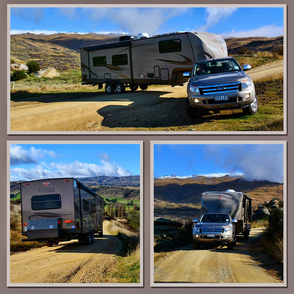
On the main highway at Fruitlands, between Alexandra & Roxburgh, there was a historic stone cottage that I had wanted to have a look at. Except it wasn’t on the main road it was up a narrow gravel side road. We always approach narrow side roads with caution because we never know if there will be an opportunity to turn around. I’m not sure why, but David was quite confident we’d be ok when he turned into the road. I didn’t hold out much hope, there was nowhere on the flat & then the road started to climb steadily towards the range. On a sharp corner we met a guy coming down, he pulled into a spare space on the verge with eyes the size of saucers when he saw us. David wound down his window to ask him if there was a turning point anywhere up there. He laughed & said yes there was but he wasn’t sure whether we’d be able to turn & “man that is huge!”. No problems said David. And it wasn’t. Try doing this with the same size (9mtr) caravan.


Mitchell Cottage was built by gold miner Andrew Mitchell for his brother, wife & their 10 children. He began the project in 1880 but didn’t complete the job until 1904 (I bet because he had to keep adding rooms). The cottage is a Catergory 1 Historic place and is one of the best surviving examples of a stonemason’s craft in NZ (which Mitchell learnt from his father in the Shetland Islands) The cottage stands amongst large schist tors overlooking the beautiful Fruitlands Valley. Andrew even carved into one schist rock, a large sundial.


Mitchell Cottage isn’t the only old dwelling in the area. There are many abandoned and derelict cottages dotted around the landscape including this former rabbiter’s sod cottage on the main road.


The landscape is pretty impressive between Alexandra & Roxburgh, not only is the land covered in giant schist rock formations but the steep rocky gorge walls of the Clutha River are solid schist too. This is the top of Lake Roxburgh, which is, once again the dammed Clutha River. You can also see the recently opened (Oct 2013) 44km Roxburgh Gorge Cycle Trail weaving its way along the cliffs.This cycle trail runs from Alex to the Roxburgh Dam & includes a 12km jet boat ride in the middle (I guess the walls are too steep for the track) If I was so inclined this would be the one cycle trail I would definitely do. The scenery is AMAZING & the jet boat ride would seal the deal!


We left the main road and crossed over the deserted Roxburgh Dam wall. “No Stopping” signs didn’t prevent me from leaping out of our slowly rolling rig to take a photo or two.


Further down the Clutha and not far past the bridge back to the Roxburgh township we located our next camp site, Pinders Pond with its beautiful reflections.


And in keeping with all the gold mining history we’ve been encountering lately, Pinders Pond was an old hydraulic elevation pond (dredge hole) used in the second gold rush period in this area. At the Gold Rush peak there were up to 30 dredges working the Clutha from where the dam now is down to Millers Flat, a distance of only 25kms.

The pond which is just a few steps from the Clutha River, is now a popular picnic & swimming spot, although I didn’t like the look of the tree & weed debris I could see in the depths. Pinders Pond is also a popular free camping area where, as long as you are self contained, you can stay for up to 4 nights. We stayed for three and had the place to ourselves for two of those nights.


Once we had set up camp we drove into Roxburgh to check the town out. Roxburgh is famous in NZ for it’s fruit growing; hot dry summers & crisp cold winters are perfect for growing fruit especially apricots & cherries although apples & pears are also grown in abundance too.

My all time favourite canned fruit is Roxdale Apricots, and when I heard the factory was going to stop canning locally grown apricots in Roxburgh back in the early 2000s, I bought about a dozen cans of apricots to ease the pain of losing that distinctively sweet apricot flavour forever. After slowly working my way through eleven of the cans I kept hold of the last can for another few years, not wanting to end the era. I finally opened that can just before we shifted out of the house in 2011 (when I was packing up the pantry). It had long expired & the tin had started to break down inside so while I had a quick sip of that unmistakable sweet Roxdale apricot syrup & a nibble of a slightly discoloured apricot half I wasn’t game to eat the whole can. I even took a photo of the occasion for posterity!


The main road in and out of Roxburgh is lined with fruit orchards and dozens of old ramshackle & quaint roadside stalls which I know in summer would be packed with delicious fruit for sale. There were still a few stalls selling apples & pears. I wanted a photo of the orchard colours, the rows of trees were in the last stages of losing their autumn colour and when I couldn’t find the ideal spot to get an expanse of colour, David suggested we drive up the range behind and see if we could look down on the town at some point along the road.

The road was actually a dirt 4WD track called “The Bullock Track” that followed an old pack track up through private land to the Old Man Range behind the town. The views were stunning but unfortunately the weather was closing in again and the sun had left the valley floor. This is looking towards the Roxburgh Dam.


As we were winding our way up the track, I suddenly spotted a set of antlers silhouetted against the light. This wasn’t a deer paddock (which has high fences), it was planted out in stock feed, so we’re pretty sure he wasn’t a farmed deer. The roar had probably brought him down from the range to try his luck with the girls in town. At least he had a decent food supply but I’m not sure how he was going to get out over the netting & barbwire fence.  He was very alert and had moved out of the thicket below a rock overhang where I’d first spotted just his antlers above the scrub. He moved off out of sight not long after I took these. David wanted me to climb over the barb wire fence and creep up on him to take some close ups. I decided I didn’t like the look of those antler spikes (nor the barbwire spikes)!


As we climbed higher the town and the orchards came into view, unfortunately the light was fading and I couldn’t pick up the colours too well. But you can still see the many squares of orchard colour nestled along the river terraces.


Never mind, the next day I managed to get some good close up orchards shots.


Finally we were just about above the town, the views down the Teviot Valley were spectacular and across to the high country farmland on the other side, high country that we’d get to see close up in a few days time.


It was about now that the cloud rolled in and it began to rain. Also, the track had become deeply rutted in places, spongy & wet, with muddy bogs here & there so we decided this “shiny” had gone far enough and turned around and headed for home. We were amazed when we caught up to a “people mover” on the way down, they hadn’t quite made it up to where we had but had travelled a fair distance. It was a local family & they were collecting mushrooms!


We stopped on the way down to see if we could spot the deer again & sure enough he gave himself away, this time a side view of those antlers and now we can see that he is a Fallow deer. Amazing to think that without the antlers he would be invisible to passing traffic. I just hope a hunter doesn’t spot him.


We arrived back at the Pond, pleased to see “Out There” parked up safe & sound and waiting for us after another great afternoon exploring.