You might remember, we’ve searched for Rock Wrens (Maori name Piwauwau) before, while in Fiordland at the Boulder Garden beside the Homer Tunnel, and at the head of Gertrude Valley, finding no birds in either location. We were going to be out of luck in the Otira Valley too.
The relatively easy track, leaves from a car-park beside the road, just east of Arthur’s Pass summit.

The track heads up a deep alpine valley on the northern side of Mt Rolleston climbing over an old glacial moraine (dirt & rock that has been formed or pushed along by glaciers as they move), and passing through subalpine scrub and tussock all the way to the Otira River foot-bridge. It’s not recommended walking the track during winter due to the avalanche risk higher up the valley and I guess there'll be plenty of snow up there now after the polar blast the country experienced a few days ago.

Looking back towards the carpark & road, we can see the Otira River which we've been following up the valley, once it reaches the road it turns west and heads down under the Otira Viaduct just around the corner.

It’s a steady and rocky climb up the valley, solid tramping boots with ankle support,and a walking pole are a major benefit when crossing some of the rocky streams that cascade down the mountainside and weave their way between boulders and rocks on their way to join the Otira River. We catch up to three fellow hikers who let us pass just before we cross Otira Slide a rather large rock slide that is part of the moraine.

It’s hard to give scale in the photos when there are no people but this one shows the angle of the track across the mountain side. We were lucky that DOC had recently cleared the summer growth from the track and it’s margins, it made it easier to walk.

Finally ahead of us we can see our target, the footbridge across the river. The Rock Wrens live in the area from just above the bridge to higher up towards the snow line at the top of the valley (or the Otira Face) which is about another hours walk further on.

I wait at the bridge for David to catch up, this last section before the bridge is very boggy and rocky with water seeping through to the river from all directions.

The bridge is bolted to the rocks and is most likely removed during winter due to the risk of an avalanche sweeping it away.

An unmarked route continues on from the footbridge and climbs rock scree and boulders to the head of the valley. This is recommended for experienced trampers only, there are a series of lightly marked poles and rock cairns to follow although for us there’s a well worn track after what has obviously been a busy summer.

We climb a little higher and find a suitable spot to have our lunch and rest behind a large boulder out of the cold wind. We can see, looking back down the valley, the three walkers we passed crossing the rock slide.

If you look up behind the walkers to the mountain across the highway you can see a few buildings. This is the Temple Basin skifield, a club skifield on Mt Temple, below are zoomed in photos of the buildings. Skiers access the skifield via a steep 45 minute walk from the highway. Most of the skiable areas are also accessed by hiking between the 3 rope tows.

I decide to carry on up the valley, leaving David to scan for the wrens in the rock gardens above the bridge. I have my notes from the bird forum and some members have found the wrens at least an hour further on. I’ll walk for another 30 minutes or so before turning around and taking my time coming back down. Stopping, watching and waiting every few metres. After crossing a large rocky scree, the route becomes more involved, climbing over and around the jumble of boulders as it tracks close to the river. On it's way down the valley, the river forms many deep cold blue pools and small rocky waterfalls.

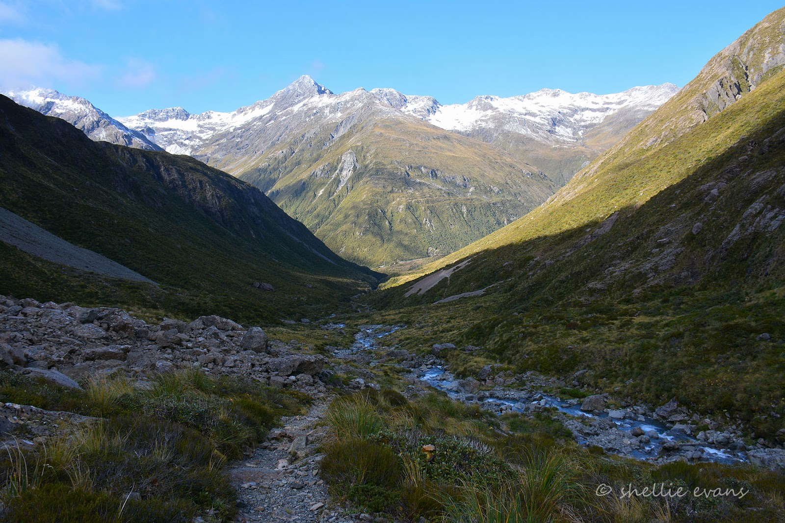
Looking back down the valley, the footbridge is about centre, just below the sunny rock slide on the right (that’s the large one we crossed on our way up). You can see the path I’ve taken on the left as it crosses the scree.

It was here as I was admiring the scenery that I heard the faint but familiar ‘keeaa’ coming down the valley. It took me a while to spot the source of the noise, they really are just tiny dots in a vast landscape when flying. Four kea (mountain parrot) were flying high above me following the contours of the mountain side down towards the road.
I was surprised to see two of them land on a rock across the river from where I was. This was the juvenile and parent I mentioned in the previous post, the baby was begging and calling. Perhaps they had to stop here for a rest before continuing on. I didn’t see them leave, as I moved further on up but I did see (and hear) another bird approaching and managed to get a long distance shot of the beautiful colours under his wings.

I climb around a corner and above a larger waterfall to find I have the mountain to myself; no road, no power pylons. no wires & no people. The silence is deafening and the views around me are just spectacular.

I walk a little further on and find a place to sit and soak it all up (and scan for Rock Wren). Above me is the head of Otira Valley and even though it looks close it’s probably another 30 minutes climb to the snow line. Across the river, a ribbon of water falls from high up Mt Rolleston. There’s a marker pole ahead of me and I decide that’s as far as I’ll climb. The sun is fast disappearing out of the valley floor and the air is cool and crisp.

I head back down, stopping every 20 metres or so to sit quietly on a rock carefully watching for any movement. I scan all the likely places the wren might be hiding, willing them to make an appearance. But nothing, it looks like the wren will remain on our ‘to see’ list. It’s not long before I catch sight of David, he’s climbed up the rocky wall behind the bridge and has found a boulder to stand on as he scans for the elusive little bird, he has no luck either.

In summer the valley, from here at about 1400 metres down to the carpark, would be full of flowering alpine plants including the Mt Cook Lily and Mountain Daisy. And perhaps the wren might be more obliging in the warmer weather.
I meet David back at the bridge, it’s now quite cold with the sun gone and the wind whistling down the valley so we make haste along the track and back to the ute.

A pity we didn’t find the wren once again but still, a great walk and spectacular scenery made up for some of the disappointment. Those elusive Rock Wren don’t have us beat just yet, we have the luxury of having time up our sleeve, we’ll be back this way again some time in the future.


