On the way home from the Archway Islands we stopped to do the short 5 minute walk to Cape Farewell; the carpark was the end of a road we had passed earlier in the day and still part of Puponga Farm Park.
Cape Farewell is the most northerly point on the South Island and is located just west of Farewell Spit. It was named by Captain James Cook in 1770 - it was the last land seen by his crew as they departed on their homeward voyage.
The sun would now be perfect to shoot the Archway Islands but it’s totally in the wrong position for the Cape (hence the sun spots on my lens). I just can’t win! Morning, with the sun rising would be perfect here! I know that the Farewell Spit tour stops here on the way to the Spit & I’m hoping that when we do the tour I’ll be able to get some better shots.
It’s fascinating seeing all the coloured rock layers in the cliffs that surround the Cape. There are a number of faultlines running through the area & I wonder how long the arch will last; a few dozen years or hundreds of years or perhaps thousands? Although it’s a wonder it is still standing, what with the wave action and earthquakes.
While standing on the platform looking over the edge we could hear seal pup cries from far below. It took a few moments to find them, frolicking about in the water and resting on rocks. One pup was having fun all by himself surfing in on the waves; he’d surf in, swim back out under the waves and surf back in again.
We walked up the hill a short way and looked over the edge of the cliffs as far as we dared. If we brought the grandkids here, they’d be tied to our sides! “ Hey look Nana, I can do roly-polys down the hill!” Oops. Plop!
The walk up to Pillar Point Lighthouse looked far too strenuous, I think I can safely say we won’t be saving that for another time!
And with that, we can now say we have visited both the most northerly & most southerly points of the South Island. This is Slope Point at the south end of the Catlins which we visited back in January.
And now for a few random shots from the road trip;
Near the Cape carpark, the iconic New Zealand Cabbage tree (alive this time).
This friendly peacock greeted us at both ends of the Archway Island walk. He was looking for hand-outs, poking his head inside the car door as soon as I opened it and following me around when he saw I was eating food. It’s hard to believe how magnificent the colours & patterns are on a peacock, how can nature produce such finery.
You’ll remember the whitebait couple we found beside the tiny stream on our way to the Arches? We had stopped to see this flock of Royal Spoonbills (Kotuku Ngutupapa), numbering 27 (or 28, we couldn't quite decide), this is the largest flock of spoonbills we’ve seen on our travels. They were very obliging and I was able to move in quite close. That was until I slipped off the log I was quietly sidling along on my behind. Then they took flight.
The tide was all the way out by the time we made our way home along the Golden Bay shoreline and the sand flats fully exposed, making for some interesting colours and patterns.
We stopped at Puponga (near the beginning of the curve to Farewell Spit), where I’d seen a sign post indicating there was an old wharf somewhere nearby. With the tide out the piles of the old Puponga Wharf were now exposed. The Puponga Wharf was used early last century by colliers to cart coal away from a number of mines in the area. Because of the shallow bay the wharf was over half a mile long and was thought to be the longest in the Southern Hemisphere at the time. And even with it being so long, the channel had to be constantly dredged to give access to the 1000 ton ships. Eventually silting in the bay overtook the wharf, the mines closed and the piles from the wharf have slowly rotted away.
While I was taking photos of the wharf piles I could hear a low rumble off in the distance. Far out on the edge of the of the water I could see tiny little specs moving about. David had seen the movement too and was looking through the binoculars. I zoomed in on them to see that there were a couple of jeeps and half a dozen quad bikes towing trailers about. This is a zoomed in shot.
It was then that we realised that they must be harvesting cockles commercially. I’d seen a programme awhile ago on Country Calendar and when I checked it out I found that a company based nearby were collecting "Littleneck Clams" or what we used to call cockles. The harvesting looked pretty intrusive, a scoop collecting the mud, transporting it up a small conveyor belt of sorts, spitting out the cockles into a bin on the back. The quad bikes had a row of trailers on the back with the fast filling bags. This is the zoomed in shot now heavily cropped! And that's part of Farewell Spit in the background on the left.
And finally here are two more old decaying wharves. That shallow Golden Bay has a lot to answer for!
This is the old Collingwood Wharf, it’s located on the ocean side of the town, by the 1930s the wharf was “high & dry” (this is at near high tide). A new wharf was then built on the inside of the town in the estuary but that also silted up fast and by the mid 1940s could no longer be used commercially.
Back towards Takaka is the tiny settlement of Onekaka which was once a major industrial area. During the 1920-30s local iron ore was turned into pig-iron and iron pipes at the Onekaka Ironworks and shipped from Onekaka wharf. Between 1922 and 1935, over 80,000 tons of iron was produced, with up to 180 men being employed. These rusting & rotting piles are all that remains of the wharf built by the Onekaka Iron & Steel Company.
There are other remains of old wharves in the area which I haven’t managed to visit. Yet.
Tiki Tour - New Zealand slang
1. a sight-seeing journey with no particular destination in mind.
2. taking the scenic route to a destination.
3. to wander aimlessly.
Showing posts with label spoonbill. Show all posts
September 07, 2014
Farewell to Old Wharves
Labels:
cabbage tree,
cape farewell,
clam,
cliffs,
Collingwood,
Day Trip,
Golden Bay,
harvest,
lighthouse,
limestone,
old,
onekaka,
peacock,
pillar point,
puponga,
royal,
slope point,
spoonbill,
wharf
January 23, 2014
Slope Point & Weir Beach, Catlins
We called around to the family to say our goodbyes and
at long last said farewell to Invercargill and headed back on up the coast towards
the Catlins, we stopped in for a coffee at the farm and then waved them goodbye
too. "At last" we said, "We're now on our adventure proper"
Since leaving Tauranga we have been travelling to visit family in Hawkes Bay & then onto Invercargill to be with family for Christmas. We've taken our time & enjoyed the journey but we've always had in mind that we need to be somewhere soon. Now we are free & easy, we can do anything we choose, we can stay for as long or as short as we want. We only have ourselves to consider. Famous last words.
This time we were able to stop as we passed over the Mataura River so I could get some shots of the dozens & dozens of little ramshackle huts & whitebait stands that line both sides of the river. The photos don't do it justice, but you can see that river twists and turns quite a number of times by the position of the huts along its banks. The huts stretch way back into the background here and there are also dozens more huts further up river for a good few kilometres.
Once through Fortrose at the southern end of the Catlins coast we were back onto a gravel road travelling through mainly sheep farming country.
I wondered about the story behind this road's name. Imagine if you lived on it, explaining it every time you gave it out. How many would believe you too.
Not too far along we then turned into Slope Point Road. We were headed for a site, Weir Beach Reserve, on the edge of an estuary that allows CSC (certified self-contained) vehicles to freedom camp. And what a great spot it is, a large grassy area with a single toilet (a contained long drop) and a small water tank with a continuous supply of crystal clear spring water.
The site is located beside a huge estuary that drains out into Haldane Bay, it really is huge and very shallow, at low tide it is one great mud (in the upper reaches) & sand mass. It's hard to imagine that so much water flows through the very small entrance out into the bay. This is just the bottom end of the estuary looking towards the mouth.
It's a great area for exploring & bird watching; there are dozens of Royal Spoonbills. They are becoming a bit too common now that we've seen so many! Unlike up north when there are just a few dotted here and there.
There were 3 other lots of campers here but the best spot was still vacant so we were thrilled to finally set up the fifth-wheeler bum into the wind (for when it returns, which it will) instead of broadside as we have been at the camping ground in Invercargill. The day had started out overcast but the cloud cover burnt off and by early afternoon it was a brilliant sunny day with not a murmur of a breeze. At last, we'd found the sun.
Later in the afternoon we drove out to the end of the road before returning to walk down to Slope Point. It was getting late in the day otherwise we would have given the sandy track at the end a go. I had visions of getting stuck & having to spend the night out here or having a very long walk home.
Looking back towards Slope Point; it obviously got it's name from the gentle slope down to the edge. A tiny white dot on the point is the marker, you can also see a few cars parked on the road at the top left, this is where you walk from across private land. The walk is closed during the lambing season
Following the pilgrimage down to the Point.
Haymaking; the grass has been cut and then turned by a tedder to dry, it is now ready for the baler to come along. The baler arrived just as we passed and by the time we returned the paddock was dotted with big green hay bales.
Since leaving Tauranga we have been travelling to visit family in Hawkes Bay & then onto Invercargill to be with family for Christmas. We've taken our time & enjoyed the journey but we've always had in mind that we need to be somewhere soon. Now we are free & easy, we can do anything we choose, we can stay for as long or as short as we want. We only have ourselves to consider. Famous last words.
This time we were able to stop as we passed over the Mataura River so I could get some shots of the dozens & dozens of little ramshackle huts & whitebait stands that line both sides of the river. The photos don't do it justice, but you can see that river twists and turns quite a number of times by the position of the huts along its banks. The huts stretch way back into the background here and there are also dozens more huts further up river for a good few kilometres.
Once through Fortrose at the southern end of the Catlins coast we were back onto a gravel road travelling through mainly sheep farming country.
I wondered about the story behind this road's name. Imagine if you lived on it, explaining it every time you gave it out. How many would believe you too.
Not too far along we then turned into Slope Point Road. We were headed for a site, Weir Beach Reserve, on the edge of an estuary that allows CSC (certified self-contained) vehicles to freedom camp. And what a great spot it is, a large grassy area with a single toilet (a contained long drop) and a small water tank with a continuous supply of crystal clear spring water.
The site is located beside a huge estuary that drains out into Haldane Bay, it really is huge and very shallow, at low tide it is one great mud (in the upper reaches) & sand mass. It's hard to imagine that so much water flows through the very small entrance out into the bay. This is just the bottom end of the estuary looking towards the mouth.
It's a great area for exploring & bird watching; there are dozens of Royal Spoonbills. They are becoming a bit too common now that we've seen so many! Unlike up north when there are just a few dotted here and there.
There were 3 other lots of campers here but the best spot was still vacant so we were thrilled to finally set up the fifth-wheeler bum into the wind (for when it returns, which it will) instead of broadside as we have been at the camping ground in Invercargill. The day had started out overcast but the cloud cover burnt off and by early afternoon it was a brilliant sunny day with not a murmur of a breeze. At last, we'd found the sun.
I bet you thought the Bluff was the southernmost point in the
South Island. Well it's not; it's Slope Point an isolated & windswept site overlooking
the Southern Pacific Ocean & the eastern side of Foveaux Strait. Slope Point
is 7 kilometres further south than Bluff and is just up the road from where we have
set up camp.
This fabulous view of Haldane Bay is looking north from the top of the hill behind the estuary which you can't see as it's tucked out of sight behind the greenery at the middle left foreground. The expanse of deep blue water you see just above it is called The Reservoir, a manmade coastal lake tucked into the rolling farmland. Curio Bay is further behind. I love the thistle foreground and the sheep in the middle. Along with the surf beach, it's quintessential New Zealand!
Later in the afternoon we drove out to the end of the road before returning to walk down to Slope Point. It was getting late in the day otherwise we would have given the sandy track at the end a go. I had visions of getting stuck & having to spend the night out here or having a very long walk home.
Up on the exposed cliffs the wind was whipping straight through us, the sea was wild and the waves huge as the tide pounded them onto the rocks. Most visitors to this area would pull in at the walk to Slope Point, if they drove a little further on they would find this huge sea cave tucked in beside a narrow canyon.
We could not get too close to the cliff edge here as the covering tussock was flat and slippery! One miss step and I'd have been on my bum and over the edge! I felt a bit safer taking this shot further down the edge as there was a bit of height between me & the edge. I love how the hebes are growing thick & wild here & in their right environment! Another expensive plant from the garden shop.
Looking back towards Slope Point; it obviously got it's name from the gentle slope down to the edge. A tiny white dot on the point is the marker, you can also see a few cars parked on the road at the top left, this is where you walk from across private land. The walk is closed during the lambing season
Following the pilgrimage down to the Point.
The plants around Slope Point itself were quite unusual, a mix of spongy groundcover & tiny silver tussock grass (sold for around $5 a small plug at the garden centre back home) The ground cover, which I had growing in my garden in Tauranga, has tiny little white flowers. The exposed dirt & rock was smooth and rounded probably from all the salt spray & wind. And that would be a tarn if it was in the mountains.
You don't get a sense of scale here, but these are big cliffs & quite scary to be near, the noise was terrific as the waves crashed and thundered onto the rocks below.
You can tell that it's a harsh environment in this area, the
trees grow at a 45 degree angle.
Underneath and on the off side of most of
these macrocarpa shelterbelts which dot the landscape, are the remains of old
homesteads (you can just see the roof edge here); the trees were planted to provide shelter for the early settler's homes.
This scene reminds me of the megalithic stone passage tombs we saw in Ireland.
Haymaking; the grass has been cut and then turned by a tedder to dry, it is now ready for the baler to come along. The baler arrived just as we passed and by the time we returned the paddock was dotted with big green hay bales.
December 16, 2013
Spoonbills & other birds
After exploring closer to home we drove right around to the other side of the harbour, directly across from our campsite but about 15kms by road. David had seen a vehicle parked up on the beach a few times and wanted to check out what was there (we think they must have been gathering paua (NZ abalone) as there was a large area of flat rocky outcrops & pools jutting out into the sea). It was with great surprise that in amongst the usual shore waders feeding in the low tide rock pools we found a flock of eleven Royal Spoonbills very resplendent in their breeding plumage of yellow breast patch, bright yellow spots above the eyes & head plumes.
Spoonbills are quite rare in New Zealand although there are quite a few pockets of birds around the country including a large flock of about 30 birds that spend a lot of time in & near the Ahuriri Estuary in Napier. Having only seen these ones before and out of the breeding season it was great to see the changes in their plumage.
![]() |
| That's the sealion beach off in the distance. |
The bird below on the left had a lot of bling on her legs; banded, & female because she was noticeably smaller.
We later saw another half a dozen or so spoonbill feeding on the mudflats further up the harbour & over the other side on our way home so is probably a good sized flock in the area. When we come back we'll have to explore more.
And back we'll definitely be coming. This time we concentrated mainly on seeking out the sealions but the area also had many birds that I would loved to have got some great shots of. As it was these were "just in passing".
![]() |
| A Bellbird (Korimako)- feeding on flax flowers |
![]() |
| That big fat Wood Pigeon (Kereru) again |
![]() |
| We passed this family of variable oystercatchers ( Torea-pango) on the way to the sealions |
![]() |
![]() |
And finally, not a bird but a bug. A huhu beetle that took up residence for a short while in our outside shoe box.
June 10, 2013
Back to Napier in the Fifth-Wheeler
Once Dad was well on the road to recovery I returned to Tauranga with the promise that both David & I would return in the fifth-wheeler in a couple of weeks time so we could help with some of the outside chores that Dad wouldn't be able to do over winter.
We stayed once again at the NZMCA park over property in Taupo on the first night, cutting the four hour trip to Napier in two. There were only another four RVs parked up so we had the pick of positions to park, not that we got to see much as it was cold & bleak outdoors. As yet we have no heating in the fifth-wheeler unless we are plugged into power so this was going to be our first winter's night with no warmth. It wasn't too bad once we were all rugged up in bed & we took our time getting up the next morning, waiting for the sun to reach our little spot. A hearty cooked breakfast also warmed the cockles.
We had an uneventful trip over the Napier-Taupo road stopping of at the Tarawera Café for coffee which was pleasant enough. I must have passed the café (or hotel as it used to be) at least 300 or 400 times in my lifetime & I don't ever recall stopping. The parking area of the café is also a NZMCA POP (Park Over Property) & would be a great place to stop if you weren't wanting to travel the road all in one go. Apparently there is great trout fishing in the stream close by & the owner (who wasn't there that day) is happy to show fishermen the rights spots.
We arrived in Napier in good time and set the fifth-wheeler up on the concrete pad next to Mum & Dads once again. We spent the next week on & off water blasting the house & paths, cleaning the windows, planting out the vege garden along with some flower plants & spaying weeds & moss along with a few other bits & pieces. Dad was still progressing well but was getting a little frustrated that he couldn't help out.
I managed to get some more photography in, this time I had heard that there was a Royal Spoonbill & a White Heron feeding in a creek that ran alongside a suburban street. Both these birds are quite rare in NZ but small numbers tend to winter over in Hawkes Bay each year. There is a resident population of about 20 spoonbills that usually feed on the Ahuriri salt flats & estuary but this one obviously though dinner was better served from the creek in town. And sure enough I found them both there, the spoonbill was very obliging & allowed me to get quite close. Unfortunately it was a very dark & overcast late afternoon so the lighting wasn't that great.
Once the house chores were finished we spent a bit of time tiki-touring around the Bay. We met family for lunch at the Puketapu Hotel which was very pleasant, the restaurant is very busy especially on the weekends as the hotel is at the turn around point of one of the local cycle trails. After lunch we took the back roads through to Paki Paki which is south of Hastings, I wanted to check out the Pekapeka Wetlands which I'd passed with Mum on our way to Wellington a few weeks ago. We passed these cute bee hives along the way.
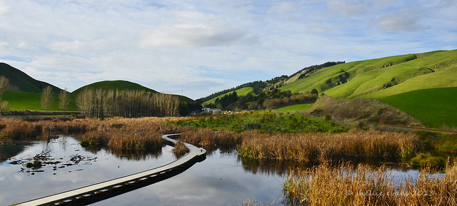
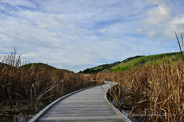
Pekapeka is a relatively small swamp, it has a rail line along one border & a major state highway on another. It has slowly been restored to it's former glory after years of neglect & abuse. The wetland had been used as an illegal dump over the years; the remains of a hotel are buried under the swamp somewhere and willows once infested & dried out the wetland where now raupo(bulrush) grows. There wasn't much birdlife to be seen other than a few swans and a couple of ducks but this is probably because it's duck shooting season & even though there's no shooting they've probably been scared away. It was a beautiful sunny day & a lovely walk around the boardwalks.
We stayed once again at the NZMCA park over property in Taupo on the first night, cutting the four hour trip to Napier in two. There were only another four RVs parked up so we had the pick of positions to park, not that we got to see much as it was cold & bleak outdoors. As yet we have no heating in the fifth-wheeler unless we are plugged into power so this was going to be our first winter's night with no warmth. It wasn't too bad once we were all rugged up in bed & we took our time getting up the next morning, waiting for the sun to reach our little spot. A hearty cooked breakfast also warmed the cockles.
We had an uneventful trip over the Napier-Taupo road stopping of at the Tarawera Café for coffee which was pleasant enough. I must have passed the café (or hotel as it used to be) at least 300 or 400 times in my lifetime & I don't ever recall stopping. The parking area of the café is also a NZMCA POP (Park Over Property) & would be a great place to stop if you weren't wanting to travel the road all in one go. Apparently there is great trout fishing in the stream close by & the owner (who wasn't there that day) is happy to show fishermen the rights spots.
We arrived in Napier in good time and set the fifth-wheeler up on the concrete pad next to Mum & Dads once again. We spent the next week on & off water blasting the house & paths, cleaning the windows, planting out the vege garden along with some flower plants & spaying weeds & moss along with a few other bits & pieces. Dad was still progressing well but was getting a little frustrated that he couldn't help out.
I managed to get some more photography in, this time I had heard that there was a Royal Spoonbill & a White Heron feeding in a creek that ran alongside a suburban street. Both these birds are quite rare in NZ but small numbers tend to winter over in Hawkes Bay each year. There is a resident population of about 20 spoonbills that usually feed on the Ahuriri salt flats & estuary but this one obviously though dinner was better served from the creek in town. And sure enough I found them both there, the spoonbill was very obliging & allowed me to get quite close. Unfortunately it was a very dark & overcast late afternoon so the lighting wasn't that great.
![]() |
| Royal Spoonbill, Maori name Kotuku-nutupapa |
![]() |
| White Heron, Maori name Kotuku |
Once the house chores were finished we spent a bit of time tiki-touring around the Bay. We met family for lunch at the Puketapu Hotel which was very pleasant, the restaurant is very busy especially on the weekends as the hotel is at the turn around point of one of the local cycle trails. After lunch we took the back roads through to Paki Paki which is south of Hastings, I wanted to check out the Pekapeka Wetlands which I'd passed with Mum on our way to Wellington a few weeks ago. We passed these cute bee hives along the way.
Pekapeka is a relatively small swamp, it has a rail line along one border & a major state highway on another. It has slowly been restored to it's former glory after years of neglect & abuse. The wetland had been used as an illegal dump over the years; the remains of a hotel are buried under the swamp somewhere and willows once infested & dried out the wetland where now raupo(bulrush) grows. There wasn't much birdlife to be seen other than a few swans and a couple of ducks but this is probably because it's duck shooting season & even though there's no shooting they've probably been scared away. It was a beautiful sunny day & a lovely walk around the boardwalks.
Labels:
Bird,
boardwalk,
camp site view,
Family,
Hawkes Bay,
kotuku,
Landscape,
nzmca,
Photo,
Road,
spoonbill,
swamp,
Walk,
white heron
Subscribe to:
Posts (Atom)


.jpg)
.jpg)