We had already driven a section of the Rainbow Road; from Hanmer to Lake Tennyson, when we were in Hanmer Springs last July. This time we would drive the 73km to Lake Tennyson from the St Arnaud end, have lunch and then return via the same route, making it a very long 146km road trip.
We had also driven to the Rainbow Skifield turnoff when we were here at the Lakes last November so we knew that the first 26km of the road was sealed.
Along the way we came across the Rainbow Station farm manager shifting a large flock of sheep, we stopped to talk to him and he told us he shifts them everyday. He pushes them high up the valley in the morning and by the next morning they are back down at the homestead having found their way around the ends of a couple of fences (over the river & up in the bush) that should be blocking their path. He tells us that the feed is much better down at the homestead but he wants them up the top to clear it out before winter. Why he doesn't just add to the fence ends I have no idea. It will be interesting to see where the sheep are when we return later in the afternoon.

There are around a dozen ford crossings along the sealed section of the road, there are some interesting names and we stop to take a photo at the best one. Most of the crossings are dry at this time of the year with just a bit of rubble over the concrete pad.

It’s about here that I need to mention that the Rainbow Road is a hydro road and has only come about because of the route that the pylons take carrying power from Canterbury through to the Nelson & Buller regions, and as such, there are plenty of pylons in the photos. There’s very little chance of taking a photo without at least one making an appearance so I figured it’s best to embrace the pylons rather than try to shoot around them.
It might now be a hydro road (built in the 1950s) but a very long time ago it was part of the overland routes used by Maori and later used by high country graziers moving mobs of sheep between the regions.
This is as far as we traveled the last time, the first rocky ford crossing without a concrete pad and with a lot of boulders. The stream was quite a lot higher then and there wasn’t a nicely smoothed out loop to drive around just a deep crossing straight over. That was still there but we took the easier option, why go looking for trouble?
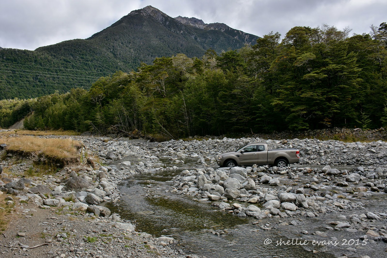
The gates that are locked in the off season are just past the ford but it’s another 10kms to the old Rainbow Station homestead where you pay a toll to drive the road. The road is good, although there are a few rocky patches, as it follows the Wairau River upstream. Along the way we pass a portaloo all on it’s lonesome & very strategically placed, we decide after a quick stop (and two cups of tea before we left).
Then we come across a working party up one of the pylons, they are blasting off rust and/or algae growth. They have their work cut out for them going by the number and precarious positions of the pylons we see further on. It would take them years to finish the job and I then I'm sure they would have to start at the beginning again. I’m now wondering if the portaloo might have been for them although it was a few kilometres away.

Finally the old homestead appears- a kilometre on a gravel road always seems to be twice as long. Dogs bark a warning and a lovely lady appears to take our money at the ‘toll booth’ which doubles as a wood shed, the wood pile acting as a high point for a boisterous puppy trying to see what his mistress is up to. We pay our $25 and the lady opens the gate for us. We tell her we’ll be returning later in the afternoon and she warns us it must be by 6pm when the gate is locked overnight.

We’re still driving along the river flats but the mountains loom off to the side and ahead of us.

We stop to open the first of the half dozen or so closed gates along the road and find another set of wagon wheels, there’s a similar set at the beginning of the road near the new homestead.

The Rainbow Road is advertised as a ‘wilderness driving experience’ only suitable for high-clearance 4WD vehicles. Drivers need to be self-sufficient and prepared for sudden changes in weather. So far it’s been a relatively easy road (except for the rocky ford). I think the real Rainbow experience is about to begin.

We see our first car approaching from the other direction, David pulls over to the side to let him pass once he’s crossed a ford. We see another 4 or 5 cars during the day along with a motorbike & four cyclists (who had stayed at Kerr Bay with us the night before) and who had set up camp at the Coldwater Creek camping area- a little less than the half way mark.

A colourful barn comes into view as we approach Hells Gate, a very narrow gorge that the road hugs through a gap in the mountains.

We cross the Wairau River close to where the Rainbow River joins it, the river after which the road and station are named.

We come across a parked vehicle just before the gorge, a guy is checking & measuring the water level. They must be power employees as we let them pass later on and they take a track up to a pylon above us.

The river has narrowed down a lot as it comes out of the gorge although it’s still very shallow.

We enter ‘Hells Gate’ and take our time driving through, stopping at one point to take in the impressive rocky mountain bluffs overhead. The road again isn’t too bad, just narrow in a few places with a couple of blind corners.

Towards the end of the gorge we come across a couple of cheerful chaps having their lunch on the side of the road. They’ve been out here for the last 3-4 days fishing, they have a Landrover camper with them although they told us they’ve been whiling away their evenings drinking with the DOC guys at a hut further up the valley!

The scenery is spectacular, the mountains surround us on all sides and those pylons take centre stage in the narrow gorge.

At the end of the gorge the road turns right and the landscape opens up as we continue to follow the river up stream.

There are a couple of huge rock slides off the mountains above us and one of them has wiped the road out. A track looks to have been bulldozed through lower down but water has washed that away. We take a narrow, higher up track which also crosses the water course but is not as deep (I took this on the way back in case it throws your bearings).

The road crosses over the next scree slide and then over another bridge across the Waiau…

…and along the side and to the top of the valley. You can see a couple of roads, the higher one is a service track to those ever present pylons. And even though it may not look like it from here, this is one huge impressive valley, the cattle grazing down below looking like ants.

At the top of the valley we come to another closed gate and the Rainbow/Molesworth Station boundary. The road now becomes a public road & it’s here that the gate is locked in the off season.

To be continued……
Part 2- Lake Sedgemere, Island Saddle to Lake Tennyson
Part 3- The Return Journey
Looks amazing. We are heading through that area from Easter. Can't wait.
ReplyDeleteAs long as the weather holds you'll have a fantastic time, the Rainbow has been one of our top off-road drives. We still haven't done the Molesworth from top to bottom, it closed early last season due to the fire risk. Safe travels.
Delete